Liste europäischer Inseln nach Fläche
Dies ist eine Liste europäischer Inseln (nach Fläche). Binneninseln sind in der Regel nicht aufgeführt.

Inseln mit einer Fläche von mehr als 200 Quadratkilometern
| Rang | Bild | Insel | Fläche in km² | Staat / Region | Lage / Anmerkungen |
|---|---|---|---|---|---|
| 1 |  | Großbritannien | 229.848 | Größte Insel Europas | |
| 2 |  | Island | 101.826 | ||
| 3 |  | Irland | 84.421 | Mit 70.273 km² ist die Republik Irland das größte Inselterritorium der Europäischen Union | |
| 4 |  | Nordinsel (Nowaja Semlja) Северный остров | 47.079 | Größte Insel Russlands in Europa | |
| 5 |  | Spitzbergen Spitsbergen | 37.673 | Größte norwegische Insel, Inselgruppe Spitzbergen | |
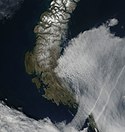
| 6 |  | Südinsel (Nowaja Semlja) Южный остров | 33.246 | ||
| 7 |  | Sizilien | 25.662 | Größte Insel Italiens und des Mittelmeers Größte Insel, die in der Europäischen Union vollständig enthalten ist | |
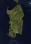
| 8 |  | Sardinien | 23.949 | ||
| 9 |  | Nordostland Nordaustlandet | 14.443 | Inselgruppe Spitzbergen | |
| 10 |  | Zypern | 9.251 | Wird geographisch zu Asien gerechnet | |
| 11 |  | Korsika | 8.741 | Größte französische Insel in Europa | |
| 12 | Kreta | 8.312 | Größte griechische Insel | ||
| 13 |  | Seeland Sjælland | 7.180 | Größte dänische Insel und größte Insel in der Ostsee | |
| 14 |  | Edgeøya | 5.074 | Inselgruppe Spitzbergen | |
| 15 |  | Vendsyssel-Thy Nordjütische Insel | 4.685 | ||
| 16 |  | Euböa | 3.655 | ||
| 17 |  | Mallorca | 3.640 | Größte spanische Insel in Europa | |
| 18 |  | Kolgujew Колгуев | 3.497 | Liegt im Autonomen Kreis der Nenzen | |
| 19 |  | Waigatsch Вайгач | 3.329 | ||
| 20 |  | Gotland | 2.994 | Größte schwedische Insel | |
| 21 |  | Fünen Fyn | 2.984 | ||
| 22 | Prinz-Georg-Land Земля Георга | 2.821 | Inselgruppe Franz-Josef-Land | ||
| 23 |  | Saaremaa Ösel | 2.672 | Größte estnische Insel | |
| 24 |  | Wilczek-Land Земля Вильчека | 2.203 | Inselgruppe Franz-Josef-Land | |
| 25 | Hinnøya | 2.198 | Größte norwegische Insel außerhalb der Inselgruppe Spitzbergen | ||
| 26 |  | Lewis and Harris | 2.179 | ||
| 27 |  | Skye | 1.656 | ||
| 28 | Soisalo | 1.638 | Größte finnische Insel und größte Binneninsel in Europa | ||
| 29 |  | Lesbos | 1.630 | ||
| 30 | Senja | 1.586 | |||
| 31 | Graham-Bell-Insel Остров Греэм-Белл | 1.557 | Inselgruppe Franz-Josef-Land | ||
| 32 |  | Rhodos | 1.398 | ||
| 33 | Öland | 1.347 | |||
| 34 |  | Barentsøya dt. Barentsinsel | 1.288 | ||
| 35 | Lolland | 1.243 | |||
| 36 | Alexandraland Земля Александры | 1.095 | Inselgruppe Franz-Josef-Land | ||
| 37 | Hall-Insel Остров Галля | 1.049 | Inselgruppe Franz-Josef-Land | ||
| 38 |  | Hiiumaa Dagö | 989 | ||
| 39 |  | Mainland (Shetland) | 969 | ||
| 40 |  | Salisbury-Insel Остров Солсбери | 960 | Inselgruppe Franz-Josef-Land | |
| 41 |  | Rügen | 926 | Größte deutsche Insel | |
| 42 | Isle of Mull | 875 | |||
| 43 | Langøya | 850 | |||
| 44 |  | Chios | 842 | ||
| 45 | Sørøya dt. Südinsel | 811 | |||
| 46 |  | Kefalonia | 781 | ||
| 47 |  | São Miguel dt. Sankt Michael | 759 | Größte portugiesische Insel | |
| 48 | Meschduscharski Междушарский остров | 748 | Inselgruppe Franz-Josef-Land | ||
| 49 | Madeira | 741 | gehört geographisch zu Europa, geologisch aber zu Afrika | ||
| 50 | Kvaløya dt. Walinsel | 737 | |||
| 51 | Anglesey walisisch Ynys Môn | 714 | |||
| 52 |  | Menorca | 694 | ||
| 53 | Fasta Åland finn. Manner-Ahvenanmaa | 685 | |||
| 54 | Kvitøya dt. Weiße Insel | 682 | |||
| 55 | Ringvassøy | 656 | |||
| 56 |  | Islay | 620 | ||
| 57 | Prins Karls Forland | 615 | Inselgruppe Spitzbergen | ||
| 58 | McClintock-Insel Остров Мак-Клинтока | 612 | Inselgruppe Franz-Josef-Land | ||
| 59 | Korfu | 592 | |||
| 60 |  | Bornholm | 588 | ||
| 61 | Hitra | 572 | |||
| 62 |  | Isle of Man | 572 | Kronbesitzung der britischen Krone | |
| 63 |  | Ibiza | 571 | ||
| 64 | Seiland | 559 | |||
| 65 | Austvågøya | 527 | Inselgruppe Lofoten | ||
| 66 | Kimitoön (schwed.) finn. Kemiönsaari | 524 | Im Schärenmeer | ||
| 67 |  | Mainland (Orkney) | 523 | ||
| 68 | Jackson-Insel остров Джексона | 521 | Inselgruppe Franz-Josef-Land | ||
| 69 | Falster | 514 | |||
| 70 | Andøya | 489 | |||
| 71 | La-Ronciere-Insel Ла-Ронсьер | 478 | Inselgruppe Franz-Josef-Land | ||
| 72 |  | Samos | 476 | ||
| 73 |  | Lemnos | 476 | ||
| 74 | Hooker-Insel остров Гукера | 460 | Inselgruppe Franz-Josef-Land | ||
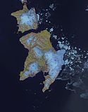
| 75 |  | Ziegler-Insel Остров Циглера | 448 | Inselgruppe Franz-Josef-Land | |
| 76 | Pico | 446 | Insel der Azoren | ||
| 77 |  | Usedom | 445 | ||
| 78 | Magerøya | 437 | wörtlich karge Insel | ||
| 79 |  | Isle of Arran | 432 | ||
| 80 | Naxos | 428 | |||
| 81 | Vestvågøya | 411 | |||
| 82 |  | Zakynthos | 406 | ||
| 83 |  | Cres | 406 | Größte Insel Kroatiens | |
| 84 |  | Krk | 406 | ||
| 85 |  | Terceira | 403 | Azoren | |
| 86 | Brač | 395 | |||
| 87 |  | Isle of Wight | 381 | Südküste Englands | |
| 88 |  | Jan Mayen | 380 | Europäisches Nordmeer/Grönlandsee | |
| 89 | Andros | 380 | |||
| 90 |  | Thasos | 379 | ||
| 91 |  | Champ-Insel Чамп | 374 | Inselgruppe Franz-Josef-Land | |
| 92 |  | Streymoy dän. Strømø | 374 | Größte Insel der Färöer | |
| 93 | Luigi-Insel Остров Луиджи | 371 | Inselgruppe Franz-Josef-Land | ||
| 94 | Mors auch Morsø oder Morsland | 368 | |||
| 95 |  | Jura | 367 | Innere Hebriden | |
| 96 |  | Orust | 346 | An der Westküste Schwedens | |
| 97 | Salm-Insel Сальм | 344 | Inselgruppe Franz-Josef-Land | ||
| 98 | Kvaløya | 336 | |||
| 99 | Karl-Alexander-Insel Остров Карла-Александра | 329 | Inselgruppe Franz-Josef-Land | ||
| 100 | Osterøy | 329 | |||
| 101 | Als | 321 | |||
| 102 | South Uist | 320 | Äußere Hebriden | ||
| 103 |  | Lefkada | 303 | ||
| 104 |  | North Uist | 303 | Äußere Hebriden | |
| 105 | Karpathos | 301 | |||
| 106 | Hvar | 300 | |||
| 107 |  | Rudolf-Insel остров Рудольфа | 296 | Inselgruppe Franz-Josef-Land | |
| 108 | Kos | 290 | |||
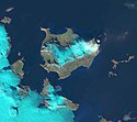
| 109 |  | Northbrook-Insel Остров Нортбрук | 289 | Inselgruppe Franz-Josef-Land | |
| 110 |  | Eva-Liv-Insel Остров Ева-Лив | 288 | Inselgruppe Franz-Josef-Land | |
| 111 | Eysturoy dän. Østerø | 286 | |||
| 112 | Pag | 285 | |||
| 113 | Langeland | 284 | |||
| 114 | Gökçeada | 279 | Größte türkische Insel in Europa | ||
| 115 | Kythira | 278 | |||
| 116 | Korčula | 276 | |||
| 117 | Arnøya | 276 | |||
| 118 |  | Wolin dt. Wollin | 265 | ||
| 119 | Ikaria | 255 | |||
| 120 | Solowezki Соловецкий | 246 | Inselgruppe Franz-Josef-Land | ||
| 121 |  | Malta | 246 | ||
| 122 |  | São Jorge dt. Sankt Georg | 246 | Insel der Azoren | |
| 123 |  | Stord | 241 | ||
| 124 |  | Wiener-Neustadt-Insel Остров Винер-Нейштадт | 237 | Inselgruppe Franz-Josef-Land | |
| 125 | Vanna auch Vannøya | 232 | |||
| 126 | Stjernøya | 231 | |||
| 127 | Møn | 226 | |||
| 128 |  | Elba | 224 | ||
| 129 | Smøla | 218 | |||
| 130 | Yell | 212 | Shetland | ||
| 131 |  | Skyros | 209 | ||
| 132 | Muhu dt. Moon/Mohn | 206 |
Inseln mit einer Fläche von 100 bis 200 Quadratkilometern




Die Liste ist nicht vollständig.
Inseln mit einer Fläche von 50 bis 100 Quadratkilometern
Diese Liste ist unvollständig. Es fehlen Daten einiger arktischer Inseln Russlands.
Inseln mit einer Fläche von 20 bis 50 Quadratkilometern
Diese Liste ist unvollständig. Es fehlen Daten einiger arktischer Inseln Russlands.
Anmerkungen
- Die Kanarischen Inseln sind kein Teil Europas, während Zypern als solcher angesehen wird, auch wenn es Meinungen gibt, dass es sowohl ein Teil Europas wie auch Asiens sei.
- Die arktischen Inseln Russlands werden als europäisch angesehen, wenn sie westlich der Jamal-Halbinsel liegen. Dies betrifft den Archipel des Franz-Josef-Landes, Nowaja Semlja, Kolgujew und Waigatsch. Spitzbergen fällt in die gleiche Gruppe.
- Grönland wird dagegen zu Nordamerika gerechnet.
- Die Daten von Bolschoi Berjosowy wurden aus Karten abgeschätzt.
Quellen
- http://islands.unep.ch/
- (also includes freshwater islands) (Memento vom 4. August 2007 im Internet Archive)
- http://www.intermin.fi/intermin/images.nsf/files/aaa29f826e98e26ac22572480031ab08/$file/esite_2007_eng.pdf
- http://www.ub.ntnu.no/formidl/utgivelser/til_opplysning/to_nr16.pdf
- http://www.kartverket.no/dnl/Den-norske-los-7-English.pdf
Siehe auch
Auf dieser Seite verwendete Medien
Flagge des Vereinigten Königreichs in der Proportion 3:5, ausschließlich an Land verwendet. Auf See beträgt das richtige Verhältnis 1:2.
Flagge des Vereinigten Königreichs in der Proportion 3:5, ausschließlich an Land verwendet. Auf See beträgt das richtige Verhältnis 1:2.
Man sagt, dass der grüne Teil die Mehrheit der katholischen Einwohner des Landes repräsentiert, der orange Teil die Minderheit der protestantischen, und die weiße Mitte den Frieden und die Harmonie zwischen beiden.
Flagge Portugals, entworfen von Columbano Bordalo Pinheiro (1857-1929), offiziell von der portugiesischen Regierung am 30. Juni 1911 als Staatsflagge angenommen (in Verwendung bereits seit ungefähr November 1910).
Autor/Urheber: Fry1989 eh?, Lizenz: CC0
Flag of the Isle of Mann. This version has the triskelion centered as a whole rather than based upon the imaginary circle created by the prongs of each leg.
Das Bild dieser Flagge lässt sich leicht mit einem Rahmen versehen
NASA-Satellitenbild Korsikas
Autor/Urheber: http://www.terraprints.com, Lizenz: CC BY 2.5
Isle of Wight, United Kingdom, from Space. The raw satellite imagery shown in these images was obtain from NASA and/or the US Geological Survey. Post-processing and production by http://www.terraprints.com
Credit Jeff Schmaltz, MODIS Rapid Response Team, NASA/GSFC The island of Sardinia sits between the Mediterranean Sea to the south and west and the Tyrrhenian Sea to the east. To its immediate north is the island of Corsica, which is a part of France. To the east of Sardinia is the middle of the Italian peninsula (not shown). Sardinia glows here with the green blush of spring.
Sardinia has had a tumultuous history. Starting in ancient times, the island was occupied by Phoenicians, Carthaginians, and Romans; thereafter it was controlled by Vandals, Byzantines, and a long string of rulers of Italian city-states. In the late 15th century, Sardinia came under the control of Spain, then in the early 18th century was passed to the Austrians. It briefly fell to Spanish occupation in 1717, but by 1720 was given over again to the control of Italian rule. This true-color Aqua MODIS image was acquired on April 27, 2003.Greek Island Skyros from space
Satellitenaufnahme Vogelfluglinie Fehmarn - Dänemark (Puttgarden - Rødby)
Autor/Urheber:
- Vaygach_Island.svg: User:ChongDae
- derivative work: bamse (talk)
This image was copied from wikipedia:en. The original description was: Created based on images from the CIA's World Fact Book.
Südinsel von Novaya Zemlya
Nordinsel von Novaya Zemlya
Stord, tophographic map
Satellite image of the island of Euboea (Greece)
Autor/Urheber: Copernicus Sentinel-2, ESA, Lizenz: CC BY-SA 3.0 igo
Date: 2018-06-21
Sensor: MSI on Sentinel-2A
Resolution: 20m (Downsampled)
RGB Composites: True color, Band 4-3-2Northbrook Island
NASA World Wind Screen Shot of Amrum, Kniepsand and Jungnamensand at the North Frisian Coast of Germany
Landsat8 Satellitenbild von Wilhelmøya - 14. September 2013 - Links teile von Olav V Land (Insel Spitzbergen). dazwischen Bjørnsundet
Landsat 7 Satellitenbild der Spitzbergen/Svalbard Inseln Edgeøya (unten) und Barentsøya (oben) vom 12. Juli 2002
Lesbos Island, Greece - September/October 1995
Autor/Urheber: Maximilian Dörrbecker (Chumwa), Lizenz: CC BY-SA 2.5
Karte der 50 größten Inseln Europas:
Szczecin Lagoon - Landsat satellite photo
NASA World Wind Screen Shot (Geocover 2000) of Kolguyev Island, Russian Arctic
Terra MODIS satellite image of Kong Karls Land, Svalbard
Fünen (Dänemark)
São Miguel Island
Satellitenfoto der Jan Mayen-Insel
Ischia Island
Sattelite image of Majorca
Autor/Urheber: NASA's Earth Observatory, Lizenz: CC BY 2.0
To download the full resolution and other files go to: earthobservatory.nasa.gov/IOTD/view.php?id=77079&src=...
Rhodes (also Rodos) is the biggest island in the Greek Dodecanese chain, which lies in the southeastern Aegean Sea. Rhodes stretches roughly 77 kilometers (48 miles) from northeast to southwest. Its highest point, Mount Attavyros (also Attaviros or Ataviros) reaches 1,200 meters (3,900 feet) above sea level. A variety of vegetation thrives on the rugged island, migratory birds use it as a resting place, and humans have lived here since the Stone Age.
The Thematic Mapper on the Landsat 5 satellite captured this image of Rhodes on August 26, 2011. Green vegetation is fairly abundant over the island, except for Mount Attavyros and some spots along the coast.
Satellite images such as this have provided more than pretty pictures. They have contributed to geologists’ understanding of the island’s history and structure.
Geological research of Rhodes is nothing new; the first geological studies of the island occurred in the 1850s. Geologizing continued the next century, and more systematic research from 1960 to 1965 resulted in a map issued by the Institute of Geology at the University of Milan, Italy. Unfortunately, these studies occurred before the widespread acceptance of a theory that changed our understanding of the Earth: plate tectonics.
Geologists now understand that our planet’s surface is composed of plates that move relative to each other. Rhodes sits in an active area, where the African Plate slides below the Aegean Plate, producing fairly strong earthquakes. Fossils found on the island date back to the late Paleozoic Era before the dinosaurs evolved. The fossils occur in limestone, indicating that what became the island of Rhodes was at that time underwater. Around 15 million years ago, tectonic activity uplifted the whole region, but between 4 million and 3 million years ago, the land sank leaving just the mountaintops above water.
When geologists reexamined Rhodes to create a new map, they not only incorporated advances in geologic theory. They also incorporated advances in remote sensing technology. A paper published in 2007 described the compilation of a new geological map of Rhodes, based in part on satellite observations by Landsat, and by Advanced Spaceborne Thermal Emission and Reflection Radiometer (ASTER) on NASA’s Terra satellite.
NASA Earth Observatory image created by Jesse Allen and Robert Simmon, using Landsat data provided by the United States Geological Survey. Caption by Michon Scott.
The Earth Observatory's mission is to share with the public the images, stories, and discoveries about climate and the environment that emerge from NASA research, including its satellite missions, in-the-field research, and climate models.Satellitenbild von Großbritannien und Irland
Satellite image of Malta in March 2003.
This image created by superimposing several satellite images using The Gimp and hand-editing the result using paintbucket, brush and smudge to make the ocean monochrome and remove most clouds.
Schiermonnikoog
Some West Frisian Islands (Netherlands) and some East Frisian Islands (Germany), from left to right: Rottumerplaat, Rottumeroog (top) with Zuiderduintjes (below), Borkum, Kachelotplate, Juist (top) and Lütje Hörn (below), Memmert
Greek Island Moni from space
Vendsyssel-Thy (Dänemark)
Colour adjusted photo of Jersey taken by an astronaut from the International Space Station on 12 March 2012.
| Identification | |
|---|---|
| Mission | ISS030 (Expedition 30) |
| Roll | E |
| Frame | 192840 |
| Country or Geographic Name | ATLANTIC OCEAN I(S). |
| Features | JERSEY, SAINT HELIER, SHIP WAKES, AIRPORT |
| Center Point Latitude | 49.2° N |
| Center Point Longitude | -2.1° E |
| Camera | |
| Camera Tilt | 37° |
| Camera Focal Length | 400 mm |
| Camera | NIKON D3S |
| Film | 4288 x 2848 pixel CMOS sensor, RGBG imager color filter. |
| Quality | |
| Percentage of Cloud Cover | 0-10% |
| Nadir What is Nadir? | |
| Date | 2012-03-12 |
| Time | 10:49:09 |
| Nadir Point Latitude | 51.7° N |
| Nadir Point Longitude | -1.5° E |
| Nadir to Photo Center Direction | South |
| Sun Azimuth | 154° |
| Spacecraft Altitude | 204 nautical miles (378 km) |
| Sun Elevation Angle | 32° |
It is easy to see from this true-colour image why Ireland is called the Emerald Isle. Intense green vegetation, primarily grassland, covers most of the country except for the exposed rock on mountaintops. Ireland owes its greenness to moderate temperatures and moist air. The Atlantic Ocean, particularly the warm currents in the North Atlantic Drift, gives the country a more temperate climate than most others at the same latitude.
Seeland (Dänemark)
Public Domain composite satellite image of Chios Prefecture; consisting of the islands of Chios (centre), of Psara and Anti-Psara (West and far west), the Oinousses islands (East of Chios). Also includes Turkish mainland (East-shaded).
Source: NASA World Wind.
In some countries this is not legally possible; if so:
Belaya Zemlya
Island of Orust, Sweden.
Satellitenbild der Griechischen Insel Thasos, vor der Makedonisch-Thrakischen Küste.
Terra MODIS satellite image of Edgeøya (bottom) and Barentsøya (top), Svalbard
NASA Space Shuttle image of São Jorge, Azores
Rudolf, Frans Jozefland
The Island of Sylt in Northern Germany from the South. Satellite view.
Wilczek Land
Terra MODIS satellite image of Nordaustlandet, Svalbard
Satellite image of Hiiumaa. OnEarth WMS global mosaic visual colour image.
Aerial Image of the Orkney Islands
Screenshot of Eigg (Inner Hebrides, Scotland) from World Wind software displaying NASA Landsat imagery. The website says "The Landsat Global Mosaic, Blue Marble, and the USGS raster maps and images are all Public Domain." (http://www.worldwindcentral.com/wiki/World_Wind_FAQ)
Autor/Urheber: Cnes - Spot Image, Lizenz: CC BY-SA 3.0
Noirmoutier Island by SPOT Satellite
Satellite view of the Isle of Man, without clouds
Autor/Urheber: NASA's Earth Observatory, Lizenz: CC BY 2.0
To download the full resolution and other files go to: earthobservatory.nasa.gov/IOTD/view.php?id=76883&src=...
Located just 600 miles (970 kilometers) from the North Pole, Franz Josef Land is perpetually coated with ice. Glaciers cover roughly 85 percent of the archipelago’s land masses, and sea ice floats in the channels between islands even in the summertime.
The Advanced Spaceborne Thermal Emission and Reflection Radiometer (ASTER) on NASA’s Terra satellite observed the islands of central Franz Josef Land on August 16 and 19, 2011. (Another sensor on Terra captured a wider view on August 17, 2011.)
The image above was made from a combination of visible and near-infrared wavelengths, and ice appears in shades of white and pale blue. The amount of sea ice filling the channels between the islands of Franz Josef Land varies from summer to summer. Captured toward the end of the Northern Hemisphere melt season, this shot shows a modest amount of sea ice on the ocean surface. Some of the ice has accumulated in bays like the one near northeastern Zieger Island.
Most of the ice in this scene is anchored to land, as large glaciers blanket the islands. Yet today’s glaciers are tiny compared to the ice sheet that dominated the region about 20,000 years ago. Studies of Franz Josef Land have actually contributed to a larger understanding of when that massive ice sheet began its slow retreat. Raised beaches, which preserve evidence of land rising as the crushing weight of overlying glaciers eases (known as isostatic rebound), were first recognized on the islands in the late nineteenth century. Researchers estimate that the giant ice sheet had retreated by about 10,000 years ago.
NASA image created by Jesse Allen, using data provided courtesy of NASA/GSFC/METI/ERSDAC/JAROS, and U.S./Japan ASTER Science Team. Caption by Michon Scott with information from Walt Meier and Ted Scambos, National Snow and Ice Data Center.
The Earth Observatory's mission is to share with the public the images, stories, and discoveries about climate and the environment that emerge from NASA research, including its satellite missions, in-the-field research, and climate models.
Like us on Facebook
Follow us on Twitter
Add us to your circles on Google+


