Liste der größten Inseln im Mittelmeer

Dies ist eine Liste der größten Inseln im Mittelmeer. Sie umfasst jene Inseln, deren Fläche zumindest 100 km² beträgt.
Das Europäische Mittelmeer ist ein Mittelmeer zwischen Südeuropa, Nordafrika und Vorderasien und ein Nebenmeer des Atlantischen Ozeans. Es ist eines der größten Binnenmeere der Welt und über die Straße von Gibraltar mit dem Atlantik sowie über den Bosporus mit dem Schwarzen Meer verbunden.
Zum Mittelmeer gehören zahlreiche Inselgruppen sowie größere und kleinere Inseln; insgesamt über 4.300 an der Zahl. Der Großteil der Inseln sind den europäischen unter den 24 Mittelmeeranrainerstaaten zugehörig. Vor den zerklüfteten Küsten Griechenlands und Kroatiens sind mit Abstand die meisten der Mittelmeerinseln vorzufinden. Die griechischen Inseln machen an die 80 Prozent aller Inseln im Mittelmeer aus; allerdings nur knapp ein Viertel der Gesamtfläche, da zu ihnen viele Eilande, Felsen und Riffe zählen, welche zumeist unbewohnt und flächenmäßig klein sind. Das Land mit dem flächenmäßig größten Anteil an den Mittelmeerinseln ist Italien; auch sind die italienischen Inseln die bevölkerungsreichsten.
Im Mittelmeer gibt es mit der Republik Zypern (de jure) und Malta zwei Inselstaaten.
Rangliste
Im Folgenden sind die größten Mittelmeerinseln in der Rangfolge ihrer Fläche aufgelistet.
![]() Karte mit allen Koordinaten: OSM | WikiMap
Karte mit allen Koordinaten: OSM | WikiMap
Siehe auch
- Liste französischer Inseln#Mittelmeer
- Liste italienischer Inseln
- Liste türkischer Inseln
- Liste der Inseln in Montenegro
- Liste griechischer Inseln
- Liste kroatischer Inseln
- Liste spanischer Inseln
Einzelnachweise
- ↑ a b c Statistiche demografiche ISTAT. (Nicht mehr online verfügbar.) Archiviert vom am 26. März 2020; abgerufen am 13. Januar 2020.
- ↑ Europe :: Cyprus — The World Factbook - Central Intelligence Agency. (Nicht mehr online verfügbar.) Archiviert vom am 26. Dezember 2018; abgerufen am 13. Januar 2020.
- ↑ British Forces Cyprus. Sovereign Base Areas Administration, abgerufen am 27. April 2020.
- ↑ France: Administrative Division (Regions and Departments) - Population Statistics, Charts and Map. Abgerufen am 13. Januar 2020.
- ↑ a b c d e f g h i j k l m n o p q r s t u v w x y z aa ab ac Ergebnisse der Volkszählung 2011 beim Nationalen Statistischen Dienst Griechenlands (ΕΛ.ΣΤΑΤ) (Memento vom 27. Juni 2015 im Internet Archive) (Excel-Dokument, 2,6 MB)
- ↑ a b c Cifras de población resultantes de la revisión del Padrón municipal referidas al 1-1-15. In: Boletín ofocial del estado. 17. Dezember 2015 (www.boe.es/boe/dias/2015/12/17/pdfs/BOE-A-2015-13745.pdf [PDF]).
- ↑ Tunisia: Administrative Division (Governorates and Delegations) - Population Statistics, Charts and Map. Abgerufen am 13. Januar 2020.
- ↑ a b c d e f g Geographical and meteorological data. In: Državni zavod za statistiku (Hrsg.): Statistički ljetopis. 2006 (www.dzs.hr/Hrv_Eng/ljetopis/2006/01-Binder.pdf [PDF]).
- ↑ Türkisches Institut für Statistik. (Nicht mehr online verfügbar.) Archiviert vom am 10. Februar 2015; abgerufen am 13. Januar 2020.
- ↑ Regional Statistics MALTA 2019 Edition. Abgerufen am 13. Januar 2020 (englisch).
- ↑ Venedig ist von der Fläche im Vergleich mit den anderen Mittelmeerinseln sehr klein, bei der Bevölkerungszahl der historischen Insel des Zentrums (Centro Storico) aber recht bedeutend
- Zahlen Venedig: Einwohner, Fläche, Anzahl Brücken und Kanäle und vieles mehr. In: venedig-reiseinfo.de. 6. November 2010, abgerufen am 27. April 2020.
Auf dieser Seite verwendete Medien
Flagge des Vereinigten Königreichs in der Proportion 3:5, ausschließlich an Land verwendet. Auf See beträgt das richtige Verhältnis 1:2.
Flagge des Vereinigten Königreichs in der Proportion 3:5, ausschließlich an Land verwendet. Auf See beträgt das richtige Verhältnis 1:2.
Das Bild dieser Flagge lässt sich leicht mit einem Rahmen versehen
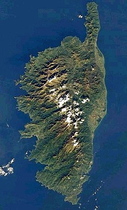
NASA-Satellitenbild Korsikas
Autor/Urheber: Sentinel-2 cloudless 2016 by EOX IT Services GmbH is licensed under a Creative Commons Attribution 4.0 International License., Lizenz: CC BY-SA 4.0
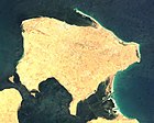
Dugi Otok (Satellitenbild)
Autor/Urheber: Sentinel-2 cloudless 2016 by EOX IT Services GmbH is licensed under a Creative Commons Attribution 4.0 International License., Lizenz: CC BY-SA 4.0
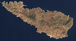
Naxos (Satellitenbild)
Satellite image of Italy in March 2003.
Autor/Urheber: Sentinel-2 cloudless 2016 by EOX IT Services GmbH is licensed under a Creative Commons Attribution 4.0 International License., Lizenz: CC BY-SA 4.0
Kreta (Satellitenbild)
Autor/Urheber: Sentinel-2 cloudless 2016 by EOX IT Services GmbH is licensed under a Creative Commons Attribution 4.0 International License., Lizenz: CC BY-SA 4.0
Brač (Satellitenbild)
Autor/Urheber: Sentinel-2 cloudless 2016 by EOX IT Services GmbH is licensed under a Creative Commons Attribution 4.0 International License., Lizenz: CC BY-SA 4.0
Samothraki (Satellitenbild)
Autor/Urheber: Horst-schlaemma, Lizenz: CC0
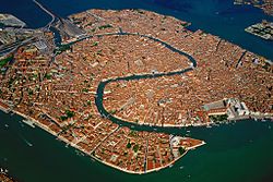
Aerial view of the old town island of Venice and its surrounding lagoons. Canal Grande in the center of the photo. Taken from a balloon.
Autor/Urheber: Sentinel-2 cloudless 2016 by EOX IT Services GmbH is licensed under a Creative Commons Attribution 4.0 International License., Lizenz: CC BY-SA 4.0
Kos (Satellitenbild)
Autor/Urheber: Sentinel-2 cloudless 2016 by EOX IT Services GmbH is licensed under a Creative Commons Attribution 4.0 International License., Lizenz: CC BY-SA 4.0
Tinos (Satellitenbild)
Autor/Urheber: Sentinel-2 cloudless 2016 by EOX IT Services GmbH is licensed under a Creative Commons Attribution 4.0 International License., Lizenz: CC BY-SA 4.0
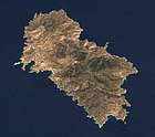
Kea (Satellitenbild)
Sattelite image of Majorca
Autor/Urheber: https://commons.wikimedia.org/wiki/User:NordNordWest, Lizenz: CC BY-SA 3.0
Die im folgenden verlinkte Mittelmeer-Karte, etwas zugeschnitten und beschriftet mit den (laut Wikipedia) 35 größten Inseln sowie den Meeresteilen. Original-Karte: https://commons.wikimedia.org/wiki/File:Mediterranean_Sea_location_map.svg
Autor/Urheber: Sentinel-2 cloudless 2016 by EOX IT Services GmbH is licensed under a Creative Commons Attribution 4.0 International License., Lizenz: CC BY-SA 4.0
Ithaka (Satellitenbild)
Autor/Urheber: Sentinel-2 cloudless 2016 by EOX IT Services GmbH is licensed under a Creative Commons Attribution 4.0 International License., Lizenz: CC BY-SA 4.0
Lesbos (Satellitenbild)
Autor/Urheber: Sentinel-2 cloudless 2016 by EOX IT Services GmbH is licensed under a Creative Commons Attribution 4.0 International License., Lizenz: CC BY-SA 4.0
Paros (Satellitenbild)
Autor/Urheber: Sentinel-2 cloudless 2016 by EOX IT Services GmbH is licensed under a Creative Commons Attribution 4.0 International License., Lizenz: CC BY-SA 4.0
Elba (Satellitenbild)
Visible colour satellite image of Rhodes.
Autor/Urheber: Sentinel-2 cloudless 2016 by EOX IT Services GmbH is licensed under a Creative Commons Attribution 4.0 International License., Lizenz: CC BY-SA 4.0
Milos (Sattelitenbild)
The island of Sardinia as seen from the International Space Station
Autor/Urheber: Sentinel-2 cloudless 2016 by EOX IT Services GmbH is licensed under a Creative Commons Attribution 4.0 International License., Lizenz: CC BY-SA 4.0
Ikaria (Satellitenbild)
Autor/Urheber: Sentinel-2 cloudless 2016 by EOX IT Services GmbH is licensed under a Creative Commons Attribution 4.0 International License., Lizenz: CC BY-SA 4.0
Mykonos (Satellitenbild)
Autor/Urheber: Sentinel-2 cloudless 2016 by EOX IT Services GmbH is licensed under a Creative Commons Attribution 4.0 International License., Lizenz: CC BY-SA 4.0
Kalymnos (Satellitenbild)
Autor/Urheber: Sentinel-2 cloudless 2016 by EOX IT Services GmbH is licensed under a Creative Commons Attribution 4.0 International License., Lizenz: CC BY-SA 4.0
Limnos (Satellitenbild)
Autor/Urheber: Sentinel-2 cloudless 2016 by EOX IT Services GmbH is licensed under a Creative Commons Attribution 4.0 International License., Lizenz: CC BY-SA 4.0
Andros (Satellitenbild)
Autor/Urheber: Sentinel-2 cloudless 2016 by EOX IT Services GmbH is licensed under a Creative Commons Attribution 4.0 International License., Lizenz: CC BY-SA 4.0
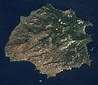
Thasos (Satellitenbild)
Autor/Urheber: Sentinel-2 cloudless 2016 by EOX IT Services GmbH is licensed under a Creative Commons Attribution 4.0 International License., Lizenz: CC BY-SA 4.0
Sant' Antioco (Satellitenbild)
Autor/Urheber: Sentinel-2 cloudless 2016 by EOX IT Services GmbH is licensed under a Creative Commons Attribution 4.0 International License., Lizenz: CC BY-SA 4.0
Brač, Hvar und Korčula (Satellitenbild)
Autor/Urheber: Sentinel-2 cloudless 2016 by EOX IT Services GmbH is licensed under a Creative Commons Attribution 4.0 International License., Lizenz: CC BY-SA 4.0
Kythnos (Satellitenbild)
Autor/Urheber: Sentinel-2 cloudless 2016 by EOX IT Services GmbH is licensed under a Creative Commons Attribution 4.0 International License., Lizenz: CC BY-SA 4.0
Korčula (Satellitenbild)
Autor/Urheber: Sentinel-2 cloudless 2016 by EOX IT Services GmbH is licensed under a Creative Commons Attribution 4.0 International License., Lizenz: CC BY-SA 4.0
Chios (Satellitenbild)
Autor/Urheber: Sentinel-2 cloudless 2016 by EOX IT Services GmbH is licensed under a Creative Commons Attribution 4.0 International License., Lizenz: CC BY-SA 4.0
Kythira (Satellitenbild)
Autor/Urheber: Sentinel-2 cloudless 2016 by EOX IT Services GmbH is licensed under a Creative Commons Attribution 4.0 International License., Lizenz: CC BY-SA 4.0
Cres (Satellitenbild)
Autor/Urheber: Sentinel-2 cloudless 2016 by EOX IT Services GmbH is licensed under a Creative Commons Attribution 4.0 International License., Lizenz: CC BY-SA 4.0
Gökçeada (Satellitenbild)
Autor/Urheber: Sentinel-2 cloudless 2016 by EOX IT Services GmbH is licensed under a Creative Commons Attribution 4.0 International License., Lizenz: CC BY-SA 4.0
Chergui (Satellitenbild)
Autor/Urheber: Sentinel-2 cloudless 2016 by EOX IT Services GmbH is licensed under a Creative Commons Attribution 4.0 International License., Lizenz: CC BY-SA 4.0
Ios (Satellitenbild)
Autor/Urheber: Sentinel-2 cloudless 2016 by EOX IT Services GmbH is licensed under a Creative Commons Attribution 4.0 International License., Lizenz: CC BY-SA 4.0
Karpathos (Satellitenbild)
Autor/Urheber: Sentinel-2 cloudless 2016 by EOX IT Services GmbH is licensed under a Creative Commons Attribution 4.0 International License., Lizenz: CC BY-SA 4.0
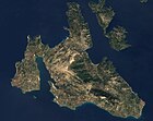
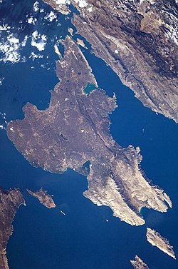
Kefalonia (Satellitenbild)
The island of Ibiza, by astronaut photograph ISS035-E-7431 was acquired on March 22, 2013, with a Nikon D3S digital camera using a 400 millimeter lens, and is provided by the ISS Crew Earth Observations experiment and Image Science & Analysis Laboratory, Johnson Space Center. The image was taken by the Expedition 35 crew. It has been cropped and enhanced to improve contrast, and lens artifacts have been removed. The International Space Station Program supports the laboratory as part of the ISS National Lab to help astronauts take pictures of Earth that will be of the greatest value to scientists and the public, and to make those images freely available on the Internet. Additional images taken by astronauts and cosmonauts can be viewed at the NASA/JSC Gateway to Astronaut Photography of Earth.
Autor/Urheber: Sentinel-2 cloudless 2016 by EOX IT Services GmbH is licensed under a Creative Commons Attribution 4.0 International License., Lizenz: CC BY-SA 4.0
Amorgos (Satellitenbild)
Autor/Urheber: Sentinel-2 cloudless 2016 by EOX IT Services GmbH is licensed under a Creative Commons Attribution 4.0 International License., Lizenz: CC BY-SA 4.0
Euböa (Satellitenbild)
Autor/Urheber: Sentinel-2 cloudless 2016 by EOX IT Services GmbH is licensed under a Creative Commons Attribution 4.0 International License., Lizenz: CC BY-SA 4.0
Djerba (Satellitenbild)


