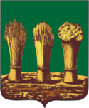
Liste der Städte in der Oblast Pensa

Dies ist eine Liste der Städte und Siedlungen städtischen Typs in der russischen Oblast Pensa.

Die folgende Tabelle enthält die Städte und städtischen Siedlungen der Oblast, ihre russischen Namen, die Verwaltungseinheiten, denen sie angehören (Rajon oder Stadtkreis), ihre Einwohnerzahlen für den 14. Oktober 2010,[1] ihre Wappen und geographischen Koordinaten. In der Oblast gibt es elf Städte (davon eine „geschlossene“) und 16 Siedlungen städtischen Typs.

Stadt*/Städt. SiedlungRussischVerwaltungseinheitEinwohnerWappenLage
BaschmakowoБашмаковоBaschmakowo10.41653° 13′ N, 43° 2′ O
BekowoБековоBekowo6.94152° 28′ N, 43° 43′ O
Belinski*БелинскийBelinski8.56552° 58′ N, 43° 25′ O
Gorodischtsche*ГородищеGorodischtsche8.09653° 16′ N, 45° 42′ O
IssaИссаIssa5.41853° 52′ N, 44° 52′ O
JewlaschewoЕвлашевоKusnezk5.013 53° 7′ N, 46° 49′ O
Kamenka*КаменкаKamenka39.57753° 11′ N, 44° 3′ O
KolyschleiКолышлейKolyschlei8.31252° 42′ N, 44° 32′ O
Kusnezk*КузнецкStadtkreis88.83953° 7′ N, 46° 36′ O
LuninoЛуниноLunino7.90553° 35′ N, 45° 13′ O
MokschanМокшанMokschan11.59253° 26′ N, 44° 37′ O
Nikolsk*НикольскNikolsk22.47153° 43′ N, 46° 5′ O
Nischni Lomow*Нижний ЛомовNischni Lomow22.67853° 32′ N, 43° 41′ O
PatschelmaПачелмаPatschelma8.05353° 20′ N, 43° 19′ O
Pensa*ПензаStadtkreis517.31153° 12′ N, 45° 0′ O
Saretschny*ЗаречныйStadtkreis (SATO)63.60153° 12′ N, 45° 10′ O
SchemyscheikaШемышейкаSchemyscheika6.51252° 54′ N, 45° 24′ O
SemettschinoЗеметчиноSemettschino10.772 53° 29′ N, 42° 36′ O
Serdobsk*СердобскSerdobsk35.39352° 28′ N, 44° 13′ O
SolotarjowkaЗолотарёвкаPensa2.630 53° 5′ N, 45° 19′ O
SosnowoborskСосновоборскSosnowoborsk6.54653° 18′ N, 46° 15′ O
Spassk*СпасскSpassk7.44253° 56′ N, 43° 11′ O
SuraСураNikolsk2.125 53° 53′ N, 45° 45′ O
Sursk*СурскGorodischtsche7.034 53° 5′ N, 45° 42′ O
TamalaТамалаTamala7.47652° 33′ N, 43° 15′ O
TschaadajewkaЧаадаевкаGorodischtsche7.599 53° 9′ N, 45° 54′ O
WerchosimВерхозимKusnezk1.785 52° 55′ N, 46° 22′ O

Einzelnachweise

  1. Itogi Vserossijskoj perepisi naselenija 2010 goda. Tom 1. Čislennostʹ i razmeščenie naselenija (Ergebnisse der allrussischen Volkszählung 2010. Band 1. Anzahl und Verteilung der Bevölkerung). Tabellen 5, S. 12–209; 11, S. 312–979 (Download von der Website des Föderalen Dienstes für staatliche Statistik der Russischen Föderation)

Auf dieser Seite verwendete Medien

Coat of Arms of Kolyshlei (Penza oblast).png
Coat of Arms of Kolyshlei (Penza oblast)
Coat of Arms of Pachelma (Penza oblast).png
Coat of Arms of Pachelma (Penza oblast)
Coat of Arms of Mokshan (Penza oblast).png
Coat of Arms of Mokshan (Penza oblast)
Coat of Arms of Sosnovoborsk (Penza oblast).png
Coat of Arms of Sosnovoborsk (Penza oblast)
Coat of Arms of Nizhny Lomov (Penza oblast).png
Coat of Arms of Nizhny Lomov (Penza oblast)
Coat of Arms of Lunino (Penza oblast).png
Coat of Arms of Lunino (Penza oblast)
Coat of Arms of Shemysheika (Penza oblast).png
Coat of Arms of Shemysheika (Penza oblast)
Coat of Arms of Tamala (Penza oblast).png
Coat of Arms of Tamala (Penza oblast)
Coat of Arms of Nikolsk (Penza oblast).png
Nikolsk (Penza oblast), coat of arms
Coat of Arms of Kuznetsk (Penza oblast).png
Kuznetsk (Penza oblast), coat of arms
Coat of Arms of Penza (Penza oblast) (2001).png
Penza (Penza oblast), coat of arms (2001)
Coat of Arms of Bednodemianovsk (Penza oblast) (2001).png
Bednodemianovsk (Penza oblast), coat of arms (2001)
Coat of Arms of Bashmakovo (Penza oblast).png
Coat of Arms of Bashmakovo (Penza oblast)
Coat of Arms of Zarechny (Penza oblast).png
Zarechny (Penza oblast), coat of arms
Coat of Arms of Bekovo (Penza oblast).png
Coat of Arms of Bekovo (Penza oblast)
Coat of Arms of Gorodishe (Penza oblast).png
Coat of Arms of Gorodishe (Penza oblast)
Coat of Arms of Kamenka (Penza oblast).png
Coat of Arms of Kamenka (Penza oblast)
Coat of Arms of Belinsky (Penza oblast).png
Coat of Arms of Belinsky (Penza oblast)
Coat of Arms of Issa (Penza oblast).png
Coat of Arms of Issa (Penza oblast)
Coat of Arms of Serdobsk (Penza oblast).png
Coat of Arms of Serdobsk (Penza oblast)