Liste der Planeten des Sonnensystems
Dieser Artikel enthält eine tabellarische Übersicht der Planeten des Sonnensystems.
| Erdähnliche Planeten | Gasplaneten | |||||||
|---|---|---|---|---|---|---|---|---|
| Merkur | Venus | Erde | Mars | Jupiter | Saturn | Uranus | Neptun | |
| Bild |  | .jpg) | .jpg) |  |  | _large.jpg) | .png) |  |
| Astronomisches Symbol | ||||||||
| Große Bahnhalbachse in km, in AE | 57.909.175 0,38709888 | 108.208.930 0,72333193 | 149.597.890 1 | 227.936.640 1,5236621 | 778.412.020 5,2033623 | 1.426.725.400 9,5370690 | 2.870.972.200 19,191261 | 4.498.252.900 30,068960 |
| Numerische Exzentrizität der Bahn | 0,20563069 | 0,00677323 | 0,01671022 | 0,09341233 | 0,04839266 | 0,05415060 | 0,04716771 | 0,00858587 |
| Umlaufperiode in siderischen Jahren | 0,2408467 | 0,61519726 | 1 | 1,8808476 | 11,862615 | 29,447498 | 84,016846 | 164,79132 |
| Mittlere Orbitalgeschwindigkeit in km/s | 47,8725 | 35,0214 | 29,7859 | 24,1309 | 13,0697 | 9,6724 | 6,8352 | 5,4778 |
| Inklination | 7,00487° | 3,39471° | — | 1,85061° | 1,30530° | 2,48446° | 0,76986° | 1,76917° |
| Länge des aufsteigenden Knotens (J2000)[1] | 48,33167° | 76,68069° | −11,26064° | 49,57854° | 100,55615° | 113,71504° | 74,22988° | 131,72169° |
| Länge der Periapsis (J2000)[1] | 77,45645° | 131,53298° | 102,94719° | 336,04084° | 14,75385° | 92,43194° | 170,96424° | 44,97135° |
| Maximale scheinbare Helligkeit | −1,9m | −4,6m | — | −2,91m | −2,94m | 0,43m | 5,32m | 7,78m |
| Mittlerer Äquatorradius in km, relativ zum Erdradius | 2.439,764 0,3825 | 6.051,59 0,9488 | 6.378,15 1 | 3.397 0,5326 | 71.492,68 11,209 | 60.267,14 9,449 | 25.559 4,007 | 24.764 3,883 |
| Volumen in 1012 km³, relativ zur Erde | 0,0608272 0,056 | 0,92840 0,86 | 1,0832 1 | 0,16314 0,15 | 1425,5 1316 | 827,13 763,6 | 69,142 63,8 | 62,526 57,7 |
| Masse in 1024 kg, relativ zur Erdmasse, relativ zur Gesamtmasse aller 8 Planeten | 0,33022 0,055270 0,00012 | 4,8685 0,81499 0,00182 | 5,9737 1 0,00224 | 0,64185 0,10745 0,00024 | 1898,7 317,84 0,71157 | 568,51 95,169 0,21306 | 86,849 14,539 0,03255 | 102,44 17,149 0,03839 |
| Dichte in g/cm³, relativ zur Erde | 5,43 0,984 | 5,24 0,95 | 5,515 1 | 3,93 0,714 | 1,33 0,241 | 0,7 0,125 | 1,3 0,23 | 1,64 0,30 |
| Durchschnittliche Schwerebeschleunigung in m/s², relativ zur Erde | 3,7 0,377 | 8,872 0,905 | 9,80665 1 | 3,72076 0,379 | 24,79 2,528 | 10,44 1,065 | 8,87 0,904 | 11,15 1,137 |
| Fluchtgeschwindigkeit in km/s | 4,25 | 10,36 | 11,18 | 5,02 | 59,54 | 35,49 | 21,29 | 23,71 |
| Rotationsperiode in siderischen Tagen | 58,646225 | 243,0187 | 1 | 1,02595675 | 0,41354 | 0,44401 | 0,71833 | 0,67125 |
| Drehsinn der Eigenrotation | rechtläufig | rückläufig | rechtläufig | rechtläufig | rechtläufig | rechtläufig | rückläufig | rechtläufig |
| Neigung des Äquators zum Orbit | 0,0° | 177,3° | 23,45° | 25,19° | 3,12° | 26,73° | 97,86° | 29,58° |
| Oberflächentemperatur in K: Minimum, Mittelwert, Maximum | 100 440 780 | 710 737 770 | 213 288 331 | 186 210 297 | 150 165 180 | 130 135 140 | 74 76 78 | 70 73 76 |
| Mittlere Atmosphärentemperatur auf Nullniveau in K | 737 | 288 | 165 | 135 | 76 | 73 | ||
| Hauptbestandteile der Atmosphäre | O2, Na[2][3] | CO2, N2 | N2, O2, Ar | CO2, N2, Ar | H2, He | H2, He | H2, He, CH4 | H2, He, CH4 |
| Anzahl der bekannten Monde | 0 | 0 | 1 | 2 | 95 | 146 | 27 | 14 |
| Ringe | Nein | Nein | Nein | Nein | Ja | Ja | Ja | Ja |


Grüner Punkt: Perihel.
Roter Punkt: Aphel.
Siehe auch
- Liste der Monde von Planeten und Zwergplaneten
- Liste der Zwergplaneten des Sonnensystems
- Liste der Asteroiden
Weblinks
- GFSC/NASA: Planetary Fact Sheet – Metric. Planeten-Faktenübersicht (englisch).
Einzelnachweise
- ↑ a b Bahnelemente. Mittlere Bahnelemente (J2000). In: univie.ac.at. Universität Wien, 24. Januar 2014, abgerufen am 6. März 2020.
- ↑ Der Merkur hat keine Atmosphäre im herkömmlichen Sinn, denn sie ist dünner als ein labortechnisch erreichbares Vakuum.
- ↑ David R. Williams: Mercury Fact Sheet. In: nssdc.gsfc.nasa.gov. NASA, 27. September 2018, abgerufen am 6. März 2020 (englisch).
Auf dieser Seite verwendete Medien
.svg)
Autor/Urheber: Denis Moskowitz, Lizenz: CC BY-SA 4.0
Planetary symbol for Saturn, ♄ U+2644
This true color picture was assembled from Voyager 2 Saturn images obtained Aug. 4 [1981] from a distance of 21 million kilometers (13 million miles) on the spacecraft's approach trajectory. Three of Saturn's icy moons are evident at left. They are, in order of distance from the planet: Tethys, 1,050 km. (652 mi.) in diameter; Dione, 1,120 km. (696 mi.); and Rhea, 1,530 km. (951 mi.). The shadow of Tethys appears on Saturn's southern hemisphere. A fourth satellite, Mimas, is less evident, appearing as a bright spot a quarter-inch in in from the planet's limb about half an inch above Tethys; the shadow of Mimas appears on the planet about three-quarters of an inch directly above that of Tethys. The pastel and yellow hues on the planet reveal many contrasting bright and darker bands in both hemispheres of Saturn's weather system. The Voyager project is managed for NASA by the Jet Propulsion Laboratory, Pasadena, California, United States.
.svg)
Autor/Urheber: Denis Moskowitz, Lizenz: CC BY-SA 4.0
Planetary symbol for Mercury
.svg)
Autor/Urheber: Denis Moskowitz, Lizenz: CC BY-SA 4.0
Planetary symbol for Mars. Moskowitz's design for the planet; does not harmonize well as a gender symbol.

(c) ESA & MPS for OSIRIS Team MPS/UPD/LAM/IAA/RSSD/INTA/UPM/DASP/IDA, CC BY-SA IGO 3.0
Echtfarbenbild des Mars, aufgenommen vom OSIRIS-Instrument auf der ESA-Raumsonde Rosetta während ihres Vorbeiflugs an dem Planeten im Februar 2007. Das Bild wurde mit den OSIRIS-Filtern Orange (rot), Grün und Blau erstellt. Alternative Beschreibung: Das erste Echtfarbenbild, das mit den OSIRIS-Farbfiltern Orange (Rot), Grün und Blau erzeugt wurde. Das Bild wurde am 24. Februar 2007 um 19:28 Uhr MEZ aus einer Entfernung von etwa 240 000 km aufgenommen; die Bildauflösung beträgt etwa 5 km/Pixel.
Autor/Urheber: NASA / Voyager 2 / PDS / OPUS / Ardenau4, Lizenz: CC0
Neptune on 1989-08-17, taken by NASA's Voyager 2 probe. This color image was composed of three frames, orange, green, and blue, taken by Voyager 2's imaging system. This color image has been calibrated to best represent Neptune's true color and appearance. Based on: Irwin, Patrick G J (2023-12-23). "Modelling the seasonal cycle of Uranus’s colour and magnitude, and comparison with Neptune". Monthly Notices of the Royal Astronomical Society 527 (4): 11521–11538. DOI:10.1093/mnras/stad3761. ISSN 0035-8711.
.svg)
Autor/Urheber: Denis Moskowitz, Lizenz: CC BY-SA 4.0
Planetary symbol for Jupiter, ♃ U+2643
Autor/Urheber:
- Original: user:Danial79 / Vektorisierung: Mrmw
Diese Abbildung zeigt die Bahnen, Knoten, und Lage der Perihelien und Aphelien der äußeren Planeten, gesehen vom nördlichen Ekliptikpol. Die Planeten laufen gegen den Uhrzeigersinn. Der blaue Teil einer Bahn liegt nördlich der Ekliptikebene, der violette südlich. Grüner Punkt: Perihel; roter Punkt: Aphel.
Original Caption Released with Image: This processed color image of Jupiter was produced in 1990 by the U.S. Geological Survey from a Voyager 2 image captured in 1979. The colors have been enhanced to bring out detail. Zones of light-colored, ascending clouds alternate with bands of dark, descending clouds. The clouds travel around the planet in alternating eastward and westward belts at speeds of up to 540 kilometers per hour. Tremendous storms as big as Earthly continents surge around the planet. The Great Red Spot (oval shape toward the lower-left) is an enormous anticyclonic storm that drifts along its belt, eventually circling the entire planet.
Autor/Urheber: / Original: user:Danial79 / Vektorisierung: Mrmw, Lizenz: CC0
Diese Abbildung zeigt die Bahnen, Knoten, und Lage der Perihelien und Aphelien der inneren Planeten. Gesehen vom nördlichen Ekliptikpol. Die Planeten laufen gegen den Uhrzeigersinn. Zum Frühlingsanfang ist die Erde in der Abbildung unten. Der blaue Teil einer Bahn liegt nördlich der Ekliptikebene, der violette südlich. Grüner Punkt: Perihel; roter Punkt: Aphel.
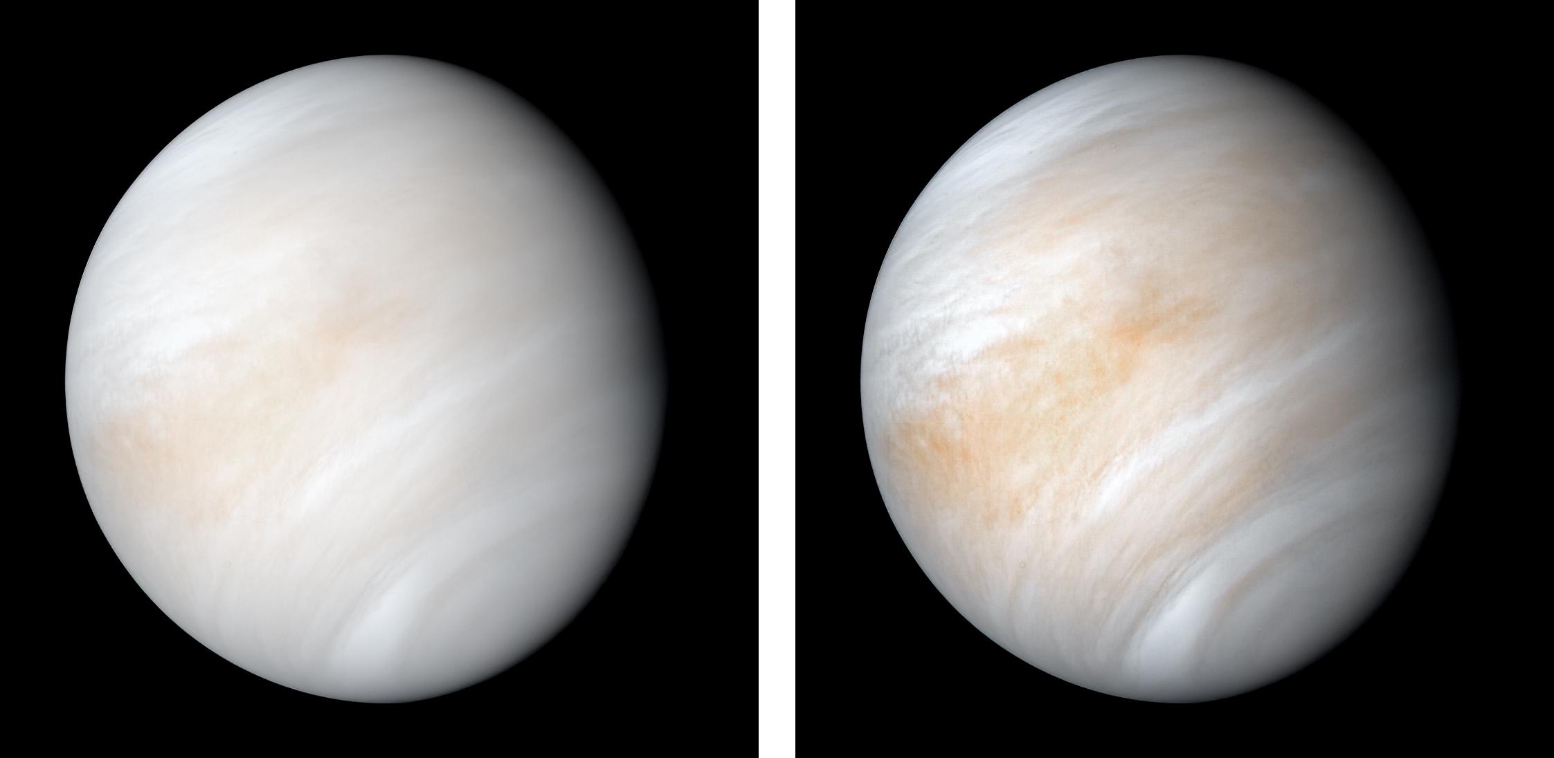
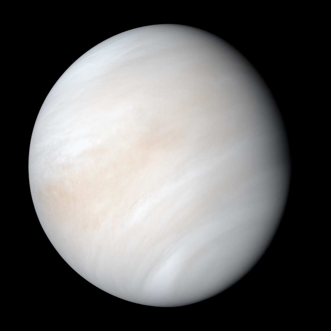
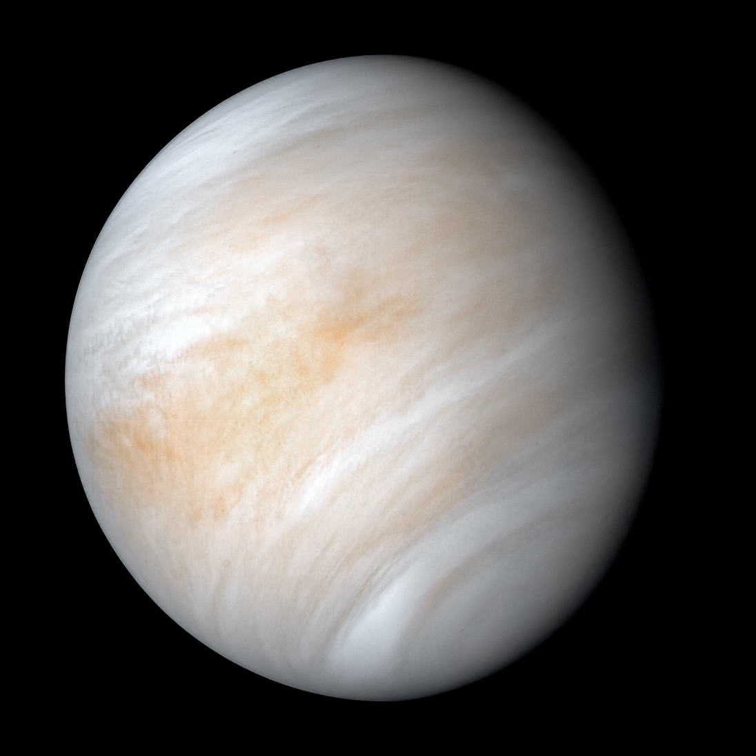
PIA23791: Venus from Mariner 10
https://photojournal.jpl.nasa.gov/catalog/PIA23791
Click here for the combined view for PIA23791
Click on an individual image below for the larger versions:
Click here for Figure A/OLD for PIA23791
Click here for Figure B/NEW for PIA23791
As it sped away from Venus, NASA's Mariner 10 spacecraft captured this seemingly peaceful view of a planet the size of Earth, wrapped in a dense, global cloud layer. But, contrary to its serene appearance, the clouded globe of Venus is a world of intense heat, crushing atmospheric pressure and clouds of corrosive acid.
This newly processed image revisits the original data with modern image processing software. A contrast-enhanced version of this view, also provided here, makes features in the planet's thick cloud cover visible in greater detail.
The clouds seen here are located about 40 miles (60 kilometers) above the planet's surface, at altitudes where Earth-like atmospheric pressures and temperatures exist. They are comprised of sulfuric acid particles, as opposed to water droplets or ice crystals, as on Earth. These cloud particles are mostly white in appearance; however, patches of red-tinted clouds also can be seen. This is due to the presence of a mysterious material that absorbs light at blue and ultraviolet wavelengths. Many chemicals have been suggested for this mystery component, from sulfur compounds to even biological materials, but a consensus has yet to be reached among researchers.
The clouds of Venus whip around the planet at nearly over 200 miles per hour (100 meters per second), circling the globe in about four and a half days. That these hurricane-force winds cover nearly the entire planet is another unexplained mystery, especially given that the solid planet itself rotates at a very slow 4 mph (less than 2 meters per second) — much slower than Earth's rotation rate of about 1,000 mph (450 meters per second).
The winds and clouds also blow to the west, not to the east as on the Earth. This is because the planet itself rotates to the west, backward compared to Earth and most of the other planets. As the clouds travel westward, they also typically progress toward the poles; this can be seen in the Mariner 10 view as a curved spiral pattern at mid latitudes. Near the equator, instead of long streaks, areas of more clumpy, discrete clouds can be seen, indicating enhanced upwelling and cloud formation in the equatorial region, spurred on by the enhanced power of sunlight there.
This view is a false color composite created by combining images taken using orange and ultraviolet spectral filters on the spacecraft's imaging camera. These were used for the red and blue channels of the color image, respectively, with the green channel synthesized by combining the other two images.
Flying past Venus en route to the first-ever flyby of Mercury, Mariner 10 became the first spacecraft to use a gravity assist to change its flight path in order to reach another planet. The images used to create this view were acquired by Mariner 10 on Feb. 7 and 8, 1974, a couple of days after the spacecraft's closest approach to Venus on Feb. 5.
Despite their many differences, comparisons between Earth and Venus are valuable for helping to understand their distinct climate histories. Nearly 50 years after this view was obtained, many fundamental questions about Venus remain unanswered. Did Venus have oceans long ago? How has its atmosphere evolved over time, and when did its runaway greenhouse effect begin? How does Venus lose its heat? How volcanically and tectonically active has Venus been over the last billion years?
This image was processed from archived Mariner 10 data by JPL engineer Kevin M. Gill.
The Mariner 10 mission was managed by NASA's Jet Propulsion Laboratory..svg)
Autor/Urheber: Kwamikagami, Lizenz: CC BY-SA 4.0
Planetary symbol for Venus, biological for female. 60/40 proportions.
.svg)
Autor/Urheber: Denis Moskowitz, Lizenz: CC BY-SA 4.0
Planetary symbol for Neptune, ♆ U+2646. Approximately the alchemical symbol for quicklime/calx (the middle tine may be full length, short or absent)
This picture is color and brightness-corrected based on File:Uranus true colour.jpg. Fringes from the original color image is omitted.
Original caption: This is an image of the planet Uranus taken by the spacecraft Voyager 2 in 1986. The Voyager project is managed for NASA by the Jet Propulsion Laboratory.
.svg)
Autor/Urheber: Denis Moskowitz, Lizenz: CC BY-SA 4.0
Planetary symbol for Uranus. U+26E2 ⛢.