Liste der Parishes in Louisiana
Der US-amerikanische Bundesstaat Louisiana ist in 64 Parishes eingeteilt, die den Countys in den meisten übrigen Bundesstaaten entsprechen.
Die offizielle Abkürzung des Staates Louisiana lautet LA, der FIPS-Code ist 22.[1]
Der FIPS-Code für jedes einzelne Parish beginnt also stets mit 22, an die jeweils eine dreistellige Zahl angehängt wird.
Die Angaben der Bevölkerungszahlen basieren auf der Volkszählung im Jahr 2010.
| Parish | FIPS-Code[2] | Parish Seat | Gründung | Ursprung | Namensherkunft | Einwohner 2010[3] | Fläche[2] | Karte |
|---|---|---|---|---|---|---|---|---|
| Acadia | 001 | Crowley | 1886 | St. Landry Parish | Acadians – Bezeichnung für die ursprünglich im östlichen Kanada ansässigen französische Siedler | 61.773 | 1.697 km² |  |
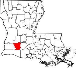
| Allen | 003 | Oberlin | 1912 | Calcasieu Parish | Henry Watkins Allen (1820–1866) – konföderierter Gouverneur von Louisiana (1864–1865) | 25.764 | 1.980 km² |  |
| Ascension | 005 | Donaldsonville | 1807 | Eines von 19 ursprünglichen Parishes in Louisiana | Ascension of Our Lord Catholic Church – Kirche in Donaldsonville | 107.215 | 755 km² |  |
| Assumption | 007 | Napoleonville | 1807 | Eines von 19 ursprünglichen Parishes in Louisiana | Assumption Roman Catholic Church – älteste Kirche im Staat Louisiana | 23.421 | 877 km² |  |
| Avoyelles | 009 | Marksville | 1807 | Eines von 19 ursprünglichen Parishes in Louisiana | Avoyel – mit den Natchez verwandtes Indianervolk | 42.073 | 2.156 km² |  |
| Beauregard | 011 | DeRidder | 1912 | Calcasieu Parish | P. G. T. Beauregard (1818–1893) – General des konföderierten Heeres | 35.654 | 3.005 km² |  |
| Bienville | 013 | Arcadia | 1848 | Claiborne Parish | Jean-Baptiste Le Moyne de Bienville (1680–1767) – französischer Gouverneur von Louisiana (mehrmals zwischen 1701 und 1743) und Gründer von New Orleans (1718) | 14.353 | 2.100 km² |  |
| Bossier | 015 | Benton | 1843 | Claiborne Parish | Pierre Bossier (1797–1844) – Mitglied des US-Repräsentantenhauses (1843–1844) | 116.979 | 2.174 km² |  |
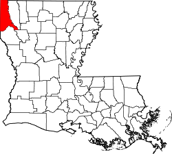
| Caddo | 017 | Shreveport | 1838 | Natchitoches Parish | Caddo – Konföderation mehrerer Indianervölker im Gebiet des Red River in Texas, Arkansas, Louisiana und Oklahoma | 254.969 | 2.284 km² |  |
| Calcasieu | 019 | Lake Charles | 1840 | St. Landry Parish | Indianischer Ausdruck für Schreiender Adler | 192.768 | 2.774 km² |  |
| Caldwell | 021 | Columbia | 1838 | Gebildet aus Teilen des Catahoula und des Ouachita Parish | Die Familie Caldwell, die zu den örtlich bekanntesten gehört | 10.132 | 1.371 km² |  |
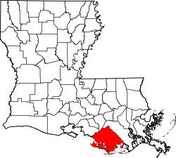
| Cameron | 023 | Cameron | 1870 | Gebildet aus Teilen des Calcasieu und des Vermilion Parish | Simon Cameron (1799–1889) – Kriegsminister der USA (1861–1862) | 6.839 | 3.401 km² |  |
| Catahoula | 025 | Harrisonburg | 1808 | Gebildet aus Teilen des Ouachita und des Rapides Parish | Catahoula Lake, der früher innerhalb der Grenzen des Parishs lag | 10.407 | 1.822 km² |  |
| Claiborne | 027 | Homer | 1828 | Natchitoches Parish | William C. C. Claiborne (1775–1817) – Gouverneur des Orleans-Territoriums (1803–1812) und des Staates Louisiana (1812–1816) | 17.195 | 1.955 km² |  |
| Concordia | 029 | Vidalia | 1807 | Eines der ursprünglichen 19 Parishes in Louisiana | Spanischer Militärposten | 20.822 | 1.802 km² |  |
| De Soto | 031 | Mansfield | 1843 | Gebildet aus Teilen des Caddo und des Natchitoches Parish | Hernando de Soto (1496 oder 1500–1542) – spanischer Seefahrer und Konquistador, führte die erste weiße Expedition zum Mississippi | 26.656 | 2.272 km² |  |
| East Baton Rouge | 033 | Baton Rouge | 1818 | Westflorida | Das französische Wort bâton rouge (dt.: Roter Pfahl) bezeichnet Grenzpfähle zwischen den Territorien der einzelnen Indianerstämmen | 440.171 | 1.180 km² |  |
| East Carroll | 035 | Lake Providence | 1877 | Carroll Parish | Charles Carroll (1737–1832) – Mitunterzeichner der Unabhängigkeitserklärung der USA | 7.759 | 1.092 km² |  |
| East Feliciana | 037 | Clinton | 1824 | Feliciana Parish | Felicite de Gálvez – Ehefrau von Bernardo de Gálvez, dem spanischen Gouverneur des Louisiana-Territoriums | 20.267 | 1.174 km² |  |
| Evangeline | 039 | Ville Platte | 1910 | St. Landry Parish | Evangeline – Hauptfigur eines Werkes von Henry Wadsworth Longfellow | 33.984 | 1.720 km² |  |
| Franklin | 041 | Winnsboro | 1843 | Gibildet aus Teilen des Carroll, Catahoula, Madison und des Ouachita Parish | Benjamin Franklin (1706–1790) – einer der Gründerväter der USA | 20.767 | 1.615 km² |  |
| Grant | 043 | Colfax | 1868 | Gebildet aus Teilen des Rapides und des Winn Parish | Ulysses S. Grant (1822–1885) – Oberbefehlshaber der US-Army im Bürgerkrieg und 18. Präsident (1869–1877) der USA | 22.309 | 1.671 km² |  |
| Iberia | 045 | New Iberia | 1868 | Gebildet aus Teilen des St. Martin und des St. Mary Parish | spanische Siedler benannten die Region in Erinnerung an die Heimat auf der Iberischen Halbinsel | 73.240 | 1.490 km² |  |
| Iberville | 047 | Plaquemine | 1807 | Eines von 19 ursprünglichen Countys in Louisiana | Pierre Le Moyne d’Iberville (1661–1706) – Gründer der französischen Kolonie Louisiana | 33.387 | 1.602 km² |  |
| Jackson | 049 | Jonesboro | 1845 | Gebildet aus Teilen des Claiborne, Ouachita und des Union Parish | Andrew Jackson (1767–1845) – siebenter Präsident der USA (1829–1837) | 16.274 | 1.476 km² |  |
| Jefferson | 051 | Gretna | 1825 | Orleans Parish | Thomas Jefferson (1743–1826) – dritter Präsident der USA (1801–1809) | 432.552 | 794 km² |  |
| Jefferson Davis | 053 | Jennings | 1912 | Calcasieu Parish | Jefferson Davis (1808–1889) – Erster und einziger Präsident der Konföderierten Staaten von Amerika (1861–1865) | 31.594 | 1.689 km² |  |
| Lafayette | 055 | Lafayette | 1823 | St. Martin Parish | Marquis de La Fayette (1757–1834) – französischer General der Kontinentalarmee im Amerikanischen Unabhängigkeitskrieg | 221.578 | 699 km² |  |
| Lafourche | 057 | Thibodaux | 1807 | Eines von 19 ursprünglichen Parishes in Louisiana | La fourche – französisches Wort für Gabel, hier Flussgabelung bzw. -verzweigung. Gemeint ist der Bayou Lafourche, ein Nebenarm des Mississippi | 96.318 | 2.809 km² |  |
| La Salle | 059 | Jena | 1908 | Catahoula Parish | Robert Cavelier de La Salle (1643–1687) – französischer Entdecker | 14.890 | 1.616 km² |  |
| Lincoln | 061 | Ruston | 1873 | Gebildet aus Teilen des Bienville, Claiborne, Jackson und des Union Parish | Abraham Lincoln (1809–1865) – 16. Präsident der USA | 46.735 | 1.221 km² |  |
| Livingston | 063 | Livingston | 1832 | St. Helena Parish | Edward Livingston (1764–1836) – Außenminister der USA (1831–1833) | 128.026 | 1.678 km² |  |
| Madison | 065 | Tallulah | 1838 | Concordia Parish | James Madison (1751–1836) – vierter Präsident der USA (1809–1817) | 12.093 | 1.616 km² |  |
| Morehouse | 067 | Bastrop | 1844 | Gebildet aus Teilen des Carroll und des Ouachita Parish | Abraham Morehouse – einer der ersten weißen Siedler der Region | 27.979 | 2.057 km² |  |
| Natchitoches | 069 | Natchitoches | 1807 | Eines der 19 ursprünglichen Parishes in Louisiana | Natchitoches – ein der Caddo-Konföderation angehörendes Indianervolk | 39.566 | 3.252 km² |  |
| Orleans | 071 | New Orleans | 1807 | Eines der 19 ursprünglichen Parishes in Louisiana | Philippe II. de Bourbon, duc d’Orléans (1674–1723) – Regent von Frankreich (1716–1723) | 343.829 | 468 km² |  |
| Ouachita | 073 | Monroe | 1807 | Eines der 19 ursprünglichen Parishes in Louisiana | Ouachita – zur Caddo-Konföderation gehörendes Indianervolk im Norden von Louisiana am Ouachita River | 153.720 | 1.581 km² |  |
| Plaquemines | 075 | Pointe à la Hache | 1807 | Eines der 19 ursprünglichen Parishes in Louisiana | Kaki (franz.: Plaqueminier) – Frucht des Kakibaumes | 23.042 | 2.187 km² |  |
| Pointe Coupee | 077 | New Roads | 1807 | Eines der 19 ursprünglichen Parishes in Louisiana | Franz.: la pointe coupée | 22.802 | 1.444 km² |  |
| Rapides Parish | 079 | Alexandria | 1807 | Eines der 19 ursprünglichen Parishes in Louisiana | Stromschnellen (franz.: Rapides) | 131.613 | 3.425 km² |  |
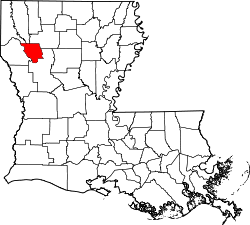
| Red River | 081 | Coushatta | 1871 | Gebildet aus Teilen des Bienville, Bossier, Caddo und des Natchitoches Parish | Red River | 9.091 | 1.008 km² |  |
| Richland | 083 | Rayville | 1868 | Gebildet aus Teilen des Carroll, Franklin, Morehouse und des Ouachita Parish | Rich Land (dt.: fruchtbares Land) | 20.725 | 1.446 km² |  |
| Sabine | 085 | Many | 1843 | Gebildet aus Teilen des Caddo und des Natchitoches Parish | Sabine River sowie Sabine Free State | 24.233 | 2.241 km² |  |
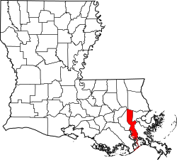
| Saint Bernard | 087 | Chalmette | 1807 | Eines der 19 ursprünglichen Parishes in Louisiana | Bernhard von Clairvaux (um 1090–1153) – Abt, Kreuzzugprediger und Mystiker | 35.875 | 1.204 km² | |
| Saint Charles | 089 | Hahnville | 1807 | Eines der 19 ursprünglichen Parishes in Louisiana | Karl Borromäus (1538–1584) – Kardinal, Erzbischof von Mailand und bedeutender Vertreter der Gegenreformation | 52.780 | 735 km² |  |
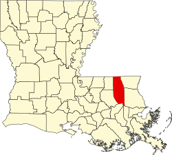
| Saint Helena | 091 | Greensburg | 1810 | Westflorida | Helena (248/250-ca. 330) – Mutter des römischen Kaisers Konstantin | 11.203 | 1.058 km² |  |
| Saint James | 093 | Convent | 1807 | Eines der 19 ursprünglichen Parishes in Louisiana | Jakobus – einer der zwölf Apostel Jesu | 22.102 | 637 km² |  |
| Saint John the Baptist | 095 | Edgard | 1807 | Eines der 19 ursprünglichen Parishes in Louisiana | Johannes der Täufer | 45.924 | 567 km² |  |
| Saint Landry | 097 | Opelousas | 1807 | Eines der 19 ursprünglichen Parishes in Louisiana | Landericus von Paris (?–656) – Bischof von Paris (650–656) | 83.384 | 2.405 km² |  |
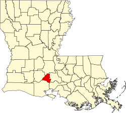
| Saint Martin | 099 | Saint Martinville | 1807 | Eines der 19 ursprünglichen Parishes in Louisiana | Martin von Tours (316/317–397) – Bischof von Tours | 52.160 | 1.916 km² |  |
| Saint Mary | 101 | Franklin | 1811 | St. Martin Parish | Maria (Mutter Jesu) | 54.650 | 1.587 km² |  |
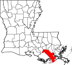
| Saint Tammany | 103 | Covington | 1810 | Westflorida | Tamanend (1628–1698) – Häuptling der Lenni Lenape | 233.740 | 2.212 km² |  |
| Tangipahoa | 105 | Amite City | 1868 | Gebildet aus Teilen des Livingston, St. Helena, St. Tammany und des Washington Parish | Indianischer Ausdruck | 121.097 | 2.047 km² |  |
| Tensas | 107 | Saint Joseph | 1843 | Concordia Parish | Taensa – Indianerstamm im Nordosten Louisiana | 5.252 | 1.560 km² |  |
| Terrebonne | 109 | Houma | 1822 | Lafourche Parish | Französischer Ausdruck für Gutes Land | 111.860 | 3.250 km² |  |
| Union | 111 | Farmerville | 1839 | Ouachita Parish | Die Union – damals übliche (innenpolitische) Bezeichnung für die USA | 22.721 | 2.273 km² |  |
| Vermilion | 113 | Abbeville | 1844 | Lafayette Parish | Vermilion River | 57.999 | 3.040 km² |  |
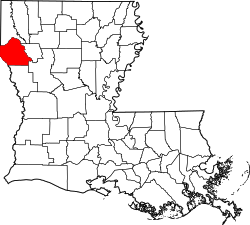
| Vernon | 115 | Leesville | 1871 | Gebildet aus Teilen des Natchitoches, Rapides und des Sabine Parish | Mount Vernon – Landsitz von George Washington | 52.334 | 3.441 km² |  |
| Washington | 117 | Franklinton | 1819 | St. Tammany Parish | George Washington (1732–1799) – erster Präsident der USA | 47.168 | 1.734 km² |  |
| Webster | 119 | Minden | 1871 | Gebildet aus Teilen des Bienville, Bossier und des Claiborne Parish | Daniel Webster (1782–1852) – Außenminister der USA (1841–1843, 1850–1852) | 41.207 | 1.542 km² |  |
| West Baton Rouge | 121 | Port Allen | 1807 | Eines der 19 ursprünglichen Parishes von Louisiana | Das französische Wort bâton rouge (dt.: Roter Pfahl) bezeichnet Grenzpfähle zwischen den Territorien der einzelnen Indianerstämmen | 23.788 | 495 km² |  |
| West Carroll | 123 | Oak Grove | 1877 | Carroll Parish | Charles Carroll (1737–1832) – Mitunterzeichner der Unabhängigkeitserklärung der USA | 11.604 | 931 km² |  |
| West Feliciana | 125 | St. Francisville | 1824 | Feliciana Parish | Felicite de Gálvez – Ehefrau von Bernardo de Gálvez, dem spanischen Gouverneur des Louisiana-Territoriums | 15.625 | 1.052 km² |  |
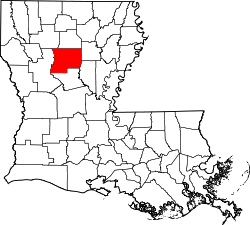
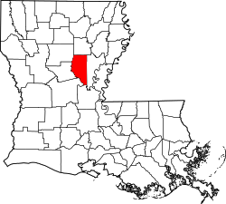
| Winn | 127 | Winnfield | 1852 | Gebildet aus Teilen des Catahoula, Natchitoches und des Rapides Parish | Walter Winn – Abgeordneter in Louisiana | 15.313 | 2.462 km² |  |
Einzelnachweise
- ↑ FIPS-Codes von Louisiana ( des vom 9. Juni 2010 im Internet Archive) Info: Der Archivlink wurde automatisch eingesetzt und noch nicht geprüft. Bitte prüfe Original- und Archivlink gemäß Anleitung und entferne dann diesen Hinweis.
- ↑ a b U.S. Census Bureau – Louisiana – State & County QuickFacts ( des vom 19. Januar 2014 im Internet Archive) Info: Der Archivlink wurde automatisch eingesetzt und noch nicht geprüft. Bitte prüfe Original- und Archivlink gemäß Anleitung und entferne dann diesen Hinweis. Flächenangaben in Quadratmeilen – Umrechnung in Quadratkilometer
- ↑ U.S. Census 2010
Auf dieser Seite verwendete Medien
This is a locator map showing Richland Parish in Louisiana. For more information, see Commons:United States county locator maps.
This is a locator map showing Winn Parish in Louisiana. For more information, see Commons:United States county locator maps.
Locator map showing Natchitoches Parish in Louisiana.
- For more information, see Commons:United States county locator maps.
This is a locator map showing West Feliciana Parish in Louisiana. For more information, see Commons:United States county locator maps.
This is a locator map showing Union Parish in Louisiana. For more information, see Commons:United States county locator maps.
This is a locator map showing East Baton Rouge Parish in Louisiana. For more information, see Commons:United States county locator maps.
This is a locator map showing East Feliciana Parish in Louisiana. For more information, see Commons:United States county locator maps.
This is a locator map showing Orleans Parish in Louisiana. For more information, see Commons:United States county locator maps.
This is a locator map showing Ouachita Parish in Louisiana. For more information, see Commons:United States county locator maps.
This is a locator map showing Concordia Parish in Louisiana. For more information, see Commons:United States county locator maps.
This is a locator map showing Beauregard Parish in Louisiana. For more information, see Commons:United States county locator maps.
This is a locator map showing Vernon Parish in Louisiana. For more information, see Commons:United States county locator maps.
This is a locator map showing Lafayette Parish in Louisiana. For more information, see Commons:United States county locator maps.
This is a locator map showing Saint John the Baptist Parish in Louisiana. For more information, see Commons:United States county locator maps.
This is a locator map showing Saint Landry Parish in Louisiana. For more information, see Commons:United States county locator maps.
This is a locator map showing Ascension Parish in Louisiana. For more information, see Commons:United States county locator maps.
This is a locator map showing Rapides Parish in Louisiana. For more information, see Commons:United States county locator maps.
This is a locator map showing Lincoln Parish in Louisiana. For more information, see Commons:United States county locator maps.
This is a locator map showing Evangeline Parish in Louisiana. For more information, see Commons:United States county locator maps.
This is a locator map showing Pointe Coupee Parish in Louisiana. For more information, see Commons:United States county locator maps.
This is a locator map showing Bossier Parish in Louisiana. For more information, see Commons:United States county locator maps.
This is a locator map showing Calcasieu Parish in Louisiana. For more information, see Commons:United States county locator maps.
This is a locator map showing Caddo Parish in Louisiana. For more information, see Commons:United States county locator maps.
This is a locator map showing Grant Parish in Louisiana. For more information, see Commons:United States county locator maps.
Locator Map of Louisiana, United States
This is a locator map showing Terrebonne Parish in Louisiana. For more information, see Commons:United States county locator maps.
This is a locator map showing West Carroll Parish in Louisiana. For more information, see Commons:United States county locator maps.
This is a locator map showing Claiborne Parish in Louisiana. For more information, see Commons:United States county locator maps.
This is a locator map showing Saint Charles Parish in Louisiana. For more information, see Commons:United States county locator maps.
This is a locator map showing Morehouse Parish in Louisiana. For more information, see Commons:United States county locator maps.
This is a locator map showing Caldwell Parish in Louisiana. For more information, see Commons:United States county locator maps.
This is a locator map showing Saint Tammany Parish in Louisiana. For more information, see Commons:United States county locator maps.
This is a locator map showing Iberia Parish in Louisiana. For more information, see Commons:United States county locator maps.
This is a locator map showing Jackson Parish in Louisiana. For more information, see Commons:United States county locator maps.
This is a locator map showing w:Baton Rouge in Louisiana. For more information, see Commons:United States county locator maps.
This is a locator map showing Avoyelles Parish in Louisiana. For more information, see Commons:United States county locator maps.
This is a locator map showing St. Bernard Parish in Louisiana. For more information, see Commons:United States county locator maps.
This is a locator map showing Lafourche Parish in Louisiana. For more information, see Commons:United States county locator maps.
This is a locator map showing Iberville Parish in Louisiana. For more information, see Commons:United States county locator maps.
This is a locator map showing Bienville Parish in Louisiana. For more information, see Commons:United States county locator maps.
This is a locator map showing Plaquemines Parish in Louisiana. For more information, see Commons:United States county locator maps.
This is a locator map showing LaSalle Parish in Louisiana. For more information, see Commons:United States county locator maps.
This is a locator map showing Saint Helena Parish in Louisiana. For more information, see Commons:United States county locator maps.
This is a locator map showing Livingston Parish in Louisiana. For more information, see Commons:United States county locator maps.
This is a locator map showing East Carroll Parish in Louisiana. For more information, see Commons:United States county locator maps.
This is a locator map showing Acadia Parish in Louisiana. For more information, see Commons:United States county locator maps.
This is a locator map showing Washington Parish in Louisiana. For more information, see Commons:United States county locator maps.
This is a locator map showing Saint Martin Parish in Louisiana. For more information, see Commons:United States county locator maps.
This is a locator map showing Vermilion Parish in Louisiana. For more information, see Commons:United States county locator maps.
This is a locator map showing Saint Mary Parish in Louisiana. For more information, see Commons:United States county locator maps.
This is a locator map showing Franklin Parish in Louisiana. For more information, see Commons:United States county locator maps.
This is a locator map showing Cameron Parish in Louisiana. For more information, see Commons:United States county locator maps.
This is a locator map showing Madison Parish in Louisiana. For more information, see Commons:United States county locator maps.
This is a locator map showing Jefferson Parish in Louisiana. For more information, see Commons:United States county locator maps.
This is a locator map showing Assumption Parish in Louisiana. For more information, see Commons:United States county locator maps.
This is a locator map showing West Baton Rouge Parish in Louisiana. For more information, see Commons:United States county locator maps.
Locator map showing Saint James Parish in Louisiana.
- For more information, see Commons:United States county locator maps.
This is a locator map showing Red River Parish in Louisiana. For more information, see Commons:United States county locator maps.
This is a locator map showing Catahoula Parish in Louisiana. For more information, see Commons:United States county locator maps.
This is a locator map showing Tangipahoa Parish in Louisiana. For more information, see Commons:United States county locator maps.
This is a locator map showing Tensas Parish in Louisiana.
This is a locator map showing Sabine Parish in Louisiana. For more information, see Commons:United States county locator maps.
This is a locator map showing Allen Parish in Louisiana. For more information, see Commons:United States county locator maps.
This is a locator map showing Webster Parish in Louisiana. For more information, see Commons:United States county locator maps.

