Liste der Kommunen von Benin

Die zwölf Departements des westafrikanischen Staates Benin sind in 77 Kommunen unterteilt, diese wiederum in Arrondissements und diese schließlich in Dörfer oder Städtische Distrikte.[1]
Kommunen nach Departements
Die Kommunen sind nachfolgend nach Departements aufgelistet:


- Boukoumbé
- Cobly
- Kérou
- Kouandé
- Matéri
- Natitingou
- Pehonko
- Tanguiéta
- Toucountouna

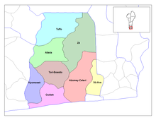
- Abomey-Calavi
- Allada
- Kpomassè
- Ouidah
- Sô-Ava
- Toffo
- Tori-Bossito
- Zè


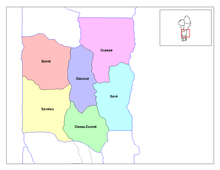
- Bantè
- Dassa-Zoumè
- Glazoué
- Ouèssè
- Savalou
- Savè

- Aplahoué
- Djakotomey
- Dogbo-Tota
- Klouékanmè
- Lalo
- Toviklin


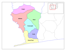
- Athiémè
- Bopa
- Comé
- Grand-Popo
- Houéyogbé

- Adjarra
- Adjohoun
- Aguegues
- Akpro-Missérété
- Avrankou
- Bonou
- Dangbo
- Porto-Novo
- Sèmè-Kpodji

- Ifangni
- Adja-Ouèrè
- Kétou
- Pobè
- Sakété

Siehe auch
Weblinks
- Monographies Communales (französisch)
Einzelnachweise
Auf dieser Seite verwendete Medien
(c) OOjs UI Team and other contributors, MIT
An icon from the OOjs UI MediaWiki lib.
Map of the communes of the department of Ouémé, Benin. Created by Rarelibra for public domain use. Created using MapInfo Professional v7.5 and various mapping resources.
Map of the communes of the department of Atlantique, Benin. Created by Rarelibra for public domain use. Created using MapInfo Professional v7.5 and various mapping resources.
Autor/Urheber: PouX, Lizenz: CC BY-SA 3.0
Communes of Benin. Drawn from Map Library data
Map of the communes of the department of Borgou, Benin. Created by Rarelibra for public domain use. Created using MapInfo Professional v7.5 and various mapping resources.
Map of the communes of the department of Donga, Benin. Created by Rarelibra for public domain use. Created using MapInfo Professional v7.5 and various mapping resources.
Map of the communes of the department of Zou, Benin. Created by Rarelibra for public domain use.
Map of the communes of the department of Atakora, Benin. Created by Rarelibra for public domain use. Created using MapInfo Professional v7.5 and various mapping resources.
Map of the communes of the department of Collines, Benin. Created by Rarelibra for public domain use. Created using MapInfo Professional v7.5 and various mapping resources.
Map of the communes of the department of Mono, Benin.
Map of the communes of the department of Alibori, Benin.
Map of the communes of the department of Plateau, Benin. Created by Rarelibra for public domain use. Created using MapInfo Professional v7.5 and various mapping resources.
Map of the communes of the department of Kouffo, Benin. Created by Rarelibra for public domain use. Created using MapInfo Professional v7.5 and various mapping resources.


