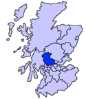
Liste der Kategorie-A-Bauwerke in der Council Area Stirling

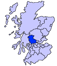
Lage von Stirling in Schottland

Die Liste der Kategorie-A-Gebäude in der Council Area Stirling umfasst sämtliche in der Kategorie A eingetragenen Baudenkmäler in der schottischen Council Area Stirling. Die Einstufung wird anhand der Kriterien von Historic Scotland vorgenommen, wobei in die höchste Kategorie A Bauwerke von nationaler oder internationaler Bedeutung einsortiert sind. In Stirling sind derzeit 86 Bauwerke in der Kategorie A gelistet.

NameLageTypEintragBild
Lecropt Churchnahe Bridge of Allan
56° 9′ 30,7″ N, 3° 57′ 54″ W
Kirche173
Lecropt Church
(c) Alex McGregor, CC BY-SA 2.0
Gutshof von Keir Housenahe Dunblane
56° 10′ 14,1″ N, 3° 58′ 42,8″ W
Bauernhof3918
South Lodge von Keir Housenahe Dunblane
56° 10′ 7,4″ N, 3° 58′ 23,5″ W
Wohngebäude3921
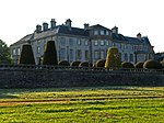
Keir Housenahe Dunblane
56° 9′ 57,7″ N, 3° 58′ 57,9″ W
Herrenhaus3935
Keir House
(c) Andrew Smith, CC BY-SA 2.0
Old Auchentroignahe Buchlyvie
56° 6′ 43,9″ N, 4° 20′ 32,3″ W
Wohngebäude3937
Queen Victoria SchoolDunblane
56° 12′ 3,1″ N, 3° 57′ 11″ W
Schule3986
Kapelle der Queen Victoria SchoolDunblane
56° 12′ 0″ N, 3° 57′ 9,6″ W
Kirche3987
Sonnenuhr von Cromlix Housenahe Kinbuck
56° 13′ 52,2″ N, 3° 57′ 58,9″ W
Sonnenuhr3997
Staumauer von Loch Venacharnahe Callander
56° 13′ 47,4″ N, 4° 15′ 47,4″ W
Wasserbauwerk4060
Couligartan Aqueduct 1nahe Loch Ard
56° 10′ 18,5″ N, 4° 29′ 57,7″ W
Brücke4151
Couligartan Aqueduct 2nahe Loch Ard
56° 10′ 10,5″ N, 4° 29′ 46,2″ W
Brücke4152
Couligartan Aqueduct 2
(c) Iain Thompson, CC BY-SA 2.0
Couligartan Aqueduct 3nahe Loch Ard
56° 9′ 56,7″ N, 4° 29′ 15,5″ W
Brücke4153
Duchray Bridgenahe Loch Ard
56° 9′ 42,4″ N, 4° 28′ 34,2″ W
Brücke4155
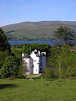
Edinample Castlenahe Lochearnhead
56° 22′ 31,7″ N, 4° 15′ 56,7″ W
Burg4198
Edinample Castle
(c) Karl and Ali, CC BY-SA 2.0
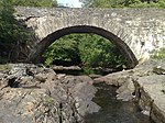
Drip Old Bridgenahe Stirling
56° 8′ 14,4″ N, 3° 58′ 50,2″ W
Brücke6725
Drip Old Bridge
(c) Richard Webb, CC BY-SA 2.0
Catter Housenahe Drymen
56° 3′ 7,8″ N, 4° 27′ 23,1″ W
Herrenhaus7628
Gribloch Housenahe Kippen
56° 6′ 52,9″ N, 4° 11′ 17,3″ W
Villa8191
Doune Stablenahe Doune
56° 12′ 12,1″ N, 4° 5′ 7,6″ W
Stallung8220
Old Newton HouseDoune
56° 11′ 11,6″ N, 4° 2′ 43,8″ W
Tower House8227
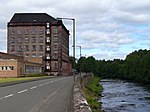
Deanston MillDeanston
56° 11′ 22,7″ N, 4° 4′ 16,1″ W
Industriebauwerk8230
Deanston Mill
(c) Colin Smith, CC BY-SA 2.0
Weberei der Deanston MillDeanston
56° 11′ 21,4″ N, 4° 4′ 18,3″ W
Industriebauwerk8231
Lanrick Macgregor Monumentnahe Deanston
56° 12′ 2,4″ N, 4° 7′ 22,2″ W
Denkmal8244
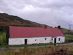
Moirlanich Longhousenahe Killin
56° 28′ 38,5″ N, 4° 20′ 9,7″ W
Wohngebäude8263Moirlanich Longhouse
Bridge of DochartKillin
56° 27′ 46,1″ N, 4° 19′ 11,9″ W
Brücke8275
Bridge of Dochart
(c) Simon Johnston, CC BY-SA 2.0
Dochart ViaductKillin
56° 27′ 54,9″ N, 4° 18′ 56″ W
Brücke8281
Dochart Viaduct
(c) Iain Lees, CC BY-SA 2.0
Kincardine-in-Mentieth Parish ChurchBlair Drummond
56° 9′ 54,1″ N, 4° 3′ 50,5″ W
Kirche8431
Kincardine-in-Mentieth Parish Church
(c) Andrew Smith, CC BY-SA 2.0
Buchanan MonumentKillearn
56° 2′ 37,7″ N, 4° 22′ 23″ W
Denkmal10389Buchanan Monument
AuchenibertKillearn
56° 2′ 32,3″ N, 4° 21′ 35,6″ W
Villa10422
Gargunnock HouseGargunnock
56° 7′ 33,3″ N, 4° 4′ 4,4″ W
Herrenhaus10438
Gargunnock House
(c) Stephen Bashford, CC BY-SA 2.0
Old Leckie Housenahe Gargunnock
56° 7′ 36,9″ N, 4° 6′ 33,9″ W
Herrenhaus10445
Blairlogie CastleBlairlogie
56° 9′ 3,5″ N, 3° 53′ 20,2″ W
Tower House10461
Culcreuch Castlenahe Fintry
56° 3′ 43,2″ N, 4° 13′ 3,3″ W
Tower House10467
Culcreuch Castle
(c) Richard Webb, CC BY-SA 2.0
Dun EaglaisKippen
56° 7′ 39,5″ N, 4° 10′ 2,4″ W
Villa12515
Milnholm Hatcherynahe Stirling
56° 3′ 59,2″ N, 3° 57′ 16,2″ W
Fischfarm15275
Bannockburn Housenahe Stirling
56° 4′ 40,3″ N, 3° 54′ 55,1″ W
Herrenhaus15277
Touch Housenahe Stirling
56° 6′ 40,2″ N, 4° 0′ 22,5″ W
Herrenhaus15295
Auchenbowie Housenahe Stirling
56° 3′ 51,5″ N, 3° 55′ 51,8″ W
Villa15303
Howietoun Fisherynahe Stirling
56° 4′ 21,9″ N, 3° 57′ 11,3″ W
Fischfarm15306
Hayford MillsCambusbarron
56° 6′ 46,4″ N, 3° 58′ 13,6″ W
Industriebauwerk19117
Cardross Housenahe Kippen
56° 9′ 4,4″ N, 4° 14′ 50,7″ W
Herrenhaus19708
Cardross House
(c) Derek Ferris, CC BY-SA 2.0
Bridge of ArdochDoune
56° 11′ 14,2″ N, 4° 2′ 52,5″ W
Brücke24667
Bridge of Ardoch
(c) Keith Salvesen, CC BY-SA 2.0
Bridge of TeithDoune
56° 11′ 11,8″ N, 4° 3′ 40,6″ W
Brücke24668
Marktkreuz von DouneDoune
56° 11′ 22,8″ N, 4° 3′ 10″ W
Marktkreuz24671Marktkreuz von Doune
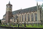
Dunblane CathedralDunblane
56° 11′ 22,1″ N, 3° 57′ 54,3″ W
Kirche26361
Dunblane Cathedral
(c) Kevin Rae, CC BY-SA 2.0
Ault WharrieDunblane
56° 11′ 7,4″ N, 3° 56′ 52,3″ W
Villa26365
Leighton LibraryDunblane
56° 11′ 19,1″ N, 3° 57′ 51,9″ W
Bibliothek26371
Leighton Library
(c) Bill Cresswell, CC BY-SA 2.0
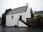
Dunblane MuseumDunblane
56° 11′ 20,4″ N, 3° 57′ 51,4″ W
Museum26372Dunblane Museum
Church of the Holy RudeStirling
56° 7′ 14,9″ N, 3° 56′ 40″ W
Kirche41083Church of the Holy Rude
Friedhof der Church of the Holy RudeStirling
56° 7′ 17″ N, 3° 56′ 43,9″ W
Friedhof41084
Friedhof der Church of the Holy Rude
(c) Carlos Delgado, CC BY-SA 3.0
Holy Trinity Episcopal ChurchStirling
56° 7′ 5,9″ N, 3° 56′ 34,1″ W
Kirche41089
Holy Trinity Episcopal Church
(c) Tom Sargent, CC BY-SA 2.0
St Ninians Old Parish KirkStirling
56° 6′ 9,6″ N, 3° 56′ 15,8″ W
Kirche41095
Friedhof der St Ninians Old Parish KirkStirling
56° 6′ 9,7″ N, 3° 56′ 14,6″ W
Friedhof41096
Friedhof der St Ninians Old Parish Kirk
(c) Robert Ferguson, CC BY-SA 2.0
AthenaeumStirling
56° 7′ 6,5″ N, 3° 56′ 18,7″ W
Clubhaus41100Athenaeum
Cowane’s HospitalStirling
56° 7′ 13,8″ N, 3° 56′ 42,2″ W
Krankenhaus41101Cowane’s Hospital
Altes Stadtgefängnis von StirlingStirling
56° 7′ 11,8″ N, 3° 56′ 38,5″ W
Gefängnis41104Altes Stadtgefängnis von Stirling
Stirling TolboothStirling
56° 7′ 14,5″ N, 3° 56′ 34,1″ W
Rathaus41110Stirling Tolbooth
Wallace MonumentStirling
56° 8′ 19,7″ N, 3° 55′ 3,9″ W
Turm41118Wallace Monument
Alter Stadtfriedhof von StirlingStirling
56° 7′ 17,9″ N, 3° 56′ 43,7″ W
Friedhof41126Alter Stadtfriedhof von Stirling
Old BridgeStirling
56° 7′ 43″ N, 3° 56′ 12,9″ W
Brücke41129
Old Bridge
(c) william craig, CC BY-SA 2.0
Bahnhof StirlingStirling
56° 7′ 11,8″ N, 3° 56′ 6,5″ W
Bahnhof41131
Bahnhof Stirling
(c) Paul McIlroy, CC BY-SA 2.0
Stirling Highland HotelStirling
56° 7′ 9,7″ N, 3° 56′ 30,8″ W
Hotel41133Stirling Highland Hotel
Äußere Verteidigungsmauer von Stirling CastleStirling
56° 7′ 24″ N, 3° 56′ 48,5″ W
Burganlage41136Äußere Verteidigungsmauer von Stirling Castle
Vorwerk von Stirling CastleStirling
56° 7′ 25″ N, 3° 56′ 50,2″ W
Burganlage41137Vorwerk von Stirling Castle
Palast von Stirling CastleStirling
56° 7′ 24,8″ N, 3° 56′ 52,4″ W
Palast41138Palast von Stirling Castle
Große Halle von Stirling CastleStirling
56° 7′ 26,5″ N, 3° 56′ 51,8″ W
Burganlage41139Große Halle von Stirling Castle
Königskapelle von Stirling CastleStirling
56° 7′ 27,2″ N, 3° 56′ 53,7″ W
Kirche41140
Königskapelle von Stirling Castle
(c) Bill Harrison, CC BY-SA 2.0
The MintStirling
56° 7′ 27,1″ N, 3° 56′ 51″ W
Burganlage41141
The Mint
(c) Mark Hope, CC BY-SA 2.0
Küche und große Batterie von Stirling CastleStirling
56° 7′ 25,6″ N, 3° 56′ 49″ W
Burganlage41142Küche und große Batterie von Stirling Castle
Alter Königspalast von Stirling CastleStirling
56° 7′ 26,5″ N, 3° 56′ 55,2″ W
Palast41143
Alter Königspalast von Stirling Castle
(c) Mark Hope, CC BY-SA 2.0
Sonnenuhr von Stirling CastleStirling
56° 7′ 27,8″ N, 3° 56′ 55,4″ W
Sonnenuhr41144
Regimentsquartier von Stirling CastleStirling
56° 7′ 25,4″ N, 3° 56′ 49,8″ W
Burganlage41145
Darnley’s HouseStirling
56° 7′ 14,1″ N, 3° 56′ 29,9″ W
Wohngebäude41239Darnley’s House
Moir of Leckie’s HouseStirling
56° 7′ 14,1″ N, 3° 56′ 28,2″ W
Wohngebäude41240
James Norrie’s LodgingStirling
56° 7′ 15,4″ N, 3° 56′ 33,3″ W
Wohngebäude41246
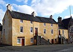
James Norrie’s Lodging
(c) Richard Kay, CC BY-SA 2.0
Argyll’s LodgingStirling
56° 7′ 18,5″ N, 3° 56′ 37,3″ W
Wohngebäude41255Argyll’s Lodging
Bruce of Auchenbowie’s HouseStirling
56° 7′ 13,9″ N, 3° 56′ 37,5″ W
Wohngebäude41464
John Cowane’s HouseStirling
56° 7′ 19,5″ N, 3° 56′ 33,1″ W
Wohngebäude41466
John Cowane’s House
(c) Robert Murray, CC BY-SA 2.0
Glengarry LodgeStirling
56° 7′ 11,5″ N, 3° 56′ 30″ W
Wohngebäude41484
Glengarry Lodge
(c) Paul McIlroy, CC BY-SA 2.0
Wehr der Deanston Millnahe Deanston
56° 11′ 56,2″ N, 4° 5′ 33,2″ W
Wasserbauwerk47650
Bannockburn RotundaStirling
56° 5′ 36,1″ N, 3° 56′ 16,1″ W
Denkmal49860
Bannockburn Rotunda
(c) Andrew Shiva / Wikipedia, CC BY-SA 4.0
Wehr des Royal Cottage AqueductLoch Katrine
56° 14′ 52,1″ N, 4° 32′ 57,3″ W
Wasserbauwerk50298
Sonnenuhr auf dem Privatfriedhof der Familie CayzerGartmore
56° 8′ 38,9″ N, 4° 22′ 55,9″ W
Sonnenuhr50406
Loch Arklet DamLoch Arklet
56° 14′ 53,4″ N, 4° 39′ 17,2″ W
Wasserbauwerk50461
Loch Arklet Dam
(c) Gordon Brown, CC BY-SA 2.0
Castle Burn Aqueductnahe Loch Ard
56° 9′ 27,6″ N, 4° 27′ 51,6″ W
Brücke51152
Castle Burn Aqueduct
(c) Iain Thompson, CC BY-SA 2.0
Rektorenvilla der Universität StirlingStirling
56° 8′ 56,6″ N, 3° 54′ 53″ W
Villa51322
Pathfoot BuildingStirling
56° 8′ 57,4″ N, 3° 55′ 36,2″ W
Universität51327Pathfoot Building

Weblinks

Commons: Kategorie-A-Bauwerke in Stirling – Sammlung von Bildern, Videos und Audiodateien

Auf dieser Seite verwendete Medien

The Loch Arklet Dam - geograph.org.uk - 1343639.jpg
(c) Gordon Brown, CC BY-SA 2.0
The Loch Arklet Dam Completed in June 1914 as part of the Glasgow Water Works system with Loch Katrine.
Old Bridge, Drip - geograph.org.uk - 1713045.jpg
(c) Richard Webb, CC BY-SA 2.0
Old Bridge, Drip The old bridge, now replaced by a modern one, shortly before the Forth joins the Teith.
Stirling cemetery.jpg
Autor/Urheber: Dmso, Lizenz: CC BY-SA 4.0
Dieses Foto zeigt das geschützte Denkmal in Schottland mit der Nummer
Church Of The Holy Rood 2013-09-03 22-28-40.jpg
Autor/Urheber: Conxa Roda, Lizenz: CC BY-SA 3.0
Dieses Foto zeigt das geschützte Denkmal in Schottland mit der Nummer
Holy Trinity Scottish Episcopal Church - geograph.org.uk - 1083935.jpg
(c) Tom Sargent, CC BY-SA 2.0
Holy Trinity Scottish Episcopal Church
Pathfoot Building.jpg
Autor/Urheber: University of Stirling, Lizenz: CC BY 4.0
Pathfoot Building University of Stirling
Stirling Castle - geograph.org.uk - 1203487.jpg
(c) Mark Hope, CC BY-SA 2.0
Stirling Castle Under the archway is the oldest surviving gateway to the castle
Stirling Tolbooth, Stirling.jpg

(18th century) Stirling Tolbooth, Stirling, Scotland
St Ninians Old Parish Church graveyard - geograph.org.uk - 1189750.jpg
(c) Robert Ferguson, CC BY-SA 2.0
St Ninians Old Parish Church graveyard A sadly neglected and vandalised site that is in dire need of some TLC and restoration.
The Athenaeum, King Street, Stirling (28607891015).jpg
Autor/Urheber: Robert Cutts from Bristol, England, UK, Lizenz: CC BY 2.0
It was built in 1816 as a reading room to a design by William Stirling. In 1859 the portico and statue of William Wallace were added by Charles Rogers. It was Rogers who designed the nearby Wallace Monument.
Old Railway Bridge over the River Dochart - geograph.org.uk - 880535.jpg
(c) Iain Lees, CC BY-SA 2.0
Old Railway Bridge over the River Dochart
Morlanich Longhouse 2004.jpg
Photo of Moirlanich Lnghouse taken 2004 by Willie Angus
Culcreuch Castle.jpg
(c) Richard Webb, CC BY-SA 2.0
Culcreuch Castle.
Dunblane Museum.jpg
Autor/Urheber: Graham Laird, Lizenz: CC BY-SA 3.0
Dieses Foto zeigt das geschützte Denkmal in Schottland mit der Nummer
The church, Kincardine-in-Menteith - geograph.org.uk - 183828.jpg
(c) Andrew Smith, CC BY-SA 2.0
Kincardine Parish Church, Kincardine-in-Menteith, Stirlingshire, Scotland, seen from the southwest
Scottish-Castle-Symbol.svg
Autor/Urheber: Majo statt Senf, Lizenz: CC BY-SA 4.0
Schlosssymbol Schottland
Norie's House, Broad Street, Stirling - geograph.org.uk - 680502.jpg
(c) Richard Kay, CC BY-SA 2.0
Norie's House, Broad Street, Stirling James Norie was a lawyer and town clerk in Stirling and built his fashionable new house in 1671. It even had its own well! The site belonged to his wife's parents an the family initials can be seen over the window, along with the Latin mottoes such as "Wisdom is the tree of life". At the top of the roof you can see Norie's wigged head looking down on you.
Gargunnock House - geograph.org.uk - 81483.jpg
(c) Stephen Bashford, CC BY-SA 2.0
Gargunnock House. Gargonnock House owned & let by The Landmark Trust. 11 of us stayed here in Feb 2000
The Leighton Library, Dunblane - geograph.org.uk - 242542.jpg
(c) Bill Cresswell, CC BY-SA 2.0
The Leighton Library, Dunblane. The oldest private library in Scotland. Built to house the books of Robert Leighton, Bishop of Dunblane (1611-1684). A collection of 4,500 books from 1505-1840 in 80 languages.
Cardross House - geograph.org.uk - 441755.jpg
(c) Derek Ferris, CC BY-SA 2.0
Cardross House Set in beautifully landscaped parkland.
Stirling Railway Station - geograph.org.uk - 525924.jpg
(c) Paul McIlroy, CC BY-SA 2.0
Stirling Railway Station There have been several railway stations in Stirling since 1848, this one has been here since 1916.
Stirling Castle - geograph.org.uk - 1203509.jpg
(c) Mark Hope, CC BY-SA 2.0
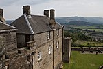
Stirling Castle The old royal apartments within the castle
Cowane's Hospital, 2003.JPG
Autor/Urheber: Elisa.rolle, Lizenz: CC BY-SA 3.0
Dieses Foto zeigt das geschützte Denkmal in Schottland mit der Nummer
Keir House - geograph.org.uk - 187323.jpg
(c) Andrew Smith, CC BY-SA 2.0
Keir House. Formerly the ancestral home of the Stirling family. It appears to me that it is virtually impossible to photograph it from within its grid-square.
Aqueduct in Loch Ard Forest - geograph.org.uk - 1033736.jpg
(c) Iain Thompson, CC BY-SA 2.0
Aqueduct in Loch Ard Forest This aqueduct carries water from Loch Katrine to Glasgow.
Chapel Royal, Stirling Castle - geograph.org.uk - 1484086.jpg
(c) Bill Harrison, CC BY-SA 2.0
Chapel Royal, Stirling Castle
Aqueduct in Loch Ard Forest - geograph.org.uk - 196801.jpg
(c) Iain Thompson, CC BY-SA 2.0
Aqueduct in Loch Ard Forest. The Loch Katrine to Glasgow Aqueduct passing over Castle Burn in Loch Ard Forest
Lecropt Kirk (geograph 4257232).jpg
(c) Alex McGregor, CC BY-SA 2.0
Lecropt Kirk
Bridge of Dochart at Killin - geograph.org.uk - 1364675.jpg
(c) Simon Johnston, CC BY-SA 2.0
Bridge of Dochart at Killin. Falls of Dochart, Killin. The water runs quietly if there hasn't been rain for a while. Fortunate this day as I was down there: 938794 784555 and so were my lads 1364681
Buchanan Obelisk, Killearn.jpg
Autor/Urheber: dave souza, Lizenz: CC BY-SA 4.0
The Buchanan Obelisk in Killearn commemorates the nearby 1506 birthplace of George Buchanan; historian, scholar and tutor to the young King James VI of Scotland.
Stirling Castle Palace, 2003.JPG
Autor/Urheber: Elisa.rolle, Lizenz: CC BY-SA 3.0
Dieses Foto zeigt das geschützte Denkmal in Schottland mit der Nummer
Kitchen, Stirling Castle (15227922226).jpg
Autor/Urheber: Brian Gratwicke from DC, USA, Lizenz: CC BY 2.0
Kitchen, Stirling Castle
Scotland-2016-Aerial-Bannockburn Visitor Centre 01.jpg
(c) Andrew Shiva / Wikipedia, CC BY-SA 4.0
Dieses Foto zeigt das geschützte Denkmal in Schottland mit der Nummer
Robert Spittal's House - geograph.org.uk - 524779.jpg
(c) Paul McIlroy, CC BY-SA 2.0
Robert Spittal's House Situated on Spittal Street, this house was founded in 1530 by Robert Spittal, tailor to James IV, to support the poor.
Stirling - Darnley's House.jpg
Autor/Urheber: Roger Wollstadt from Sarasota, Florida, Lizenz: CC BY-SA 2.0
Lord Darnley, second husband of Mary, Queen of Scots, stayed in this house at the foot of Broad Street when the Queen came to Stirling.
Wfm stirling high v1.jpg
Autor/Urheber: Finlay McWalter, Lizenz: CC-BY-SA-3.0
Stirling Highland Hotel in Stirling, Scotland, UK. The building was formerly the High School of Stirling
Doune, village centre and mercat cross.JPG
Autor/Urheber: Kim Traynor, Lizenz: CC BY-SA 3.0
Doune, village centre and mercat cross
Argyll's Lodging 20090619 02.jpg
Autor/Urheber: Otter, Lizenz: CC BY-SA 3.0
Argyll's Lodging, Stirling, Scotland - east wing facade
Doune, the Old Bridge over Ardoch Burn - geograph.org.uk - 1323494.jpg
(c) Keith Salvesen, CC BY-SA 2.0
Doune: the Old Bridge over Ardoch Burn
ScotlandStirling.png
Autor/Urheber: unknown, Lizenz: CC-BY-SA-3.0
Stirling-Old-Town-Jail-Front.JPG
Autor/Urheber: RayFyfe, Lizenz: CC BY-SA 3.0
This is the front view of the prison building - the Old Town Jail was the new Stirling County Jail which opened in 1847 - and which was described as having a modern design. It relieved pressure on the nearby old Tolbooth Jail.
Old Bridge, Stirling - geograph.org.uk - 29192.jpg
(c) william craig, CC BY-SA 2.0
Old Bridge, Stirling. Spans River Forth
Church Of The Holy Rude Churchyard - 01.jpg
(c) Carlos Delgado, CC BY-SA 3.0
Church Of The Holy Rude Churchyard, Stirling, Scotland, United Kingdom.
Wallace Monument (8038778646).jpg
Autor/Urheber: Steve Collis from Melbourne, Australia, Lizenz: CC BY 2.0
Wallace Monument
Stirling Castle Outer Defences.JPG
Part of the Outer Defences of Stirling Castle, Stirling, Scotland, that were built following the attempted Jacobite invasion of 1708.
John Cowane's House.jpg
(c) Robert Murray, CC BY-SA 2.0
Stirling, John Cowane's house, St. Mary's Wynd