Liste der Kategorie-A-Bauwerke in den Scottish Borders
Die Liste der Kategorie-A-Gebäude in den Scottish Borders umfasst sämtliche in der Kategorie A eingetragenen Baudenkmäler in der schottischen Council Area Scottish Borders. Die Einstufung wird anhand der Kriterien von Historic Scotland vorgenommen, wobei in die höchste Kategorie A Bauwerke von nationaler oder internationaler Bedeutung einsortiert sind. In den Scottish Borders sind derzeit 177 Bauwerke in der Kategorie A gelistet.
Weblinks
Auf dieser Seite verwendete Medien
(c) Walter Baxter, CC BY-SA 2.0
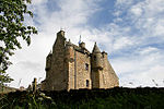
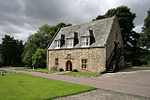
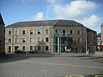
The visitor centre at Ferniehirst Castle
(c) Walter Baxter, CC BY-SA 2.0
Kelso Old Parish Church The church is located in Abbey Row and was built in 1771-73 to an octagonal plan. The walls are of buff sandstone and while the lower windows are rectangular, the upper ones are arched. The slated roof is capped by a cupola. The adjacent churchyard is a grassed and wooded area with a random spread of headstones, obelisks and table tombs. (Source: Pevsner Architectural Guide, The Buildings of Scotland - Borders). Viewed from a car park at the corner of the square.
(c) Adam D Hope, CC BY-SA 2.0
Stables Building The Haining Selkirk These old stables are now converted to living accommodation
(c) Phil Thirkell, CC BY-SA 2.0
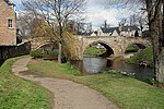
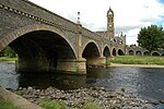
Union Bridge. Taken from the English side.
Autor/Urheber: Scotland. Royal Commission on the Ancient and Historical Monuments and Constructions, Lizenz: No restrictions
Identifier: sixthreportinven00scot (find matches)
Title: Sixth report and inventory of monuments and constructions in the county of Berwick
Year: 1915 (1910s)
Authors: Scotland. Royal Commission on the Ancient and Historical Monuments and Constructions
Subjects:
Publisher: Edinburgh : H.M. Stationery Off.
Contributing Library: Robarts - University of Toronto
Digitizing Sponsor: University of Toronto
View Book Page: Book Viewer
About This Book: Catalog Entry
View All Images: All Images From Book
Click here to view book online to see this illustration in context in a browseable online version of this book.
Text Appearing Before Image:
y the resultof this reconstruction. Heraldic lJaneL—Over the arch of the modern gateway to theeast of the castle is a panel containing two shields bearing arms:Dexter, A saltire between two stars in chief and base and twocrescents in flanks; Sinister, A lion rampant crowned. Carved belowthe shields respectively are the initials A- H and E • M and the date1581. The contents of the panel have been re-cut. The arms andinitials are those of Andrew Haig, who owned Bemersyde at thedate given, and those of his third wife, Elizabeth Macdougall. Sun-dial.—On the lawn to the south of the castle is a sun-dial ofEenaissance design. The dial has a sloping stone gnomon and isoctagonal on plan. It is supported by a moulded baluster resting ona modernised pedestal and approached by three broad steps. The dialface measures 1 foot 8 \ inches between the parallel sides, and theheight from the top of the steps to the point of the gnomon is fully Ancient and Historical Monuments—County of Berwick.
Text Appearing After Image:
Fig. 144.—Dovecot, Mertoun House (No. 262). To face p. 151. inventory of monuments, etc., in county of berwick. 151 Parish of Mertoun. 7 feet. Carved in relief on the northern side of the dial face is ashield bearing the Haig arms with helmet and mantling, and on theeastern margin of the sloping gnomon bemersyde 1691 is also cutin relief. The section of the dial stone is such that sixteen surfacesare developed on the sides, each one bearing a small dial of conven-tional design. See Cast, and Bom. Arch., iii. p. 220, and v. p. 234 (illus.); TheHaigs of Bemersyde, p. 4 (illus.). O.S.M., Ber., xxx. SW. and SE. Visited 15th April 1912. 262. Mertoun House.—This mansion-house is situated on a plateauon the northern bank of the river Tweed, 2 miles east-north-east ofSt Boswells. It is a plain classic building three storeys in heightwith a modern addition at the southern end, and was erected in1702-3 from designs by Sir William Bruce. In the course of altera-tions carried out on this hous
Note About Images
(c) Astrid H, CC BY-SA 2.0
Dieses Foto zeigt das geschützte Denkmal in Schottland mit der Nummer
(c) Walter Baxter, CC BY-SA 2.0
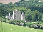
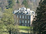
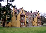
Glenmayne House A large Baronial house on an elevated site overlooking the River Tweed. Built in 1866 for John Murray, a wool merchant and pelt-monger. (Source: Borders and Berwick, An Architectural Guide by Charles Alexander Strang). Viewed in February from a hillside on the opposite side of the River Tweed. The hill in the far background is Meigle Hill.
(c) Walter Baxter, CC BY-SA 2.0
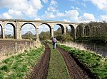
Roxburgh Viaduct Viewed from the Borders Abbeys Way on a fine April day. This bridge carried the St Boswells to Kelso branch railway line over the River Teviot, but it was closed in 1964. The six segmental central spans are curved and skewed, with four semicircular arches either side. A footbridge is attached to the north side of the bridge.
(c) Mark Hope, CC BY-SA 2.0
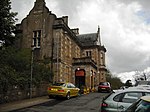
Mary, Queen of Scots Visitor Centre. This 16 Cent. house was where Mary Queen of Scots stayed during her visit to Jedburgh in 1566. Coat of Arms 1208039
Autor/Urheber: Scotland. Royal Commission on the Ancient and Historical Monuments and Constructions, Lizenz: No restrictions
Identifier: sixthreportinven00scot (find matches)
Title: Sixth report and inventory of monuments and constructions in the county of Berwick
Year: 1915 (1910s)
Authors: Scotland. Royal Commission on the Ancient and Historical Monuments and Constructions
Subjects:
Publisher: Edinburgh : H.M. Stationery Off.
Contributing Library: Robarts - University of Toronto
Digitizing Sponsor: University of Toronto
View Book Page: Book Viewer
About This Book: Catalog Entry
View All Images: All Images From Book
Click here to view book online to see this illustration in context in a browseable online version of this book.
Text Appearing Before Image:
h wall, near the east end, is a plain ambry with check for door. Grave-slab.—Lying within the church, at the west end, is asepulchral slab measuring 5 feet 6 inches in length by 1 foot9 inches in breadth bearing a Latin cross. The ends of the arms arepointed and set between four fleurs-de-lis, the lower two of which arestemmed and rise along with the cross from the graduated base. Other two grave-slabs are illustrated in the Proceedings of theBerwickshire Naturalists Club, cited below. See Eccles. Arch., iii. p. 412 (plan and illus.); Ber. Nat. Club,1890-91, p. 168 (illus.). O.S.M., Ber., xx. SE. Visited 10th August 1908. 282. Westruther Church—This church was originally erected in1649, repaired in 1752, and rebuilt in 1840. It is no longer usedas a place of worship, and presents no features of interest. Font.—Set on a wooden stand within the church is a roundunornamented stone basin or font 11 inches in diameter and 5 inches Ancient and Historical Monuments—County of Berwick.
Text Appearing After Image:
To face-p. 159. inventory of monuments, etc., in county of berwick. 159 Parish of Westruther. in height. It is alleged to have been brought from the old church atBassendean. See Ber. Nat. Club, 1901-2, p. 109 (illus.); Caledonia, iii. p. 389. O.S.M., Ber., xxi. NW. Visited 6th October 1908. Castellated and Domestic Structures. 283. Evelaw Tower. — Situated about 2 miles north-east of West-ruther village is the ruinous keep of Evelaw Tower on an ;__ plan>with only part of the outer walls standing. The main block measures33 feet in length by 22 feet in width, and the wing, which is at thenorth-west angle, 14 feet 6 inches by 11 feet. The external anglesare all rounded. See Cast, and Bom. Arch., iii. p. 546 (plan and illus.). O.S.M., Ber., xv. SW. Visited 6th October 1908. 284. Wedderlie House. — This small mansion - house (fig. 149)occupies a lonely site at the base of the Lammermoors about 1 mileto the north of Westruther village. The older part of the buildingconsists of a keep
Note About Images
(c) Sandy Gemmill, CC BY-SA 2.0
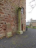
Mercat Cross, Melrose The view of the Mercat Cross (the Scottish term for market cross) in Melrose.
Autor/Urheber: Scotland. Royal Commission on the Ancient and Historical Monuments and Constructions, Lizenz: No restrictions
Identifier: sixthreportinven00scot (find matches)
Title: Sixth report and inventory of monuments and constructions in the county of Berwick
Year: 1915 (1910s)
Authors: Scotland. Royal Commission on the Ancient and Historical Monuments and Constructions
Subjects:
Publisher: Edinburgh : H.M. Stationery Off.
Contributing Library: Robarts - University of Toronto
Digitizing Sponsor: University of Toronto
View Book Page: Book Viewer
About This Book: Catalog Entry
View All Images: All Images From Book
Click here to view book online to see this illustration in context in a browseable online version of this book.
Text Appearing Before Image:
MOTO wing. ^ $$$ms$^-M^M. Fio. 67.— Cowdenknowes (No. 127). Ancient and Historical Monuments—County of Berwick. ~0
Text Appearing After Image:
To face p. 70. Ancient and Historical Monuments—County of Berwick.
Note About Images
Walter Scott's Courtroom in Selkirk Market Place
(c) Louise Gibbard, CC BY-SA 2.0
Ashiestiel Bridge Clovenfords. Ashiestiel Bridge is the largest single span bridge of this type. Located one mile from the village of Clovenfords and spans the river tweed passing through the glorious Scottish Borders.
(c) Martin Thirkettle, CC BY-SA 2.0
Thirlestane Castle, Lauder, Scottish Borders
(c) JThomas, CC BY-SA 2.0
Tower House and dairy, Manderston House, in the Scottish Borders
(c) Walter Baxter, CC BY-SA 2.0
Cranshaws Parish Church The church is set within a walled enclosure and dates back to 1899 with some fragments incorporated from a previous church of 1739 on the same site.
(c) Mark Hope, CC BY-SA 2.0
Traquair House The oldest inhabited house in Scotland
Autor/Urheber: Steve Collis from Melbourne, Australia, Lizenz: CC BY 2.0
Melrose Abbey (HDR)
Autor/Urheber: Jonathan Oldenbuck, Lizenz: CC BY-SA 3.0
Diese Datei wurde mit Commonist hochgeladen.
(c) Lisa Jarvis, CC BY-SA 2.0
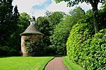
Longformacus House Doocot Early to mid 18th century circular red sandstone doocot with conical roof, surmounted by conical, timber drum with arched pigeon openings. It has been reported that there are 490 wooden nests inside. It is thought to be contemporary with the nearby Longformacus House
(c) Lisa Jarvis, CC BY-SA 2.0
Cranshaws Castle. An old old peel tower, the stronghold of the Douglas family. Said to be haunted by a brownie (invisible goblin)
Autor/Urheber: Kjetil Bjørnsrud, Lizenz: CC BY 2.5
The river Tweed, Peebles, Scotland
(c) Mark J Richards in der Wikipedia auf Englisch, CC BY-SA 3.0
This is the front or east elevation Marchmont House
Autor/Urheber: Majo statt Senf, Lizenz: CC BY-SA 4.0
Schlosssymbol Schottland
(c) G Laird, CC BY-SA 2.0
Leaving Walkerburn to the East Looking east along Galashiels Road (A72).
(c) Iain Lees, CC BY-SA 2.0
Channelkirk in Lauderdale
Autor/Urheber: Klaus with K, Lizenz: CC BY-SA 3.0
Coldstream Bridge.
(c) Lisa Jarvis, CC BY-SA 2.0
Greenlaw Town Hall. Greenlaw County Hall was built in 1829-31 to house the offices associated with the local government of Berwickshire, Greenlaw being, at that time, the county town of Berwickshire. The dome was designed as the fire-proof room for the safe storage of documents. The building became largely redundant when the management of Berwickshire was transferred to Duns in 1903. It was converted into a Community Centre in 1960, a swimming pool in 1973 and abandoned in the 1980s. It is now on the Scottish Buildings at Risk Register.
(c) Walter Baxter, CC BY-SA 2.0
Darnick Tower. This occupied house is built of red sandstone and carries the bull's head motif of the Heiton family. Built in 1595, it was restored in 1865 and a 2 storey east extension added in 1869.
Fisher's Tower, the roofless shell remains of the second tower of Darnick (of 16th century origin), are within the grounds of Darnick Tower.
(Source: Borders and Berwick by Charles Alexander Strang)(c) Walter Baxter, CC BY-SA 2.0
St Helens Church at Cockburnspath This attractive church dates from the 1500s. There have been many alterations over the years but the striking feature of the building is the circular tower on the west wall.
Autor/Urheber: Otter, Lizenz: CC BY-SA 3.0
Abbotsford House, Scottish Borders, Scotland.
(c) james denham, CC BY-SA 2.0
Polwarth Parish Kirk. The kirk at historic Polwarth is a Borders jewel sitting atop the braes. It is suggested there has been a church here since 900 AD. The church was consecrated by David de Bereham, Archbishop of St. Andrews in 1242 and dedicated to St. Kentigern (Mungo) It is one of the most interesting churches I have visited and there are inscriptions, in Latin, everywhere you look; the inscriptions tell of the church's history. A crypt containing the remains of local aristocrats, the Humes of Marchmont, is housed in the east end of the building. Looking at Mike Richardson's image 985495 will show the image better than I can tell.
(c) Bill Henderson, CC BY-SA 2.0
Greenlaw Church of Scotland
(c) Stanley Howe, CC BY-SA 2.0
Greenlaw War Memorial I choose to focus on the structure to the left of the bench seat, as the future fate of the Scottish Greek Revival architecture behind it is still uncertain.
(c) Walter Baxter, CC BY-SA 2.0
Kelso Racecourse, near to Kelso, Scottish Borders, Great Britain. This is a view of the southwest end of the racecourse with the grandstands in the background.
(c) Callum Black, CC BY-SA 2.0
Pease Bridge. A tractor towing a trailer load of Brussels sprouts for the Christmas market crosses Pease Bridge. Viewed from the Southern Upland Way at the south side of the bridge.
(c) Walter Baxter, CC BY-SA 2.0
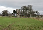
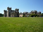
Ferniehirst Castle
(c) James Yardley, CC BY-SA 2.0
Dieses Foto zeigt das geschützte Denkmal in Schottland mit der Nummer
Autor/Urheber: Jonathan Oldenbuck, Lizenz: CC BY-SA 4.0
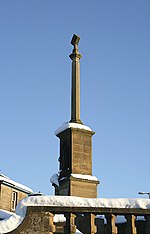
Monument in Hawick, Scotland, celebrating the defeat of an English raiding party in 1514.
Autor/Urheber: Otter, Lizenz: CC-BY-SA-3.0
Foulden Tithe Barn, Foulden, Scotland
(c) John Haddington, CC BY-SA 2.0
Leaderfoot viaduct Now closed for rail traffic.
(c) M J Richardson, CC BY-SA 2.0
The old Ancrum Bridge
(c) Douglas B, CC BY-SA 2.0
Fogo Bridge. Fogo bridge over the river Blackadder
(c) Jim Barton, CC BY-SA 2.0
Glen House The southeast aspect of this imposing house in Glen Estate.
Autor/Urheber: Otter, Lizenz: CC-BY-SA-3.0
Edrom Church, Scottish Borders, Scotland - Edrom Church (1732) from the south west, with the burial vault to the left and Blackadder Aisle to the right
(c) Kevin Rae, CC BY-SA 2.0
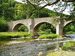
Yair Bridge. This bridge that spans the River Tweed was built in 1760 as part of the Selkirk to Edinburgh Turnpike road. Today as well as cars it is where the Southern Upland Way crosses the Tweed.
(c) Lisa Jarvis, CC BY-SA 2.0
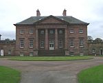
Manderston House Edwardian country house, home of Lord and Lady Palmer. The 'downstairs'have been preserved to give an idea of life in such a house in the 1900s. It has a staircase which is a replica of the Petite Trianon at Versailles, an dis plated in silver.
Autor/Urheber: Otter, Lizenz: CC BY-SA 3.0
Gifford's Stone, West Linton, Scottish Borders, Scotland.
(c) Walter Baxter, CC BY-SA 2.0
Legerwood Parish Church This red sandstone building dates back to the 12th century. The west gable wall has a rose window and a birdcage belfry. There are two date stones (commemorating repairs) set into the external walling, one on the west wall dated 1717 and the other on the south wall dated 1804.
(c) Walter Baxter, CC BY-SA 2.0
The West Lodge entrance to Ladykirk House Ladykirk West Lodge, constructed in 1799, has a spectacular lion-topped Corinthian archway and columned screen walls. (Source: Borders and Berwick, An Architectural Guide by Charles Alexander Strang).
(c) Alison Stamp, CC BY-SA 2.0
Dryburgh Abbey An Historic Scotland Property. The grave of General Haig is through the arches in the left of this photo.
(c) Walter Baxter, CC BY-SA 2.0
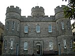
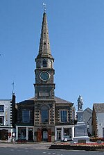
Newgate, Market Place, Jedburgh Built in 1756 with the steeple added in 1761, this replaced the Tolbooth/Town House on this site, and is a prominent landmark in the town. Newgate, annexed to the County Buildings, was superseded by Jedburgh Castle Jail in 1823. Viewed from Abbey Place in the adjoining square.
(c) Jeff Wells, CC BY-SA 2.0
Lennel House. Now a nursing home, Lennel House dates from about 1820. Beatrix Potter spent some holidays here; her room is thought to have been the round room on the ground floor at the left of the picture.
(c) Kevin Rae, CC BY-SA 2.0
Preston Bridge. This Bridge crosses the River Whiteadder and dates from 1770.
(c) Dave Pickersgill, CC BY-SA 2.0
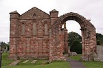
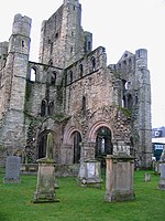
Kelso Abbey from the south-East
(c) Walter Baxter, CC BY-SA 2.0
Marchmont Doocot. This circular doocot was built by James Williamson in 1749. It stands at the end of an avenue, 1.8km northeast of Marchmont House.
(c) Callum Black, CC BY-SA 2.0
Broughton Place. Tower house hosting an art gallery. http://www.broughtongallery.co.uk/
(c) wfmillar, CC BY-SA 2.0
Kelso North Parish Church
(c) Chris Eilbeck, CC BY-SA 2.0
Leithen Lodge. On a private road up the valley of the Leithen Water
(c) Walter Baxter, CC BY-SA 2.0
Ettrick Riverside Business Centre, Selkirk This converted and restored 19th century 4-storey Ettrick and Yarrow Spinners Mill in Dunsdale Road is now owned by Scottish Enterprise Borders who offer a range of accommodation for all types of Businesses. Scottish Enterprise is Scotlands main economic, enterprise, innovation and investment agency. My grandfather worked in this mill as a foreman spinner in the 1950s.
(c) james denham, CC BY-SA 2.0
Ayton and Burnmouth Parish Church This kirk, as you can imagine, is very difficult to photograph when the trees are in full leaf.
Autor/Urheber: Internet Archive Book Images, Lizenz: No restrictions
Identifier: castellateddomes05macg (find matches)
Title: The castellated and domestic architecture of Scotland, from the twelfth to the eighteenth century
Year: 1887 (1880s)
Authors: MacGibbon, David, d. 1902 Ross, Thomas, 1839-1930
Subjects: Architecture Architecture, Domestic Castles
Publisher: Edinburgh : D. Douglas
Contributing Library: University of California Libraries
Digitizing Sponsor: Internet Archive
View Book Page: Book Viewer
About This Book: Catalog Entry
View All Images: All Images From Book
Click here to view book online to see this illustration in context in a browseable online version of this book.
Text Appearing Before Image:
Fig. 1599.—Dundas Castle. From an inscription seen on the SUNDIALS 430 SUNDIALS those of Sir Walter Dundas, and his lady, Dame Ann Menteith; and thelatter, amongst other things, advise visitors to behave themselves seemly,to forbear to do harm to the fountain, nor yet shouldst those inclinedto injure the signs of the dial.* Lamancha llou^e, PeehJesshirp,.—-This very beautiful dial exhibits thegreatest variation from the type of any known example. It has the usual
Text Appearing After Image:
Fig. 1(500.—Laraancha HouseBack View. Fig. 1601.—Lamancha House.Front View. cylinder, liollowed out in a very pronounced form (Fig. 1600), but all theother details are changed. The dial on the top is square (Fig. 1601), * For further particulars see Miss Gattys Book of Sundials. SUNDIALS 431 — SUNDIALS the eight horns being wanting; the lower corners are canted off, the figures are arranged in a circle, and are finely cut, and the gnomon, made of thin iron, is of a pleasing design. Following the circle of the cylinder is the motto fugit hora (Fig. 1602). The under side of the stone is cut into so as to leave a drum-shaped dial (a new form), the shadows on which are cast by the sides of the cutting. The sides of the dial-stone contain each a single distinct and different figure, unlike those usually found in this position. The oblong hollow on one side has two carved serpents starting with their intertwisted tails and wriggling round the sides of the hollow, the upper edge of whi
Note About Images
(c) james denham, CC BY-SA 2.0
The Steekit Yetts of Traquair, Scottish Borders, Great Britain. The stuck gates of Traquair were slammed shut in 1746 after the Jacobite rebellion of 1745 was crushed and a disillusioned Prince Charles Stewart escaped to Italy and a lifetime's exile. The Stewarts of Traquair made the decision the gates would only be reopened when a Stewart returned to the throne of Scotland. Traquair, the oldest inhabited house in Scotland, has been in the same family, now descendants, the Maxwell-Stuarts, since the 15th century.
Autor/Urheber: Kim Traynor, Lizenz: CC BY-SA 3.0
Mercat cross at Coldingham, Berwickshire
- The finial of the cross displays a thistle and a rose to commemorate the marriage of James IV to Margaret Tudor in 1503.
- Among other gifts, James bestowed revenues from the priory at Coldingham on his new queen.
(c) Jim Barton, CC BY-SA 2.0
Teviot Bridge near Kelso
Autor/Urheber: Timo Newton-Syms from Helsinki, Finland and Chalfont St Giles, Bucks, UK, Lizenz: CC BY-SA 2.0
Floors Castle, Kelso, Scotland
(c) James Denham, CC BY-SA 2.0
Greenlaw Old Mercat Cross
(c) Adam D Hope, CC BY-SA 2.0
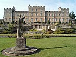
Haining House Selkirk A grand old house with statues at the front overlooking the loch.
(c) Walter Baxter, CC BY-SA 2.0
The Canongate Bridge in Jedburgh A 16th century narrow bridge over the Jed Water, now only used by pedestrians, and at one time the only main access bridge into the town.
(c) Steve Kent, CC BY-SA 2.0
Dieses Foto zeigt das geschützte Denkmal in Schottland mit der Nummer
(c) Lisa Jarvis, CC BY-SA 2.0
Manderston House Stables, near Duns. Magnificent Stables of Manderston House 151469.
Autor/Urheber: Kim Traynor, Lizenz: CC BY-SA 3.0
Gunsgreen House, Eyemouth
(c) Walter Baxter, CC BY-SA 2.0
Chirnside Primary School An impressive 1937 Art Deco school that sits back from the A6105.
(c) james denham, CC BY-SA 2.0
The entrance to Floors Castle This, the main (town) gates, are flanked by two lodges. Floors Castle is home to the Dukes of Roxburghe at Kelso.
Autor/Urheber: Otter, Lizenz: CC BY-SA 3.0
Ladykirk Church, Scottish Borders, Scotland. View from south east.
(c) Walter Baxter, CC BY-SA 2.0
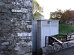
Old urinal in Walkerburn A cast iron urinal c.1897 from the Saracen Foundry (Macfalane's) of Glasgow. A unique survivor in the Borders. Ladies should approach this rare object with care. (Source: Borders and Berwick, An Architectural Guide by Charles Alexander Strang).
Inside there are two urinal places, each with the following original lettering halfway up the wall:
PLEASE ADJUST YOUR DRESS BEFORE LEAVING
There must have been some funny looking guys in Walkerburn 100 years ago.(c) Chris Heaton, CC BY-SA 2.0
The Drygrange Bridge over the River Tweed. Ancient and modern. The Old Fly or Drygrange Bridge built in 1780 now only carries pedestrians, horses and cyclists. The new version takes the A68 over the River Tweed.
(c) Richard Webb, CC BY-SA 2.0
Gateway, Wedderburn Castle The castle is in a neighbouring square and is hired out for fully serviced accommodation and weddings.
(c) Jim Barton, CC BY-SA 2.0
Entrance to the Chambers Institution, Peebles
(c) Tish Graham, CC BY-SA 2.0
A view of Ednam House Hotel from the garden
Autor/Urheber: Kim Traynor, Lizenz: CC BY-SA 3.0
Mercat Cross at Cockburnspath, Berwickshire
(c) Irvine Smith, CC BY-SA 2.0
Hoselaw Chapel. A few miles due east of Kelso, Scottish Borders.
(c) Richard Webb, CC BY-SA 2.0
Stobo Castle. Centrepiece of the estate, and now an upmarket, very upmarket "health farm". Taken quickly as the "Can I Help Yous" bore down on me.
(c) James Denham, CC BY-SA 2.0
St. John the Evangelist Church in Jedburgh
(c) Mark Hope, CC BY-SA 2.0
Beanscene Hawick This former mill was renovated to form a multi-functional building that incorporates a café, a theatre/cinema, studios and workshops. The original waterwheel is visible via a glass floor.
(c) Jim Barton, CC BY-SA 2.0
Cross Kirk The church dates from 1261, and a Trinitarian Priory was founded there over 200 years later (Exploring Scotland's Heritage, J R Baldwin, HMSO Edinburgh 1989).
(c) Lisa Jarvis, CC BY-SA 2.0
Bughtrig. Bughtrig means farm on a ridge. The present Georgian house was built between 1780 to 1790. The matching East and West Wings were added later, probably in the mid 19th century. The gardens are open to the public.
Autor/Urheber: Jonathan Oldenbuck, Lizenz: CC BY-SA 4.0
Kirkhope Tower, a pele tower in the Scottish Borders
Autor/Urheber: Jonathan Oldenbuck, Lizenz: CC BY-SA 3.0
Diese Datei wurde mit Commonist hochgeladen.
(c) Walter Baxter, CC BY-SA 2.0
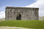
The remains of Hermitage Chapel The foundations of a 13th century chapel 400m west of Hermitage Castle (the castle is in the background). This site might have been an old manor-place with residential buildings of wood (now gone) and just this private chapel built of stone. (Source: information plaque on site) According to the Explorer Map the chapel shares two squares along this line of view (confirmed by GPS).
(c) Iain Lees, CC BY-SA 2.0
Dieses Foto zeigt das geschützte Denkmal in Schottland mit der Nummer
(c) Callum Black, CC BY-SA 2.0
Dieses Foto zeigt das geschützte Denkmal in Schottland mit der Nummer
(c) james denham, CC BY-SA 2.0
Old Gala House, Galashiels The fine old house was built in 1583 (with later extensions) for the Pringles of Galashiels. Sir James left the house in 1632 because financial difficulties and the house passed to Hugh Scott after marriage to Sir James' daughter, Jean. The Scotts lived in the house until 1876 when they moved to New Gala House (now demolished. The house is now a museum and very much used by the community.
(c) Pat Pierpoint, CC BY-SA 2.0
Hirsel House, Coldstream.
(c) Jim Smillie, CC BY-SA 2.0
Melrose Station. An Italian restaurant now occupies part of the building. The chimneys which are just visible can be seen in File:The former Melrose Railway Station - geograph.org.uk - 255709.jpg
(c) Anthony Parkes, CC BY-SA 2.0
Jedburgh Old and Trinity Parish Church
(c) Richard Webb, CC BY-SA 2.0
River Whiteadder The attractive glen of the Whiteadder near Abbey St Bathans. A view towards The Retreat, a former hunting lodge from Edin's Hall.
The kirk dates from mediaevel times and was much extended and restored in the 17th century
(c) Walter Baxter, CC BY-SA 2.0
Mausoleum on Springwood Estate This mausoleum near the River Teviot is for the Scott Douglas family.
(c) Jim Barton, CC BY-SA 2.0
Tweed bridge at Kelso The handsome bridge for the A699 road from Selkirk.
(c) Walter Baxter, CC BY-SA 2.0
Hume Castle Viewed in evening light from Hume Craigs.
(c) Richard Webb, CC BY-SA 2.0
Nisbet House, 17th century tower house, recently renovated.
Autor/Urheber: Vinckie, Lizenz: CC BY-SA 4.0
Nom du fichier : DSCN2378.JPG
Taille du fichier : 659.5 Ko (675326 octets) Date : 2003/10/23 14:27:23 Taille de l'image : 1600 x 1200 pixels Résolution : 300 x 300 ppp Profondeur en bits : 8 bits/canal Attribut de protection : Désactivé Attribut Masqué : Désactivé ID de l'appareil : N/A Appareil : E775 Mode de qualité : FINE Mode de mesure : Multizones Mode d'exposition : Programme Auto Speed Light : Non Distance Focale : 5.8 mm Vitesse d'obturation : 1/96.1 seconde Ouverture : F7.9 Correction d'exposition : 0 IL Balance des blancs : Auto Objectif : Intégré Mode Synchro-Flash : Réduction des Yeux Rouges Différence d'exposition : N/A Programme Décalable : N/A Sensibilité : Auto Renforcement de la netteté : Auto Type d'image : Couleur Mode Couleur : N/A Saturation : N/A Contrôle Saturation : N/A Compensation des tons : Normal Latitude (GPS) : N/A Longitude (GPS) : N/A
Altitude (GPS) : N/A(c) Walter Baxter, CC BY-SA 2.0
Nisbet Hill Doocot This late 18th century doocot, with its unique pentagonal plan, has a crenellated parapet and ribbed stone roof.


