Liste der Kategorie-A-Bauwerke in South Ayrshire
Die Liste der Kategorie-A-Gebäude in South Ayrshire umfasst sämtliche in der Kategorie A eingetragenen Baudenkmäler in der schottischen Council Area South Ayrshire. Die Einstufung wird anhand der Kriterien von Historic Scotland vorgenommen, wobei in die höchste Kategorie A Bauwerke von nationaler oder internationaler Bedeutung einsortiert sind. In South Ayrshire sind derzeit 73 Bauwerke in der Kategorie A gelistet.
Weblinks
Auf dieser Seite verwendete Medien
(c) Mary and Angus Hogg, CC BY-SA 2.0
Cassillis House Located close to the River Doon, near Dalrymple, Cassillis House is the setting for the famous ballad "Johnnie Faa" - https://books.google.co.uk/books?id=2XACAAAAQAAJ&printsec=frontcover&dq=Miscellany+by+Allan+Ramsay#PPA427,M1 Before her marriage to the powerful chief of the Kennedys, the countess had loved a young knight, Sir John Fall. She eloped with him, disguised as the gypsy, "Johnnie Faa". The Earl brought them back and made her watch the gypsy band and her disguised lover being hanged from the Dule Tree in front of Cassillis House. The Earl imprisoned the Countess for life in his town house, Maybole Castle 241392. He then divorced her and remarried. No human rights in those days!
(c) Mary and Angus Hogg, CC BY-SA 2.0
Old Windmill at Ballantrae
(c) wfmillar, CC BY-SA 2.0
Wellington Square Gardens, Ayr With the County Buildings forming the background.
(c) Dan, CC BY-SA 2.0
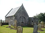
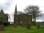
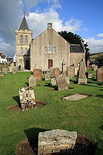
St. Quivox parish church St. Quivox Church dates from 1767 and it was built upon another building from medieval times. The name St. Quivox is believed to have been derived from 'Santa Kennocha Virgo in Coila" (a female personage of some local note, who lived in the reign of Malcolm II ).
(c) Dan, CC BY-SA 2.0
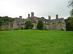
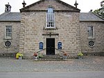
Oswald Hall, Auchincruive
Autor/Urheber: Conxa Roda, Lizenz: CC BY-SA 3.0
Dieses Foto zeigt das geschützte Denkmal in Schottland mit der Nummer
(c) John McLeish, CC BY-SA 2.0
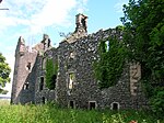
Baltersan Castle Ruins of this Castle situated near Maybole Ayrshire.
(c) Mary and Angus Hogg, CC BY-SA 2.0
Culzean's Ruined Arch The arch was constructed as a ruin to add to the overall effect of the castle site. It lies at the start of a viaduct leading to the castle, which can be seen through the opening.
(c) Paulrussell aus der englischsprachigen Wikipedia, CC-BY-SA-3.0
(C) Paul Russell, 2006. All Rights Reserved. For subsequent use please seek permission from 'paulrussellhndtv@yahoo.co.uk'
(c) James Allan, CC BY-SA 2.0
Bridge to Bargany Bridge over the Water of Girvan with Bargany House in the background.
(c) George Rankin, CC BY-SA 2.0
Loudon Hall Loudoun Hall is one of the oldest buildings in Ayr, late 1400's and is situated in the Boat Vennel, which is near the bottom of the High Street. It was built for a James Tait, wealthy merchant who traded with European countries. In the 16th Century, it became the townhouse for the Campbells of Loudoun, the heridary sheriffs of Ayr.
(c) Ian Rainey, CC BY-SA 2.0
Macrae's Monument. A-Listed Building renovated in 2001. From 1725 to 1731 James Macrae was Governor of Madras where he made his fortune. He purchased Orangefield Estate, and the mansion became the airport terminal in WW2, demolished after the present terminal opened. See also http://www.clan-macrae.org.uk/scotland/articles.cfm?ID=90
(c) Kenneth Mallard, CC BY-SA 2.0
Culzean Castle Robert Adam substantially transformed an earlier castle for David Kennedy, tenth Earl of Cassilis in 1775. Adam worked on the castle's interior as well as the Home Farm and stables https://www.geograph.org.uk/photo/1560844 . The spectacular oval staircase is regarded as one of Adam's finest achievements. A west wing was added in 1879. The castle houses historic collections relating to Robert Adam, tables, chairs and wall sconces as well as original 18th-century items and some Adam revival pieces that were owned by the Kennedy family. Other features in the estate include the Camellia House https://www.geograph.org.uk/photo/1797907 ; walled garden https://www.geograph.org.uk/photo/1860017 ; Swan Pond https://www.geograph.org.uk/photo/1860007 and cottage https://www.geograph.org.uk/photo/1859989 . Culzean Castle and Country Park is owned and managed by the National Trust for Scotland http://www.nts.org.uk/Property/97 .
(c) Mary and Angus Hogg, CC BY-SA 2.0
Entering The Culzean Visitor Centre The buildings were the former Home Farm, designed by Robert Adam and arranged around a central courtyard. The site was converted to the Visitor Centre in 1972. The reception area, exhibition and shop is visible directly through the arch.
Autor/Urheber: Otter, Lizenz: CC-BY-SA-3.0
Maybole Collegiate Church, Maybole, South Ayrshire, Scotland - interior
(c) Stephen McKay, CC BY-SA 2.0
Auld Brig, Ayr. This 13th century cobbled bridge crosses the River Ayr in the centre of Ayr.
Autor/Urheber: Majo statt Senf, Lizenz: CC BY-SA 4.0
Schlosssymbol Schottland
(c) Alan Reid, CC BY-SA 2.0
Winter at Penkill Castle
(c) Mary and Angus Hogg, CC BY-SA 2.0
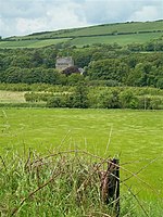
Towards Killochan Castle Looking across the Girvan Valley at a barley field near Hawkhill Farm. The Saltire is flying over Killochan Castle.
(c) John McLeish, CC BY-SA 2.0
Burns Cottage, Alloway., near to Alloway, South Ayrshire, Great Britain. A view of the birth place of Robert Burns.
Autor/Urheber: Der ursprünglich hochladende Benutzer war Dreamer84 in der Wikipedia auf Englisch, Lizenz: CC BY 2.5
Laigh Milton Viaduct near Gatehead, East Ayrshire, Scotland in February 2006. Formerly known as 'Milton Bridge', it was built as part of the Kilmarnock and Troon Railway, and is thought to be the oldest surviving railway viaduct in the world.
(c) Ian Paterson, CC BY-SA 2.0
The Catholic Church of Our Lady of the Assumption and St Meddan The crowned mini-spire is quite unusual.
(c) Mary and Angus Hogg, CC BY-SA 2.0
Lady Cathcart's House Located in The Sandgate, this is one of the oldest buildings in Ayr and is believed to date from the early 17th century. The house was restored by the Scottish Historic Buildings Trust in 1991 and the ground floor is now occupied by the tourist information office. John Loudon McAdam, the famous road-maker, was born here in 1756. (Source: "Ayrshire: Discovering A County", by Dane Love).
(c) wfmillar, CC BY-SA 2.0
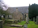
St. Cuthbert's Church, Monkton. Ruined church close to Prestwick Airport.1417356
Autor/Urheber: Jonathan Oldenbuck, Lizenz: CC BY-SA 3.0
Blairquhan Castle, Ayrshire, Scotland, entrance front
(c) Mary and Angus Hogg, CC BY-SA 2.0
The Auld Kirk Of St John The Baptist Glorious autumn colours in the old churchyard.
(c) Mary and Angus Hogg, CC BY-SA 2.0
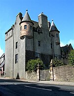
Maybole Castle Dating from the early 17th century, Maybole Castle was built as the town house of the 6th Earl of Cassillis and still belongs to the Kennedy family. The present castle is all that remains of a much larger building and grounds. Space was needed to improve the main road through the town in the 19th century. The castle is open to the public on specific dates during the summer months, with tours led by members of the Maybole Historical Society.
Autor/Urheber: Rosser1954, Lizenz: CC BY-SA 3.0
Souter Johhnie's House, Kirkoswald, South Ayrshire, Scotland.
(c) Dan, CC BY-SA 2.0
St. Quivox parish church St. Quivox Church dates from 1767 and it was built upon another building from medieval times. The 1822 Mausoleum of the Campbell's of Craigie, designed by W.H. Playfair, is visible on the right.
(c) James Allan, CC BY-SA 2.0
Hoolity Ha' A building passed by all visitors to Culzean Castle (on the exit road) but noticed by very few of them, this former gatehouse is now described by the Scottish National Trust as 'Scotland's grandest bedsit' and is available to NTS members as holiday accommodation. The adjacent bridge over Glenside Gorge is Hoolity Bridge. The name is derived from the Scots 'Hoolet' or 'Howlet' meaning young owl, which birds are often still heard around here.
Autor/Urheber: Rosser1954 Roger Griffith, Lizenz: CC BY-SA 3.0
Symington Church and porch. South Ayrshire, Scotland.
(c) Ian Knox, CC BY-SA 2.0
Culzean Castle - Garden.
Autor/Urheber: SeaDave from Fairlie, Scotland, Lizenz: CC BY 2.0
Dramatic and forlorn on the edge of a busy golf course. What stories could they tell ?
(c) Billy McCrorie, CC BY-SA 2.0
Holy Trinity Episcopal Church, Ayr
(c) Elliott Simpson, CC BY-SA 2.0
Culzean Castle and Country Park The Swan Pond
(c) wfmillar, CC BY-SA 2.0
Cathcart St. meets New Bridge St., Ayr The building on the left of frame now empty, the town hall further down New Bridge St.
(c) Mary and Angus Hogg, CC BY-SA 2.0
The New Bridge Looking across the Ayr towards the fine bow-fronted buildings on the south side. The double bow-fronted building was the town house of Alexander Stevens, the mason who over-viewed the construction work in 1786-88. These houses were saved from redevelopment by a local conservation group. The original bridge was so severely damaged in 1877 by storms and floods that a replacement had to be built. Completed in 1879, the new bridge has retained many of the attractive features of its predecessor. (Sources: "Discovering Ayrshire" by John Strawhorn, and "Ayr Stories" by Dane Love.)
(c) pam fray, CC BY-SA 2.0
The Kennedy Mausoleum, Ballantrae On the corner of The Vennel and Main Street, next to the parish church.
Autor/Urheber: Rosser1954, Lizenz: CC BY-SA 3.0
Tarbolton Church, South Ayrshire, Scotland.
(c) Mary and Angus Hogg, CC BY-SA 2.0
The Burns Monument Maintained by the National Trust for Scotland, this fine monument is set amid attractive gardens, near the Auld Brig O'Doon.
(c) Kenneth Mallard, CC BY-SA 2.0
Culzean Castle - camellia house
(c) George Rankin, CC BY-SA 2.0
Brig o' Doon Bridge View of the Brig o' Doon Bridge from the river side.
Autor/Urheber: Rosser1954, Lizenz: CC BY-SA 3.0
The Bachelors' Club, Tarbolton, South Ayrshire, Scotland.
(c) Walter Baxter, CC BY-SA 2.0
St Cuthbert's Parish Church at Straiton The main part of the church dates from 1758, but older parts date back to pre-Reformation times. The church was renovated in 1901 when the bell tower was added. There are many interesting old gravestones in the churchyard.
(c) Billy McCrorie, CC BY-SA 2.0
Kirkoswald Parish Church
Auchans Castle, East Ayrshire, Scotland
(c) Mary and Angus Hogg, CC BY-SA 2.0
The Wallace Monument On Barnweil Hill. William Wallace was the leader of the Scottish resistance to Edward I of England. During a period of truce, the King's barons summoned the Scots to a Court of Justiciary, held in one of the Barns of Ayr in 1297. Now the site of the Wallace Tower, this building was being used by the English as barracks. Wallace's men arrived first, but 360 Ayrshire barons were hanged one by one as they entered the building. When this was reported to Wallace, he mustered a group of men and returned to the Barns at night, where the English were feasting and celebrating their day's work. In revenge, Wallace and his men sealed the building and set fire to it, killing all the occupants. Ayr Castle was also captured and 5,000 English troops were killed, including the judges who had presided over the Scots' executions. As the Scots left the scene, Wallace stopped at a nearby vantage point to view the blazing remains of the Barns. He is said to have commented: "The Barns o' Ayr burn weel!" Ever since then, the hill has been known as Barnweil Hill. The memorial tower to Wallace was erected in 1856 and, until recently, was available for public access. (Sources: Information Board at the Wallace Tower 1314214 and "Ayr Stories", by Dane Love)
(c) Dan, CC BY-SA 2.0
Oswald's Temple, Auchincruive
(c) Philip Halling, CC BY-SA 2.0
Culzean Castle Entrance in to Culzean Castle.
(c) James Allan, CC BY-SA 2.0
Cat Gates The original inner entrance to Culzean Castle, with Coade stone cats (restored in 1995) surmounting the pillars. There originally were lodge cottages on either side; these were demolished in the 1950s.
