Liste der Kategorie-A-Bauwerke in Renfrewshire

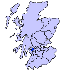
Lage von Renfrewshire in Schottland

Die Liste der Kategorie-A-Gebäude in Renfrewshire umfasst sämtliche in der Kategorie A eingetragenen Baudenkmäler in der schottischen Council Area Renfrewshire. Die Einstufung wird anhand der Kriterien von Historic Scotland vorgenommen, wobei in die höchste Kategorie A Bauwerke von nationaler oder internationaler Bedeutung einsortiert sind. In Renfrewshire sind derzeit 35 Bauwerke in der Kategorie A gelistet.

NameLageTypEintragBild
Formakin Housenahe Bishopton
55° 54′ 20,1″ N, 4° 32′ 42,2″ W
Herrenhaus10903
Formakin House
(c) wfmillar, CC BY-SA 2.0
Mar Hall Hotelnahe Erskine
55° 55′ 15,4″ N, 4° 28′ 43,6″ W
Hotel10909Mar Hall Hotel
Lochwinnoch Parish ChurchLochwinnoch
55° 47′ 38″ N, 4° 37′ 42,6″ W
Kirche12654
Lochwinnoch Parish Church
(c) Alan Reid, CC BY-SA 2.0
Statuen an der Houston and Kilellan Parish ChurchHouston
55° 52′ 14″ N, 4° 32′ 33,4″ W
Statuen12695
Northbar HouseInchinnan
55° 53′ 33″ N, 4° 25′ 50,8″ W
Bauernhaus12730
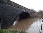
Inchinnan BridgeRenfrew
55° 52′ 51,4″ N, 4° 24′ 42,4″ W
Brücke12732Inchinnan Bridge
Kilbarchan SteepleKilbarchan
55° 50′ 10,1″ N, 4° 33′ 6,2″ W
Turm12839
Kilbarchan Steeple
(c) wfmillar, CC BY-SA 2.0
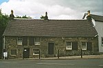
Weaver’s CottageKilbarchan
55° 50′ 10,4″ N, 4° 33′ 14,3″ W
Wohngebäude12843
Weaver’s Cottage
(c) Pam Brophy, CC BY-SA 2.0
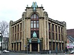
India of InchinnanInchinnan
55° 53′ 11″ N, 4° 26′ 24,8″ W
Industriegebäude13459
India of Inchinnan
(c) Thomas Nugent, CC BY-SA 2.0
Paisley AbbeyPaisley
55° 50′ 42″ N, 4° 25′ 13,1″ W
Kloster38910Paisley Abbey
Place of PaisleyPaisley
55° 50′ 40,6″ N, 4° 25′ 13,9″ W
Pfarrhaus38911
Place of Paisley
(c) Thomas Nugent, CC BY-SA 2.0
Domestic Finishing MillPaisley
55° 50′ 30,7″ N, 4° 25′ 6,8″ W
Industriegebäude38915
Domestic Finishing Mill
(c) Thomas Nugent, CC BY-SA 2.0
Mile End MillPaisley
55° 50′ 33,7″ N, 4° 24′ 39,5″ W
Industriegebäude38917
Mile End Mill
(c) Thomas Nugent, CC BY-SA 2.0
Blackhall Railway ViaductPaisley
55° 50′ 24,1″ N, 4° 24′ 23″ W
Brücke38923Blackhall Railway Viaduct
Russell InstitutePaisley
55° 50′ 36,5″ N, 4° 25′ 26″ W
Klinik38944
Russell Institute
(c) Thomas Nugent, CC BY-SA 2.0
Paisley High ChurchPaisley
55° 50′ 46,3″ N, 4° 25′ 41,6″ W
Kirche38946
Paisley High Church
(c) Thomas Nugent, CC BY-SA 2.0
Christian Social Action CentrePaisley
55° 50′ 44,9″ N, 4° 25′ 38,4″ W
Kirche38948
Christian Social Action Centre
(c) Thomas Nugent, CC BY-SA 2.0
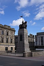
Kriegerdenkmal von PaisleyPaisley
55° 50′ 44,3″ N, 4° 25′ 26,5″ W
Denkmal38953
Kriegerdenkmal von Paisley
(c) Raymond Okonski, CC BY-SA 2.0
George A. Clark Town HallPaisley
55° 50′ 43,1″ N, 4° 25′ 18,2″ W
Verwaltungsgebäude38978
George A. Clark Town Hall
(c) Stephen Sweeney, CC BY-SA 2.0
7 Gilmour StreetPaisley
55° 50′ 45,8″ N, 4° 25′ 26,3″ W
Kreditinstitut38994
St Matthew’s ChurchPaisley
55° 50′ 32,9″ N, 4° 25′ 18,1″ W
Kirche39007
St Matthew’s Church
(c) Thomas Nugent, CC BY-SA 2.0
Hawkhead Hospital, Gebäude 7+8Paisley
55° 50′ 3,9″ N, 4° 23′ 29,1″ W
Klinik39011
Hawkhead Hospital
(c) Richard Webb, CC BY-SA 2.0
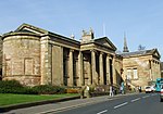
Paisley MuseumPaisley
55° 50′ 43,1″ N, 4° 25′ 48,9″ W
Museum39025
Paisley Museum
(c) Thomas Nugent, CC BY-SA 2.0
Coats Memorial ChurchPaisley
55° 50′ 41,3″ N, 4° 25′ 56,8″ W
Kirche39027
Coats Memorial Church
(c) Thomas Nugent, CC BY-SA 2.0
Brunnen in der Love StreetPaisley
55° 51′ 1,3″ N, 4° 25′ 42″ W
Brunnen39035
Brunnen in der Love Street
(c) Thomas Nugent, CC BY-SA 2.0
CrosbiePaisley
55° 49′ 42,5″ N, 4° 26′ 50,3″ W
Villa39049
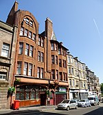
The Bull InnPaisley
55° 50′ 40,9″ N, 4° 25′ 34,2″ W
Gaststätte, Wohngebäude39058
The Bull Inn
(c) Thomas Nugent, CC BY-SA 2.0
John Neilson InstitutionPaisley
55° 50′ 42,9″ N, 4° 26′ 2,2″ W
Schule39069
John Neilson Institution
(c) Thomas Nugent, CC BY-SA 2.0
Coats ObservatoryPaisley
55° 50′ 44,6″ N, 4° 25′ 51,9″ W
Observatorium39072
Coats Observatory
(c) Thomas Nugent, CC BY-SA 2.0
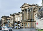
Gerichtsgebäude von PaisleyPaisley
55° 50′ 55″ N, 4° 25′ 36,4″ W
Gerichtsgebäude39103
Gerichtsgebäude von Paisley
(c) Thomas Nugent, CC BY-SA 2.0
Statuen in der Renfrew Old Parish ChurchRenfrew
55° 52′ 40,5″ N, 4° 23′ 11,3″ W
Statuen40417
White Cart BridgeRenfrew
55° 52′ 48,6″ N, 4° 24′ 37,2″ W
Brücke40424
White Cart Bridge
(c) william craig, CC BY-SA 2.0
Schwingbrücke von RenfrewRenfrew
55° 52′ 48″ N, 4° 24′ 32,8″ W
Brücke40425
Schwingbrücke von Renfrew
(c) william craig, CC BY-SA 2.0
Rathaus von RenfrewRenfrew
55° 52′ 44,3″ N, 4° 23′ 14″ W
Rathaus40430
Rathaus von Renfrew
(c) G Laird, CC BY-SA 2.0
Penilee Sports PavilionPaisley
55° 50′ 55,9″ N, 4° 22′ 44,4″ W
Sportanlage43679

Weblinks

Commons: Kategorie-A-Bauwerke in Renfrewshire – Sammlung von Bildern, Videos und Audiodateien

Auf dieser Seite verwendete Medien

Scottish-Castle-Symbol.svg
Autor/Urheber: Majo statt Senf, Lizenz: CC BY-SA 4.0
Schlosssymbol Schottland
Mar Hall Hotel.jpeg
Autor/Urheber: Discolover18, Lizenz: CC BY-SA 3.0
Erskine House. Also known as the Earl of Mar hotel. Grade A listed building. Designed by Sir Robert Smirke. Former Erskine hospital building.
Hawkhead Hospital - geograph.org.uk - 1545448.jpg
(c) Richard Webb, CC BY-SA 2.0
Hawkhead Hospital Former hospital now being developed for housing.
Former Middle Church (geograph 3828466).jpg
(c) Thomas Nugent, CC BY-SA 2.0
Former Middle Church
Domestic Finishing Mill - geograph.org.uk - 372366.jpg
(c) Thomas Nugent, CC BY-SA 2.0
Domestic Finishing Mill Part of the Anchor Mills complex by the River Cart.
Coats Observatory - geograph.org.uk - 386195.jpg
(c) Thomas Nugent, CC BY-SA 2.0
Coats Observatory On Oakshaw Hill, funded by Thomas Coats of the Paisley threadmaking firm. Further information is available here http://www.paisley.org.uk/attractions/observatory.php
Paisley Blackhall bridge.jpg
Autor/Urheber: Afterbrunel, Lizenz: CC BY-SA 4.0
Blackhall Bridge Paisley 7 January 2015
Ornate fountain - geograph.org.uk - 395478.jpg
(c) Thomas Nugent, CC BY-SA 2.0
Ornate fountain. In Fountain gardens, a gift from Thomas Coats of the threadmaking family to the poor people of Paisley in 1868. There is a statue of Robert Burns in the background 395481. An nearby information board explains that the fountain is 8.5 metres high and shot water a further 9 metres high. It includes life sized walruses, lizards, sea horses, dolphins and herons with shells and small animals on the cast iron rocks forming the edge of the basin.
Steeple Kilbarchan.jpg
(c) wfmillar, CC BY-SA 2.0
The Steeple, Kilbarchan. The Steeple was erected in 1755. The buildings attached to the Steeple were originally used as a school and meal market. A statue of Habbie Simpson, Kilbarchan’s famous left handed piper can be seen in a niche on the Steeple.
ScotlandRenfrewshire.png
Autor/Urheber: unknown, Lizenz: CC-BY-SA-3.0
Old White Cart bridge - geograph.org.uk - 35388.jpg
(c) william craig, CC BY-SA 2.0
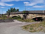
Old White Cart bridge. Built 1812 3-span ashlar bridge landlocked between Black Cart and White Cart bridges.
India of Inchinnan - geograph.org.uk - 467525.jpg
(c) Thomas Nugent, CC BY-SA 2.0
India of Inchinnan Fine Art Deco office building, purpose built by India Tyres in 1931. Lay derelict for several years after the factory closed, but was restored and converted to individual office spaces, reopening in 2003. The factory was located to the rear of this building and was demolished in 1982.
Coats Memorial Church.jpg
(c) Thomas Nugent, CC BY-SA 2.0
Coats Memorial baptist Church, Paisley, Scotland. Claims to be the largest Baptist church in the world. Designed by Hippolyte J Blanc, 1885
Paisley Museum and Art Galleries - geograph.org.uk - 387047.jpg
(c) Thomas Nugent, CC BY-SA 2.0
Paisley Museum and Art Galleries This fine building at the top of the High Street also contains a library.
The Russell Institute - geograph.org.uk - 395444.jpg
(c) Thomas Nugent, CC BY-SA 2.0
The Russell Institute. Children's clinic donated to Paisley in 1927 by Miss Agnes Russell as a memorial to her brothers, Robert and Thomas. See also 395449 & 395455.
John Neilson Institution - geograph.org.uk - 386213.jpg
(c) Thomas Nugent, CC BY-SA 2.0
John Neilson Institution A former school, Bequeathed to the town by John Neilson, a local grocer. Designed by Charles Wilson and opened in 1852. Last used as a school in 1968. Now converted to flats. See also 386210.
Lochwinnoch Parish Church (geograph 2254799).jpg
(c) Alan Reid, CC BY-SA 2.0
Lochwinnoch Parish Church
Place of Paisley - geograph.org.uk - 372356.jpg
(c) Thomas Nugent, CC BY-SA 2.0
Place of Paisley Joined to Paisley Abbey, these crow-stepped buildings are all that remain of the once extensive monastery that occupied this site.
Mile End Mill - geograph.org.uk - 371328.jpg
(c) Thomas Nugent, CC BY-SA 2.0
Mile End Mill See another view of the mill here 371316.
The Bull Inn (geograph 4998160).jpg
(c) Thomas Nugent, CC BY-SA 2.0
The Bull Inn
Renfrewshire county.jpg
(c) Thomas Nugent, CC BY-SA 2.0
Former County Hall of Renfrewshire in en:Paisley. Now the Paisley en:Sheriff Court
Paisley Town Hall - geograph.org.uk - 1191130.jpg
(c) Stephen Sweeney, CC BY-SA 2.0
Paisley Town Hall Overlooking Abbey Close.
White Cart bridge - geograph.org.uk - 35385.jpg
(c) william craig, CC BY-SA 2.0
White Cart bridge. a Scherzer rolling lift bridge built 1924 recently refurbished
IMGP0444 Inshinnan Bridge v1.png
Autor/Urheber: Ian Robertson, Lizenz: CC BY 3.0
Inshinnan Bridge on black cart
Paisley War Memorial - geograph.org.uk - 411180.jpg
(c) Raymond Okonski, CC BY-SA 2.0
Paisley War Memorial Unveiled in 1924 to honour the fallen in the Great (1st) War.
High Church - geograph.org.uk - 387075.jpg
(c) Thomas Nugent, CC BY-SA 2.0
High Church A rear view of the church, built as High Church in 1750, now known as Oakshaw Trinity Parish Church.
St Matthews Church of the Nazarene - geograph.org.uk - 395396.jpg
(c) Thomas Nugent, CC BY-SA 2.0
St Matthews Church of the Nazarene Art Nouveau church designed in 1906 in the MacKintosh style, but by William D McLennan.
Renfrew Town Hall - geograph.org.uk - 1279960.jpg
(c) G Laird, CC BY-SA 2.0
Renfrew Town Hall Grade 1 listed building in the Gothic Revival Style situated at the end of High Street.
National Trust Weaver's Cottage, Kilbarchan - geograph.org.uk - 1018.jpg
(c) Pam Brophy, CC BY-SA 2.0
National Trust Weaver's Cottage: Kilbarchan. The cottage is situated in the centre of the village and has an interesting exhibition of how paisley shawls were produced. It is in the south western corner of the square.
Paisley Abbey 20120410.jpg
Autor/Urheber: Otter, Lizenz: CC BY-SA 3.0
Paisley Abbey, Paisley, Renfrewshire, Scotland.