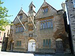
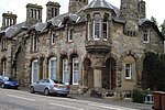
Liste der Kategorie-A-Bauwerke in Midlothian

Lage von Midlothian in Schottland

Die Liste der Kategorie-A-Gebäude in Midlothian umfasst sämtliche in der Kategorie A eingetragenen Baudenkmäler in der schottischen Council Area Midlothian. Die Einstufung wird anhand der Kriterien von Historic Scotland vorgenommen, wobei in die höchste Kategorie A Bauwerke von nationaler oder internationaler Bedeutung einsortiert sind. In Midlothian sind derzeit 68 Bauwerke in der Kategorie A gelistet.

NameLageTypEintragBild
Stallungen von Preston Hallnahe Pathhead
55° 52′ 57,4″ N, 2° 58′ 0″ W
Stallungen113
Whitehill Housenahe Rosewell
55° 50′ 45,8″ N, 3° 7′ 31,3″ W
Herrenhaus687
North Gatenahe Pathhead
55° 53′ 38,1″ N, 2° 57′ 23,3″ W
Tor745
Lions Gatenahe Pathhead
55° 52′ 34,3″ N, 2° 58′ 20,4″ W
Tor746
Lions Gate
(c) james denham, CC BY-SA 2.0
Crichton Collegiate Churchnahe Crichton
55° 50′ 37,4″ N, 2° 59′ 25,1″ W
Kirche753Crichton Collegiate Church
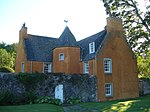
Ford HouseFord
55° 52′ 6,9″ N, 2° 58′ 38,8″ W
Villa756
Ford House (Midlothian)
(c) kim traynor, CC BY-SA 2.0
Crichton Housenahe Crichton
55° 51′ 6,2″ N, 2° 57′ 33,7″ W
Herrenhaus757
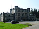
Oxenfoord Castlenahe Pathhead
55° 52′ 43,4″ N, 2° 58′ 45,8″ W
Schloss768
Oxenfoord Castle
(c) Richard West, CC BY-SA 2.0
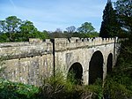
Oxenfoord Viaductnahe Pathhead
55° 52′ 46,2″ N, 2° 58′ 45,8″ W
Brücke769
Oxenfoord Viaduct
(c) kim traynor, CC BY-SA 2.0
Preston Hallnahe Pathhead
55° 52′ 52,1″ N, 2° 58′ 11,1″ W
Herrenhaus775
Gärten von Preston Hallnahe Pathhead
55° 52′ 57,7″ N, 2° 58′ 41,2″ W
Gärten777
The Templenahe Pathhead
55° 53′ 13,7″ N, 2° 58′ 7,5″ W
Mausoleum779
The Temple
(c) Jim Barton, CC BY-SA 2.0
Cockpen and Carrington Parish ChurchBonnyrigg
55° 51′ 58″ N, 3° 5′ 21,2″ W
Kirche780
Dalhousie Castlenahe Bonnyrigg
55° 51′ 38,6″ N, 3° 4′ 57″ W
Schloss784
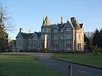
Vogrie Housenahe Pathhead
55° 51′ 30″ N, 2° 59′ 26,2″ W
Herrenhaus799
Vogrie House
(c) ronnie leask, CC BY-SA 2.0
Borthwick Castlenahe North Middleton
55° 49′ 36″ N, 3° 0′ 26,8″ W
Burg805
Borthwick Castle
(c) stephen samson, CC BY-SA 2.0
Middleton Hallnahe Middleton
55° 48′ 48,7″ N, 3° 0′ 35,8″ W
Herrenhaus806
Arniston Housenahe Gorebridge
55° 49′ 25,4″ N, 3° 4′ 39,1″ W
Herrenhaus808
Arniston House
(c) Kevin Rae, CC BY-SA 2.0
Grotte von Arniston Housenahe Gorebridge
55° 49′ 16,3″ N, 3° 4′ 49,7″ W
Grotte811
North Gate-Lodgenahe Gorebridge
55° 50′ 22,6″ N, 3° 3′ 38,7″ W
Wohngebäude814
Gewächshaus von Dalkeith HouseDalkeith
55° 54′ 7,7″ N, 3° 3′ 36,2″ W
Gewächshaus1410
Gewächshaus von Dalkeith House
(c) Kay Williams, CC BY-SA 2.0
Dalkeith HouseDalkeith
55° 53′ 58,8″ N, 3° 4′ 4,4″ W
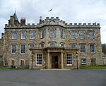
Schloss1411Dalkeith House
Dark WalkDalkeith
55° 53′ 51″ N, 3° 3′ 35,1″ W
Tor1412
King’s GateDalkeith
55° 53′ 51,5″ N, 3° 5′ 9,2″ W
Tor1437
King’s Gate
(c) Sandy Gemmill, CC BY-SA 2.0
Montagu BridgeDalkeith
55° 54′ 5,5″ N, 3° 4′ 2,3″ W
Brücke1440
Montagu Bridge
(c) Jim Barton, CC BY-SA 2.0
St Mary’s ChapelDalkeith
55° 53′ 52,9″ N, 3° 3′ 54,8″ W
Kirche1441
St Mary’s Chapel
(c) kim traynor, CC BY-SA 2.0
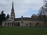
Stallungen von Dalkeith HouseDalkeith
55° 54′ 5,9″ N, 3° 3′ 39,8″ W
Stallungen1442
Glenesk Railway ViaductDalkeith
55° 53′ 33,4″ N, 3° 4′ 58,8″ W
Brücke1445
Lothian BridgePathhead
55° 52′ 11,8″ N, 2° 58′ 28,6″ W
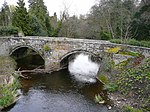
Brücke5090Lothian Bridge
Taubenturm von Mavisbank HouseLoanhead
55° 52′ 46,7″ N, 3° 7′ 48,6″ W
Taubenturm7386
Taubenturm von Mavisbank House
(c) Richard Webb, CC BY-SA 2.0
Gartenhaus von Mavisbank HouseLoanhead
55° 52′ 19,5″ N, 3° 8′ 17,9″ W
Gartenhaus7387
Melville Castlenahe Lasswade
55° 53′ 27,6″ N, 3° 6′ 15,1″ W
Schloss7394
Melville Castle
(c) kim traynor, CC BY-SA 2.0
Lasswade CottageLasswade
55° 52′ 52,3″ N, 3° 7′ 31,1″ W
Villa7398
Mavisbank HouseLoanhead
55° 52′ 27″ N, 3° 8′ 21,5″ W
Herrenhaus7404
Mavisbank House
(c) Peter Gordon, CC BY-SA 2.0
Glencorse Old Parish ChurchPenicuik
55° 51′ 16,7″ N, 3° 12′ 26,5″ W
Kirche7454
Glencorse Old Parish Church
(c) james waugh, CC BY-SA 2.0
Glencorse Parish ChurchPenicuik
55° 51′ 3″ N, 3° 12′ 17,5″ W
Kirche7456
Glencorse Parish Church
(c) Sandy Gemmill, CC BY-SA 2.0
Bush HousePenicuik
55° 51′ 33,2″ N, 3° 12′ 24,4″ W
Herrenhaus7462
Bush House
(c) Richard Webb, CC BY-SA 2.0
Willie’s Templenahe Rosewell
55° 53′ 23,2″ N, 3° 6′ 42,7″ W
Folly12940
Hawthornden Castlenahe Rosewell
55° 51′ 39,2″ N, 3° 8′ 31″ W
Schloss13023Hawthornden Castle
Roslin Castlenahe Roslin
55° 51′ 9,4″ N, 3° 9′ 36″ W
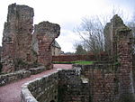
Burgruine13026Roslin Castle
Rosslyn ChapelRoslin
55° 51′ 19,4″ N, 3° 9′ 35,4″ W
Kirche13028
Rosslyn Chapel
(c) ronnie leask, CC BY-SA 2.0
Auchendinny Housenahe Auchendinny
55° 50′ 22″ N, 3° 11′ 46,8″ W
Herrenhaus13034
Bilston ViaductLoanhead
55° 52′ 16,9″ N, 3° 9′ 3,6″ W
Brücke13035
Bilston Viaduct
(c) Morley Sewell, CC BY-SA 2.0
Tor von Woolmet HouseDanderhall
55° 55′ 2,6″ N, 3° 6′ 36,4″ W
Tor14184
Tor von Woolmet House
(c) M J Richardson, CC BY-SA 2.0
Newbattle AbbeyNewbattle
55° 52′ 57,9″ N, 3° 4′ 1,2″ W
Herrenhaus14561Newbattle Abbey
Nördliche Sonnenuhr von Newbattle AbbeyNewbattle
55° 53′ 0″ N, 3° 3′ 58,3″ W
Sonnenuhr14562
Südliche Sonnenuhr von Newbattle AbbeyNewbattle
55° 52′ 57,7″ N, 3° 3′ 56,3″ W
Sonnenuhr14563
Maiden BridgeNewbattle
55° 53′ 16,3″ N, 3° 43′ 3″ W
Brücke14564
Maiden Bridge
(c) kim traynor, CC BY-SA 2.0
Monkland WallNewbattle
55° 52′ 59,3″ N, 3° 4′ 13″ W
Mauer14566
Monkland Wall
(c) james denham, CC BY-SA 2.0
Port LodgeNewbattle
55° 52′ 53″ N, 3° 4′ 14,6″ W
Wohngebäude14567
Port Lodge
(c) Richard Webb, CC BY-SA 2.0
Newbattle Old BridgeNewbattle
55° 52′ 47,7″ N, 3° 4′ 12,9″ W
Brücke14568
Newbattle Old Bridge
(c) Jonathan Billinger, CC BY-SA 2.0
Lady Victoria CollieryNewtongrange
55° 51′ 43,1″ N, 3° 4′ 3,6″ W
Bergwerk14604
Lady Victoria Colliery
(c) Alan Murray-Rust, CC BY-SA 2.0
Gärten von Arniston Housenahe Gorebridge
55° 49′ 13,3″ N, 3° 4′ 42,3″ W
Gärten14625
Bauernhof von Rosebery Housenahe Temple
55° 48′ 19,2″ N, 3° 6′ 49,1″ W
Bauernhof14630
Bauernhof von Rosebery House
(c) Chris Eilbeck, CC BY-SA 2.0
Penicuik Housenahe Penicuik
55° 49′ 10,9″ N, 3° 15′ 2,7″ W
Herrenhaus14634Penicuik House
New Penicuik Housenahe Penicuik
55° 49′ 15,4″ N, 3° 15′ 5,2″ W
Herrenhaus14635
New Penicuik House
(c) ronnie leask, CC BY-SA 2.0
Gewächshaus von Fairfield HouseDalkeith
55° 53′ 30,6″ N, 3° 4′ 10,1″ W
Gewächshaus24339
St David’s ChurchDalkeith
55° 53′ 27″ N, 3° 4′ 32,5″ W
Kirche24355St David’s Church
Eskbank HouseDalkeith
55° 53′ 25,2″ N, 3° 4′ 47,3″ W
Villa24375
St Nicholas ChurchDalkeith
55° 53′ 43,6″ N, 3° 4′ 7,5″ W
Kirche24377St Nicholas Church
Altes Rathaus von DalkeithDalkeith
55° 53′ 43,5″ N, 3° 4′ 4,2″ W
Rathaus24417Altes Rathaus von Dalkeith
Corn Exchange von DalkeithDalkeith
55° 53′ 46,3″ N, 3° 3′ 59,5″ W
Handelsgebäude24422Corn Exchange von Dalkeith
Linsandel HouseDalkeith
55° 53′ 21,7″ N, 3° 4′ 52,8″ W
Villa24443
Dalkeith LodgeDalkeith
55° 53′ 30,9″ N, 3° 4′ 0,5″ W
Wohngebäude24452
22–34 Bridge StreetPenicuik
55° 49′ 28,6″ N, 3° 13′ 17,8″ W
Wohngebäude39294
22–34 Bridge Street
(c) Morley Sewell, CC BY-SA 2.0
Penicuik South ChurchPenicuik
55° 49′ 21,9″ N, 3° 13′ 16,2″ W
Kirche39295
Penicuik South Church
(c) james denham, CC BY-SA 2.0
Gärten von Mavisbank Housenahe Loanhead
55° 52′ 25,2″ N, 3° 8′ 14″ W
Gärten44166
Gefängnisturm von GlencorsePenicuik
55° 50′ 42,9″ N, 3° 12′ 12,1″ W
Turm44614

Weblinks

Commons: Kategorie-A-Bauwerke in Midlothian – Sammlung von Bildern, Videos und Audiodateien

Auf dieser Seite verwendete Medien

Roslin or Rosslyn Chapel - geograph.org.uk - 1098119.jpg
(c) ronnie leask, CC BY-SA 2.0
Roslin or Rosslyn Chapel Founded in the early 15th century by Wm. St.Clair, Earl of Orkney, this is truly a magical building associated with the Knights Templar. The Holy Grail is said to be buried here. A claim used by Dan Brown in his book,"The Da Vinci Code" which was filmed here. The interior has magnificent stone carvings and, amongst its mysteries, carvings of a maize plant done before the discovery of America. For many years the roof has been covered in scaffolding and plastic sheeting in an attempt to dry out the stonework. This old photo shows the building before this restoration was started. The exterior is, in my view, not attractive but the interior is truly outstanding.If visiting I recommend taking binoculars to view the elaborate carvings covering the entire ceiling. It is still used as an Episcopalian church.
King's Gate entrance to Dalkeith Park - geograph.org.uk - 605175.jpg
(c) Sandy Gemmill, CC BY-SA 2.0
King's Gate entrance to Dalkeith Park The view of the King's Gate entrance to Dalkeith Park. The gatehouse is on the right.
Lady Victoria Colliery - geograph.org.uk - 1639730.jpg
(c) Alan Murray-Rust, CC BY-SA 2.0
Lady Victoria Colliery This view gives some idea of the extent of surviving buildings. Between the headstocks and the chimney is the winding engine house; the large building to the right is the power house which would have included the compressors for the underground compressed air machinery.
Bilston Viaduct - geograph.org.uk - 903527.jpg
(c) Morley Sewell, CC BY-SA 2.0
Bilston Viaduct The Bilston Viaduct over the Bilston Glen near Loanhead is now a walk/cycleway. The viaduct was built in 1892 and once carried the Glencorse branch of the old Edinburgh, Loanhead & Roslin Railway, which took coal and limestone from the mines in Midlothian. It was renovated for its new use in 1999.
Borthwick Castle - geograph.org.uk - 852272.jpg
(c) stephen samson, CC BY-SA 2.0
Borthwick Castle Borthwick Castle is great surviving U plan medieval castle. It was built by Sir William Borthwick in 1430 on the site of an earlier tower.
Penicuik House restoration, 2011.jpg
Autor/Urheber: kim traynor, Lizenz: CC BY-SA 3.0
Penicuik House restoration
Melville Castle.jpg
(c) kim traynor, CC BY-SA 2.0
Melville Castle
Glencorse Old Church (geograph 2174449).jpg
(c) james waugh, CC BY-SA 2.0
Glencorse Old Church
Maiden Bridge, Newbattle Abbey (geograph 3561870).jpg
(c) kim traynor, CC BY-SA 2.0
Maiden Bridge, Newbattle Abbey
Newbattle Road heading for Eskbank - geograph.org.uk - 1358488.jpg
(c) james denham, CC BY-SA 2.0
Newbattle Road heading for Eskbank
Bush House - geograph.org.uk - 583145.jpg
(c) Richard Webb, CC BY-SA 2.0
Bush House House and estate now host the Centre of Rural Economy with Edinburgh University, Scottish College of Agriculture and a biotechnology park.
Scottish-Castle-Symbol.svg
Autor/Urheber: Majo statt Senf, Lizenz: CC BY-SA 4.0
Schlosssymbol Schottland
Dalkeith Palace in 2011.jpg
Autor/Urheber: Kim Traynor, Lizenz: CC BY 3.0
Frontage of Dalkeith Palace, now styling itself more modestly as Dalkeith House. The building is the work of several architects including additions by Vanbrugh. The main portion was built between 1702 and 1711. It is now the Scottish Campus of the University of Wisconsin
Tolbooth, Dalkeith.jpg
Autor/Urheber: Kim Traynor, Lizenz: CC BY-SA 3.0
The 18thC building bears a tablet from the Old Tolbooth on the site, dated 1648. The last public hanging in Dalkeith took place at the front of the building in 1827.
Parkend, Bridge Street, Penicuik - geograph.org.uk - 911908.jpg
(c) Morley Sewell, CC BY-SA 2.0
Parkend, Bridge Street, Penicuik This building, on Bridge Street to the north of the Telford Bridge on the A701 and said to be in a Venetian-Gothic" style, was built by Frederick Pillington of Edinbugh. This architect also built the old free Church, now the South Church, on the other side of both the bridge and the road in a similar style in 1862,
St Mary's Church, Dalkeith Park - geograph.org.uk - 1417491.jpg
(c) kim traynor, CC BY-SA 2.0
St Mary's Church, Dalkeith Park The church, built as a private chapel for the Duke of Buccleuch in 1845, made headlines in May 1913 when a bomb was discovered, presumed to have been planted by local militant suffragettes. A similar bomb exploded days later at Edinburgh's Blackford Hill Observatory. No arrests were made.
Cockpen and Carrington Church 345.jpg
(c) Roger W Haworth, CC BY 2.5
Dieses Foto zeigt das geschützte Denkmal in Schottland mit der Nummer
St. David's Roman Catholic Church, Dalkeith by Owen Proudfoot.jpg
Autor/Urheber: Owen Proudfoot, Lizenz: CC BY-SA 2.0
St. David's Roman Catholic Church, Dalkeith
Dalkeith Parish Kirk.jpg
Autor/Urheber: Kim Traynor, Lizenz: CC BY-SA 3.0
Now known as the St Nicholas Buccleuch Church,
Oxenfoord Castle 01.jpg
(c) Richard West, CC BY-SA 2.0
Midlothian Architecture : Oxenfoord Castle, near Pathhead
Gateway to Woolmet House (geograph 1844648).jpg
(c) M J Richardson, CC BY-SA 2.0
Gateway to Woolmet House
Lothian Bridge near Pathhead, Midlothian.JPG
Autor/Urheber: Kim Traynor, Lizenz: CC BY-SA 3.0
Lothian Bridge near Pathhead, Midlothian
Ford House - geograph.org.uk - 1516426.jpg
(c) kim traynor, CC BY-SA 2.0
Ford House 17thC house in the village of Ford.
Doocot, Mavisbank (geograph 3964806).jpg
(c) Richard Webb, CC BY-SA 2.0
Doocot, Mavisbank
Glencorse Kirk - geograph.org.uk - 321519.jpg
(c) Sandy Gemmill, CC BY-SA 2.0
Glencorse Kirk The Church of Scotland Parish Church for Glencorse.

The minister of Glencorse is also minister of the two nearby congregations in Roslin and in Bilston.

The church is on the edge of Glencorse (or Milton Bridge) and the view is from a neighbouring farmer's field. The War Memorial is to the right of the church building (above the hay trough) and the houses behind the church belong to the Ministry of Defence and provide accommodation for personnel based at the Glencorse Barracks.
Crichton church.jpg
Autor/Urheber: Jonathan Oldenbuck, Lizenz: CC BY-SA 3.0
Crichton Collegiate Church, Midlothian, Scotland.
Vogrie House - geograph.org.uk - 1118554.jpg
(c) ronnie leask, CC BY-SA 2.0
Vogrie House In the 1870's, the Perth whisky family, the Dewars, commissioned the Perth architect Andrew Heiton to build a mansion on their estate. The estate was sold in 1924 becoming an outstation for the Edinburgh Mental Hospital. In the 1960's, during the period of the Cold War, it was the Civil Defence HQ for Midlothian and is now the centre for the popular Vogrie Country Park with extensive woodlands, miles of paths and includes a golf course. The Dewar name is however continued in the village of Dewartown nearby.
Arniston House - geograph.org.uk - 35520.jpg
(c) Kevin Rae, CC BY-SA 2.0
Dieses Foto zeigt das geschützte Denkmal in Schottland mit der Nummer
Oxenfoord Viaduct (geograph 2363572).jpg
(c) kim traynor, CC BY-SA 2.0
Oxenfoord Viaduct
Hawthornden Castle, 2013.jpg
Autor/Urheber: Magnus Hagdorn from UK, Lizenz: CC BY-SA 2.0
Hawthornden Castle
Penicuik House - geograph.org.uk - 929714.jpg
(c) ronnie leask, CC BY-SA 2.0
Penicuik House This estate has been owned by the Clerks of Penicuik for several centuries. A family that has played a prominent role in Scottish history. When the palladian mansion was destroyed by fire over a century ago the stables block was converted to their home. The prominent domed doocot is a copy of 'Arthurs O'on' (0ven), a Roman temple which once stood near Falkirk.
Montagu Bridge, Dalkeith Country Park - geograph.org.uk - 1589872.jpg
(c) Jim Barton, CC BY-SA 2.0
Montagu Bridge, Dalkeith Country Park This elegant 18th century bridge as seen from the east bank of the North Esk.
The Temple, Preston Hall (geograph 2437518).jpg
(c) Jim Barton, CC BY-SA 2.0
The Temple, Preston Hall
Newbattle Abbey.jpg
Autor/Urheber: Kim Traynor, Lizenz: CC BY-SA 3.0
In the late 1930s, Philip Kerr, 11th Marquess of Lothian, bequeathed his house to the nation for the express purpose of creating a residential adult college to provide a non-vocational education for students of a working-class background. The College opened in 1937 and continues to serve its original purpose. Its warden between 1949 and 1955 was the poet Edwin Muir.
The Lion Gate - geograph.org.uk - 1706742.jpg
(c) james denham, CC BY-SA 2.0
The Lion Gate At Preston Hall near Pathhead in Midlothian.
The Conservatory, Dalkeith country park - geograph.org.uk - 690132.jpg
(c) Kay Williams, CC BY-SA 2.0
The Conservatory, Dalkeith country park Conservatory, now ruined, built about 1832 to a design by William Burn and used to grow exotic fruits for the Duke of Buccleuch at Dalkeith House. The boiler was said to consume up to a ton of coal a day.
Corn Exchange, Dalkeith.jpg
Autor/Urheber: Kim Traynor, Lizenz: CC BY-SA 3.0
Corn Exchange, Dalkeith
Newbattle Old Bridge - geograph.org.uk - 937301.jpg
(c) Jonathan Billinger, CC BY-SA 2.0
Newbattle Old Bridge The River South Esk viewed from the new bridge on the B703.
RoslinCastle1.JPG
Autor/Urheber: Taken by User:Supergolden, Lizenz: CC BY-SA 3.0
Entrance to Roslin Castle, near Edinburgh, Scotland.