Liste der Kategorie-A-Bauwerke in East Ayrshire

Lage von East Ayrshire in Schottland

Die Liste der Kategorie-A-Gebäude in East Ayrshire umfasst sämtliche in der Kategorie A eingetragenen Baudenkmäler in der schottischen Council Area East Ayrshire. Die Einstufung wird anhand der Kriterien von Historic Scotland vorgenommen, wobei in die höchste Kategorie A Bauwerke von nationaler oder internationaler Bedeutung einsortiert sind. In East Ayrshire sind derzeit 44 Bauwerke in der Kategorie A gelistet.

NameLageTypEintragBild
Lodges von Dumfries Housenahe Auchinleck
55° 27′ 52″ N, 4° 18′ 43,3″ W
Wohngebäude96
Auchinleck Housenahe Ochiltree
55° 28′ 41,2″ N, 4° 21′ 48,2″ W
Herrenhaus948
Auchinleck House
(c) david johnston, CC BY-SA 2.0
Waterside Engine HouseWaterside
55° 20′ 41,1″ N, 4° 27′ 31,6″ W
Industriegebäude1092
The Hillnahe Dunlop
55° 42′ 24,9″ N, 4° 31′ 40,2″ W
Bauernhof5184
Dunlop Housenahe Dunlop
55° 42′ 42″ N, 4° 30′ 17,1″ W
Schloss5187Dunlop House
Clandeboye VaultDunlop
55° 42′ 42,3″ N, 4° 32′ 26,2″ W
Mausoleum5191Clandeboye Vault
Clandeboye SchoolDunlop
55° 42′ 42,3″ N, 4° 32′ 25,9″ W
Schule5192
KirklandDunlop
55° 42′ 44,9″ N, 4° 32′ 17″ W
Pfarrhaus5194Kirkland
Rowallan Castlenahe Kilmarnock
55° 39′ 0,5″ N, 4° 29′ 20,6″ W
Herrenhaus12523Rowallan Castle
Rowallan Housenahe Kilmaurs
55° 39′ 9,1″ N, 4° 29′ 32,1″ W
Villa12524Rowallan House
Craufurdland Castlenahe Kilmarnock
55° 38′ 10,2″ N, 4° 27′ 16,5″ W
Herrenhaus12530
Loudoun Castlenahe Galston
55° 36′ 38,1″ N, 4° 22′ 22″ W
Schloss12536Loudoun Castle
Laigh Milton Viaductnahe Gatehead
55° 35′ 55,7″ N, 4° 34′ 1,8″ W
Brücke12556Laigh Milton Viaduct
Cessnock Castlenahe Galston
55° 35′ 25,5″ N, 4° 21′ 52,3″ W
Herrenhaus12562
Taubenhaus von Tour GardenKilmaurs
55° 38′ 0,9″ N, 4° 31′ 16,5″ W
Taubenhaus12578Taubenhaus von Tour Garden
Altes Rathaus von KilmaursKilmaurs
55° 38′ 18,1″ N, 4° 31′ 37,1″ W
Rathaus12588Altes Rathaus von Kilmaurs
Alexander Morton MonumentDarvel
55° 36′ 33,2″ N, 4° 17′ 59,8″ W
Monument13461
Sornhill Farmnahe Galston
55° 34′ 41,3″ N, 4° 22′ 1,1″ W
Herrenhaus13829
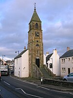
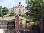
Catrine Parish ChurchCatrine
55° 30′ 20″ N, 4° 19′ 58,4″ W
Kirche14264
Catrine Parish Church
(c) Angela Mudge, CC BY-SA 2.0
Sorn Old BridgeSorn
55° 30′ 45,9″ N, 4° 17′ 54,1″ W
Brücke14272
Sorn Old Bridge
(c) Gordon Brown, CC BY-SA 2.0
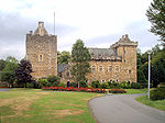
Sorn Castlenahe Sorn
55° 30′ 51,4″ N, 4° 18′ 3,6″ W
Herrenhaus14273
Sorn Castle
(c) Gordon Brown, CC BY-SA 2.0
Stallungen von Sorn Castlenahe Sorn
55° 30′ 55,3″ N, 4° 18′ 17,6″ W
Stallungen14274
Stair BridgeStair
55° 28′ 48,4″ N, 4° 28′ 25,7″ W
Brücke14371Stair Bridge
Stair HouseStair
55° 28′ 59,4″ N, 4° 28′ 12,9″ W
Herrenhaus14372
Stair House
(c) Robert Watson, CC BY-SA 2.0
Dumfries Housenahe Cumnock
55° 27′ 20,2″ N, 4° 18′ 29″ W
Herrenhaus14413
Dumfries House
(c) Gordon Brown, CC BY-SA 2.0
Brücke von Dumfries Housenahe Cumnock
55° 27′ 27,8″ N, 4° 18′ 49,2″ W
Brücke14414Brücke von Dumfries House
Taubenhaus von Dumfries Housenahe Cumnock
55° 27′ 18,5″ N, 4° 18′ 39,8″ W
Taubenhaus14416Taubenhaus von Dumfries House
Mauchline CastleMauchline
55° 30′ 57,4″ N, 4° 22′ 50,8″ W
Tower House14471Mauchline Castle
Ballochmyle Viaductnahe Mauchline
55° 29′ 58,3″ N, 4° 21′ 44,4″ W
Brücke14483Ballochmyle Viaduct
Kennox Housenahe Stewarton
55° 40′ 15,9″ N, 4° 34′ 11,7″ W
Herrenhaus18490
High Williamshawnahe Stewarton
55° 42′ 11,7″ N, 4° 29′ 2,4″ W
Bauernhof18496
High Williamshaw
(c) Thomas Nugent, CC BY-SA 2.0
Taubenturm von Treesbank Housenahe Riccarton
55° 34′ 43,2″ N, 4° 30′ 30,5″ W
Taubenturm18512
Caprington Castlenahe Kilmarnock
55° 35′ 37,7″ N, 4° 31′ 42,8″ W
Herrenhaus18517
Caprington Castle
(c) wfmillar, CC BY-SA 2.0
Craigengillannahe Dalmellington
55° 17′ 44,4″ N, 4° 24′ 20,5″ W
Herrenhaus18793
Craigengillan
(c) Ann Cook, CC BY-SA 2.0
Stallungen von Craigengillannahe Dalmellington
55° 17′ 43,2″ N, 4° 24′ 19,7″ W
Stallungen18794
Stallungen von Craigengillan
(c) Ann Cook, CC BY-SA 2.0
Barskimming New Bridgenahe Mauchline
55° 29′ 48,7″ N, 4° 24′ 15,8″ W
Brücke19483
Barskimming New Bridge
(c) Bob Forrest, CC BY-SA 2.0
Marktkreuz von CumnockCumnock
55° 27′ 14,5″ N, 4° 15′ 58,3″ W
Marktkreuz24093Marktkreuz von Cumnock
Bank Railway ViaductCumnock
55° 27′ 31,6″ N, 4° 15′ 25,1″ W
Brücke24133Bank Railway Viaduct
St Sophia’s ChurchGalston
55° 35′ 56,7″ N, 4° 22′ 39,4″ W
Kirche32010
St Sophia’s Church
(c) Dan, CC BY-SA 2.0
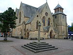
Laigh KirkKilmarnock
55° 36′ 34,6″ N, 4° 29′ 52″ W
Kirche35875
Laigh Kirk
(c) Billy McCrorie, CC BY-SA 2.0
Dean CastleKilmarnock
55° 37′ 23,8″ N, 4° 29′ 2,1″ W
Burg35884Dean Castle
Palace TheatreKilmarnock
55° 36′ 34,8″ N, 4° 29′ 39,7″ W
Theater35903
Palace Theatre
(c) M J Richardson, CC BY-SA 2.0
Holy Trinity ChurchKilmarnock
55° 36′ 27,4″ N, 4° 30′ 1,6″ W
Kirche35946
Holy Trinity Church
(c) wfmillar, CC BY-SA 2.0
Old High KirkKilmarnock
55° 36′ 44,4″ N, 4° 29′ 40,9″ W
Kirche35965
Old High Kirk
(c) wfmillar, CC BY-SA 2.0

Weblinks

Commons: Kategorie-A-Bauwerke in East Ayrshire – Sammlung von Bildern, Videos und Audiodateien

Auf dieser Seite verwendete Medien

Scottish-Castle-Symbol.svg
Autor/Urheber: Majo statt Senf, Lizenz: CC BY-SA 4.0
Schlosssymbol Schottland
Old bridge over the river Ayr at Sorn - geograph.org.uk - 106823.jpg
(c) Gordon Brown, CC BY-SA 2.0
Old bridge over the river Ayr at Sorn.
Holy Trinity Scottish Episcopal Church, Kilmarnock - geograph.org.uk - 1607137.jpg
(c) wfmillar, CC BY-SA 2.0
Holy Trinity Scottish Episcopal Church, Kilmarnock. According to a local. The site of the Church and Parsonage were formerly the terminus of the first railway in Scotland, built by the Duke of Portland to transport coal from the mines of Kilmarnock to the pier at Troon for export. I was also told that the railway wagons were horse drawn.[1]
Loudoun Castle Hastings Campbell.jpg
Loudoun Castle, Galston, East Ayrshire, Scotland; home of the Campbell and Hastings - Earls of Loudoun, etc.
Kilmaursthe jougs.JPG
The 'Jougs', Council chambers, in Kilmaurs, East Ayrshire, Scotland.
Rowallan Castle.JPG
Autor/Urheber: Sagereid, Lizenz: CC BY-SA 3.0
Rowallan Castle
Craigengillan House - geograph.org.uk - 1308030.jpg
(c) Ann Cook, CC BY-SA 2.0
Craigengillan House This is Craigengillan House on the Craigengillan Estate.
Old Cumnock Old Church and mercat cross.JPG
Autor/Urheber: Kim Traynor, Lizenz: CC BY-SA 3.0
Old Cumnock Old Church and mercat cross
Templand Bridge Cumnock Scotland.jpg
Autor/Urheber: Snapshots Of The Past, Lizenz: CC BY-SA 2.0
Templand Bridge Cumnock Scotland
The Laigh Kirk, Kilmarnock (geograph 5077810).jpg
(c) Billy McCrorie, CC BY-SA 2.0
The Laigh Kirk, Kilmarnock
Stair Bridge over River Ayr. 2010..JPG
Stair Bridge over the River Ayr, East Ayrshire, Scotland
Ayrshire Rowallan Castle 3.jpg
Autor/Urheber: PaulT (Gunther Tschuch), Lizenz: CC BY-SA 4.0
Rowallan House near Castle (Ayrshire, Scotland, UK)
Old Church Yard Cemetery - geograph.org.uk - 205172.jpg
(c) Angela Mudge, CC BY-SA 2.0
Old Church Yard Cemetery. The cemetery in Catrine with Chapel Brae on the hill top
Dumfries House - frontage - geograph.org.uk - 927581.jpg
(c) Gordon Brown, CC BY-SA 2.0
Dumfries House - frontage Dumfries House is an A-listed Palladian mansion built between 1754 and 1760 for the 5th earl of Dumfries by the architect brothers John, Robert and James Adam. The house came by marriage into the ownership of the 1st Marquess of Bute in 1803; it was put up for sale by John Dumfries, the 6th Marquess, and in 2007 purchased by a consortium led by HRH The Prince of Wales, Duke of Rothesay.
Mauchline Castle 1790 - Ayrshire.jpg
Mauchline Castle, Ayrshire, Scotland. 1790
ScotlandEastAyrshire.png
Autor/Urheber: unknown, Lizenz: CC-BY-SA-3.0
Kirkfauld dovecote at Saint Maurs-Glencairn Church, Kilmaurs.JPG
Autor/Urheber: Rosser1954, Lizenz: CC BY-SA 4.0
The 1636 Kirkfauld dovecote at Saint Maurs-Glencairn Church, Kilmaurs, East Ayrshire, Scotland.
Dean Castle.JPG
Autor/Urheber: Fraser Sutherland, Lizenz: CC BY 2.5
A picture of Dean Castle, kilmarnock.
Observatory on the Craigengillan estate - geograph.org.uk - 1308044.jpg
(c) Ann Cook, CC BY-SA 2.0
Observatory on the Craigengillan estate This observatory stands next to Craigengillan House. It was built towards the end of the 19th century.
Laigh Milton Viaduct 2006.jpg
Autor/Urheber: Der ursprünglich hochladende Benutzer war Dreamer84 in der Wikipedia auf Englisch, Lizenz: CC BY 2.5
Laigh Milton Viaduct near Gatehead, East Ayrshire, Scotland in February 2006. Formerly known as 'Milton Bridge', it was built as part of the Kilmarnock and Troon Railway, and is thought to be the oldest surviving railway viaduct in the world.
Caprington Castle - geograph.org.uk - 334293.jpg
(c) wfmillar, CC BY-SA 2.0
Caprington Castle Majestic house home of Cuninghames and the very helpful Mrs Cuninghame. Great to walk around and great for snowdrops at this time of year.
Sorn Castle from the River Ayr Way - geograph.org.uk - 519591.jpg
(c) Gordon Brown, CC BY-SA 2.0
Sorn Castle from the River Ayr Way
Stair House, East Ayrshire.jpg
(c) Robert Watson, CC BY-SA 2.0
Stair House, East Ayrshire, dates from the 17th century

Stair House, Ayrshire. Set in the idyllic surroundings of the Ayrshire countryside, Stair is a small hamlet and has a number of attractions that are of historical interest. Stair House built in the 17th century is one of the loveliest houses in Scotland. It has links with Robert Burns.

A good vantage point to view its beautiful exterior is from Stair Bridge.
Dumfries House dovecot.JPG
The old Dovecot or Doocot at Dumfries House, East Ayrshire, Scotland.
Dunlopchurchpicture.jpg
The 'Picture House' at Dunlop church. This is the tomb of the first Protestant Minister of the parish, Hans Hamilton, together with his wife. The structure was erected by his son, Viscount Clandeboye.
Dunlop old manse - 1930s.jpg
Dunlop Old Manse, East Ayrshire, Scotland.
KilmarnockBusStation.jpg
(c) M J Richardson, CC BY-SA 2.0
Bus station and Palace Theatre
Ballochmyle Viaduct, Mauchline.JPG
Autor/Urheber: Rosser1954, Lizenz: CC BY-SA 3.0
Ballochmyle Viaduct, Kilmarnock to Dumfries and Carlisle line, East Ayrshire, Scotland.
Barskimming Bridge - geograph.org.uk - 305270.jpg
(c) Bob Forrest, CC BY-SA 2.0
Barskimming Bridge This is a very old road bridge made from red sandstone rock which was quarried locally. The red sandstone was formed under desert conditions as shown by the rounded nature of the quartz grains found in the rock. Geologically, it dates from around Carboniferous/Permian times. At present there is some debate about to which of these geological periods it actually belongs.
Dunlop House, north facing aspect, East Ayrshire.JPG
Autor/Urheber: Rosser1954, Lizenz: CC BY-SA 4.0
Dunlop House, north facing aspect, East Ayrshire, Scotland. David Hamilton was the architect for Jir John Dunlop. 1831-34.
High Williamshaw - geograph.org.uk - 171135.jpg
(c) Thomas Nugent, CC BY-SA 2.0
High Williamshaw. A fine building, off the B769 NE of Stewarton.
Avenue Bridge over the Lugar at Dumfries House.JPG
Avenue Bridge over the Lugar Water at Dumfries House, East Ayrshire, Scotland.