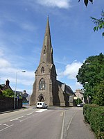
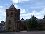
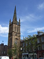
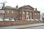
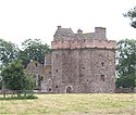
Liste der Kategorie-A-Bauwerke in Angus

Lage von Angus in Schottland

Die Liste der Kategorie-A-Gebäude in Angus umfasst sämtliche in der Kategorie A eingetragenen Baudenkmäler in der schottischen Council Area Angus. Die Einstufung wird anhand der Kriterien von Historic Scotland vorgenommen, wobei in die höchste Kategorie A Bauwerke von nationaler oder internationaler Bedeutung einsortiert sind. In Angus sind derzeit 81 Bauwerke in der Kategorie A gelistet.

NameLageTypEintragBild
Barry Millnahe Carnoustie
56° 30′ 15,9″ N, 2° 45′ 30,4″ W
Mühle4649
Barry Mill
(c) Gwen and James Anderson, CC BY-SA 2.0
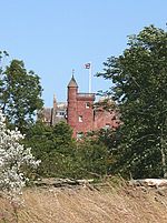
Careston Castlenahe Brechin
56° 43′ 41,7″ N, 2° 46′ 7,3″ W
Tower House4656
Careston Castle
(c) Alan Morrison, CC BY-SA 2.0
Bridge of Dunnahe Farnell
56° 42′ 59,1″ N, 2° 33′ 9,3″ W
Brücke4677
Bridge of Dun
(c) Trish Steel, CC BY-SA 2.0
House of Dunnahe Montrose
56° 43′ 45,6″ N, 2° 32′ 25,3″ W
Herrenhaus4691
House of Dun
(c) JThomas, CC BY-SA 2.0
Court of Officesnahe Montrose
56° 43′ 45,2″ N, 2° 32′ 28,3″ W
Herrenhaus4692
Court of Offices
(c) Sarah Charlesworth, CC BY-SA 2.0
St Vigeans Parish ChurchArbroath
56° 34′ 36,2″ N, 2° 35′ 24,7″ W
Kirche4770
St Vigeans Parish Church
(c) David Gray, CC BY-SA 2.0
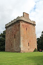
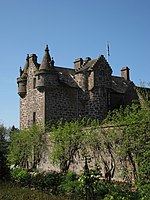
Melgund Castlenahe Brechin
56° 41′ 47,3″ N, 2° 44′ 33,5″ W
Tower House4931
Melgund Castle
(c) Anne Burgess, CC BY-SA 2.0
Usan Housenahe Montrose
56° 41′ 16,6″ N, 2° 27′ 18,6″ W
Herrenhaus4964
Usan House
(c) Ian Cleland, CC BY-SA 2.0
Dunninald Castlenahe Montrose
56° 40′ 45,3″ N, 2° 29′ 7,5″ W
Herrenhaus4972
Dunninald Castle
(c) Dominic Dawn Harry and Jacob Paterson, CC BY-SA 2.0
Kirk Tower Housenahe Montrose
56° 41′ 34,2″ N, 2° 29′ 7,2″ W
Kirche4979
Kirk Tower House
(c) James Denham, CC BY-SA 2.0
Craig House (Angus)nahe Montrose
56° 41′ 49,1″ N, 2° 29′ 12,4″ W
Herrenhaus4984
Torhaus von Craig Housenahe Montrose
56° 41′ 48,3″ N, 2° 29′ 9,6″ W
Tor4985
Kintrockat Housenahe Brechin
56° 43′ 18,4″ N, 2° 42′ 24,5″ W
Villa5011
Ardovie Housenahe Brechin
56° 41′ 53,5″ N, 2° 39′ 57,4″ W
Villa5016
Brechin CastleBrechin
56° 43′ 44,2″ N, 2° 39′ 32,7″ W
Herrenhaus5030
Brechin Castle
(c) Bill Irving, CC BY-SA 2.0
Stannochy Bridgenahe Brechin
56° 43′ 18,4″ N, 2° 40′ 54,4″ W
Brücke5042
Stannochy Bridge
(c) Alan Morrison, CC BY-SA 2.0
Auchterhouse Old Mansion HouseAuchterhouse
56° 31′ 22,1″ N, 3° 5′ 19,1″ W
Herrenhaus5689
Auchterhouse Old Mansion House
(c) James Allan, CC BY-SA 2.0
Taubenhaus des Auchterhouse Old Mansion HouseAuchterhouse
56° 31′ 24,3″ N, 3° 5′ 14″ W
Taubenhaus5690
East Gatesnahe Liff
56° 28′ 25,2″ N, 3° 6′ 25,3″ W
Tor10854
East Gates
(c) David Hawgood, CC BY-SA 2.0
Gallerynahe Marykirk
56° 46′ 51,4″ N, 2° 32′ 12″ W
Herrenhaus11165
Marykirk BridgeMarykirk
56° 46′ 32,1″ N, 2° 30′ 55,4″ W
Brücke11177
Zollhaus von MarykirkMarykirk
56° 46′ 31,1″ N, 2° 30′ 58,5″ W
Zollhaus11178
Inglis Memorial HallEdzell
56° 48′ 26,1″ N, 2° 39′ 13″ W
Halle11261
Inglis Memorial Hall
(c) Alan Morrison, CC BY-SA 2.0
Ethie Castlenahe Lunan
56° 36′ 44,4″ N, 2° 30′ 39,8″ W
Herrenhaus11278
Ethie Castle
(c) Anne Burgess, CC BY-SA 2.0
Baldovie Farmhousenahe Kirriemuir
56° 40′ 24,7″ N, 3° 6′ 14,8″ W
Bauernhaus11417
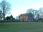
Farnell Parish KirkFarnell
56° 41′ 20,6″ N, 2° 36′ 35,5″ W
Kirche11497
Farnell Parish Kirk
(c) Alan Morrison, CC BY-SA 2.0
Farnell CastleFarnell
56° 41′ 22,5″ N, 2° 36′ 35,6″ W
Tower House11501
Strathmore AisleGlamis
56° 36′ 34,4″ N, 3° 0′ 4,3″ W
Kirchenrest11556
Inverquharity Castlenahe Kirriemuir
56° 42′ 34,3″ N, 2° 57′ 48,2″ W
Tower House11665Inverquharity Castle
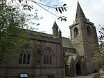
Taubenhaus von Rochelhillnahe Glamis
56° 35′ 38,5″ N, 3° 1′ 9,7″ W
Taubenhaus11670
Taubenhaus von Rochelhill
(c) Dan, CC BY-SA 2.0
Glamis Castlenahe Glamis
56° 37′ 12,7″ N, 3° 0′ 6,1″ W
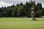
Schloss11701Glamis Castle
Sonnenuhr von Glamis Castlenahe Glamis
56° 37′ 11″ N, 3° 0′ 5,4″ W
Sonnenuhr11705
Sonnenuhr von Glamis Castle
(c) Philip Halling, CC BY-SA 2.0
Taubenhaus von Glamis Castlenahe Glamis
56° 36′ 48,1″ N, 3° 0′ 18,4″ W
Taubenhaus11710
Taubenhaus von Glamis Castle
(c) Trish Steel, CC BY-SA 2.0
Gutshof von Pitmuies Housenahe Friockheim
56° 38′ 17,7″ N, 2° 42′ 25,6″ W
Bauernhof11875
Gardyne Castlenahe Friockheim
56° 37′ 44,1″ N, 2° 41′ 46,8″ W
Tower House11914
Gardyne Castle
(c) William Muir, CC BY-SA 2.0
Taubenhaus von Edzell CastleEdzell
56° 48′ 41,1″ N, 2° 40′ 31″ W
Taubenhaus12385
Taubenhaus von Edzell Castle
(c) Douglas Nelson, CC BY-SA 2.0
Pitmuies Housenahe Friockheim
56° 38′ 15,5″ N, 2° 42′ 25,7″ W
Herrenhaus13076
Pitmuies House
(c) Russel Wills, CC BY-SA 2.0
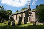
Lundie Parish ChurchLundie
56° 30′ 58,1″ N, 3° 9′ 16,1″ W
Kirche13090
Lundie Parish Church
(c) Anne Burgess, CC BY-SA 2.0
Fowlis Easter Parish ChurchFowlis Easter
56° 29′ 17,9″ N, 3° 6′ 9,4″ W
Kirche13144
Fowlis Easter Parish Church
(c) philip blackwood, CC BY-SA 2.0
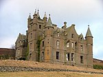
Balintore Castlenahe Kirriemuir
56° 43′ 2,8″ N, 3° 9′ 40″ W
Herrenhaus13757
Balintore Castle
(c) Lloyd Housley, CC BY-SA 2.0
Tealing Parish Churchnahe Tealing
56° 31′ 47″ N, 2° 58′ 16,9″ W
Kirche17450
Tealing Parish Church
(c) Dan, CC BY-SA 2.0
South Balluderon Farmnahe Tealing
56° 31′ 50″ N, 3° 1′ 0″ W
Bauernhof17458
Pitscandly Housenahe Lunanhead
56° 39′ 42,2″ N, 2° 50′ 34,2″ W
Herrenhaus17657
Sonnenuhr von Balnamoon Housenahe Brechin
56° 45′ 45,6″ N, 2° 44′ 7,1″ W
Sonnenuhr17700
House of Kinnabernahe Montrose
56° 44′ 47,5″ N, 2° 27′ 0,7″ W
Herrenhaus17762
House of Kinnaber
(c) Stanley Howe, CC BY-SA 2.0
Stracathro Housenahe Edzell
56° 46′ 47,5″ N, 2° 36′ 51,6″ W
Herrenhaus17803
Stracathro House
(c) cisco, CC BY-SA 2.0
Stallungen von Stracathro Housenahe Edzell
56° 46′ 48,7″ N, 2° 37′ 2,8″ W
Stallung17804
Downie Park Housenahe Kirriemuir
56° 42′ 54,3″ N, 2° 58′ 3,6″ W
Villa18034
West Gatenahe Carnoustie
56° 32′ 8,2″ N, 2° 45′ 51,5″ W
Tor18418
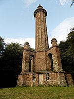
Gedenksäule von Panmure Housenahe Carnoustie
56° 32′ 25,1″ N, 2° 45′ 13,3″ W
Denkmal18419
Gedenksäule von Panmure House
(c) Douglas Nelson, CC BY-SA 2.0
Gagie Housenahe Wellbank
56° 31′ 37,2″ N, 2° 53′ 48,3″ W
Villa19001Gagie House
Sommerhaus von Gagie Housenahe Wellbank
56° 31′ 36,7″ N, 2° 53′ 47,8″ W
Wohngebäude19004
Murroes Housenahe Wellbank
56° 30′ 15,5″ N, 2° 52′ 37″ W
Villa19011
Baltic WorksArbroath
56° 33′ 50,2″ N, 2° 35′ 18,1″ W
Mühle21141
Baltic Works
(c) Alan Morrison, CC BY-SA 2.0
Signal Tower MuseumArbroath
56° 33′ 16,9″ N, 2° 35′ 11,3″ W
Museum21230
Signal Tower Museum
(c) Kevin Bruce, CC BY-SA 2.0
The ElmsArbroath
56° 33′ 58,9″ N, 2° 36′ 0,9″ W
Villa21250
Kapelle des Western CemeteryArbroath
56° 33′ 58,7″ N, 2° 36′ 43,3″ W
Kirche21252Kapelle des Western Cemetery
Hospitalfield HouseArbroath
56° 33′ 15,8″ N, 2° 36′ 36,9″ W
Villa21253
Hospitalfield House
(c) Sarah Charlesworth, CC BY-SA 2.0
Brechin CathedralBrechin
56° 43′ 50,5″ N, 2° 39′ 40,8″ W
Kirche22439Brechin Cathedral
25–27 High StreetBrechin
56° 43′ 53,7″ N, 2° 39′ 35,3″ W
Wohn- und Geschäftsgebäude22476
68–74 High StreetBrechin
56° 43′ 50,9″ N, 2° 39′ 32,8″ W
Wohn- und Geschäftsgebäude22505
Maison Dieu ChapelBrechin
56° 43′ 58,2″ N, 2° 39′ 38,5″ W
Kirchenruine22508
Maison Dieu Chapel
(c) Karen Vernon, CC BY-SA 2.0
West and St Columba’s Parish ChurchBrechin
56° 44′ 0,9″ N, 2° 39′ 26,4″ W
Kirche22522
West and St Columba’s Parish Church
(c) Stanley Howe, CC BY-SA 2.0
Brechin BridgeBrechin
56° 43′ 24″ N, 2° 38′ 52,8″ W
Brücke22549
Brechin Bridge
(c) Alan Morrison, CC BY-SA 2.0
Gardner Memorial ChurchBrechin
56° 43′ 53″ N, 2° 39′ 16,2″ W
Kirche22568
Gardner Memorial Church
(c) Stanley Howe, CC BY-SA 2.0
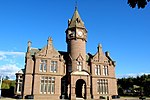
Sheriff Court BuildingForfar
56° 38′ 40,4″ N, 2° 53′ 18,4″ W
öffentliches Gebäude31542Sheriff Court Building
Lowson Memorial Parish ChurchForfar
56° 38′ 47,8″ N, 2° 52′ 26,2″ W
Kirche31604
Lowson Memorial Parish Church
(c) Anne Burgess, CC BY-SA 2.0
St Mary’s ChurchKirriemuir
56° 40′ 37,2″ N, 3° 0′ 29,3″ W
Kirche36899
Holly HouseMontrose
56° 42′ 38,6″ N, 2° 28′ 8″ W
Wohngebäude38041
The RetreatMontrose
56° 42′ 37,5″ N, 2° 28′ 8,4″ W
Wohngebäude38046
Carnegie Free LibraryMontrose
56° 42′ 35,5″ N, 2° 28′ 8,9″ W
Bibliothek38051
Carnegie Free Library
(c) Ann Harrison, CC BY-SA 2.0
Rathaus von MontroseMontrose
56° 42′ 39,3″ N, 2° 28′ 4,9″ W
Rathaus38083Rathaus von Montrose
Old and St Andrew’s ChurchMontrose
56° 42′ 38,3″ N, 2° 28′ 3,7″ W
Kirche38084
Old and St Andrew’s Church
(c) Stanley Howe, CC BY-SA 2.0
Straton HouseMontrose
56° 42′ 33,2″ N, 2° 28′ 6,1″ W
Wohngebäude38095
Montrose Royal InfirmaryMontrose
56° 42′ 28″ N, 2° 28′ 28,3″ W
Krankenhaus38112Montrose Royal Infirmary
1–8 Panmure TerraceMontrose
56° 42′ 38,4″ N, 2° 27′ 52,9″ W
Wohngebäude38195
1–8 Panmure Terrace
(c) Ann Harrison, CC BY-SA 2.0
St Mary’s and St Peter’s Episcopal ChurchMontrose
56° 42′ 38,8″ N, 2° 27′ 48,1″ W
Kirche38204
St Mary’s and St Peter’s Episcopal Church
(c) Stanley Howe, CC BY-SA 2.0
Chapel WorksMontrose
56° 42′ 37,7″ N, 2° 27′ 40″ W
Mühle38212
Chapel Works
(c) Leslie Barrie, CC BY-SA 2.0
Montrose Airfield Gebäude 48Montrose
56° 43′ 27,1″ N, 2° 27′ 46,8″ W
Militäranlage38228Montrose Airfield Gebäude 48
Bell Rock Lighthousenahe Arbroath
56° 25′ 58,3″ N, 2° 23′ 17,1″ W
Leuchtturm45197
Bell Rock Lighthouse
(c) Derek Robertson, CC BY-SA 2.0
Logie Schoolhousenahe Montrose
56° 45′ 45,4″ N, 2° 29′ 43,7″ W
Schule50209

Weblinks

Commons: Kategorie-A-Bauwerke in Angus – Sammlung von Bildern, Videos und Audiodateien

Auf dieser Seite verwendete Medien

Kirk Tower House (geograph 1897495).jpg
(c) James Denham, CC BY-SA 2.0
Kirk Tower House
House of Pitmuies - geograph.org.uk - 1443545.jpg
(c) Russel Wills, CC BY-SA 2.0
House of Pitmuies An eighteenth century house with courtyard, walled garden, rose garden, alpine meadow, woodland garden and riverside walk.
Fowlis Church - geograph.org.uk - 40048.jpg
(c) philip blackwood, CC BY-SA 2.0
Fowlis Church, Angus, Scotland. Situated in the village of Fowlis, western side of grid square, north west aspect of the Church.
Stracathro House.jpg
(c) cisco, CC BY-SA 2.0
Stracathro Mansion House, a fine A listed Palladian Mansion House by Archibald Simpson built 1824-27. 1938-2002 staff residence for Stracathro Hospital
Dovecot near Mains of Rochelhill - geograph.org.uk - 1081456.jpg
(c) Dan, CC BY-SA 2.0
Dovecot near Mains of Rochelhill This dovecot is arguably the oldest in Scotland (Dorward, D. The Sidlaw Hills. 2004. Pinkfoot Press).
Scottish Episcopal Church, Montrose - geograph.org.uk - 512079.jpg
(c) Stanley Howe, CC BY-SA 2.0
Scottish Episcopal Church, Montrose St Mary's and St Peter's.
Gates at East Lodge, Balruddery - geograph.org.uk - 558418.jpg
(c) David Hawgood, CC BY-SA 2.0
Gates at East Lodge, Balruddery Balruddery Burn runs down just by this driveway.
Maison Dieu - geograph.org.uk - 905127.jpg
(c) Karen Vernon, CC BY-SA 2.0
Maison Dieu Maison Dieu (House of God) was a medieval hospital founded by William de Brechin. It was not a hospital in the modern sense where people were looked after when sick, but it was a place to give shelter to poor or old people who could no longer look after themselves. It housed a master and chaplains who prayed for the soul of the founder as well as the poor folk it sheltered.
Lundie kirk.jpg
(c) Anne Burgess, CC BY-SA 2.0
Lundie Parish Kirk
Melgund Castle.jpg
(c) Anne Burgess, CC BY-SA 2.0
Melgund Castle, east of Aberlemno, Angus, built in 1543 on the orders of Cardinal David Beaton
Hospitalfield house.jpg
(c) Sarah Charlesworth, CC BY-SA 2.0
Hospitalfield House in Arbroath, Scotland.
Lowson Memorial Church - geograph.org.uk - 443383.jpg
(c) Anne Burgess, CC BY-SA 2.0
Lowson Memorial Church From the gate. The church stands in its own well-maintained grounds.
Bridge of Dun - geograph.org.uk - 828630.jpg
(c) Trish Steel, CC BY-SA 2.0
Bridge of Dun The bridge was completed in January 1787 and is of a Gothic style, with three arches. At the root of each arch is a columned refuge, and the parapets have castellated features.
Balintore Castle Nr. Kirriemuir - geograph.org.uk - 67384.jpg
(c) Lloyd Housley, CC BY-SA 2.0
Dieses Foto zeigt das geschützte Denkmal in Schottland mit der Nummer
Ethie Castle.jpg
(c) Anne Burgess, CC BY-SA 2.0
Ethie Castle
Scottish-Castle-Symbol.svg
Autor/Urheber: Majo statt Senf, Lizenz: CC BY-SA 4.0
Schlosssymbol Schottland
Barry Mill in the twilight - geograph.org.uk - 1318281.jpg
(c) Gwen and James Anderson, CC BY-SA 2.0
Barry Mill in the twilight Orange light spills out into the twilight from Barry Mill.
The castellated and domestic architecture of Scotland, from the twelfth to the eighteenth century (1887) (14801986203).jpg
Autor/Urheber: Internet Archive Book Images, Lizenz: No restrictions

Identifier: castellateddomes05macg (find matches)
Title: The castellated and domestic architecture of Scotland, from the twelfth to the eighteenth century
Year: 1887 (1880s)
Authors: MacGibbon, David, d. 1902 Ross, Thomas, 1839-1930
Subjects: Architecture Architecture, Domestic Castles
Publisher: Edinburgh : D. Douglas
Contributing Library: University of California Libraries
Digitizing Sponsor: Internet Archive

View Book Page: Book Viewer
About This Book: Catalog Entry
View All Images: All Images From Book
Click here to view book online to see this illustration in context in a browseable online version of this book.

Text Appearing Before Image:
Pio. 1385. —Gagie House. Block Plan of House and Garden. Although it has been slightly altered in parts, and has had variousmodern additions attached to it (shown by hatched lines on Plan, * Memorials of Angus and Mearns, p. 235. t We have to thank Mr, T. S. Robertson for the sketches of Gagie, and thehistorical information is obtained from Wardens Aiujus or Forfarshire, Vol. v. p. 11. FOURTH PERIOD — 276 — GAGIE HOUSE Fig. 1385), it still retains a certain old-fashioned aspect both as regardsthe house itself and its surroundings. The old part of the building is shown tinted black on Plan. It is a longnarrow structure of two stories in height, with round turrets at the southgable (seen in the View, Fig. 1386). There has been an alteration on thisgable, which has been Avidened, as is seen from the perpendicular lines ofthe old corners. Some of the rooms retain certain of their old features, such as chimney-pieces, wood-panelled walls and doors, and in one room (Fig. 1387) there
Text Appearing After Image:
Fio. 1386.—Gagie House. View from South-East. is a quaint writing-desk, with drawers fitted into the lower part of thewindow. Some of the ironwork from the doors, and other details, areshown in Fig. 1388. The garden, with its old enclosing walls, still remains intact, with agroup of yew trees in front of the house. The summer-house (Fig. 1389)is a fair specimen of Renaissance work, and has an open Doric colonnadetowards the garden. On the building are carved the Guthrie arms,with the date 1614. The sundial (marked on the Plan), although of aplain design, well befits its situation. GAGIK HOUSE 277 FOURTH PERIOD At the end of the sixteenth century Gagie belonged to a family of thename of Sibbald, and in 1610 it was sold to William Guthrie, second son

Note About Images

Please note that these images are extracted from scanned page images that may have been digitally enhanced for readability - coloration and appearance of these illustrations may not perfectly resemble the original work.
Mains of Edzell Doocot-geograph-3497226.jpg
(c) Douglas Nelson, CC BY-SA 2.0
Mains of Edzell Dovecote
Inverquharity Castle.jpg
Autor/Urheber: Stephencdickson, Lizenz: CC BY-SA 4.0
Inverquharity Castle
Dunninald Castle - geograph.org.uk - 122034.jpg
(c) Dominic Dawn Harry and Jacob Paterson, CC BY-SA 2.0
Dunninald Castle.
Signal Tower Museum - geograph.org.uk - 1247673.jpg
(c) Kevin Bruce, CC BY-SA 2.0
Signal Tower Museum Taken from the harbour
The Old Manor House - geograph.org.uk - 131117.jpg
(c) James Allan, CC BY-SA 2.0
The Old Manor House. This seems to be the Auchterhouse from which the village takes its name
Mortuary Chapel - Western Cemetery - Arbroath.jpg
Autor/Urheber: Nick Birse, Lizenz: CC BY-SA 4.0
Patrick Allen Fraser Memorial Mortuary Chapel, Western Cemetery, Arbroath. This is a Category A listed building.
Montrose Infirmary, Montrose - South elevation.JPG
Autor/Urheber: Nick Birse, Lizenz: CC BY-SA 4.0
Montrose Infirmary, Bridge Street, Montrose. James Collie, Glasgow, 1836-39, early purpose-built hospital building. Greek Revival. 2-storey main block with symmetrical entrance elevation to E
Farnell Church.jpg
(c) Alan Morrison, CC BY-SA 2.0
Farnell Church, Farnell, Angus
Brechin Cathedral 20090616 from the south.jpg
Autor/Urheber: Otter, Lizenz: CC BY-SA 3.0
Brechin Cathedral, Brechin, Angus, Scotland - from the south
The Panmure Testimonial (geograph 3546873).jpg
(c) Douglas Nelson, CC BY-SA 2.0
The Panmure Testimonial
Gardner Memorial Church, Brechin - geograph.org.uk - 511905.jpg
(c) Stanley Howe, CC BY-SA 2.0
Gardner Memorial Church, Brechin On St Ninian's Square.
Brechin Castle - geograph.org.uk - 115557.jpg
(c) Bill Irving, CC BY-SA 2.0
Brechin Castle. Brechin Castle from the main drive
Burkes Sheds.jpg
Autor/Urheber: Kevan Dickin, Lizenz: CC BY-SA 3.0
Burkes Sheds built in December 1913 and probably the oldest military hangars of their type in the world.
Bell Rock Lighthouse.jpg
(c) Derek Robertson, CC BY-SA 2.0
Bell Rock Lighthouse. Situated 11 miles out from Arbroath the lighthouse was built by Robert Stevenson in 1811, upon the infamous Inchcape reef. At high water the reef is hidden about 12 foot below the water level, at low water it is 4 foot above the sea.
Chapel Works, Montrose (geograph 3420186).jpg
(c) Leslie Barrie, CC BY-SA 2.0
Chapel Works, Montrose
Stannochy Bridge over River South Esk near Brechin - geograph.org.uk - 646593.jpg
(c) Alan Morrison, CC BY-SA 2.0
Stannochy Bridge over River South Esk near Brechin
Forfar Town Hall.JPG
Autor/Urheber: Russ Hamer, Lizenz: CC BY-SA 3.0
Forfar Town Hall Scotland
The Yard Entrance of the House of Dun - geograph.org.uk - 951776.jpg
(c) Sarah Charlesworth, CC BY-SA 2.0
The Yard Entrance of the House of Dun
Town House, Montrose.JPG
Autor/Urheber: Nick Birse, Lizenz: CC BY-SA 4.0
Montrose Town House, High Street Montrose. A Category A listed building. The steeple behind the building belongs to the Category A listed Montrose Parish Church (Listed building No. 38084).
St Vigeans Parish Church.jpg
(c) David Gray, CC BY-SA 2.0
St Vigeans Parish Church, also home to a museum
Disused Factory in Arbroath - geograph.org.uk - 1152069.jpg
(c) Alan Morrison, CC BY-SA 2.0
Disused Factory in Arbroath I believe this to be the factory of Giddings & Lewis. Picture taken from High Road Bridge, Arbroath. Correction - the factory is infact the former Baltic Works and bonded warehouse in Dens Road, across the road from the Giddings & Lewis-Fraser works, now a Morrisons and Tesco supermarket.
Brechin Bridge over River South Esk - geograph.org.uk - 1065515.jpg
(c) Alan Morrison, CC BY-SA 2.0
Brechin Bridge over River South Esk
The Carnegie Library - geograph.org.uk - 1311138.jpg
(c) Ann Harrison, CC BY-SA 2.0
The Carnegie Library Gifted to the town of Montrose by Andrew Carnegie and opened in 1905.
Sundial at Glamis Castle - geograph.org.uk - 918201.jpg
(c) Philip Halling, CC BY-SA 2.0
Sundial at Glamis Castle This large sundial in the grounds of Glamis Castle is 21 feet (7 metres) high and was built in 1671. When built the sundial was used to set clocks in the castle. Since it was built in the 17th century a number of changes to time in Britain have taken place. In the 18th century Britain changed to the Gregorian Calander, in the 19th century time throughout the land was standardised with Greenwich Mean Time and finally in the early 20th British Summer Time.
Church of Scotland 'Old and St Andrew's' - geograph.org.uk - 512014.jpg
(c) Stanley Howe, CC BY-SA 2.0
Church of Scotland 'Old and St Andrew's' Montrose town centre.
Church, Kirkton of Tealing - geograph.org.uk - 1628947.jpg
(c) Dan, CC BY-SA 2.0
Church, Kirkton of Tealing This church is no longer in use as services are now held in Murroes church.
Careston Castle and surrounding area - geograph.org.uk - 1202120.jpg
(c) Alan Morrison, CC BY-SA 2.0
Careston Castle and surrounding area Picture taken, looking north, from Aberlemno / Brechin Road at its junction with Hillbarns Farm road. While driving along the Castle stood out in the brilliant sunshine, hence the photograph.