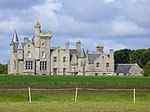
Liste der Kategorie-A-Bauwerke auf den Orkneyinseln
Die Liste der Kategorie-A-Bauwerke auf den Orkneys umfasst sämtliche in der Kategorie A eingetragenen Baudenkmäler auf den Orkneyinseln. Die Einstufung wird anhand der Kriterien von Historic Scotland vorgenommen, wobei in die höchste Kategorie A Bauwerke von nationaler oder internationaler Bedeutung einsortiert sind. Auf den Orkneyinseln sind derzeit 18 Bauwerke in der Kategorie A gelistet.
Weblinks
Auf dieser Seite verwendete Medien
Autor/Urheber: Otter, Lizenz: CC BY-SA 3.0
Tankerness House Museum, Kirkwall, Mainland, Orkney, Scotland.
(c) Alex Cameron, CC BY-SA 2.0
Old Lighthouse, North Ronaldsay. Although known as the 'Old Lighthouse', it has not contained a light for many years -- but it is visible from a long way away nevertheless.
(c) George Brown, CC BY-SA 2.0
Muckle Skerry Lighthouse Muckle Skerry lighthouse seen from the perimeter wall. Completed in 1794, it was the first lighthouse built by Robert Stevenson and T Smith. It originally consisted of two light towers but this was changed to a more powerful single light in 1895. The main lighthouse is 36 metres high. It became automated in 1994.
Autor/Urheber: Gregory J Kingsley, Lizenz: CC BY-SA 3.0
Front quarter profile of the Italian Chapel on the small isle called Lamb Holm. This is located on the edge of Scapa Flow in the Orkney Islands (north of Great Britain). The chapel was built by WWII Italian prisoners of war captured in North Africa and put to work on the Churchill Barriers in the Orkney Islands. Using the limited materials they had leftover from the barrier project, the prisoners converted two nissin huts into this chapel. Much of the artistic work was done by Domenico Chiocchetti who returned to finish his work after the war ended.
(c) Lis Burke, CC BY-SA 2.0
Wetland near Bride's Ness. Looking from the pebble beach across the North Ronaldsay sheep dyke to an area of wetland.
Autor/Urheber: Richard Harvey, Lizenz: CC BY-SA 3.0
Hoy High Lighthouse, Graemsay, Orkney Islands.
Autor/Urheber: Majo statt Senf, Lizenz: CC BY-SA 4.0
Schlosssymbol Schottland
(c) John Comloquoy, CC BY-SA 2.0
St Peter's Kirk, Sandwick. St Peter's stands on the north side of the Bay of Skaill. The kirk was built in 1836 on the site of an older one.
(c) Wolfgang Schlick, CC BY-SA 2.0
Melsetter House, Hoy, Orkney. A fine Orkney country mansion designed by R. Lethaby. Called by Mae Morris (daughter of William Morris, who provided furniture and interior design) as "a fairy place at the end of the universe ...". South gable seen from the garden.
(c) Colin Smith, CC BY-SA 2.0
Balfour Castle Imposing Victorian pile built around Cliffdale, the previous house. It is now an exclusive hotel.
Autor/Urheber: Robert Scarth, Lizenz: CC BY-SA 2.0
St. Magnus Cathedral, Kirkwall
(c) Ian Balcombe, CC BY-SA 2.0
Cemetery, Kirkhouse Taken from a glider, looking West over South Ronaldsay.
Autor/Urheber: Wojsyl, Lizenz: CC-BY-SA-3.0
Skaill House, Orkney, Scotland
Autor/Urheber: Richard Harvey, Lizenz: CC-BY-SA-3.0
Scapa Flow Visitor Centre, Hoy.


