Liste der Kategorie-A-Bauwerke auf den Äußeren Hebriden
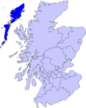
Die Liste der Kategorie-A-Gebäude auf den Äußeren Hebriden umfasst sämtliche in der Kategorie A eingetragenen Baudenkmäler in der schottischen Unitary Authority Äußere Hebriden. Die Einstufung wird anhand der Kriterien von Historic Scotland vorgenommen, wobei in die höchste Kategorie A Bauwerke von nationaler oder internationaler Bedeutung einsortiert sind. Auf den Äußeren Hebriden sind derzeit 18 Bauwerke in der Kategorie A gelistet.
Weblinks
Auf dieser Seite verwendete Medien
Autor/Urheber: Majo statt Senf, Lizenz: CC BY-SA 4.0
Schlosssymbol Schottland
(c) Stephen Branley, CC BY-SA 2.0
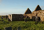
St. Clement's Church St Clement's Church, on the Isle of Harris is situated in the village of Rodel, three miles south of Leverburgh. It was built in the late 15th century for the Chiefs of the MacLeods of Harris, who lived at Dunvegan Castle on the Isle of Skye.
(c) David Maclennan, CC BY-SA 2.0
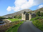
Lews Castle, Stornoway This is the Lews Castle, Stornoway, which overlooks Stornoway harbour.
Autor/Urheber: Original uploader was en:User:Morrismaciver at en.wikipedia, Lizenz: CC BY-SA 2.5
Photographed by Morris R. MacIver 24 December 2005.
(c) Anne Burgess, CC BY-SA 2.0
Teampall Mholuaidh The tiny chapel of St Moluag (The 1:25,000 map says St Molveg) is still in use as an episcopal church. It is thought to date from the 16th century, and was restored in 1912 after being abandoned for many years. It has a reputation as a place of healing.
(c) Les Hull, CC BY-SA 2.0
Abhainnsuidhe (Amhuinnsuidhe) Castle The castle is a hotel and can be hired exclusively I was informed by some inmates for a "princely sum". Their web site is worth looking at --- even if it's just to see how the other half live - or is it 5%? One owner was Thomas Sopwith the aircraft pioneer and I was told that The Bulmer (cider) family owned it at one time. Most of this is second hand information.
(c) Rob Burke, CC BY-SA 2.0
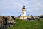
Lighthouse buildings, Butt of Lewis / Rubha Robhanais.
(c) simon stewart, CC BY-SA 2.0
Eilean Glas lighthouse Scalpay.
(c) Bob Jones, CC BY-SA 2.0
Entrance to Dun Sron an Duin, Berneray
(c) Anne Burgess, CC BY-SA 2.0
Net Storage Nets and fishing gear are stored in bins, keeping the quay tidy. The eighteenth century buildings house harbourside offices.
Autor/Urheber: Otter, Lizenz: CC BY-SA 3.0
Kisimul Castle, Barra, Scotland - from south west
(c) Peter Ward, CC BY-SA 2.0
Struan cottage. Traditional thatched cottage, since restored.


