Liste der Highways in British Columbia
Folgende Highways stehen unter der Verwaltung des British Columbia Ministry of Transport.[1]
| Zeichen | Nummer | Name | Beginn | Ende | Länge, in km |
|---|---|---|---|---|---|
| 1 | Trans-Canada Highway | Victoria, Mile Zero | Kicking Horse Pass, weiter auf | 1039 | |
| 1A | Chemainus | Crofton, weiter auf | Ladysmith, weiter auf | 16 | |
| West End Vancouver, weiter auf | Abbotsford, weiter auf | 17 | |||
| Old Yale Road | Chilliwack, Yale Rd, weiter auf | Rosedale, weiter auf | 73 | ||
| 2 | Tupper Highway | Tupper, weiter auf | Dawson Creek, weiter auf | 42 | |
| 3 | Crowsnest Highway | Hope, weiter auf | Crowsnest Pass, weiter auf | 837 | |
| 3A | Kaleden Highway | Keremeos, weiter auf | Kaleden, weiter auf | 154 | |
| Castlegar-Nelson-Creston Highway | Castlegar, weiter auf | Creston, weiter auf | 35 | ||
| 3B | Nancy Greene Lake, weiter auf | Meadows, weiter auf | 71 | ||
| 4 | Pacific Rim Highway, Port Alberni Highway | Qualicum Beach, weiter auf | Tofino | 163 | |
| 4A | Old Alberni Highway | Parksville, weiter auf | Coombs, weiter auf | 12 | |
| 5 | Southern Yellowhead Highway, Coquihalla Highway | Hope, weiter auf | Tête Jaune Cache, weiter auf | 524 | |
| 5A | Princeton-Kamloops Highway | Princeton, weiter auf | Kamloops, weiter auf | 182 | |
| 6 | Monashee Highway | Salmo, weiter auf | Vernon, weiter auf | 407 | |
| 7 | Lougheed Highway | Vancouver, weiter auf | Hope, weiter auf | 149 | |
| 7A | Barnet Highway | Vancouver, Burnaby, Boundary Rd | Coquitlam, weiter auf | 26 | |
| 7B | Mary Hill Bypass | Coquitlam, weiter auf | Port Coquitlam, weiter auf | 9 | |
| 8 | Nicola Highway | Merritt, weiter auf | Spences Bridge, weiter auf | 61 | |
| 9 | Agassiz Highway | Bridal Falls, weiter auf | Harrison Hot Springs | 18 | |
| 10 | Ladner-Langley Highway | Ladner, weiter auf | Langley, weiter auf | 38 | |
| 11 | Abbotsford-Mission Highway | Huntingdon, weiter auf | Mission, weiter auf | 17 | |
| 12 | Lytton, weiter auf | Lillooet, weiter auf | 62 | ||
| 13 | Aldergrove Highway | Aldergrove, weiter auf | nördlich Aldergrove, weiter auf | 12 | |
| 14 | Juan de Fuca Highway, West Coast Road | Langford, weiter auf | Port Renfrew | 103 | |
| 15 | Pacific Highway | Douglas, weiter auf | Surrey, weiter auf | 20 | |
| 16 | Queen Charlottes Highway, Yellowhead Highway, Trans-Canada Highway | Masset | Yellowhead Pass, weiter auf | 1347 | |
| 17 | Patricia Bay Highway, Tsawassen Highway | Victoria, weiter auf | Ladner, weiter auf | 45 | |
| 17A | West Saanich Road | Saanich, weiter auf | North Saanich bei Swartz Bay, weiter auf | 27 | |
| 18 | Cowichan Valley Highway | Lake Cowichan | North Cowichan, Duncan, weiter auf | 26 | |
| 19 | Island Highway | Nanaimo, Duke Point Ferry | Port Hardy | 406 | |
| 19A | Oceanside Route, Old Island Highway | Nanaimo, weiter auf | Campbell River, weiter auf | 135 | |
| 20 | Chilcotin Highway, Alexander MacKenzie Highway | Williams Lake, weiter auf | Bella Coola | 457 | |
| 21 | Rykerts, weiter auf | Creston, weiter auf | 14 | ||
| 22 | Paterson, weiter auf | Castlegar, weiter auf | 47 | ||
| 22A | Waneta, weiter auf | Trail, weiter auf | 11 | ||
| 23 | Big Bend Highway | Nakusp, weiter auf | Mica Dam | 250 | |
| 24 | Little Fort Highway, Interlakes Highway | 93 Mile House, weiter auf | Little Fort, weiter auf | 97 | |
| 26 | Quesnel, weiter auf | Barkerville | 82 | ||
| 27 | Stuart Lake Highway | Vanderhoof, weiter auf | Fort St. James | 53 | |
| 28 | Strathcona Highway | Gold River | Campbell River, weiter auf | 89 | |
| 29 | Don Philips Way, Hudson's Hope Loop | Tumbler Ridge, weiter auf | Charlie Lake, weiter auf | 237 | |
| 30 | Port Alice Road | Beaver Lake, weiter auf | Port Alice | 30 | |
| 31 | Selkirk Highway | Balfour, weiter auf | Galena Bay, weiter auf | 175 | |
| 31A | New Denver, weiter auf | Kaslo, weiter auf | 47 | ||
| 33 | Rock Creek, weiter auf | Kelowna, weiter auf | 129 | ||
| 35 | North Francois Highway | Burns Lake, weiter auf | Francois Lake Ferry | 23 | |
| 37 | Kitimat Cassiar Highway | Kitimat | Watson Lake | 874 | |
| 37A | Glacier Highway, Stewart Highway | Stewart | Meziadin Junction, weiter auf | 65 | |
| 39 | Mackenzie | Parsnip River, weiter auf | Mackenzie | 36 | |
| 41 | Carson, weiter auf | Grand Forks, weiter auf | 1 | ||
| 43 | Elk Valley Highway | Sparwood, weiter auf | Elkford | 35 | |
| 49 | Spirit River Highway, Northern Woods and Water Route | Dawson Creek, weiter auf | Grenze zu Alberta bei Bay Tree, weiter auf | 16 | |
| 52 | Heritage Highway, Tumbler Ridge Loop | Arras, weiter auf | Tupper, weiter auf | 243 | |
| 77 | Liard Highway | Fort Nelson, weiter auf | Fort Liard | 138 | |
| 91 | Annacis Highway, Richmond Freeway | Delta, weiter auf | Richmond, weiter auf | 22 | |
| 91A | Queensborough Connector | Vancouver, New Westminster | Richmond, weiter auf | 3 | |
| 93 | Kootenay Highway, Banff-Windermere Parkway | Rooseville, weiter auf | Vermilion Pass, weiter auf | 397 | |
| 95 | Columbia Highway | Kingsgate, weiter auf | Golden, weiter auf | 329 | |
| 95A | Kimberley Highway | Cranbrook, weiter auf | Ta Ta Creek, weiter auf | 55 | |
| 97 | Okanagan Highway, Cariboo Highway, John Hart Highway, Alaska Highway | Osoyoos, weiter auf | Teslin, Highway 1 (Yukon) | 2081 | |
| 97A | Vernon, weiter auf | Sicamous, weiter auf | 65 | ||
| 97B | Grindrod, weiter auf | Salmon Arm, weiter auf | 14 | ||
| 97C | Okanagan Connector, Coquihalla Connector | Peachland, weiter auf | Aspen Grove, weiter auf | 220 | |
| 97D | Meadow Creek Road | Logan Lake, weiter auf | Lac Le Jeune, weiter auf | 24 | |
| 99 | Sea-to-Sky Highway, Duffey Lake Road | Peace Arch, weiter auf | Cache Creek, weiter auf | 409 | |
| 99A | King George Boulevard | Surrey, weiter auf | Vancouver, weiter auf | 50 | |
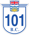
| 101 | Sunshine Coast Highway | Langdale Ferry | Lund | 159 | |
| 113 | Nisga'a Highway | Terrace, weiter auf | Cranberry Junction, weiter auf | 158 | |
| 118 | Central Babine Lake Highway, Topley Landing Road | Topley, weiter auf | Granisle | 50 | |
| 395 | Cascade, weiter auf | Christina Lake, weiter auf | 4 |
Für die Highways 3, 5 und 113 existieren noch spezielle Kennzeichen, die jedoch aufgrund des Urheberrechts in der deutschsprachigen Wikipedia nicht als Symbol dargestellt werden dürfen.
Weblinks
- DriveBC: Informationen zum Zustand der Highways in British Columbia
- Webcams der Highways in British Columbia
- Official Numbered Routes in British Columbia
Einzelnachweise
- ↑ B.C. Landmark Kilometre Inventory (LKI). British Columbia Ministry of Transportation, abgerufen am 20. Juni 2019 (englisch).
Auf dieser Seite verwendete Medien
Shield of Highway 16 in British Columbia.
Shield for British Columbia Highway 23. Arms from File:Arms of British Columbia.svg, shield shape and other details simple shapes.
Shield for British Columbia Highway 113. Arms from File:Arms of British Columbia.svg, shield shape and other details simple shapes.
Shield for British Columbia Highway 118. Arms from File:Arms of British Columbia.svg, shield shape and other details simple shapes.
Shield for British Columbia Highway 4. Arms from File:Arms of British Columbia.svg, shield shape and other details simple shapes.
Shield for British Columbia Highway 39. Arms from File:Arms of British Columbia.svg, shield shape and other details simple shapes.
24-by-24-inch (600 mm × 600 mm) Washington state highway route marker.
Shield for British Columbia Highway 13. Arms from File:Arms of British Columbia.svg, shield shape and other details simple shapes.
Shield for British Columbia Highway 37A. Arms from File:Arms of British Columbia.svg, shield shape and other details simple shapes.
Shield for British Columbia Highway 17. Arms from File:Arms of British Columbia.svg, shield shape and other details simple shapes.
Shield for British Columbia Highway 18. Arms from File:Arms of British Columbia.svg, shield shape and other details simple shapes.
Shield for British Columbia Highway 395. Arms from File:Arms of British Columbia.svg, shield shape and other details simple shapes.
24-by-24-inch (600 mm × 600 mm) Washington state highway route marker.
Autor/Urheber: MuzikMachine, Lizenz: CC BY-SA 4.0
Yellowhead shield for British Columbia highway 5.
Shield for British Columbia Highway 49. Arms from File:Arms of British Columbia.svg, shield shape and other details simple shapes.
Shield for British Columbia Highway 97D. Arms from File:Arms of British Columbia.svg, shield shape and other details simple shapes.
Shield for British Columbia Highway 97A. Arms from File:Arms of British Columbia.svg, shield shape and other details simple shapes.
Shield for British Columbia Highway 7. Arms from File:Arms of British Columbia.svg, shield shape and other details simple shapes.
Shield for British Columbia Highway 77. Arms from File:Arms of British Columbia.svg, shield shape and other details simple shapes.
24-by-24-inch (600 mm × 600 mm) Washington state highway route marker.
Shield for British Columbia Highway 27. Arms from File:Arms of British Columbia.svg, shield shape and other details simple shapes.
Shield for British Columbia Highway 24. Arms from File:Arms of British Columbia.svg, shield shape and other details simple shapes.
Shield for British Columbia Highway 11. Arms from File:Arms of British Columbia.svg, shield shape and other details simple shapes.
Shield for British Columbia Highway 30. Arms from File:Arms of British Columbia.svg, shield shape and other details simple shapes.
Shield for British Columbia Highway 97B. Arms from File:Arms of British Columbia.svg, shield shape and other details simple shapes.
Shield for British Columbia Highway 5A. Arms from File:Arms of British Columbia.svg, shield shape and other details simple shapes.
Shield for British Columbia Highway 12. Arms from File:Arms of British Columbia.svg, shield shape and other details simple shapes.
600 mm × 600 mm (24 in × 24 in) U.S. Highway shield, made to the specifications of the 2004 edition of Standard Highway Signs. (Note that there is a missing "J" label on the left side of the diagram.) Uses the Roadgeek 2005 fonts. (United States law does not permit the copyrighting of typeface designs, and the fonts are meant to be copies of a U.S. Government-produced work anyway.)
Shield for British Columbia Highway 91. Arms from File:Arms of British Columbia.svg, shield shape and other details simple shapes.
Shield for British Columbia Highway 37. Arms from File:Arms of British Columbia.svg, shield shape and other details simple shapes.
Shield for British Columbia Highway 3B. Arms from File:Arms of British Columbia.svg, shield shape and other details simple shapes.
Shield for British Columbia Highway 99. Arms from File:Arms of British Columbia.svg, shield shape and other details simple shapes.
Shield for British Columbia Highway 8. Arms from File:Arms of British Columbia.svg, shield shape and other details simple shapes.
Shield for British Columbia Highway 10. Arms from File:Arms of British Columbia.svg, shield shape and other details simple shapes.
600 mm × 600 mm (24 in × 24 in) U.S. Highway shield, made to the specifications of the 2004 edition of Standard Highway Signs. (Note that there is a missing "J" label on the left side of the diagram.) Uses the Roadgeek 2005 fonts. (United States law does not permit the copyrighting of typeface designs, and the fonts are meant to be copies of a U.S. Government-produced work anyway.)
Shield for British Columbia highway 1A. Arms from File:Arms of British Columbia.svg, shield shape and other details simple shapes.
Shield for British Columbia Highway 6. Arms from File:Arms of British Columbia.svg, shield shape and other details simple shapes.
24-by-24-inch (600 mm × 600 mm) Washington state highway route marker.
Shield for British Columbia Highway 99A. Arms from File:Arms of British Columbia.svg, shield shape and other details simple shapes.
Shield for British Columbia Highway 22. Arms from File:Arms of British Columbia.svg, shield shape and other details simple shapes.
Shield for British Columbia Highway 28. Arms from File:Arms of British Columbia.svg, shield shape and other details simple shapes.
Shield for British Columbia Highway 3. Arms from File:Arms of British Columbia.svg, shield shape and other details simple shapes.
Shield for British Columbia Highway 4A. Arms from File:Arms of British Columbia.svg, shield shape and other details simple shapes.
Shield for British Columbia Highway 3A. Arms from File:Arms of British Columbia.svg, shield shape and other details simple shapes.
Shield for British Columbia Highway 93. Arms from File:Arms of British Columbia.svg, shield shape and other details simple shapes.
Shield for British Columbia Highway 19A. Arms from File:Arms of British Columbia.svg, shield shape and other details simple shapes.
Shield for British Columbia Highway 43. Arms from File:Arms of British Columbia.svg, shield shape and other details simple shapes.
24-by-24-inch (600 mm × 600 mm) Washington state highway route marker.
Shield for British Columbia Highway 26. Arms from File:Arms of British Columbia.svg, shield shape and other details simple shapes.
Shield for British Columbia Highway 33. Arms from File:Arms of British Columbia.svg, shield shape and other details simple shapes.
Shield of Highway 1 in British Columbia.
A PD version of the Trans-Canada Highway shield. Version PD du panneau representant la route transcanadienne Trans-Canada highway 1 Route transcanadienne 1
A PD version of the Trans-Canada Highway shield. Version PD du panneau representant la route transcanadienne Trans-Canada highway 16 Route transcanadienne 16
Shield for British Columbia Highway 91A. Arms from File:Arms of British Columbia.svg, shield shape and other details simple shapes.
Shield for British Columbia Highway 101. Arms from File:Arms of British Columbia.svg, shield shape and other details simple shapes.
Shield for British Columbia Highway 95A. Arms from File:Arms of British Columbia.svg, shield shape and other details simple shapes.
Shield for British Columbia Highway 9. Arms from File:Arms of British Columbia.svg, shield shape and other details simple shapes.
Shield for British Columbia Highway 15. Arms from File:Arms of British Columbia.svg, shield shape and other details simple shapes.
Shield for British Columbia Highway 97. Arms from File:Arms of British Columbia.svg, shield shape and other details simple shapes.
Shield for British Columbia Highway 31. Arms from File:Arms of British Columbia.svg, shield shape and other details simple shapes.
24-by-24-inch (600 mm × 600 mm) Washington state highway route marker.
750 mm × 600 mm (30 in × 24 in) U.S. Highway shield, made to the specifications of the 2004 edition of Standard Highway Signs. (Note that there is a missing "J" label on the left side of the diagram.) Uses the Roadgeek 2005 fonts. (United States law does not permit the copyrighting of typeface designs, and the fonts are meant to be copies of a U.S. Government-produced work anyway.)
24-by-24-inch (600 mm × 600 mm) Washington state highway route marker.
Shield for British Columbia Highway 52. Arms from File:Arms of British Columbia.svg, shield shape and other details simple shapes.
Shield for British Columbia Highway 7B. Arms from File:Arms of British Columbia.svg, shield shape and other details simple shapes.
Shield for British Columbia Highway 21. Arms from File:Arms of British Columbia.svg, shield shape and other details simple shapes.
Shield for British Columbia Highway 17A. Arms from File:Arms of British Columbia.svg, shield shape and other details simple shapes.
Shield for British Columbia Highway 7A. Arms from File:Arms of British Columbia.svg, shield shape and other details simple shapes.
Shield for British Columbia Highway 95. Arms from File:Arms of British Columbia.svg, shield shape and other details simple shapes.
Shield for British Columbia Highway 22A. Arms from File:Arms of British Columbia.svg, shield shape and other details simple shapes.
Shield for British Columbia Highway 35. Arms from File:Arms of British Columbia.svg, shield shape and other details simple shapes.
Shield for British Columbia Highway 97C. Arms from File:Arms of British Columbia.svg, shield shape and other details simple shapes.
Shield for British Columbia Highway 14. Arms from File:Arms of British Columbia.svg, shield shape and other details simple shapes.
Shield for British Columbia Highway 19. Arms from File:Arms of British Columbia.svg, shield shape and other details simple shapes.
Shield for British Columbia Highway 41. Arms from File:Arms of British Columbia.svg, shield shape and other details simple shapes.
Route marker for State Highway 1 in Idaho.
Shield for British Columbia Highway 31A. Arms from File:Arms of British Columbia.svg, shield shape and other details simple shapes.
Shield for British Columbia Highway 20. Arms from File:Arms of British Columbia.svg, shield shape and other details simple shapes.
Shield for British Columbia highway 2. Arms from File:Arms of British Columbia.svg, shield shape and other details simple shapes.
Shield for British Columbia Highway 29. Arms from File:Arms of British Columbia.svg, shield shape and other details simple shapes.
600 mm × 600 mm (24 in × 24 in) U.S. Highway shield, made to the specifications of the 2004 edition of Standard Highway Signs. (Note that there is a missing "J" label on the left side of the diagram.) Uses the Roadgeek 2005 fonts. (United States law does not permit the copyrighting of typeface designs, and the fonts are meant to be copies of a U.S. Government-produced work anyway.)


