Liste der Gemeinden im Landkreis Hof

Karte des Landkreises Hof

Die Liste der Gemeinden im Landkreis Hof gibt einen Überblick über die Verwaltungseinheiten des Landkreises. Es gibt 27 politische Gemeinden, von denen 17 eine eigene Verwaltung haben, und 4 Verwaltungsgemeinschaften.

Legende

  • Verwaltungseinheit: Name der Gemeinde und Angabe der Gemeindeart: Gemeinde (–), Markt (M), Stadt (St) oder Name der Verwaltungsgemeinschaft. Einheitsgemeinden wie auch Verwaltungsgemeinschaften sind fett gedruckt
  • Wappen: Wappen der Gemeinde
  • GT: Gemeindeteile der Gemeinde. Der Wiki-Link ist mit der Gemeindegliederung der jeweiligen Gemeinde verknüpft.
  • VG: Zeigt ggf. an, ob eine Gemeinde zu einer Verwaltungsgemeinschaft gehört
  • Karte: Zeigt die Lage der Gemeinde im Landkreis
  • Fläche: Fläche der Stadt beziehungsweise Gemeinde, angegeben in Quadratkilometer
  • Einwohner: Zahl der Menschen, die in der Gemeinde beziehungsweise Stadt leben (Stand: 31. Dezember 2021[1])
  • EW-Dichte: Angegeben ist die Einwohnerdichte, gerechnet auf die Fläche der Verwaltungseinheit, angegeben in Einwohner pro km2 (Stand: 31. Dezember 2021[2])
  • Statistik: Link zur kommunalen Statistik des Bayerischen Landesamts für Statistik
  • Website: Website der Gemeinde bzw. der Verwaltungsgemeinschaft

Gemeinden

VerwaltungseinheitWappenGTVGKarteFlächeEinwohnerEW-
Dichte
StatistikWebsite
Landkreis HofWappen des Landkreises HofDer Landkreis Hof892,5293907105[3][4]
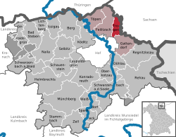
Feilitzsch, VGFeilitzschLage der Verwaltungsgemeinschaft Feilitzsch im Landkreis Hof85,53
(9.6 %)
6172
(6.6 %)
72
Lichtenberg, VGLichtenbergLage der Verwaltungsgemeinschaft Lichtenberg im Landkreis Hof28,16
(3.2 %)
1998
(2.1 %)
71[5]
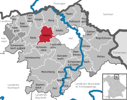
Schauenstein, VGSchauensteinLage der Verwaltungsgemeinschaft Schauenstein im Landkreis Hof36,91
(4.1 %)
3076
(3.3 %)
83
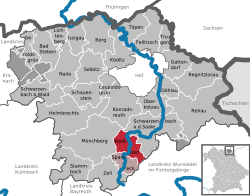
Sparneck, VGSparneckLage der Verwaltungsgemeinschaft Sparneck im Landkreis Hof38,26
(4.3 %)
2738
(2.9 %)
72
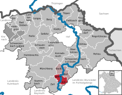
Bad Steben, MWappen der Gemeinde Bad Steben21Lage der Gemeinde Bad Steben im Landkreis Hof25,84
(2.9 %)
3387
(3.6 %)
131[6][7]
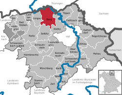
BergWappen der Gemeinde Berg30Lage der Gemeinde Berg im Landkreis Hof38,91
(4.4 %)
2008
(2.1 %)
52[8][9]
DöhlauWappen der Gemeinde Döhlau7Lage der Gemeinde Döhlau im Landkreis Hof15,25
(1.7 %)
3819
(4.1 %)
250[10][11]
FeilitzschWappen der Gemeinde Feilitzsch9FeilitzschLage der Gemeinde Feilitzsch im Landkreis Hof30,22
(3.4 %)
2720
(2.9 %)
90[12][13]
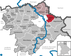
GattendorfWappen der Gemeinde Gattendorf13FeilitzschLage der Gemeinde Gattendorf im Landkreis Hof22,19
(2.5 %)
1035
(1.1 %)
47[14][15]
GeroldsgrünWappen der Gemeinde Geroldsgrün21Lage der Gemeinde Geroldsgrün im Landkreis Hof15,57
(1.7 %)
2636
(2.8 %)
169[16][17]
Helmbrechts, StWappen der Gemeinde Helmbrechts40Lage der Gemeinde Helmbrechts im Landkreis Hof58,72
(6.6 %)
8368
(8.9 %)
143[18][19]
IssigauWappen der Gemeinde Issigau14LichtenbergLage der Gemeinde Issigau im Landkreis Hof18,69
(2.1 %)
982
(1 %)
53[20][21]
KöditzWappen der Gemeinde Köditz16Lage der Gemeinde Köditz im Landkreis Hof31,44
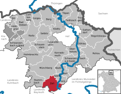
(3.5 %)
2429
(2.6 %)
77[22][23]
KonradsreuthWappen der Gemeinde Konradsreuth36Lage der Gemeinde Konradsreuth im Landkreis Hof43,25
(4.8 %)
3136
(3.3 %)
73[24][25]
LeupoldsgrünWappen der Gemeinde Leupoldsgrün6SchauensteinLage der Gemeinde Leupoldsgrün im Landkreis Hof10,25
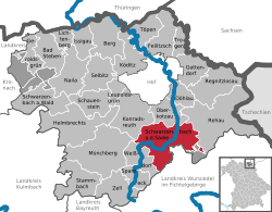
(1.1 %)
1174
(1.3 %)
115[26][27]
Lichtenberg, StWappen der Gemeinde Lichtenberg8LichtenbergLage der Gemeinde Lichtenberg im Landkreis Hof9,47
(1.1 %)
1016
(1.1 %)
107[28][29]
Münchberg, StWappen der Gemeinde Münchberg60Lage der Gemeinde Münchberg im Landkreis Hof68,79
(7.7 %)
10049
(10.7 %)
146[30][31]
NailaWappen der Gemeinde Naila37Lage der Gemeinde Naila im Landkreis Hof37,05
(4.2 %)
7580
(8.1 %)
205[32][33]
Oberkotzau, MWappen der Gemeinde Oberkotzau8Lage der Gemeinde Oberkotzau im Landkreis Hof21,51
(2.4 %)
5265
(5.6 %)
245[34][35]
RegnitzlosauWappen der Gemeinde Regnitzlosau31Lage der Gemeinde Regnitzlosau im Landkreis Hof39,90
(4.5 %)
2252
(2.4 %)
56[36][37]
Rehau, StWappen der Gemeinde Rehau29Lage der Gemeinde Rehau im Landkreis Hof80,33
(9 %)
9324
(9.9 %)
116[38][39]
Schauenstein, StWappen der Gemeinde Schauenstein18SchauensteinLage der Gemeinde Schauenstein im Landkreis Hof26,66
(3 %)
1902
(2 %)
71[40][41]
Schwarzenbach am Wald, StWappen der Gemeinde Schwarzenbach am Wald41Lage der Gemeinde Schwarzenbach am Wald im Landkreis Hof36,71
(4.1 %)
4356
(4.6 %)
119[42][43]
Schwarzenbach an der Saale, StWappen der Gemeinde Schwarzenbach an der Saale27Lage der Gemeinde Schwarzenbach an der Saale im Landkreis Hof59,16
(6.6 %)
6821
(7.3 %)
115[44][45]
Selbitz, StWappen der Gemeinde Selbitz17Lage der Gemeinde Selbitz im Landkreis Hof27,75
(3.1 %)
4286
(4.6 %)
154[46][47]
Sparneck, MWappen der Gemeinde Sparneck12SparneckLage der Gemeinde Sparneck im Landkreis Hof16,36
(1.8 %)
1575
(1.7 %)
96[48][49]
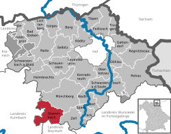
StammbachWappen der Gemeinde Stammbach45Lage der Gemeinde Stammbach im Landkreis Hof34,67
(3.9 %)
2334
(2.5 %)
67[50][51]
TöpenWappen der Gemeinde Töpen9FeilitzschLage der Gemeinde Töpen im Landkreis Hof20,80
(2.3 %)
1011
(1.1 %)
49[52][53]
TrogenWappen der Gemeinde Trogen7FeilitzschLage der Gemeinde Trogen im Landkreis Hof12,32
(1.4 %)
1406
(1.5 %)
114[54][55]
WeißdorfWappen der Gemeinde Weißdorf13SparneckLage der Gemeinde Weißdorf im Landkreis Hof21,90
(2.5 %)
1163
(1.2 %)
53[56][57]
Zell im Fichtelgebirge, MWappen der Gemeinde Zell im Fichtelgebirge17Lage der Gemeinde Zell im Fichtelgebirge im Landkreis Hof31,25
(3.5 %)
1873
(2 %)
60[58][59]

Siehe auch

Weblinks

Einzelnachweise

  1. Genesis Online-Datenbank des Bayerischen Landesamtes für Statistik Tabelle 12411-003r Fortschreibung des Bevölkerungsstandes: Gemeinden, Stichtag (Einwohnerzahlen auf Grundlage des Zensus 2011) (Hilfe dazu).
  2. Genesis Online-Datenbank des Bayerischen Landesamtes für Statistik Tabelle 12411-003r Fortschreibung des Bevölkerungsstandes: Gemeinden, Stichtag (Einwohnerzahlen auf Grundlage des Zensus 2011) (Hilfe dazu).
  3. Landkreis Hof: Amtliche Statistik des LfStat
  4. http://www.landkreis-hof.de/
  5. https://www.vg-lichtenberg.de/
  6. Bad Steben: Amtliche Statistik des LfStat
  7. https://www.markt-badsteben.de/
  8. Berg: Amtliche Statistik des LfStat
  9. https://www.berg-ofr.de/
  10. Döhlau: Amtliche Statistik des LfStat
  11. https://www.doehlau.de/
  12. Feilitzsch: Amtliche Statistik des LfStat
  13. https://feilitzsch.de/
  14. Gattendorf: Amtliche Statistik des LfStat
  15. https://www.gattendorf.de/
  16. Geroldsgrün: Amtliche Statistik des LfStat
  17. https://www.geroldsgruen.de/
  18. Helmbrechts: Amtliche Statistik des LfStat
  19. https://www.stadt-helmbrechts.de
  20. Issigau: Amtliche Statistik des LfStat
  21. https://www.issigau.de/
  22. Köditz: Amtliche Statistik des LfStat
  23. https://gemeinde-koeditz.de/
  24. Konradsreuth: Amtliche Statistik des LfStat
  25. https://www.konradsreuth.de/
  26. Leupoldsgrün: Amtliche Statistik des LfStat
  27. http://www.leupoldsgruen.de/
  28. Lichtenberg: Amtliche Statistik des LfStat
  29. https://www.stadt-lichtenberg.de/
  30. Münchberg: Amtliche Statistik des LfStat
  31. https://www.muenchberg.de/
  32. Naila: Amtliche Statistik des LfStat
  33. https://www.naila.de/
  34. Oberkotzau: Amtliche Statistik des LfStat
  35. https://www.oberkotzau.de/
  36. Regnitzlosau: Amtliche Statistik des LfStat
  37. https://www.regnitzlosau.de/
  38. Rehau: Amtliche Statistik des LfStat
  39. https://www.stadt-rehau.de/
  40. Schauenstein: Amtliche Statistik des LfStat
  41. https://www.schauenstein.de/
  42. Schwarzenbach am Wald: Amtliche Statistik des LfStat
  43. https://www.schwarzenbach-wald.de/
  44. Schwarzenbach an der Saale: Amtliche Statistik des LfStat
  45. https://www.schwarzenbach-saale.de/
  46. Selbitz: Amtliche Statistik des LfStat
  47. https://www.selbitz.de/
  48. Sparneck: Amtliche Statistik des LfStat
  49. https://www.sparneck.de/
  50. Stammbach: Amtliche Statistik des LfStat
  51. https://www.stammbach.de/
  52. Töpen: Amtliche Statistik des LfStat
  53. https://www.toepen.de/
  54. Trogen: Amtliche Statistik des LfStat
  55. https://www.trogen.de/
  56. Weißdorf: Amtliche Statistik des LfStat
  57. https://www.weissdorf.de/
  58. Zell im Fichtelgebirge: Amtliche Statistik des LfStat
  59. https://www.markt-zell.de/

Auf dieser Seite verwendete Medien

Bad Steben in HO.svg
Deutsch (de): Lagekarte von Bad Steben, Landkreis Hof, Bayern, Deutschland.
English (en): Locator map of Bad Steben in District of Hof, Bavaria, Germany.
français (fr): Plan de localisation de la municipalité Bad Steben dans l'arrondissement de Hof dans Bavière, Allemagne.
hornjoserbsce (hsb): Poziciska karta gmejny Bad Steben, Landkreis Hof, Bayern, Němska.
македонски (mk): Положбена карта на Bad Steben во рамките на Landkreis Hof, Bayern, Германија.
Nederlands (nl): Detailkaart van Bad Steben in de Landkreis Hof, Bayern, Duitsland.
Esperanto (eo): Situomapo de Bad Steben en Landkreis Hof, Bayern, Germanio.
മലയാളം (ml): ജർമ്മനിയിലെ Bavaria, District of Hof, Bad Steben ഭൂപടസ്ഥാനം.
Verwaltungsgemeinschaft Schauenstein in HO.svg
Deutsch (de): Lagekarte von Verwaltungsgemeinschaft Schauenstein, Landkreis Hof, Bayern, Deutschland.
English (en): Locator map of Verwaltungsgemeinschaft Schauenstein in District of Hof, Bavaria, Germany.
français (fr): Plan de localisation de la municipalité Verwaltungsgemeinschaft Schauenstein dans l'arrondissement de Hof dans Bavière, Allemagne.
hornjoserbsce (hsb): Poziciska karta gmejny Verwaltungsgemeinschaft Schauenstein, Landkreis Hof, Bayern, Němska.
македонски (mk): Положбена карта на Verwaltungsgemeinschaft Schauenstein во рамките на Landkreis Hof, Bayern, Германија.
Nederlands (nl): Detailkaart van Verwaltungsgemeinschaft Schauenstein in de Landkreis Hof, Bayern, Duitsland.
Esperanto (eo): Situomapo de Verwaltungsgemeinschaft Schauenstein en Landkreis Hof, Bayern, Germanio.
മലയാളം (ml): ജർമ്മനിയിലെ Bavaria, District of Hof, Verwaltungsgemeinschaft Schauenstein ഭൂപടസ്ഥാനം.
Gattendorf in HO.svg
Deutsch (de): Lagekarte von Gattendorf, Landkreis Hof, Bayern, Deutschland.
English (en): Locator map of Gattendorf in District of Hof, Bavaria, Germany.
français (fr): Plan de localisation de la municipalité Gattendorf dans l'arrondissement de Hof dans Bavière, Allemagne.
hornjoserbsce (hsb): Poziciska karta gmejny Gattendorf, Landkreis Hof, Bayern, Němska.
македонски (mk): Положбена карта на Gattendorf во рамките на Landkreis Hof, Bayern, Германија.
Nederlands (nl): Detailkaart van Gattendorf in de Landkreis Hof, Bayern, Duitsland.
Esperanto (eo): Situomapo de Gattendorf en Landkreis Hof, Bayern, Germanio.
മലയാളം (ml): ജർമ്മനിയിലെ Bavaria, District of Hof, Gattendorf ഭൂപടസ്ഥാനം.
Helmbrechts in HO.svg
Deutsch (de): Lagekarte von Helmbrechts, Landkreis Hof, Bayern, Deutschland.
English (en): Locator map of Helmbrechts in District of Hof, Bavaria, Germany.
français (fr): Plan de localisation de la municipalité Helmbrechts dans l'arrondissement de Hof dans Bavière, Allemagne.
hornjoserbsce (hsb): Poziciska karta gmejny Helmbrechts, Landkreis Hof, Bayern, Němska.
македонски (mk): Положбена карта на Helmbrechts во рамките на Landkreis Hof, Bayern, Германија.
Nederlands (nl): Detailkaart van Helmbrechts in de Landkreis Hof, Bayern, Duitsland.
Esperanto (eo): Situomapo de Helmbrechts en Landkreis Hof, Bayern, Germanio.
മലയാളം (ml): ജർമ്മനിയിലെ Bavaria, District of Hof, Helmbrechts ഭൂപടസ്ഥാനം.
Verwaltungsgemeinschaft Sparneck in HO.svg
Deutsch (de): Lagekarte von Verwaltungsgemeinschaft Sparneck, Landkreis Hof, Bayern, Deutschland.
English (en): Locator map of Verwaltungsgemeinschaft Sparneck in District of Hof, Bavaria, Germany.
français (fr): Plan de localisation de la municipalité Verwaltungsgemeinschaft Sparneck dans l'arrondissement de Hof dans Bavière, Allemagne.
hornjoserbsce (hsb): Poziciska karta gmejny Verwaltungsgemeinschaft Sparneck, Landkreis Hof, Bayern, Němska.
македонски (mk): Положбена карта на Verwaltungsgemeinschaft Sparneck во рамките на Landkreis Hof, Bayern, Германија.
Nederlands (nl): Detailkaart van Verwaltungsgemeinschaft Sparneck in de Landkreis Hof, Bayern, Duitsland.
Esperanto (eo): Situomapo de Verwaltungsgemeinschaft Sparneck en Landkreis Hof, Bayern, Germanio.
മലയാളം (ml): ജർമ്മനിയിലെ Bavaria, District of Hof, Verwaltungsgemeinschaft Sparneck ഭൂപടസ്ഥാനം.
Naila in HO.svg
Deutsch (de): Lagekarte von Naila, Landkreis Hof, Bayern, Deutschland.
English (en): Locator map of Naila in District of Hof, Bavaria, Germany.
français (fr): Plan de localisation de la municipalité Naila dans l'arrondissement de Hof dans Bavière, Allemagne.
hornjoserbsce (hsb): Poziciska karta gmejny Naila, Landkreis Hof, Bayern, Němska.
македонски (mk): Положбена карта на Naila во рамките на Landkreis Hof, Bayern, Германија.
Nederlands (nl): Detailkaart van Naila in de Landkreis Hof, Bayern, Duitsland.
Esperanto (eo): Situomapo de Naila en Landkreis Hof, Bayern, Germanio.
മലയാളം (ml): ജർമ്മനിയിലെ Bavaria, District of Hof, Naila ഭൂപടസ്ഥാനം.
Konradsreuth in HO.svg
Deutsch (de): Lagekarte von Konradsreuth, Landkreis Hof, Bayern, Deutschland.
English (en): Locator map of Konradsreuth in District of Hof, Bavaria, Germany.
français (fr): Plan de localisation de la municipalité Konradsreuth dans l'arrondissement de Hof dans Bavière, Allemagne.
hornjoserbsce (hsb): Poziciska karta gmejny Konradsreuth, Landkreis Hof, Bayern, Němska.
македонски (mk): Положбена карта на Konradsreuth во рамките на Landkreis Hof, Bayern, Германија.
Nederlands (nl): Detailkaart van Konradsreuth in de Landkreis Hof, Bayern, Duitsland.
Esperanto (eo): Situomapo de Konradsreuth en Landkreis Hof, Bayern, Germanio.
മലയാളം (ml): ജർമ്മനിയിലെ Bavaria, District of Hof, Konradsreuth ഭൂപടസ്ഥാനം.
Verwaltungsgemeinschaft Feilitzsch in HO.svg
Deutsch (de): Lagekarte von Verwaltungsgemeinschaft Feilitzsch, Landkreis Hof, Bayern, Deutschland.
English (en): Locator map of Verwaltungsgemeinschaft Feilitzsch in District of Hof, Bavaria, Germany.
français (fr): Plan de localisation de la municipalité Verwaltungsgemeinschaft Feilitzsch dans l'arrondissement de Hof dans Bavière, Allemagne.
hornjoserbsce (hsb): Poziciska karta gmejny Verwaltungsgemeinschaft Feilitzsch, Landkreis Hof, Bayern, Němska.
македонски (mk): Положбена карта на Verwaltungsgemeinschaft Feilitzsch во рамките на Landkreis Hof, Bayern, Германија.
Nederlands (nl): Detailkaart van Verwaltungsgemeinschaft Feilitzsch in de Landkreis Hof, Bayern, Duitsland.
Esperanto (eo): Situomapo de Verwaltungsgemeinschaft Feilitzsch en Landkreis Hof, Bayern, Germanio.
മലയാളം (ml): ജർമ്മനിയിലെ Bavaria, District of Hof, Verwaltungsgemeinschaft Feilitzsch ഭൂപടസ്ഥാനം.
Wappen Stammbach.svg
Wappen der Gemeinde Stammbach
Leupoldsgrün in HO.svg
Deutsch (de): Lagekarte von Leupoldsgrün, Landkreis Hof, Bayern, Deutschland.
English (en): Locator map of Leupoldsgrün in District of Hof, Bavaria, Germany.
français (fr): Plan de localisation de la municipalité Leupoldsgrün dans l'arrondissement de Hof dans Bavière, Allemagne.
hornjoserbsce (hsb): Poziciska karta gmejny Leupoldsgrün, Landkreis Hof, Bayern, Němska.
македонски (mk): Положбена карта на Leupoldsgrün во рамките на Landkreis Hof, Bayern, Германија.
Nederlands (nl): Detailkaart van Leupoldsgrün in de Landkreis Hof, Bayern, Duitsland.
Esperanto (eo): Situomapo de Leupoldsgrün en Landkreis Hof, Bayern, Germanio.
മലയാളം (ml): ജർമ്മനിയിലെ Bavaria, District of Hof, Leupoldsgrün ഭൂപടസ്ഥാനം.
Sparneck in HO.svg
Deutsch (de): Lagekarte von Sparneck, Landkreis Hof, Bayern, Deutschland.
English (en): Locator map of Sparneck in District of Hof, Bavaria, Germany.
français (fr): Plan de localisation de la municipalité Sparneck dans l'arrondissement de Hof dans Bavière, Allemagne.
hornjoserbsce (hsb): Poziciska karta gmejny Sparneck, Landkreis Hof, Bayern, Němska.
македонски (mk): Положбена карта на Sparneck во рамките на Landkreis Hof, Bayern, Германија.
Nederlands (nl): Detailkaart van Sparneck in de Landkreis Hof, Bayern, Duitsland.
Esperanto (eo): Situomapo de Sparneck en Landkreis Hof, Bayern, Germanio.
മലയാളം (ml): ജർമ്മനിയിലെ Bavaria, District of Hof, Sparneck ഭൂപടസ്ഥാനം.
Schauenstein in HO.svg
Deutsch (de): Lagekarte von Schauenstein, Landkreis Hof, Bayern, Deutschland.
English (en): Locator map of Schauenstein in District of Hof, Bavaria, Germany.
français (fr): Plan de localisation de la municipalité Schauenstein dans l'arrondissement de Hof dans Bavière, Allemagne.
hornjoserbsce (hsb): Poziciska karta gmejny Schauenstein, Landkreis Hof, Bayern, Němska.
македонски (mk): Положбена карта на Schauenstein во рамките на Landkreis Hof, Bayern, Германија.
Nederlands (nl): Detailkaart van Schauenstein in de Landkreis Hof, Bayern, Duitsland.
Esperanto (eo): Situomapo de Schauenstein en Landkreis Hof, Bayern, Germanio.
മലയാളം (ml): ജർമ്മനിയിലെ Bavaria, District of Hof, Schauenstein ഭൂപടസ്ഥാനം.
Regnitzlosau in HO.svg
Deutsch (de): Lagekarte von Regnitzlosau, Landkreis Hof, Bayern, Deutschland.
English (en): Locator map of Regnitzlosau in District of Hof, Bavaria, Germany.
français (fr): Plan de localisation de la municipalité Regnitzlosau dans l'arrondissement de Hof dans Bavière, Allemagne.
hornjoserbsce (hsb): Poziciska karta gmejny Regnitzlosau, Landkreis Hof, Bayern, Němska.
македонски (mk): Положбена карта на Regnitzlosau во рамките на Landkreis Hof, Bayern, Германија.
Nederlands (nl): Detailkaart van Regnitzlosau in de Landkreis Hof, Bayern, Duitsland.
Esperanto (eo): Situomapo de Regnitzlosau en Landkreis Hof, Bayern, Germanio.
മലയാളം (ml): ജർമ്മനിയിലെ Bavaria, District of Hof, Regnitzlosau ഭൂപടസ്ഥാനം.
Berg in HO.svg
Deutsch (de): Lagekarte von Berg, Landkreis Hof, Bayern, Deutschland.
English (en): Locator map of Berg in District of Hof, Bavaria, Germany.
français (fr): Plan de localisation de la municipalité Berg dans l'arrondissement de Hof dans Bavière, Allemagne.
hornjoserbsce (hsb): Poziciska karta gmejny Berg, Landkreis Hof, Bayern, Němska.
македонски (mk): Положбена карта на Berg во рамките на Landkreis Hof, Bayern, Германија.
Nederlands (nl): Detailkaart van Berg in de Landkreis Hof, Bayern, Duitsland.
Esperanto (eo): Situomapo de Berg en Landkreis Hof, Bayern, Germanio.
മലയാളം (ml): ജർമ്മനിയിലെ Bavaria, District of Hof, Berg ഭൂപടസ്ഥാനം.
Verwaltungsgemeinschaft Lichtenberg in HO.svg
Deutsch (de): Lagekarte von Verwaltungsgemeinschaft Lichtenberg, Landkreis Hof, Bayern, Deutschland.
English (en): Locator map of Verwaltungsgemeinschaft Lichtenberg in District of Hof, Bavaria, Germany.
français (fr): Plan de localisation de la municipalité Verwaltungsgemeinschaft Lichtenberg dans l'arrondissement de Hof dans Bavière, Allemagne.
hornjoserbsce (hsb): Poziciska karta gmejny Verwaltungsgemeinschaft Lichtenberg, Landkreis Hof, Bayern, Němska.
македонски (mk): Положбена карта на Verwaltungsgemeinschaft Lichtenberg во рамките на Landkreis Hof, Bayern, Германија.
Nederlands (nl): Detailkaart van Verwaltungsgemeinschaft Lichtenberg in de Landkreis Hof, Bayern, Duitsland.
Esperanto (eo): Situomapo de Verwaltungsgemeinschaft Lichtenberg en Landkreis Hof, Bayern, Germanio.
മലയാളം (ml): ജർമ്മനിയിലെ Bavaria, District of Hof, Verwaltungsgemeinschaft Lichtenberg ഭൂപടസ്ഥാനം.
Münchberg in HO.svg
Deutsch (de): Lagekarte von Münchberg, Landkreis Hof, Bayern, Deutschland.
English (en): Locator map of Münchberg in District of Hof, Bavaria, Germany.
français (fr): Plan de localisation de la municipalité Münchberg dans l'arrondissement de Hof dans Bavière, Allemagne.
hornjoserbsce (hsb): Poziciska karta gmejny Münchberg, Landkreis Hof, Bayern, Němska.
македонски (mk): Положбена карта на Münchberg во рамките на Landkreis Hof, Bayern, Германија.
Nederlands (nl): Detailkaart van Münchberg in de Landkreis Hof, Bayern, Duitsland.
Esperanto (eo): Situomapo de Münchberg en Landkreis Hof, Bayern, Germanio.
മലയാളം (ml): ജർമ്മനിയിലെ Bavaria, District of Hof, Münchberg ഭൂപടസ്ഥാനം.
Töpen in HO.svg
Deutsch (de): Lagekarte von Töpen, Landkreis Hof, Bayern, Deutschland.
English (en): Locator map of Töpen in District of Hof, Bavaria, Germany.
français (fr): Plan de localisation de la municipalité Töpen dans l'arrondissement de Hof dans Bavière, Allemagne.
hornjoserbsce (hsb): Poziciska karta gmejny Töpen, Landkreis Hof, Bayern, Němska.
македонски (mk): Положбена карта на Töpen во рамките на Landkreis Hof, Bayern, Германија.
Nederlands (nl): Detailkaart van Töpen in de Landkreis Hof, Bayern, Duitsland.
Esperanto (eo): Situomapo de Töpen en Landkreis Hof, Bayern, Germanio.
മലയാളം (ml): ജർമ്മനിയിലെ Bavaria, District of Hof, Töpen ഭൂപടസ്ഥാനം.
Selbitz in HO.svg
Deutsch (de): Lagekarte von Selbitz, Landkreis Hof, Bayern, Deutschland.
English (en): Locator map of Selbitz in District of Hof, Bavaria, Germany.
français (fr): Plan de localisation de la municipalité Selbitz dans l'arrondissement de Hof dans Bavière, Allemagne.
hornjoserbsce (hsb): Poziciska karta gmejny Selbitz, Landkreis Hof, Bayern, Němska.
македонски (mk): Положбена карта на Selbitz во рамките на Landkreis Hof, Bayern, Германија.
Nederlands (nl): Detailkaart van Selbitz in de Landkreis Hof, Bayern, Duitsland.
Esperanto (eo): Situomapo de Selbitz en Landkreis Hof, Bayern, Germanio.
മലയാളം (ml): ജർമ്മനിയിലെ Bavaria, District of Hof, Selbitz ഭൂപടസ്ഥാനം.
Feilitzsch in HO.svg
Deutsch (de): Lagekarte von Feilitzsch, Landkreis Hof, Bayern, Deutschland.
English (en): Locator map of Feilitzsch in District of Hof, Bavaria, Germany.
français (fr): Plan de localisation de la municipalité Feilitzsch dans l'arrondissement de Hof dans Bavière, Allemagne.
hornjoserbsce (hsb): Poziciska karta gmejny Feilitzsch, Landkreis Hof, Bayern, Němska.
македонски (mk): Положбена карта на Feilitzsch во рамките на Landkreis Hof, Bayern, Германија.
Nederlands (nl): Detailkaart van Feilitzsch in de Landkreis Hof, Bayern, Duitsland.
Esperanto (eo): Situomapo de Feilitzsch en Landkreis Hof, Bayern, Germanio.
മലയാളം (ml): ജർമ്മനിയിലെ Bavaria, District of Hof, Feilitzsch ഭൂപടസ്ഥാനം.
Zell im Fichtelgebirge in HO.svg
Deutsch (de): Lagekarte von Zell im Fichtelgebirge, Landkreis Hof, Bayern, Deutschland.
English (en): Locator map of Zell im Fichtelgebirge in District of Hof, Bavaria, Germany.
français (fr): Plan de localisation de la municipalité Zell im Fichtelgebirge dans l'arrondissement de Hof dans Bavière, Allemagne.
hornjoserbsce (hsb): Poziciska karta gmejny Zell im Fichtelgebirge, Landkreis Hof, Bayern, Němska.
македонски (mk): Положбена карта на Zell im Fichtelgebirge во рамките на Landkreis Hof, Bayern, Германија.
Nederlands (nl): Detailkaart van Zell im Fichtelgebirge in de Landkreis Hof, Bayern, Duitsland.
Esperanto (eo): Situomapo de Zell im Fichtelgebirge en Landkreis Hof, Bayern, Germanio.
മലയാളം (ml): ജർമ്മനിയിലെ Bavaria, District of Hof, Zell im Fichtelgebirge ഭൂപടസ്ഥാനം.
Oberkotzau in HO.svg
Deutsch (de): Lagekarte von Oberkotzau, Landkreis Hof, Bayern, Deutschland.
English (en): Locator map of Oberkotzau in District of Hof, Bavaria, Germany.
français (fr): Plan de localisation de la municipalité Oberkotzau dans l'arrondissement de Hof dans Bavière, Allemagne.
hornjoserbsce (hsb): Poziciska karta gmejny Oberkotzau, Landkreis Hof, Bayern, Němska.
македонски (mk): Положбена карта на Oberkotzau во рамките на Landkreis Hof, Bayern, Германија.
Nederlands (nl): Detailkaart van Oberkotzau in de Landkreis Hof, Bayern, Duitsland.
Esperanto (eo): Situomapo de Oberkotzau en Landkreis Hof, Bayern, Germanio.
മലയാളം (ml): ജർമ്മനിയിലെ Bavaria, District of Hof, Oberkotzau ഭൂപടസ്ഥാനം.
COA Trogen Feuerwehr 20201002 164456.svg
SVG vom COA Trogen, das am Gebäude der Trogener Feuerwehr hängt. Da online keine SVG-Version des Wappens gefunden wurde, wurde hier das Wappen aus einem Foto (Quelle siehe unten) extrahiert und vektorisiert.
Döhlau in HO.svg
Deutsch (de): Lagekarte von Döhlau, Landkreis Hof, Bayern, Deutschland.
English (en): Locator map of Döhlau in District of Hof, Bavaria, Germany.
français (fr): Plan de localisation de la municipalité Döhlau dans l'arrondissement de Hof dans Bavière, Allemagne.
hornjoserbsce (hsb): Poziciska karta gmejny Döhlau, Landkreis Hof, Bayern, Němska.
македонски (mk): Положбена карта на Döhlau во рамките на Landkreis Hof, Bayern, Германија.
Nederlands (nl): Detailkaart van Döhlau in de Landkreis Hof, Bayern, Duitsland.
Esperanto (eo): Situomapo de Döhlau en Landkreis Hof, Bayern, Germanio.
മലയാളം (ml): ജർമ്മനിയിലെ Bavaria, District of Hof, Döhlau ഭൂപടസ്ഥാനം.
Schwarzenbach an der Saale in HO.svg
Deutsch (de): Lagekarte von Schwarzenbach a.d.Saale, Landkreis Hof, Bayern, Deutschland.
English (en): Locator map of Schwarzenbach a.d.Saale in District of Hof, Bavaria, Germany.
français (fr): Plan de localisation de la municipalité Schwarzenbach a.d.Saale dans l'arrondissement de Hof dans Bavière, Allemagne.
hornjoserbsce (hsb): Poziciska karta gmejny Schwarzenbach a.d.Saale, Landkreis Hof, Bayern, Němska.
македонски (mk): Положбена карта на Schwarzenbach a.d.Saale во рамките на Landkreis Hof, Bayern, Германија.
Nederlands (nl): Detailkaart van Schwarzenbach a.d.Saale in de Landkreis Hof, Bayern, Duitsland.
Esperanto (eo): Situomapo de Schwarzenbach a.d.Saale en Landkreis Hof, Bayern, Germanio.
മലയാളം (ml): ജർമ്മനിയിലെ Bavaria, District of Hof, Schwarzenbach a.d.Saale ഭൂപടസ്ഥാനം.
Geroldsgrün in HO.svg
Deutsch (de): Lagekarte von Geroldsgrün, Landkreis Hof, Bayern, Deutschland.
English (en): Locator map of Geroldsgrün in District of Hof, Bavaria, Germany.
français (fr): Plan de localisation de la municipalité Geroldsgrün dans l'arrondissement de Hof dans Bavière, Allemagne.
hornjoserbsce (hsb): Poziciska karta gmejny Geroldsgrün, Landkreis Hof, Bayern, Němska.
македонски (mk): Положбена карта на Geroldsgrün во рамките на Landkreis Hof, Bayern, Германија.
Nederlands (nl): Detailkaart van Geroldsgrün in de Landkreis Hof, Bayern, Duitsland.
Esperanto (eo): Situomapo de Geroldsgrün en Landkreis Hof, Bayern, Germanio.
മലയാളം (ml): ജർമ്മനിയിലെ Bavaria, District of Hof, Geroldsgrün ഭൂപടസ്ഥാനം.
Bavaria HO (district).svg
Deutsch (de): Lagekarte von Landkreis Hof in Bayern, Deutschland.
English (en): Locator map of District of Hof in Bavaria, Germany.
français (fr): Plan de localisation de l'arrondissement Landkreis Hof dans le Land Bayern, Allemagne.
Nederlands (nl): Detailkaart van Landkreis Hof in Bayern, Duitsland.
Esperanto (eo): Situomapo de [[:eo:{{{mun}}}|komunumo nekonata]] en Landkreis Hof, Bayern, Germanio.
മലയാളം (ml): ജർമ്മനിയിലെ Bavaria District of Hof, ഭൂപടസ്ഥാനം.
Schwarzenbach am Wald in HO.svg
Deutsch (de): Lagekarte von Schwarzenbach am Wald, Landkreis Hof, Bayern, Deutschland.
English (en): Locator map of Schwarzenbach am Wald in District of Hof, Bavaria, Germany.
français (fr): Plan de localisation de la municipalité Schwarzenbach am Wald dans l'arrondissement de Hof dans Bavière, Allemagne.
hornjoserbsce (hsb): Poziciska karta gmejny Schwarzenbach am Wald, Landkreis Hof, Bayern, Němska.
македонски (mk): Положбена карта на Schwarzenbach am Wald во рамките на Landkreis Hof, Bayern, Германија.
Nederlands (nl): Detailkaart van Schwarzenbach am Wald in de Landkreis Hof, Bayern, Duitsland.
Esperanto (eo): Situomapo de Schwarzenbach am Wald en Landkreis Hof, Bayern, Germanio.
മലയാളം (ml): ജർമ്മനിയിലെ Bavaria, District of Hof, Schwarzenbach am Wald ഭൂപടസ്ഥാനം.
Trogen in HO.svg
Deutsch (de): Lagekarte von Trogen, Landkreis Hof, Bayern, Deutschland.
English (en): Locator map of Trogen in District of Hof, Bavaria, Germany.
français (fr): Plan de localisation de la municipalité Trogen dans l'arrondissement de Hof dans Bavière, Allemagne.
hornjoserbsce (hsb): Poziciska karta gmejny Trogen, Landkreis Hof, Bayern, Němska.
македонски (mk): Положбена карта на Trogen во рамките на Landkreis Hof, Bayern, Германија.
Nederlands (nl): Detailkaart van Trogen in de Landkreis Hof, Bayern, Duitsland.
Esperanto (eo): Situomapo de Trogen en Landkreis Hof, Bayern, Germanio.
മലയാളം (ml): ജർമ്മനിയിലെ Bavaria, District of Hof, Trogen ഭൂപടസ്ഥാനം.
Municipalities in HO.svg
Deutsch (de): Lagekarte von Landkreis Hof in Bayern, Deutschland.
English (en): Locator map of District of Hof in Bavaria, Germany.
français (fr): Plan de localisation de l'arrondissement de Hof dans le Land Bavière, Allemagne.
Nederlands (nl): Detailkaart van Landkreis Hof in Bayern, Duitsland.
Esperanto (eo): Situomapo de komunumo nekonata en Landkreis Hof, Bayern, Germanio.
മലയാളം (ml): ജർമ്മനിയിലെ Bavaria District of Hof, ഭൂപടസ്ഥാനം.
Wappen Weißdorf.svg
Autor/Urheber: Kilom691, Lizenz: CC BY-SA 3.0
Armes de Weissdorf
Stammbach in HO.svg
Deutsch (de): Lagekarte von Stammbach, Landkreis Hof, Bayern, Deutschland.
English (en): Locator map of Stammbach in District of Hof, Bavaria, Germany.
français (fr): Plan de localisation de la municipalité Stammbach dans l'arrondissement de Hof dans Bavière, Allemagne.
hornjoserbsce (hsb): Poziciska karta gmejny Stammbach, Landkreis Hof, Bayern, Němska.
македонски (mk): Положбена карта на Stammbach во рамките на Landkreis Hof, Bayern, Германија.
Nederlands (nl): Detailkaart van Stammbach in de Landkreis Hof, Bayern, Duitsland.
Esperanto (eo): Situomapo de Stammbach en Landkreis Hof, Bayern, Germanio.
മലയാളം (ml): ജർമ്മനിയിലെ Bavaria, District of Hof, Stammbach ഭൂപടസ്ഥാനം.
Weißdorf in HO.svg
Deutsch (de): Lagekarte von Weißdorf, Landkreis Hof, Bayern, Deutschland.
English (en): Locator map of Weißdorf in District of Hof, Bavaria, Germany.
français (fr): Plan de localisation de la municipalité Weißdorf dans l'arrondissement de Hof dans Bavière, Allemagne.
hornjoserbsce (hsb): Poziciska karta gmejny Weißdorf, Landkreis Hof, Bayern, Němska.
македонски (mk): Положбена карта на Weißdorf во рамките на Landkreis Hof, Bayern, Германија.
Nederlands (nl): Detailkaart van Weißdorf in de Landkreis Hof, Bayern, Duitsland.
Esperanto (eo): Situomapo de Weißdorf en Landkreis Hof, Bayern, Germanio.
മലയാളം (ml): ജർമ്മനിയിലെ Bavaria, District of Hof, Weißdorf ഭൂപടസ്ഥാനം.
Coat of arms of Feilitzsch.svg
Das Wappen der oberfränkischen Gemeinde Feilitzsch.
Köditz in HO.svg
Deutsch (de): Lagekarte von Köditz, Landkreis Hof, Bayern, Deutschland.
English (en): Locator map of Köditz in District of Hof, Bavaria, Germany.
français (fr): Plan de localisation de la municipalité Köditz dans l'arrondissement de Hof dans Bavière, Allemagne.
hornjoserbsce (hsb): Poziciska karta gmejny Köditz, Landkreis Hof, Bayern, Němska.
македонски (mk): Положбена карта на Köditz во рамките на Landkreis Hof, Bayern, Германија.
Nederlands (nl): Detailkaart van Köditz in de Landkreis Hof, Bayern, Duitsland.
Esperanto (eo): Situomapo de Köditz en Landkreis Hof, Bayern, Germanio.
മലയാളം (ml): ജർമ്മനിയിലെ Bavaria, District of Hof, Köditz ഭൂപടസ്ഥാനം.
Issigau in HO.svg
Deutsch (de): Lagekarte von Issigau, Landkreis Hof, Bayern, Deutschland.
English (en): Locator map of Issigau in District of Hof, Bavaria, Germany.
français (fr): Plan de localisation de la municipalité Issigau dans l'arrondissement de Hof dans Bavière, Allemagne.
hornjoserbsce (hsb): Poziciska karta gmejny Issigau, Landkreis Hof, Bayern, Němska.
македонски (mk): Положбена карта на Issigau во рамките на Landkreis Hof, Bayern, Германија.
Nederlands (nl): Detailkaart van Issigau in de Landkreis Hof, Bayern, Duitsland.
Esperanto (eo): Situomapo de Issigau en Landkreis Hof, Bayern, Germanio.
മലയാളം (ml): ജർമ്മനിയിലെ Bavaria, District of Hof, Issigau ഭൂപടസ്ഥാനം.
Lichtenberg in HO.svg
Deutsch (de): Lagekarte von Lichtenberg, Landkreis Hof, Bayern, Deutschland.
English (en): Locator map of Lichtenberg in District of Hof, Bavaria, Germany.
français (fr): Plan de localisation de la municipalité Lichtenberg dans l'arrondissement de Hof dans Bavière, Allemagne.
hornjoserbsce (hsb): Poziciska karta gmejny Lichtenberg, Landkreis Hof, Bayern, Němska.
македонски (mk): Положбена карта на Lichtenberg во рамките на Landkreis Hof, Bayern, Германија.
Nederlands (nl): Detailkaart van Lichtenberg in de Landkreis Hof, Bayern, Duitsland.
Esperanto (eo): Situomapo de Lichtenberg en Landkreis Hof, Bayern, Germanio.
മലയാളം (ml): ജർമ്മനിയിലെ Bavaria, District of Hof, Lichtenberg ഭൂപടസ്ഥാനം.
Rehau in HO.svg
Deutsch (de): Lagekarte von Rehau, Landkreis Hof, Bayern, Deutschland.
English (en): Locator map of Rehau in District of Hof, Bavaria, Germany.
français (fr): Plan de localisation de la municipalité Rehau dans l'arrondissement de Hof dans Bavière, Allemagne.
hornjoserbsce (hsb): Poziciska karta gmejny Rehau, Landkreis Hof, Bayern, Němska.
македонски (mk): Положбена карта на Rehau во рамките на Landkreis Hof, Bayern, Германија.
Nederlands (nl): Detailkaart van Rehau in de Landkreis Hof, Bayern, Duitsland.
Esperanto (eo): Situomapo de Rehau en Landkreis Hof, Bayern, Germanio.
മലയാളം (ml): ജർമ്മനിയിലെ Bavaria, District of Hof, Rehau ഭൂപടസ്ഥാനം.