Liste der Gemeinden im Landkreis Forchheim

Karte des Landkreises Forchheim

Die Liste der Gemeinden im Landkreis Forchheim gibt einen Überblick über die Verwaltungseinheiten des Landkreises. Es gibt 29 politische Gemeinden, von denen 13 eine eigene Verwaltung haben, und 6 Verwaltungsgemeinschaften.

Legende

  • Verwaltungseinheit: Name der Gemeinde und Angabe der Gemeindeart: Gemeinde (–), Markt (M), Stadt (St), Große Kreisstadt (GKSt) oder Name der Verwaltungsgemeinschaft. Einheitsgemeinden wie auch Verwaltungsgemeinschaften sind fett gedruckt
  • Wappen: Wappen der Gemeinde
  • GT: Gemeindeteile der Gemeinde. Der Wiki-Link ist mit der Gemeindegliederung der jeweiligen Gemeinde verknüpft.
  • VG: Zeigt ggf. an, ob eine Gemeinde zu einer Verwaltungsgemeinschaft gehört
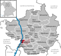
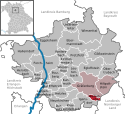
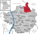
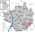
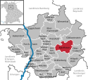
  • Karte: Zeigt die Lage der Gemeinde im Landkreis
  • Fläche: Fläche der Stadt beziehungsweise Gemeinde, angegeben in Quadratkilometer
  • Einwohner: Zahl der Menschen die in der Gemeinde beziehungsweise Stadt leben (Stand: 31. Dezember 2021[1])
  • EW-Dichte: Angegeben ist die Einwohnerdichte, gerechnet auf die Fläche der Verwaltungseinheit, angegeben in Einwohner pro km2 (Stand: 31. Dezember 2021[2])
  • Statistik: Link zur kommunalen Statistik des Bayerischen Landesamts für Statistik
  • Website: Website der der Gemeinde bzw. der Verwaltungsgemeinschaft

Gemeinden

VerwaltungseinheitWappenGTVGKarteFlächeEinwohnerEW-
Dichte
StatistikWebsite
Landkreis ForchheimWappen des Landkreises ForchheimDer Landkreis Forchheim642,79116753182[3][4]
Dormitz, VGDormitzLage der Verwaltungsgemeinschaft Dormitz im Landkreis Forchheim23,82
(3.7 %)
4913
(4.2 %)
206[5]
Ebermannstadt, VGEbermannstadtLage der Verwaltungsgemeinschaft Ebermannstadt im Landkreis Forchheim62,43
(9.7 %)
8093
(6.9 %)
130[6]
Effeltrich, VGEffeltrichLage der Verwaltungsgemeinschaft Effeltrich im Landkreis Forchheim17,09
(2.7 %)
4117
(3.5 %)
241[7]
Gosberg, VGGosbergLage der Verwaltungsgemeinschaft Gosberg im Landkreis Forchheim29,52
(4.6 %)
4989
(4.3 %)
169[8]
Gräfenberg, VGGräfenbergLage der Verwaltungsgemeinschaft Gräfenberg im Landkreis Forchheim68,11
(10.6 %)
6931
(5.9 %)
102[9]
Kirchehrenbach, VGKirchehrenbachLage der Verwaltungsgemeinschaft Kirchehrenbach im Landkreis Forchheim36,24
(5.6 %)
5926
(5.1 %)
164[10]
DormitzWappen der Gemeinde Dormitz2DormitzLage der Gemeinde Dormitz im Landkreis Forchheim4,57
(0.7 %)
2086
(1.8 %)
456[11][12]
Ebermannstadt, StWappen der Gemeinde Ebermannstadt17EbermannstadtLage der Gemeinde Ebermannstadt im Landkreis Forchheim49,96
(7.8 %)
6924
(5.9 %)
139[13][14]
EffeltrichWappen der Gemeinde Effeltrich2EffeltrichLage der Gemeinde Effeltrich im Landkreis Forchheim11,92
(1.9 %)
2596
(2.2 %)
218[15][16]
Eggolsheim, MWappen der Gemeinde Eggolsheim13Lage der Gemeinde Eggolsheim im Landkreis Forchheim48,91
(7.6 %)
6560
(5.6 %)
134[17][18]
Egloffstein, MWappen der Gemeinde Egloffstein16Lage der Gemeinde Egloffstein im Landkreis Forchheim28,04
(4.4 %)
2099
(1.8 %)
75[19][20]
Forchheim, GKStWappen der Gemeinde Forchheim7Lage der Gemeinde Forchheim im Landkreis Forchheim44,43
(6.9 %)
32433
(27.8 %)
730[21][22]
Gößweinstein, MWappen der Gemeinde Gößweinstein31Lage der Gemeinde Gößweinstein im Landkreis Forchheim57,69
(9 %)
4086
(3.5 %)
71[23][24]
Gräfenberg, StWappen der Gemeinde Gräfenberg15GräfenbergLage der Gemeinde Gräfenberg im Landkreis Forchheim37,86
(5.9 %)
4223
(3.6 %)
112[25][26]
HallerndorfWappen der Gemeinde Hallerndorf9Lage der Gemeinde Hallerndorf im Landkreis Forchheim41,33
(6.4 %)
4208
(3.6 %)
102[27][28]
HausenWappen der Gemeinde Hausen2Lage der Gemeinde Hausen im Landkreis Forchheim13,52
(2.1 %)
3803
(3.3 %)
281[29][30]
HeroldsbachWappen der Gemeinde Heroldsbach4Lage der Gemeinde Heroldsbach im Landkreis Forchheim15,60
(2.4 %)
5122
(4.4 %)
328[31][32]
HetzlesWappen der Gemeinde Hetzles2DormitzLage der Gemeinde Hetzles im Landkreis Forchheim11,75
(1.8 %)
1374
(1.2 %)
117[33][34]
Hiltpoltstein, MWappen der Gemeinde Hiltpoltstein12GräfenbergLage der Gemeinde Hiltpoltstein im Landkreis Forchheim25,55
(4 %)
1522
(1.3 %)
60[35][36]
Igensdorf, MWappen der Gemeinde Igensdorf25Lage der Gemeinde Igensdorf im Landkreis Forchheim28,83
(4.5 %)
5133
(4.4 %)
178[37][38]
KirchehrenbachWappen der Gemeinde Kirchehrenbach2KirchehrenbachLage der Gemeinde Kirchehrenbach im Landkreis Forchheim8,24
(1.3 %)
2211
(1.9 %)
268[39][40]
KleinsendelbachWappen der Gemeinde Kleinsendelbach5DormitzLage der Gemeinde Kleinsendelbach im Landkreis Forchheim7,50
(1.2 %)
1453
(1.2 %)
194[41][42]
KunreuthWappen der Gemeinde Kunreuth4GosbergLage der Gemeinde Kunreuth im Landkreis Forchheim9,79
(1.5 %)
1417
(1.2 %)
145[43][44]
LangensendelbachWappen der Gemeinde Langensendelbach2Lage der Gemeinde Langensendelbach im Landkreis Forchheim9,58
(1.5 %)
3098
(2.7 %)
323[45][46]
LeutenbachWappen der Gemeinde Leutenbach7KirchehrenbachLage der Gemeinde Leutenbach im Landkreis Forchheim19,39
(3 %)
1657
(1.4 %)
85[47][48]
Neunkirchen am Brand, MWappen der Gemeinde Neunkirchen am Brand11Lage der Gemeinde Neunkirchen am Brand im Landkreis Forchheim26,40
(4.1 %)
8140
(7 %)
308[49][50]
ObertrubachWappen der Gemeinde Obertrubach16Lage der Gemeinde Obertrubach im Landkreis Forchheim21,14
(3.3 %)
2224
(1.9 %)
105[51][52]
PinzbergWappen der Gemeinde Pinzberg5GosbergLage der Gemeinde Pinzberg im Landkreis Forchheim13,32
(2.1 %)
1968
(1.7 %)
148[53][54]
PoxdorfWappen der Gemeinde Poxdorf1EffeltrichLage der Gemeinde Poxdorf im Landkreis Forchheim5,17
(0.8 %)
1521
(1.3 %)
294[55][56]
Pretzfeld, MWappen der Gemeinde Pretzfeld12Lage der Gemeinde Pretzfeld im Landkreis Forchheim24,20
(3.8 %)
2386
(2 %)
99[57][58]
UnterleinleiterWappen der Gemeinde Unterleinleiter2EbermannstadtLage der Gemeinde Unterleinleiter im Landkreis Forchheim12,47
(1.9 %)
1169
(1 %)
94[59][60]
WeilersbachWappen der Gemeinde Weilersbach5KirchehrenbachLage der Gemeinde Weilersbach im Landkreis Forchheim8,61
(1.3 %)
2058
(1.8 %)
239[61][62]
WeißenoheWappen der Gemeinde Weißenohe5GräfenbergLage der Gemeinde Weißenohe im Landkreis Forchheim4,70
(0.7 %)
1186
(1 %)
252[63][64]
WiesenthauWappen der Gemeinde Wiesenthau2GosbergLage der Gemeinde Wiesenthau im Landkreis Forchheim6,41
(1 %)
1604
(1.4 %)
250[65][66]
Wiesenttal, MWappen der Gemeinde Wiesenttal21Lage der Gemeinde Wiesenttal im Landkreis Forchheim45,90
(7.1 %)
2492
(2.1 %)
54[67][68]

Siehe auch

Weblinks

Einzelnachweise

  1. Genesis Online-Datenbank des Bayerischen Landesamtes für Statistik Tabelle 12411-003r Fortschreibung des Bevölkerungsstandes: Gemeinden, Stichtag (Einwohnerzahlen auf Grundlage des Zensus 2011) (Hilfe dazu).
  2. Genesis Online-Datenbank des Bayerischen Landesamtes für Statistik Tabelle 12411-003r Fortschreibung des Bevölkerungsstandes: Gemeinden, Stichtag (Einwohnerzahlen auf Grundlage des Zensus 2011) (Hilfe dazu).
  3. Landkreis Forchheim: Amtliche Statistik des LfStat
  4. http://www.landkreis-forchheim.de/
  5. https://www.vgdormitz.de/
  6. https://www.ebermannstadt.de/
  7. https://vg-effeltrich.de/
  8. https://www.vg-gosberg.de/
  9. https://www.verwaltungsgemeinschaft-graefenberg.de/
  10. http://vg-kirchehrenbach.de/
  11. Dormitz: Amtliche Statistik des LfStat
  12. https://www.dormitz.de/
  13. Ebermannstadt: Amtliche Statistik des LfStat
  14. https://www.ebermannstadt.de/
  15. Effeltrich: Amtliche Statistik des LfStat
  16. https://www.effeltrich.de/
  17. Eggolsheim: Amtliche Statistik des LfStat
  18. https://www.eggolsheim.de/
  19. Egloffstein: Amtliche Statistik des LfStat
  20. https://www.egloffstein.de/
  21. Forchheim: Amtliche Statistik des LfStat
  22. https://www.forchheim.de/
  23. Gößweinstein: Amtliche Statistik des LfStat
  24. https://www.goessweinstein.de/
  25. Gräfenberg: Amtliche Statistik des LfStat
  26. https://www.graefenberg.de/
  27. Hallerndorf: Amtliche Statistik des LfStat
  28. https://www.hallerndorf.de/
  29. Hausen: Amtliche Statistik des LfStat
  30. https://www.hausen.de/
  31. Heroldsbach: Amtliche Statistik des LfStat
  32. https://www.heroldsbach.de/
  33. Hetzles: Amtliche Statistik des LfStat
  34. https://www.hetzles.de/
  35. Hiltpoltstein: Amtliche Statistik des LfStat
  36. https://www.hiltpoltstein.de/
  37. Igensdorf: Amtliche Statistik des LfStat
  38. https://www.igensdorf.de/
  39. Kirchehrenbach: Amtliche Statistik des LfStat
  40. http://www.kirchehrenbach.de
  41. Kleinsendelbach: Amtliche Statistik des LfStat
  42. https://www.kleinsendelbach.de/
  43. Kunreuth: Amtliche Statistik des LfStat
  44. https://www.gemeinde-kunreuth.de/
  45. Langensendelbach: Amtliche Statistik des LfStat
  46. https://www.langensendelbach.de/
  47. Leutenbach: Amtliche Statistik des LfStat
  48. http://www.gemeinde-leutenbach.de/
  49. Neunkirchen am Brand: Amtliche Statistik des LfStat
  50. https://www.neunkirchen-am-brand.de/
  51. Obertrubach: Amtliche Statistik des LfStat
  52. https://www.obertrubach.de/
  53. Pinzberg: Amtliche Statistik des LfStat
  54. https://www.vg-gosberg.de/
  55. Poxdorf: Amtliche Statistik des LfStat
  56. https://www.poxdorf.de/
  57. Pretzfeld: Amtliche Statistik des LfStat
  58. https://www.pretzfeld.de/
  59. Unterleinleiter: Amtliche Statistik des LfStat
  60. https://www.unterleinleiter.de/
  61. Weilersbach: Amtliche Statistik des LfStat
  62. http://www.weilersbach.de
  63. Weißenohe: Amtliche Statistik des LfStat
  64. https://www.weissenohe.de/
  65. Wiesenthau: Amtliche Statistik des LfStat
  66. https://www.wiesenthau.de
  67. Wiesenttal: Amtliche Statistik des LfStat
  68. https://www.wiesenttal.de

Auf dieser Seite verwendete Medien

Unterleinleiter in FO.svg
Deutsch (de): Lagekarte von Unterleinleiter, Landkreis Forchheim, Bayern, Deutschland.
English (en): Locator map of Unterleinleiter in District of Forchheim, Bavaria, Germany.
français (fr): Plan de localisation de la municipalité Unterleinleiter dans l'arrondissement de Forchheim dans Bavière, Allemagne.
hornjoserbsce (hsb): Poziciska karta gmejny Unterleinleiter, Landkreis Forchheim, Bayern, Němska.
македонски (mk): Положбена карта на Unterleinleiter во рамките на Landkreis Forchheim, Bayern, Германија.
Nederlands (nl): Detailkaart van Unterleinleiter in de Landkreis Forchheim, Bayern, Duitsland.
Esperanto (eo): Situomapo de Unterleinleiter en Landkreis Forchheim, Bayern, Germanio.
മലയാളം (ml): ജർമ്മനിയിലെ Bavaria, District of Forchheim, Unterleinleiter ഭൂപടസ്ഥാനം.
Gräfenberg in FO.svg
Deutsch (de): Lagekarte von Gräfenberg, Landkreis Forchheim, Bayern, Deutschland.
English (en): Locator map of Gräfenberg in District of Forchheim, Bavaria, Germany.
français (fr): Plan de localisation de la municipalité Gräfenberg dans l'arrondissement de Forchheim dans Bavière, Allemagne.
hornjoserbsce (hsb): Poziciska karta gmejny Gräfenberg, Landkreis Forchheim, Bayern, Němska.
македонски (mk): Положбена карта на Gräfenberg во рамките на Landkreis Forchheim, Bayern, Германија.
Nederlands (nl): Detailkaart van Gräfenberg in de Landkreis Forchheim, Bayern, Duitsland.
Esperanto (eo): Situomapo de Gräfenberg en Landkreis Forchheim, Bayern, Germanio.
മലയാളം (ml): ജർമ്മനിയിലെ Bavaria, District of Forchheim, Gräfenberg ഭൂപടസ്ഥാനം.
Eggolsheim in FO.svg
Deutsch (de): Lagekarte von Eggolsheim, Landkreis Forchheim, Bayern, Deutschland.
English (en): Locator map of Eggolsheim in District of Forchheim, Bavaria, Germany.
français (fr): Plan de localisation de la municipalité Eggolsheim dans l'arrondissement de Forchheim dans Bavière, Allemagne.
hornjoserbsce (hsb): Poziciska karta gmejny Eggolsheim, Landkreis Forchheim, Bayern, Němska.
македонски (mk): Положбена карта на Eggolsheim во рамките на Landkreis Forchheim, Bayern, Германија.
Nederlands (nl): Detailkaart van Eggolsheim in de Landkreis Forchheim, Bayern, Duitsland.
Esperanto (eo): Situomapo de Eggolsheim en Landkreis Forchheim, Bayern, Germanio.
മലയാളം (ml): ജർമ്മനിയിലെ Bavaria, District of Forchheim, Eggolsheim ഭൂപടസ്ഥാനം.
Effeltrich in FO.svg
Deutsch (de): Lagekarte von Effeltrich, Landkreis Forchheim, Bayern, Deutschland.
English (en): Locator map of Effeltrich in District of Forchheim, Bavaria, Germany.
français (fr): Plan de localisation de la municipalité Effeltrich dans l'arrondissement de Forchheim dans Bavière, Allemagne.
hornjoserbsce (hsb): Poziciska karta gmejny Effeltrich, Landkreis Forchheim, Bayern, Němska.
македонски (mk): Положбена карта на Effeltrich во рамките на Landkreis Forchheim, Bayern, Германија.
Nederlands (nl): Detailkaart van Effeltrich in de Landkreis Forchheim, Bayern, Duitsland.
Esperanto (eo): Situomapo de Effeltrich en Landkreis Forchheim, Bayern, Germanio.
മലയാളം (ml): ജർമ്മനിയിലെ Bavaria, District of Forchheim, Effeltrich ഭൂപടസ്ഥാനം.
Langensendelbach in FO.svg
Deutsch (de): Lagekarte von Langensendelbach, Landkreis Forchheim, Bayern, Deutschland.
English (en): Locator map of Langensendelbach in District of Forchheim, Bavaria, Germany.
français (fr): Plan de localisation de la municipalité Langensendelbach dans l'arrondissement de Forchheim dans Bavière, Allemagne.
hornjoserbsce (hsb): Poziciska karta gmejny Langensendelbach, Landkreis Forchheim, Bayern, Němska.
македонски (mk): Положбена карта на Langensendelbach во рамките на Landkreis Forchheim, Bayern, Германија.
Nederlands (nl): Detailkaart van Langensendelbach in de Landkreis Forchheim, Bayern, Duitsland.
Esperanto (eo): Situomapo de Langensendelbach en Landkreis Forchheim, Bayern, Germanio.
മലയാളം (ml): ജർമ്മനിയിലെ Bavaria, District of Forchheim, Langensendelbach ഭൂപടസ്ഥാനം.
Kirchehrenbach in FO.svg
Deutsch (de): Lagekarte von Kirchehrenbach, Landkreis Forchheim, Bayern, Deutschland.
English (en): Locator map of Kirchehrenbach in District of Forchheim, Bavaria, Germany.
français (fr): Plan de localisation de la municipalité Kirchehrenbach dans l'arrondissement de Forchheim dans Bavière, Allemagne.
hornjoserbsce (hsb): Poziciska karta gmejny Kirchehrenbach, Landkreis Forchheim, Bayern, Němska.
македонски (mk): Положбена карта на Kirchehrenbach во рамките на Landkreis Forchheim, Bayern, Германија.
Nederlands (nl): Detailkaart van Kirchehrenbach in de Landkreis Forchheim, Bayern, Duitsland.
Esperanto (eo): Situomapo de Kirchehrenbach en Landkreis Forchheim, Bayern, Germanio.
മലയാളം (ml): ജർമ്മനിയിലെ Bavaria, District of Forchheim, Kirchehrenbach ഭൂപടസ്ഥാനം.
Pinzberg in FO.svg
Deutsch (de): Lagekarte von Pinzberg, Landkreis Forchheim, Bayern, Deutschland.
English (en): Locator map of Pinzberg in District of Forchheim, Bavaria, Germany.
français (fr): Plan de localisation de la municipalité Pinzberg dans l'arrondissement de Forchheim dans Bavière, Allemagne.
hornjoserbsce (hsb): Poziciska karta gmejny Pinzberg, Landkreis Forchheim, Bayern, Němska.
македонски (mk): Положбена карта на Pinzberg во рамките на Landkreis Forchheim, Bayern, Германија.
Nederlands (nl): Detailkaart van Pinzberg in de Landkreis Forchheim, Bayern, Duitsland.
Esperanto (eo): Situomapo de Pinzberg en Landkreis Forchheim, Bayern, Germanio.
മലയാളം (ml): ജർമ്മനിയിലെ Bavaria, District of Forchheim, Pinzberg ഭൂപടസ്ഥാനം.
Poxdorf in FO.svg
Deutsch (de): Lagekarte von Poxdorf, Landkreis Forchheim, Bayern, Deutschland.
English (en): Locator map of Poxdorf in District of Forchheim, Bavaria, Germany.
français (fr): Plan de localisation de la municipalité Poxdorf dans l'arrondissement de Forchheim dans Bavière, Allemagne.
hornjoserbsce (hsb): Poziciska karta gmejny Poxdorf, Landkreis Forchheim, Bayern, Němska.
македонски (mk): Положбена карта на Poxdorf во рамките на Landkreis Forchheim, Bayern, Германија.
Nederlands (nl): Detailkaart van Poxdorf in de Landkreis Forchheim, Bayern, Duitsland.
Esperanto (eo): Situomapo de Poxdorf en Landkreis Forchheim, Bayern, Germanio.
മലയാളം (ml): ജർമ്മനിയിലെ Bavaria, District of Forchheim, Poxdorf ഭൂപടസ്ഥാനം.
Neunkirchen am Brand in FO.svg
Deutsch (de): Lagekarte von Neunkirchen a.Brand, Landkreis Forchheim, Bayern, Deutschland.
English (en): Locator map of Neunkirchen a.Brand in District of Forchheim, Bavaria, Germany.
français (fr): Plan de localisation de la municipalité Neunkirchen a.Brand dans l'arrondissement de Forchheim dans Bavière, Allemagne.
hornjoserbsce (hsb): Poziciska karta gmejny Neunkirchen a.Brand, Landkreis Forchheim, Bayern, Němska.
македонски (mk): Положбена карта на Neunkirchen a.Brand во рамките на Landkreis Forchheim, Bayern, Германија.
Nederlands (nl): Detailkaart van Neunkirchen a.Brand in de Landkreis Forchheim, Bayern, Duitsland.
Esperanto (eo): Situomapo de Neunkirchen a.Brand en Landkreis Forchheim, Bayern, Germanio.
മലയാളം (ml): ജർമ്മനിയിലെ Bavaria, District of Forchheim, Neunkirchen a.Brand ഭൂപടസ്ഥാനം.
Weißenohe in FO.svg
Deutsch (de): Lagekarte von Weißenohe, Landkreis Forchheim, Bayern, Deutschland.
English (en): Locator map of Weißenohe in District of Forchheim, Bavaria, Germany.
français (fr): Plan de localisation de la municipalité Weißenohe dans l'arrondissement de Forchheim dans Bavière, Allemagne.
hornjoserbsce (hsb): Poziciska karta gmejny Weißenohe, Landkreis Forchheim, Bayern, Němska.
македонски (mk): Положбена карта на Weißenohe во рамките на Landkreis Forchheim, Bayern, Германија.
Nederlands (nl): Detailkaart van Weißenohe in de Landkreis Forchheim, Bayern, Duitsland.
Esperanto (eo): Situomapo de Weißenohe en Landkreis Forchheim, Bayern, Germanio.
മലയാളം (ml): ജർമ്മനിയിലെ Bavaria, District of Forchheim, Weißenohe ഭൂപടസ്ഥാനം.
Hetzles in FO.svg
Deutsch (de): Lagekarte von Hetzles, Landkreis Forchheim, Bayern, Deutschland.
English (en): Locator map of Hetzles in District of Forchheim, Bavaria, Germany.
français (fr): Plan de localisation de la municipalité Hetzles dans l'arrondissement de Forchheim dans Bavière, Allemagne.
hornjoserbsce (hsb): Poziciska karta gmejny Hetzles, Landkreis Forchheim, Bayern, Němska.
македонски (mk): Положбена карта на Hetzles во рамките на Landkreis Forchheim, Bayern, Германија.
Nederlands (nl): Detailkaart van Hetzles in de Landkreis Forchheim, Bayern, Duitsland.
Esperanto (eo): Situomapo de Hetzles en Landkreis Forchheim, Bayern, Germanio.
മലയാളം (ml): ജർമ്മനിയിലെ Bavaria, District of Forchheim, Hetzles ഭൂപടസ്ഥാനം.
Verwaltungsgemeinschaft Effeltrich in FO.svg
Deutsch (de): Lagekarte von Verwaltungsgemeinschaft Effeltrich, Landkreis Forchheim, Bayern, Deutschland.
English (en): Locator map of Verwaltungsgemeinschaft Effeltrich in District of Forchheim, Bavaria, Germany.
français (fr): Plan de localisation de la municipalité Verwaltungsgemeinschaft Effeltrich dans l'arrondissement de Forchheim dans Bavière, Allemagne.
hornjoserbsce (hsb): Poziciska karta gmejny Verwaltungsgemeinschaft Effeltrich, Landkreis Forchheim, Bayern, Němska.
македонски (mk): Положбена карта на Verwaltungsgemeinschaft Effeltrich во рамките на Landkreis Forchheim, Bayern, Германија.
Nederlands (nl): Detailkaart van Verwaltungsgemeinschaft Effeltrich in de Landkreis Forchheim, Bayern, Duitsland.
Esperanto (eo): Situomapo de Verwaltungsgemeinschaft Effeltrich en Landkreis Forchheim, Bayern, Germanio.
മലയാളം (ml): ജർമ്മനിയിലെ Bavaria, District of Forchheim, Verwaltungsgemeinschaft Effeltrich ഭൂപടസ്ഥാനം.
Weilersbach in FO.svg
Deutsch (de): Lagekarte von Weilersbach, Landkreis Forchheim, Bayern, Deutschland.
English (en): Locator map of Weilersbach in District of Forchheim, Bavaria, Germany.
français (fr): Plan de localisation de la municipalité Weilersbach dans l'arrondissement de Forchheim dans Bavière, Allemagne.
hornjoserbsce (hsb): Poziciska karta gmejny Weilersbach, Landkreis Forchheim, Bayern, Němska.
македонски (mk): Положбена карта на Weilersbach во рамките на Landkreis Forchheim, Bayern, Германија.
Nederlands (nl): Detailkaart van Weilersbach in de Landkreis Forchheim, Bayern, Duitsland.
Esperanto (eo): Situomapo de Weilersbach en Landkreis Forchheim, Bayern, Germanio.
മലയാളം (ml): ജർമ്മനിയിലെ Bavaria, District of Forchheim, Weilersbach ഭൂപടസ്ഥാനം.
Wiesenttal in FO.svg
Deutsch (de): Lagekarte von Wiesenttal, Landkreis Forchheim, Bayern, Deutschland.
English (en): Locator map of Wiesenttal in District of Forchheim, Bavaria, Germany.
français (fr): Plan de localisation de la municipalité Wiesenttal dans l'arrondissement de Forchheim dans Bavière, Allemagne.
hornjoserbsce (hsb): Poziciska karta gmejny Wiesenttal, Landkreis Forchheim, Bayern, Němska.
македонски (mk): Положбена карта на Wiesenttal во рамките на Landkreis Forchheim, Bayern, Германија.
Nederlands (nl): Detailkaart van Wiesenttal in de Landkreis Forchheim, Bayern, Duitsland.
Esperanto (eo): Situomapo de Wiesenttal en Landkreis Forchheim, Bayern, Germanio.
മലയാളം (ml): ജർമ്മനിയിലെ Bavaria, District of Forchheim, Wiesenttal ഭൂപടസ്ഥാനം.
Dormitz in FO.svg
Deutsch (de): Lagekarte von Dormitz, Landkreis Forchheim, Bayern, Deutschland.
English (en): Locator map of Dormitz in District of Forchheim, Bavaria, Germany.
français (fr): Plan de localisation de la municipalité Dormitz dans l'arrondissement de Forchheim dans Bavière, Allemagne.
hornjoserbsce (hsb): Poziciska karta gmejny Dormitz, Landkreis Forchheim, Bayern, Němska.
македонски (mk): Положбена карта на Dormitz во рамките на Landkreis Forchheim, Bayern, Германија.
Nederlands (nl): Detailkaart van Dormitz in de Landkreis Forchheim, Bayern, Duitsland.
Esperanto (eo): Situomapo de Dormitz en Landkreis Forchheim, Bayern, Germanio.
മലയാളം (ml): ജർമ്മനിയിലെ Bavaria, District of Forchheim, Dormitz ഭൂപടസ്ഥാനം.
Verwaltungsgemeinschaft Ebermannstadt in FO.svg
Deutsch (de): Lagekarte von Verwaltungsgemeinschaft Ebermannstadt, Landkreis Forchheim, Bayern, Deutschland.
English (en): Locator map of Verwaltungsgemeinschaft Ebermannstadt in District of Forchheim, Bavaria, Germany.
français (fr): Plan de localisation de la municipalité Verwaltungsgemeinschaft Ebermannstadt dans l'arrondissement de Forchheim dans Bavière, Allemagne.
hornjoserbsce (hsb): Poziciska karta gmejny Verwaltungsgemeinschaft Ebermannstadt, Landkreis Forchheim, Bayern, Němska.
македонски (mk): Положбена карта на Verwaltungsgemeinschaft Ebermannstadt во рамките на Landkreis Forchheim, Bayern, Германија.
Nederlands (nl): Detailkaart van Verwaltungsgemeinschaft Ebermannstadt in de Landkreis Forchheim, Bayern, Duitsland.
Esperanto (eo): Situomapo de Verwaltungsgemeinschaft Ebermannstadt en Landkreis Forchheim, Bayern, Germanio.
മലയാളം (ml): ജർമ്മനിയിലെ Bavaria, District of Forchheim, Verwaltungsgemeinschaft Ebermannstadt ഭൂപടസ്ഥാനം.
Wiesenthau in FO.svg
Deutsch (de): Lagekarte von Wiesenthau, Landkreis Forchheim, Bayern, Deutschland.
English (en): Locator map of Wiesenthau in District of Forchheim, Bavaria, Germany.
français (fr): Plan de localisation de la municipalité Wiesenthau dans l'arrondissement de Forchheim dans Bavière, Allemagne.
hornjoserbsce (hsb): Poziciska karta gmejny Wiesenthau, Landkreis Forchheim, Bayern, Němska.
македонски (mk): Положбена карта на Wiesenthau во рамките на Landkreis Forchheim, Bayern, Германија.
Nederlands (nl): Detailkaart van Wiesenthau in de Landkreis Forchheim, Bayern, Duitsland.
Esperanto (eo): Situomapo de Wiesenthau en Landkreis Forchheim, Bayern, Germanio.
മലയാളം (ml): ജർമ്മനിയിലെ Bavaria, District of Forchheim, Wiesenthau ഭൂപടസ്ഥാനം.
Kleinsendelbach in FO.svg
Deutsch (de): Lagekarte von Kleinsendelbach, Landkreis Forchheim, Bayern, Deutschland.
English (en): Locator map of Kleinsendelbach in District of Forchheim, Bavaria, Germany.
français (fr): Plan de localisation de la municipalité Kleinsendelbach dans l'arrondissement de Forchheim dans Bavière, Allemagne.
hornjoserbsce (hsb): Poziciska karta gmejny Kleinsendelbach, Landkreis Forchheim, Bayern, Němska.
македонски (mk): Положбена карта на Kleinsendelbach во рамките на Landkreis Forchheim, Bayern, Германија.
Nederlands (nl): Detailkaart van Kleinsendelbach in de Landkreis Forchheim, Bayern, Duitsland.
Esperanto (eo): Situomapo de Kleinsendelbach en Landkreis Forchheim, Bayern, Germanio.
മലയാളം (ml): ജർമ്മനിയിലെ Bavaria, District of Forchheim, Kleinsendelbach ഭൂപടസ്ഥാനം.
DEU Weilersbach COA.svg
Wappen von Weilersbach
Igensdorf in FO.svg
Deutsch (de): Lagekarte von Igensdorf, Landkreis Forchheim, Bayern, Deutschland.
English (en): Locator map of Igensdorf in District of Forchheim, Bavaria, Germany.
français (fr): Plan de localisation de la municipalité Igensdorf dans l'arrondissement de Forchheim dans Bavière, Allemagne.
hornjoserbsce (hsb): Poziciska karta gmejny Igensdorf, Landkreis Forchheim, Bayern, Němska.
македонски (mk): Положбена карта на Igensdorf во рамките на Landkreis Forchheim, Bayern, Германија.
Nederlands (nl): Detailkaart van Igensdorf in de Landkreis Forchheim, Bayern, Duitsland.
Esperanto (eo): Situomapo de Igensdorf en Landkreis Forchheim, Bayern, Germanio.
മലയാളം (ml): ജർമ്മനിയിലെ Bavaria, District of Forchheim, Igensdorf ഭൂപടസ്ഥാനം.
Bavaria FO.svg
Deutsch (de): Lagekarte von Landkreis Forchheim in Bayern, Deutschland.
English (en): Locator map of District of Forchheim in Bavaria, Germany.
français (fr): Plan de localisation de l'arrondissement Landkreis Forchheim dans le Land Bayern, Allemagne.
Nederlands (nl): Detailkaart van Landkreis Forchheim in Bayern, Duitsland.
Esperanto (eo): Situomapo de [[:eo:{{{mun}}}|komunumo nekonata]] en Landkreis Forchheim, Bayern, Germanio.
മലയാളം (ml): ജർമ്മനിയിലെ Bavaria District of Forchheim, ഭൂപടസ്ഥാനം.
Kunreuth in FO.svg
Deutsch (de): Lagekarte von Kunreuth, Landkreis Forchheim, Bayern, Deutschland.
English (en): Locator map of Kunreuth in District of Forchheim, Bavaria, Germany.
français (fr): Plan de localisation de la municipalité Kunreuth dans l'arrondissement de Forchheim dans Bavière, Allemagne.
hornjoserbsce (hsb): Poziciska karta gmejny Kunreuth, Landkreis Forchheim, Bayern, Němska.
македонски (mk): Положбена карта на Kunreuth во рамките на Landkreis Forchheim, Bayern, Германија.
Nederlands (nl): Detailkaart van Kunreuth in de Landkreis Forchheim, Bayern, Duitsland.
Esperanto (eo): Situomapo de Kunreuth en Landkreis Forchheim, Bayern, Germanio.
മലയാളം (ml): ജർമ്മനിയിലെ Bavaria, District of Forchheim, Kunreuth ഭൂപടസ്ഥാനം.
Heroldsbach in FO.svg
Deutsch (de): Lagekarte von Heroldsbach, Landkreis Forchheim, Bayern, Deutschland.
English (en): Locator map of Heroldsbach in District of Forchheim, Bavaria, Germany.
français (fr): Plan de localisation de la municipalité Heroldsbach dans l'arrondissement de Forchheim dans Bavière, Allemagne.
hornjoserbsce (hsb): Poziciska karta gmejny Heroldsbach, Landkreis Forchheim, Bayern, Němska.
македонски (mk): Положбена карта на Heroldsbach во рамките на Landkreis Forchheim, Bayern, Германија.
Nederlands (nl): Detailkaart van Heroldsbach in de Landkreis Forchheim, Bayern, Duitsland.
Esperanto (eo): Situomapo de Heroldsbach en Landkreis Forchheim, Bayern, Germanio.
മലയാളം (ml): ജർമ്മനിയിലെ Bavaria, District of Forchheim, Heroldsbach ഭൂപടസ്ഥാനം.
Verwaltungsgemeinschaft Kirchehrenbach in FO.svg
Deutsch (de): Lagekarte von Verwaltungsgemeinschaft Kirchehrenbach, Landkreis Forchheim, Bayern, Deutschland.
English (en): Locator map of Verwaltungsgemeinschaft Kirchehrenbach in District of Forchheim, Bavaria, Germany.
français (fr): Plan de localisation de la municipalité Verwaltungsgemeinschaft Kirchehrenbach dans l'arrondissement de Forchheim dans Bavière, Allemagne.
hornjoserbsce (hsb): Poziciska karta gmejny Verwaltungsgemeinschaft Kirchehrenbach, Landkreis Forchheim, Bayern, Němska.
македонски (mk): Положбена карта на Verwaltungsgemeinschaft Kirchehrenbach во рамките на Landkreis Forchheim, Bayern, Германија.
Nederlands (nl): Detailkaart van Verwaltungsgemeinschaft Kirchehrenbach in de Landkreis Forchheim, Bayern, Duitsland.
Esperanto (eo): Situomapo de Verwaltungsgemeinschaft Kirchehrenbach en Landkreis Forchheim, Bayern, Germanio.
മലയാളം (ml): ജർമ്മനിയിലെ Bavaria, District of Forchheim, Verwaltungsgemeinschaft Kirchehrenbach ഭൂപടസ്ഥാനം.
Verwaltungsgemeinschaft Gräfenberg in FO.svg
Deutsch (de): Lagekarte von Verwaltungsgemeinschaft Gräfenberg, Landkreis Forchheim, Bayern, Deutschland.
English (en): Locator map of Verwaltungsgemeinschaft Gräfenberg in District of Forchheim, Bavaria, Germany.
français (fr): Plan de localisation de la municipalité Verwaltungsgemeinschaft Gräfenberg dans l'arrondissement de Forchheim dans Bavière, Allemagne.
hornjoserbsce (hsb): Poziciska karta gmejny Verwaltungsgemeinschaft Gräfenberg, Landkreis Forchheim, Bayern, Němska.
македонски (mk): Положбена карта на Verwaltungsgemeinschaft Gräfenberg во рамките на Landkreis Forchheim, Bayern, Германија.
Nederlands (nl): Detailkaart van Verwaltungsgemeinschaft Gräfenberg in de Landkreis Forchheim, Bayern, Duitsland.
Esperanto (eo): Situomapo de Verwaltungsgemeinschaft Gräfenberg en Landkreis Forchheim, Bayern, Germanio.
മലയാളം (ml): ജർമ്മനിയിലെ Bavaria, District of Forchheim, Verwaltungsgemeinschaft Gräfenberg ഭൂപടസ്ഥാനം.
Gößweinstein in FO.svg
Deutsch (de): Lagekarte von Gößweinstein, Landkreis Forchheim, Bayern, Deutschland.
English (en): Locator map of Gößweinstein in District of Forchheim, Bavaria, Germany.
français (fr): Plan de localisation de la municipalité Gößweinstein dans l'arrondissement de Forchheim dans Bavière, Allemagne.
hornjoserbsce (hsb): Poziciska karta gmejny Gößweinstein, Landkreis Forchheim, Bayern, Němska.
македонски (mk): Положбена карта на Gößweinstein во рамките на Landkreis Forchheim, Bayern, Германија.
Nederlands (nl): Detailkaart van Gößweinstein in de Landkreis Forchheim, Bayern, Duitsland.
Esperanto (eo): Situomapo de Gößweinstein en Landkreis Forchheim, Bayern, Germanio.
മലയാളം (ml): ജർമ്മനിയിലെ Bavaria, District of Forchheim, Gößweinstein ഭൂപടസ്ഥാനം.
Municipalities in FO.svg
Deutsch (de): Lagekarte von Landkreis Forchheim in Bayern, Deutschland.
English (en): Locator map of District of Forchheim in Bavaria, Germany.
français (fr): Plan de localisation de l'arrondissement de Forchheim dans le Land Bavière, Allemagne.
Nederlands (nl): Detailkaart van Landkreis Forchheim in Bayern, Duitsland.
Esperanto (eo): Situomapo de komunumo nekonata en Landkreis Forchheim, Bayern, Germanio.
മലയാളം (ml): ജർമ്മനിയിലെ Bavaria District of Forchheim, ഭൂപടസ്ഥാനം.
Egloffstein in FO.svg
Deutsch (de): Lagekarte von Egloffstein, Landkreis Forchheim, Bayern, Deutschland.
English (en): Locator map of Egloffstein in District of Forchheim, Bavaria, Germany.
français (fr): Plan de localisation de la municipalité Egloffstein dans l'arrondissement de Forchheim dans Bavière, Allemagne.
hornjoserbsce (hsb): Poziciska karta gmejny Egloffstein, Landkreis Forchheim, Bayern, Němska.
македонски (mk): Положбена карта на Egloffstein во рамките на Landkreis Forchheim, Bayern, Германија.
Nederlands (nl): Detailkaart van Egloffstein in de Landkreis Forchheim, Bayern, Duitsland.
Esperanto (eo): Situomapo de Egloffstein en Landkreis Forchheim, Bayern, Germanio.
മലയാളം (ml): ജർമ്മനിയിലെ Bavaria, District of Forchheim, Egloffstein ഭൂപടസ്ഥാനം.
Pretzfeld in FO.svg
Deutsch (de): Lagekarte von Pretzfeld, Landkreis Forchheim, Bayern, Deutschland.
English (en): Locator map of Pretzfeld in District of Forchheim, Bavaria, Germany.
français (fr): Plan de localisation de la municipalité Pretzfeld dans l'arrondissement de Forchheim dans Bavière, Allemagne.
hornjoserbsce (hsb): Poziciska karta gmejny Pretzfeld, Landkreis Forchheim, Bayern, Němska.
македонски (mk): Положбена карта на Pretzfeld во рамките на Landkreis Forchheim, Bayern, Германија.
Nederlands (nl): Detailkaart van Pretzfeld in de Landkreis Forchheim, Bayern, Duitsland.
Esperanto (eo): Situomapo de Pretzfeld en Landkreis Forchheim, Bayern, Germanio.
മലയാളം (ml): ജർമ്മനിയിലെ Bavaria, District of Forchheim, Pretzfeld ഭൂപടസ്ഥാനം.
Obertrubach in FO.svg
Deutsch (de): Lagekarte von Obertrubach, Landkreis Forchheim, Bayern, Deutschland.
English (en): Locator map of Obertrubach in District of Forchheim, Bavaria, Germany.
français (fr): Plan de localisation de la municipalité Obertrubach dans l'arrondissement de Forchheim dans Bavière, Allemagne.
hornjoserbsce (hsb): Poziciska karta gmejny Obertrubach, Landkreis Forchheim, Bayern, Němska.
македонски (mk): Положбена карта на Obertrubach во рамките на Landkreis Forchheim, Bayern, Германија.
Nederlands (nl): Detailkaart van Obertrubach in de Landkreis Forchheim, Bayern, Duitsland.
Esperanto (eo): Situomapo de Obertrubach en Landkreis Forchheim, Bayern, Germanio.
മലയാളം (ml): ജർമ്മനിയിലെ Bavaria, District of Forchheim, Obertrubach ഭൂപടസ്ഥാനം.
Leutenbach in FO.svg
Deutsch (de): Lagekarte von Leutenbach, Landkreis Forchheim, Bayern, Deutschland.
English (en): Locator map of Leutenbach in District of Forchheim, Bavaria, Germany.
français (fr): Plan de localisation de la municipalité Leutenbach dans l'arrondissement de Forchheim dans Bavière, Allemagne.
hornjoserbsce (hsb): Poziciska karta gmejny Leutenbach, Landkreis Forchheim, Bayern, Němska.
македонски (mk): Положбена карта на Leutenbach во рамките на Landkreis Forchheim, Bayern, Германија.
Nederlands (nl): Detailkaart van Leutenbach in de Landkreis Forchheim, Bayern, Duitsland.
Esperanto (eo): Situomapo de Leutenbach en Landkreis Forchheim, Bayern, Germanio.
മലയാളം (ml): ജർമ്മനിയിലെ Bavaria, District of Forchheim, Leutenbach ഭൂപടസ്ഥാനം.
Verwaltungsgemeinschaft Dormitz in FO.svg
Deutsch (de): Lagekarte von Verwaltungsgemeinschaft Dormitz, Landkreis Forchheim, Bayern, Deutschland.
English (en): Locator map of Verwaltungsgemeinschaft Dormitz in District of Forchheim, Bavaria, Germany.
français (fr): Plan de localisation de la municipalité Verwaltungsgemeinschaft Dormitz dans l'arrondissement de Forchheim dans Bavière, Allemagne.
hornjoserbsce (hsb): Poziciska karta gmejny Verwaltungsgemeinschaft Dormitz, Landkreis Forchheim, Bayern, Němska.
македонски (mk): Положбена карта на Verwaltungsgemeinschaft Dormitz во рамките на Landkreis Forchheim, Bayern, Германија.
Nederlands (nl): Detailkaart van Verwaltungsgemeinschaft Dormitz in de Landkreis Forchheim, Bayern, Duitsland.
Esperanto (eo): Situomapo de Verwaltungsgemeinschaft Dormitz en Landkreis Forchheim, Bayern, Germanio.
മലയാളം (ml): ജർമ്മനിയിലെ Bavaria, District of Forchheim, Verwaltungsgemeinschaft Dormitz ഭൂപടസ്ഥാനം.
Hausen in FO.svg
Deutsch (de): Lagekarte von Hausen, Landkreis Forchheim, Bayern, Deutschland.
English (en): Locator map of Hausen in District of Forchheim, Bavaria, Germany.
français (fr): Plan de localisation de la municipalité Hausen dans l'arrondissement de Forchheim dans Bavière, Allemagne.
hornjoserbsce (hsb): Poziciska karta gmejny Hausen, Landkreis Forchheim, Bayern, Němska.
македонски (mk): Положбена карта на Hausen во рамките на Landkreis Forchheim, Bayern, Германија.
Nederlands (nl): Detailkaart van Hausen in de Landkreis Forchheim, Bayern, Duitsland.
Esperanto (eo): Situomapo de Hausen en Landkreis Forchheim, Bayern, Germanio.
മലയാളം (ml): ജർമ്മനിയിലെ Bavaria, District of Forchheim, Hausen ഭൂപടസ്ഥാനം.
Verwaltungsgemeinschaft Gosberg in FO.svg
Deutsch (de): Lagekarte von Verwaltungsgemeinschaft Gosberg, Landkreis Forchheim, Bayern, Deutschland.
English (en): Locator map of Verwaltungsgemeinschaft Gosberg in District of Forchheim, Bavaria, Germany.
français (fr): Plan de localisation de la municipalité Verwaltungsgemeinschaft Gosberg dans l'arrondissement de Forchheim dans Bavière, Allemagne.
hornjoserbsce (hsb): Poziciska karta gmejny Verwaltungsgemeinschaft Gosberg, Landkreis Forchheim, Bayern, Němska.
македонски (mk): Положбена карта на Verwaltungsgemeinschaft Gosberg во рамките на Landkreis Forchheim, Bayern, Германија.
Nederlands (nl): Detailkaart van Verwaltungsgemeinschaft Gosberg in de Landkreis Forchheim, Bayern, Duitsland.
Esperanto (eo): Situomapo de Verwaltungsgemeinschaft Gosberg en Landkreis Forchheim, Bayern, Germanio.
മലയാളം (ml): ജർമ്മനിയിലെ Bavaria, District of Forchheim, Verwaltungsgemeinschaft Gosberg ഭൂപടസ്ഥാനം.
Hiltpoltstein in FO.svg
Deutsch (de): Lagekarte von Hiltpoltstein, Landkreis Forchheim, Bayern, Deutschland.
English (en): Locator map of Hiltpoltstein in District of Forchheim, Bavaria, Germany.
français (fr): Plan de localisation de la municipalité Hiltpoltstein dans l'arrondissement de Forchheim dans Bavière, Allemagne.
hornjoserbsce (hsb): Poziciska karta gmejny Hiltpoltstein, Landkreis Forchheim, Bayern, Němska.
македонски (mk): Положбена карта на Hiltpoltstein во рамките на Landkreis Forchheim, Bayern, Германија.
Nederlands (nl): Detailkaart van Hiltpoltstein in de Landkreis Forchheim, Bayern, Duitsland.
Esperanto (eo): Situomapo de Hiltpoltstein en Landkreis Forchheim, Bayern, Germanio.
മലയാളം (ml): ജർമ്മനിയിലെ Bavaria, District of Forchheim, Hiltpoltstein ഭൂപടസ്ഥാനം.
Hallerndorf in FO.svg
Deutsch (de): Lagekarte von Hallerndorf, Landkreis Forchheim, Bayern, Deutschland.
English (en): Locator map of Hallerndorf in District of Forchheim, Bavaria, Germany.
français (fr): Plan de localisation de la municipalité Hallerndorf dans l'arrondissement de Forchheim dans Bavière, Allemagne.
hornjoserbsce (hsb): Poziciska karta gmejny Hallerndorf, Landkreis Forchheim, Bayern, Němska.
македонски (mk): Положбена карта на Hallerndorf во рамките на Landkreis Forchheim, Bayern, Германија.
Nederlands (nl): Detailkaart van Hallerndorf in de Landkreis Forchheim, Bayern, Duitsland.
Esperanto (eo): Situomapo de Hallerndorf en Landkreis Forchheim, Bayern, Germanio.
മലയാളം (ml): ജർമ്മനിയിലെ Bavaria, District of Forchheim, Hallerndorf ഭൂപടസ്ഥാനം.
Forchheim in FO.svg
Deutsch (de): Lagekarte von Forchheim, Landkreis Forchheim, Bayern, Deutschland.
English (en): Locator map of Forchheim in District of Forchheim, Bavaria, Germany.
français (fr): Plan de localisation de la municipalité Forchheim dans l'arrondissement de Forchheim dans Bavière, Allemagne.
hornjoserbsce (hsb): Poziciska karta gmejny Forchheim, Landkreis Forchheim, Bayern, Němska.
македонски (mk): Положбена карта на Forchheim во рамките на Landkreis Forchheim, Bayern, Германија.
Nederlands (nl): Detailkaart van Forchheim in de Landkreis Forchheim, Bayern, Duitsland.
Esperanto (eo): Situomapo de Forchheim en Landkreis Forchheim, Bayern, Germanio.
മലയാളം (ml): ജർമ്മനിയിലെ Bavaria, District of Forchheim, Forchheim ഭൂപടസ്ഥാനം.
Ebermannstadt in FO.svg
Deutsch (de): Lagekarte von Ebermannstadt, Landkreis Forchheim, Bayern, Deutschland.
English (en): Locator map of Ebermannstadt in District of Forchheim, Bavaria, Germany.
français (fr): Plan de localisation de la municipalité Ebermannstadt dans l'arrondissement de Forchheim dans Bavière, Allemagne.
hornjoserbsce (hsb): Poziciska karta gmejny Ebermannstadt, Landkreis Forchheim, Bayern, Němska.
македонски (mk): Положбена карта на Ebermannstadt во рамките на Landkreis Forchheim, Bayern, Германија.
Nederlands (nl): Detailkaart van Ebermannstadt in de Landkreis Forchheim, Bayern, Duitsland.
Esperanto (eo): Situomapo de Ebermannstadt en Landkreis Forchheim, Bayern, Germanio.
മലയാളം (ml): ജർമ്മനിയിലെ Bavaria, District of Forchheim, Ebermannstadt ഭൂപടസ്ഥാനം.