Liste der Gemeinden im Landkreis Bayreuth

Karte des Landkreises Bayreuth

Die Liste der Gemeinden im Landkreis Bayreuth gibt einen Überblick über die Verwaltungseinheiten des Landkreises. Es gibt 33 politische Gemeinden, von denen 13 eine eigene Verwaltung haben, und 6 Verwaltungsgemeinschaften.

Legende

  • Verwaltungseinheit: Name der Gemeinde und Angabe der Gemeindeart: Gemeinde (–), Markt (M), Stadt (St) oder Name der Verwaltungsgemeinschaft. Einheitsgemeinden wie auch Verwaltungsgemeinschaften sind fett gedruckt
  • Wappen: Wappen der Gemeinde
  • GT: Gemeindeteile der Gemeinde. Der Wiki-Link ist mit der Gemeindegliederung der jeweiligen Gemeinde verknüpft.
  • VG: Zeigt ggf. an, ob eine Gemeinde zu einer Verwaltungsgemeinschaft gehört
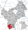
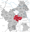
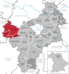
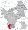
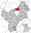
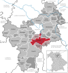
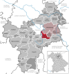
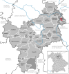
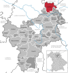
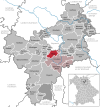
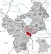
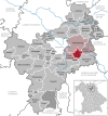
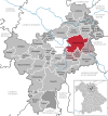
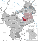
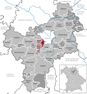
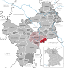
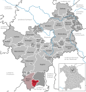
  • Karte: Zeigt die Lage der Gemeinde im Landkreis
  • Fläche: Fläche der Stadt beziehungsweise Gemeinde, angegeben in Quadratkilometer
  • Einwohner: Zahl der Menschen die in der Gemeinde beziehungsweise Stadt leben (Stand: 31. Dezember 2021[1])
  • EW-Dichte: Angegeben ist die Einwohnerdichte, gerechnet auf die Fläche der Verwaltungseinheit, angegeben in Einwohner pro km2 (Stand: 31. Dezember 2021[2])
  • Statistik: Link zur kommunalen Statistik des Bayerischen Landesamts für Statistik
  • Website: Website der der Gemeinde bzw. der Verwaltungsgemeinschaft

Gemeinden

VerwaltungseinheitWappenGTVGKarteFlächeEinwohnerEW-
Dichte
StatistikWebsite
Landkreis BayreuthWappen des Landkreises BayreuthDer Landkreis Bayreuth1273,7410364881[3][4]
Betzenstein, VGBetzensteinLage der Verwaltungsgemeinschaft Betzenstein im Landkreis Bayreuth67,15
(5.3 %)
3812
(3.7 %)
57
Creußen, VGCreußenLage der Verwaltungsgemeinschaft Creußen im Landkreis Bayreuth116,07
(9.1 %)
7937
(7.7 %)
68[5]
Hollfeld, VGHollfeldLage der Verwaltungsgemeinschaft Hollfeld im Landkreis Bayreuth124,08
(9.7 %)
7100
(6.9 %)
57[6]
Mistelbach, VGMistelbachLage der Verwaltungsgemeinschaft Mistelbach im Landkreis Bayreuth34,44
(2.7 %)
5171
(5 %)
150[7]
Mistelgau, VGMistelgauLage der Verwaltungsgemeinschaft Mistelgau im Landkreis Bayreuth44,04
(3.5 %)
5232
(5 %)
119
Weidenberg, VGWeidenbergLage der Verwaltungsgemeinschaft Weidenberg im Landkreis Bayreuth142,24
(11.2 %)
9366
(9 %)
66[8]
AhorntalWappen der Gemeinde Ahorntal26Lage der Gemeinde Ahorntal im Landkreis Bayreuth43,47
(3.4 %)
2192
(2.1 %)
50[9][10]
AufseßWappen der Gemeinde Aufseß10HollfeldLage der Gemeinde Aufseß im Landkreis Bayreuth29,41
(2.3 %)
1285
(1.2 %)
44[11][12]
Bad Berneck im Fichtelgebirge, StWappen der Gemeinde Bad Berneck im Fichtelgebirge38Lage der Gemeinde Bad Berneck im Fichtelgebirge im Landkreis Bayreuth38,26
(3 %)
4418
(4.3 %)
115[13][14]
Betzenstein, StWappen der Gemeinde Betzenstein24BetzensteinLage der Gemeinde Betzenstein im Landkreis Bayreuth51,85
(4.1 %)
2490
(2.4 %)
48[15][16]
BindlachWappen der Gemeinde Bindlach35Lage der Gemeinde Bindlach im Landkreis Bayreuth37,60
(3 %)
7344
(7.1 %)
195[17][18]
BischofsgrünWappen der Gemeinde Bischofsgrün15Lage der Gemeinde Bischofsgrün im Landkreis Bayreuth8,39
(0.7 %)
1855
(1.8 %)
221[19][20]
Creußen, StWappen der Gemeinde Creußen38CreußenLage der Gemeinde Creußen im Landkreis Bayreuth64,89
(5.1 %)
5026
(4.8 %)
77[21][22]
EckersdorfWappen der Gemeinde Eckersdorf24Lage der Gemeinde Eckersdorf im Landkreis Bayreuth36,17
(2.8 %)
5062
(4.9 %)
140[23][24]
EmtmannsbergWappen der Gemeinde Emtmannsberg21WeidenbergLage der Gemeinde Emtmannsberg im Landkreis Bayreuth22,33
(1.8 %)
1043
(1 %)
47[25][26]
FichtelbergWappen der Gemeinde Fichtelberg3Lage der Gemeinde Fichtelberg im Landkreis Bayreuth5,16
(0.4 %)
1773
(1.7 %)
344[27][28]
GefreesWappen der Gemeinde Gefrees44Lage der Gemeinde Gefrees im Landkreis Bayreuth50,30
(3.9 %)
4271
(4.1 %)
85[29][30]
GeseesWappen der Gemeinde Gesees7MistelbachLage der Gemeinde Gesees im Landkreis Bayreuth10,44
(0.8 %)
1279
(1.2 %)
123[31][32]
GlashüttenWappen der Gemeinde Glashütten2MistelgauLage der Gemeinde Glashütten im Landkreis Bayreuth3,53
(0.3 %)
1365
(1.3 %)
387[33][34]
Goldkronach, StWappen der Gemeinde Goldkronach29Lage der Gemeinde Goldkronach im Landkreis Bayreuth30,67
(2.4 %)
3444
(3.3 %)
112[35][36]
HaagWappen der Gemeinde Haag11CreußenLage der Gemeinde Haag im Landkreis Bayreuth15,89
(1.2 %)
957
(0.9 %)
60[37][38]
HeinersreuthWappen der Gemeinde Heinersreuth18Lage der Gemeinde Heinersreuth im Landkreis Bayreuth14,65
(1.2 %)
3756
(3.6 %)
256[39][40]
Hollfeld, StWappen der Gemeinde Hollfeld24HollfeldLage der Gemeinde Hollfeld im Landkreis Bayreuth80,66
(6.3 %)
4951
(4.8 %)
61[41][42]
HummeltalWappen der Gemeinde Hummeltal20MistelbachLage der Gemeinde Hummeltal im Landkreis Bayreuth21,91
(1.7 %)
2353
(2.3 %)
107[43][44]
KirchenpingartenWappen der Gemeinde Kirchenpingarten16WeidenbergLage der Gemeinde Kirchenpingarten im Landkreis Bayreuth33,55
(2.6 %)
1274
(1.2 %)
38[45][46]
MehlmeiselWappen der Gemeinde Mehlmeisel10Lage der Gemeinde Mehlmeisel im Landkreis Bayreuth13,23
(1 %)
1318
(1.3 %)
100[47][48]
MistelbachWappen der Gemeinde Mistelbach6MistelbachLage der Gemeinde Mistelbach im Landkreis Bayreuth6,13
(0.5 %)
1539
(1.5 %)
251[49][50]
MistelgauWappen der Gemeinde Mistelgau42MistelgauLage der Gemeinde Mistelgau im Landkreis Bayreuth42,52
(3.3 %)
3867
(3.7 %)
91[51][52]
Pegnitz, StWappen der Gemeinde Pegnitz49Lage der Gemeinde Pegnitz im Landkreis Bayreuth100,00
(7.9 %)
13298
(12.8 %)
133[53][54]
PlankenfelsWappen der Gemeinde Plankenfels14HollfeldLage der Gemeinde Plankenfels im Landkreis Bayreuth14,01
(1.1 %)
864
(0.8 %)
62[55][56]
Plech, MWappen der Gemeinde Plech6BetzensteinLage der Gemeinde Plech im Landkreis Bayreuth15,30
(1.2 %)
1322
(1.3 %)
86[57][58]
Pottenstein, StWappen der Gemeinde Pottenstein35Lage der Gemeinde Pottenstein im Landkreis Bayreuth73,29
(5.8 %)
5234
(5 %)
71[59][60]
Prebitzführt kein Wappen14CreußenLage der Gemeinde Prebitz im Landkreis Bayreuth21,00
(1.6 %)
991
(1 %)
47[61][62]
Schnabelwaid, MWappen der Gemeinde Schnabelwaid8CreußenLage der Gemeinde Schnabelwaid im Landkreis Bayreuth21,28
(1.7 %)
963
(0.9 %)
45[63][64]
SeybothenreuthWappen der Gemeinde Seybothenreuth8WeidenbergLage der Gemeinde Seybothenreuth im Landkreis Bayreuth17,44
(1.4 %)
1263
(1.2 %)
72[65][66]
SpeichersdorfWappen der Gemeinde Speichersdorf31Lage der Gemeinde Speichersdorf im Landkreis Bayreuth52,91
(4.2 %)
5813
(5.6 %)
110[67][68]
Waischenfeld, StWappen der Gemeinde Waischenfeld29Lage der Gemeinde Waischenfeld im Landkreis Bayreuth57,94
(4.5 %)
3037
(2.9 %)
52[69][70]
WarmensteinachWappen der Gemeinde Warmensteinach18Lage der Gemeinde Warmensteinach im Landkreis Bayreuth32,62
(2.6 %)
2215
(2.1 %)
68[71][72]
Weidenberg, MWappen der Gemeinde Weidenberg53WeidenbergLage der Gemeinde Weidenberg im Landkreis Bayreuth68,92
(5.4 %)
5786
(5.6 %)
84[73][74]

Siehe auch

Weblinks

Einzelnachweise

  1. Genesis Online-Datenbank des Bayerischen Landesamtes für Statistik Tabelle 12411-003r Fortschreibung des Bevölkerungsstandes: Gemeinden, Stichtag (Einwohnerzahlen auf Grundlage des Zensus 2011) (Hilfe dazu).
  2. Genesis Online-Datenbank des Bayerischen Landesamtes für Statistik Tabelle 12411-003r Fortschreibung des Bevölkerungsstandes: Gemeinden, Stichtag (Einwohnerzahlen auf Grundlage des Zensus 2011) (Hilfe dazu).
  3. Landkreis Bayreuth: Amtliche Statistik des LfStat
  4. https://www.landkreis-kulmbach.de/
  5. https://www.vg-creussen.de/
  6. https://www.hollfeld.de/buergerservice-und-politik/stadtrat/vg-hollfeld-aufsess-plankenfels/
  7. https://www.vg-mistelbach.de/
  8. https://www.weidenberg.de/
  9. Ahorntal: Amtliche Statistik des LfStat
  10. https://www.ahorntal.de/
  11. Aufseß: Amtliche Statistik des LfStat
  12. https://www.aufsess.de/
  13. Bad Berneck im Fichtelgebirge: Amtliche Statistik des LfStat
  14. https://bad-berneck.com/
  15. Betzenstein: Amtliche Statistik des LfStat
  16. https://www.betzenstein.de/
  17. Bindlach: Amtliche Statistik des LfStat
  18. https://www.bindlach.de/
  19. Bischofsgrün: Amtliche Statistik des LfStat
  20. https://bischofsgruen.de/
  21. Creußen: Amtliche Statistik des LfStat
  22. https://www.stadt-creussen.de/
  23. Eckersdorf: Amtliche Statistik des LfStat
  24. https://www.eckersdorf.de/
  25. Emtmannsberg: Amtliche Statistik des LfStat
  26. https://www.emtmannsberg.de/
  27. Fichtelberg: Amtliche Statistik des LfStat
  28. https://www.fichtelberg.de/
  29. Gefrees: Amtliche Statistik des LfStat
  30. https://www.gefrees.de/
  31. Gesees: Amtliche Statistik des LfStat
  32. https://www.gesees.de/
  33. Glashütten: Amtliche Statistik des LfStat
  34. https://www.glashuetten.de/
  35. Goldkronach: Amtliche Statistik des LfStat
  36. https://www.goldkronach.de/
  37. Haag: Amtliche Statistik des LfStat
  38. https://www.haag-oberfranken.de/
  39. Heinersreuth: Amtliche Statistik des LfStat
  40. http://www.heinersreuth.de/
  41. Hollfeld: Amtliche Statistik des LfStat
  42. https://www.hollfeld.de/
  43. Hummeltal: Amtliche Statistik des LfStat
  44. https://www.hummeltal.de/
  45. Kirchenpingarten: Amtliche Statistik des LfStat
  46. https://www.kirchenpingarten.de/
  47. Mehlmeisel: Amtliche Statistik des LfStat
  48. https://www.mehlmeisel.de/
  49. Mistelbach: Amtliche Statistik des LfStat
  50. https://www.mistelbach.de/
  51. Mistelgau: Amtliche Statistik des LfStat
  52. https://www.mistelgau.de/
  53. Pegnitz: Amtliche Statistik des LfStat
  54. https://www.pegnitz.de/
  55. Plankenfels: Amtliche Statistik des LfStat
  56. http://www.plankenfels.de/
  57. Plech: Amtliche Statistik des LfStat
  58. https://www.plech.de/
  59. Pottenstein: Amtliche Statistik des LfStat
  60. https://www.pottenstein.de/
  61. Prebitz: Amtliche Statistik des LfStat
  62. https://www.gemeinde-prebitz.de/
  63. Schnabelwaid: Amtliche Statistik des LfStat
  64. https://www.markt-schnabelwaid.de/
  65. Seybothenreuth: Amtliche Statistik des LfStat
  66. https://www.seybothenreuth.de/
  67. Speichersdorf: Amtliche Statistik des LfStat
  68. https://www.speichersdorf.de/
  69. Waischenfeld: Amtliche Statistik des LfStat
  70. https://www.waischenfeld.de/
  71. Warmensteinach: Amtliche Statistik des LfStat
  72. Archivierte Kopie (Memento des Originals vom 26. Februar 2021 im Internet Archive)  Info: Der Archivlink wurde automatisch eingesetzt und noch nicht geprüft. Bitte prüfe Original- und Archivlink gemäß Anleitung und entferne dann diesen Hinweis.@1@2Vorlage:Webachiv/IABot/warmensteinach.de
  73. Weidenberg: Amtliche Statistik des LfStat
  74. https://www.weidenberg.de/

Auf dieser Seite verwendete Medien

Fichtelberg in BT.svg
Deutsch (de): Lagekarte von Fichtelberg, Landkreis Bayreuth, Bayern, Deutschland.
English (en): Locator map of Fichtelberg in District of Bayreuth, Bavaria, Germany.
français (fr): Plan de localisation de la municipalité Fichtelberg dans l'arrondissement de Bayreuth dans Bavière, Allemagne.
hornjoserbsce (hsb): Poziciska karta gmejny Fichtelberg, Landkreis Bayreuth, Bayern, Němska.
македонски (mk): Положбена карта на Fichtelberg во рамките на Landkreis Bayreuth, Bayern, Германија.
Nederlands (nl): Detailkaart van Fichtelberg in de Landkreis Bayreuth, Bayern, Duitsland.
Esperanto (eo): Situomapo de Fichtelberg en Landkreis Bayreuth, Bayern, Germanio.
മലയാളം (ml): ജർമ്മനിയിലെ Bavaria, District of Bayreuth, Fichtelberg ഭൂപടസ്ഥാനം.
Pottenstein in BT.svg
Deutsch (de): Lagekarte von Pottenstein, Landkreis Bayreuth, Bayern, Deutschland.
English (en): Locator map of Pottenstein in District of Bayreuth, Bavaria, Germany.
français (fr): Plan de localisation de la municipalité Pottenstein dans l'arrondissement de Bayreuth dans Bavière, Allemagne.
hornjoserbsce (hsb): Poziciska karta gmejny Pottenstein, Landkreis Bayreuth, Bayern, Němska.
македонски (mk): Положбена карта на Pottenstein во рамките на Landkreis Bayreuth, Bayern, Германија.
Nederlands (nl): Detailkaart van Pottenstein in de Landkreis Bayreuth, Bayern, Duitsland.
Esperanto (eo): Situomapo de Pottenstein en Landkreis Bayreuth, Bayern, Germanio.
മലയാളം (ml): ജർമ്മനിയിലെ Bavaria, District of Bayreuth, Pottenstein ഭൂപടസ്ഥാനം.
Verwaltungsgemeinschaft Mistelgau in BT.svg
Deutsch (de): Lagekarte von Verwaltungsgemeinschaft Mistelgau, Landkreis Bayreuth, Bayern, Deutschland.
English (en): Locator map of Verwaltungsgemeinschaft Mistelgau in District of Bayreuth, Bavaria, Germany.
français (fr): Plan de localisation de la municipalité Verwaltungsgemeinschaft Mistelgau dans l'arrondissement de Bayreuth dans Bavière, Allemagne.
hornjoserbsce (hsb): Poziciska karta gmejny Verwaltungsgemeinschaft Mistelgau, Landkreis Bayreuth, Bayern, Němska.
македонски (mk): Положбена карта на Verwaltungsgemeinschaft Mistelgau во рамките на Landkreis Bayreuth, Bayern, Германија.
Nederlands (nl): Detailkaart van Verwaltungsgemeinschaft Mistelgau in de Landkreis Bayreuth, Bayern, Duitsland.
Esperanto (eo): Situomapo de Verwaltungsgemeinschaft Mistelgau en Landkreis Bayreuth, Bayern, Germanio.
മലയാളം (ml): ജർമ്മനിയിലെ Bavaria, District of Bayreuth, Verwaltungsgemeinschaft Mistelgau ഭൂപടസ്ഥാനം.
Glashütten in BT.svg
Deutsch (de): Lagekarte von Glashütten, Landkreis Bayreuth, Bayern, Deutschland.
English (en): Locator map of Glashütten in District of Bayreuth, Bavaria, Germany.
français (fr): Plan de localisation de la municipalité Glashütten dans l'arrondissement de Bayreuth dans Bavière, Allemagne.
hornjoserbsce (hsb): Poziciska karta gmejny Glashütten, Landkreis Bayreuth, Bayern, Němska.
македонски (mk): Положбена карта на Glashütten во рамките на Landkreis Bayreuth, Bayern, Германија.
Nederlands (nl): Detailkaart van Glashütten in de Landkreis Bayreuth, Bayern, Duitsland.
Esperanto (eo): Situomapo de Glashütten en Landkreis Bayreuth, Bayern, Germanio.
മലയാളം (ml): ജർമ്മനിയിലെ Bavaria, District of Bayreuth, Glashütten ഭൂപടസ്ഥാനം.
Mistelgau in BT.svg
Deutsch (de): Lagekarte von Mistelgau, Landkreis Bayreuth, Bayern, Deutschland.
English (en): Locator map of Mistelgau in District of Bayreuth, Bavaria, Germany.
français (fr): Plan de localisation de la municipalité Mistelgau dans l'arrondissement de Bayreuth dans Bavière, Allemagne.
hornjoserbsce (hsb): Poziciska karta gmejny Mistelgau, Landkreis Bayreuth, Bayern, Němska.
македонски (mk): Положбена карта на Mistelgau во рамките на Landkreis Bayreuth, Bayern, Германија.
Nederlands (nl): Detailkaart van Mistelgau in de Landkreis Bayreuth, Bayern, Duitsland.
Esperanto (eo): Situomapo de Mistelgau en Landkreis Bayreuth, Bayern, Germanio.
മലയാളം (ml): ജർമ്മനിയിലെ Bavaria, District of Bayreuth, Mistelgau ഭൂപടസ്ഥാനം.
Bavaria BT (district).svg
Deutsch (de): Lagekarte von Landkreis Bayreuth in Bayern, Deutschland.
English (en): Locator map of District of Bayreuth in Bavaria, Germany.
français (fr): Plan de localisation de l'arrondissement Landkreis Bayreuth dans le Land Bayern, Allemagne.
Nederlands (nl): Detailkaart van Landkreis Bayreuth in Bayern, Duitsland.
Esperanto (eo): Situomapo de [[:eo:{{{mun}}}|komunumo nekonata]] en Landkreis Bayreuth, Bayern, Germanio.
മലയാളം (ml): ജർമ്മനിയിലെ Bavaria District of Bayreuth, ഭൂപടസ്ഥാനം.
Warmensteinach in BT.svg
Deutsch (de): Lagekarte von Warmensteinach, Landkreis Bayreuth, Bayern, Deutschland.
English (en): Locator map of Warmensteinach in District of Bayreuth, Bavaria, Germany.
français (fr): Plan de localisation de la municipalité Warmensteinach dans l'arrondissement de Bayreuth dans Bavière, Allemagne.
hornjoserbsce (hsb): Poziciska karta gmejny Warmensteinach, Landkreis Bayreuth, Bayern, Němska.
македонски (mk): Положбена карта на Warmensteinach во рамките на Landkreis Bayreuth, Bayern, Германија.
Nederlands (nl): Detailkaart van Warmensteinach in de Landkreis Bayreuth, Bayern, Duitsland.
Esperanto (eo): Situomapo de Warmensteinach en Landkreis Bayreuth, Bayern, Germanio.
മലയാളം (ml): ജർമ്മനിയിലെ Bavaria, District of Bayreuth, Warmensteinach ഭൂപടസ്ഥാനം.
Verwaltungsgemeinschaft Hollfeld in BT.svg
Deutsch (de): Lagekarte von Verwaltungsgemeinschaft Hollfeld, Landkreis Bayreuth, Bayern, Deutschland.
English (en): Locator map of Verwaltungsgemeinschaft Hollfeld in District of Bayreuth, Bavaria, Germany.
français (fr): Plan de localisation de la municipalité Verwaltungsgemeinschaft Hollfeld dans l'arrondissement de Bayreuth dans Bavière, Allemagne.
hornjoserbsce (hsb): Poziciska karta gmejny Verwaltungsgemeinschaft Hollfeld, Landkreis Bayreuth, Bayern, Němska.
македонски (mk): Положбена карта на Verwaltungsgemeinschaft Hollfeld во рамките на Landkreis Bayreuth, Bayern, Германија.
Nederlands (nl): Detailkaart van Verwaltungsgemeinschaft Hollfeld in de Landkreis Bayreuth, Bayern, Duitsland.
Esperanto (eo): Situomapo de Verwaltungsgemeinschaft Hollfeld en Landkreis Bayreuth, Bayern, Germanio.
മലയാളം (ml): ജർമ്മനിയിലെ Bavaria, District of Bayreuth, Verwaltungsgemeinschaft Hollfeld ഭൂപടസ്ഥാനം.
Hummeltal in BT.svg
Deutsch (de): Lagekarte von Hummeltal, Landkreis Bayreuth, Bayern, Deutschland.
English (en): Locator map of Hummeltal in District of Bayreuth, Bavaria, Germany.
français (fr): Plan de localisation de la municipalité Hummeltal dans l'arrondissement de Bayreuth dans Bavière, Allemagne.
hornjoserbsce (hsb): Poziciska karta gmejny Hummeltal, Landkreis Bayreuth, Bayern, Němska.
македонски (mk): Положбена карта на Hummeltal во рамките на Landkreis Bayreuth, Bayern, Германија.
Nederlands (nl): Detailkaart van Hummeltal in de Landkreis Bayreuth, Bayern, Duitsland.
Esperanto (eo): Situomapo de Hummeltal en Landkreis Bayreuth, Bayern, Germanio.
മലയാളം (ml): ജർമ്മനിയിലെ Bavaria, District of Bayreuth, Hummeltal ഭൂപടസ്ഥാനം.
Goldkronach in BT.svg
Deutsch (de): Lagekarte von Goldkronach, Landkreis Bayreuth, Bayern, Deutschland.
English (en): Locator map of Goldkronach in District of Bayreuth, Bavaria, Germany.
français (fr): Plan de localisation de la municipalité Goldkronach dans l'arrondissement de Bayreuth dans Bavière, Allemagne.
hornjoserbsce (hsb): Poziciska karta gmejny Goldkronach, Landkreis Bayreuth, Bayern, Němska.
македонски (mk): Положбена карта на Goldkronach во рамките на Landkreis Bayreuth, Bayern, Германија.
Nederlands (nl): Detailkaart van Goldkronach in de Landkreis Bayreuth, Bayern, Duitsland.
Esperanto (eo): Situomapo de Goldkronach en Landkreis Bayreuth, Bayern, Germanio.
മലയാളം (ml): ജർമ്മനിയിലെ Bavaria, District of Bayreuth, Goldkronach ഭൂപടസ്ഥാനം.
Weidenberg in BT.svg
Deutsch (de): Lagekarte von Weidenberg, Landkreis Bayreuth, Bayern, Deutschland.
English (en): Locator map of Weidenberg in District of Bayreuth, Bavaria, Germany.
français (fr): Plan de localisation de la municipalité Weidenberg dans l'arrondissement de Bayreuth dans Bavière, Allemagne.
hornjoserbsce (hsb): Poziciska karta gmejny Weidenberg, Landkreis Bayreuth, Bayern, Němska.
македонски (mk): Положбена карта на Weidenberg во рамките на Landkreis Bayreuth, Bayern, Германија.
Nederlands (nl): Detailkaart van Weidenberg in de Landkreis Bayreuth, Bayern, Duitsland.
Esperanto (eo): Situomapo de Weidenberg en Landkreis Bayreuth, Bayern, Germanio.
മലയാളം (ml): ജർമ്മനിയിലെ Bavaria, District of Bayreuth, Weidenberg ഭൂപടസ്ഥാനം.
Heinersreuth in BT.svg
Deutsch (de): Lagekarte von Heinersreuth, Landkreis Bayreuth, Bayern, Deutschland.
English (en): Locator map of Heinersreuth in District of Bayreuth, Bavaria, Germany.
français (fr): Plan de localisation de la municipalité Heinersreuth dans l'arrondissement de Bayreuth dans Bavière, Allemagne.
hornjoserbsce (hsb): Poziciska karta gmejny Heinersreuth, Landkreis Bayreuth, Bayern, Němska.
македонски (mk): Положбена карта на Heinersreuth во рамките на Landkreis Bayreuth, Bayern, Германија.
Nederlands (nl): Detailkaart van Heinersreuth in de Landkreis Bayreuth, Bayern, Duitsland.
Esperanto (eo): Situomapo de Heinersreuth en Landkreis Bayreuth, Bayern, Germanio.
മലയാളം (ml): ജർമ്മനിയിലെ Bavaria, District of Bayreuth, Heinersreuth ഭൂപടസ്ഥാനം.
Bad Berneck im Fichtelgebirge in BT.svg
Deutsch (de): Lagekarte von Bad Berneck im Fichtelgebirge, Landkreis Bayreuth, Bayern, Deutschland.
English (en): Locator map of Bad Berneck im Fichtelgebirge in District of Bayreuth, Bavaria, Germany.
français (fr): Plan de localisation de la municipalité Bad Berneck im Fichtelgebirge dans l'arrondissement de Bayreuth dans Bavière, Allemagne.
hornjoserbsce (hsb): Poziciska karta gmejny Bad Berneck im Fichtelgebirge, Landkreis Bayreuth, Bayern, Němska.
македонски (mk): Положбена карта на Bad Berneck im Fichtelgebirge во рамките на Landkreis Bayreuth, Bayern, Германија.
Nederlands (nl): Detailkaart van Bad Berneck im Fichtelgebirge in de Landkreis Bayreuth, Bayern, Duitsland.
Esperanto (eo): Situomapo de Bad Berneck im Fichtelgebirge en Landkreis Bayreuth, Bayern, Germanio.
മലയാളം (ml): ജർമ്മനിയിലെ Bavaria, District of Bayreuth, Bad Berneck im Fichtelgebirge ഭൂപടസ്ഥാനം.
Emtmannsberg in BT.svg
Deutsch (de): Lagekarte von Emtmannsberg, Landkreis Bayreuth, Bayern, Deutschland.
English (en): Locator map of Emtmannsberg in District of Bayreuth, Bavaria, Germany.
français (fr): Plan de localisation de la municipalité Emtmannsberg dans l'arrondissement de Bayreuth dans Bavière, Allemagne.
hornjoserbsce (hsb): Poziciska karta gmejny Emtmannsberg, Landkreis Bayreuth, Bayern, Němska.
македонски (mk): Положбена карта на Emtmannsberg во рамките на Landkreis Bayreuth, Bayern, Германија.
Nederlands (nl): Detailkaart van Emtmannsberg in de Landkreis Bayreuth, Bayern, Duitsland.
Esperanto (eo): Situomapo de Emtmannsberg en Landkreis Bayreuth, Bayern, Germanio.
മലയാളം (ml): ജർമ്മനിയിലെ Bavaria, District of Bayreuth, Emtmannsberg ഭൂപടസ്ഥാനം.
Kirchenpingarten in BT.svg
Deutsch (de): Lagekarte von Kirchenpingarten, Landkreis Bayreuth, Bayern, Deutschland.
English (en): Locator map of Kirchenpingarten in District of Bayreuth, Bavaria, Germany.
français (fr): Plan de localisation de la municipalité Kirchenpingarten dans l'arrondissement de Bayreuth dans Bavière, Allemagne.
hornjoserbsce (hsb): Poziciska karta gmejny Kirchenpingarten, Landkreis Bayreuth, Bayern, Němska.
македонски (mk): Положбена карта на Kirchenpingarten во рамките на Landkreis Bayreuth, Bayern, Германија.
Nederlands (nl): Detailkaart van Kirchenpingarten in de Landkreis Bayreuth, Bayern, Duitsland.
Esperanto (eo): Situomapo de Kirchenpingarten en Landkreis Bayreuth, Bayern, Germanio.
മലയാളം (ml): ജർമ്മനിയിലെ Bavaria, District of Bayreuth, Kirchenpingarten ഭൂപടസ്ഥാനം.
Eckersdorf in BT.svg
Deutsch (de): Lagekarte von Eckersdorf, Landkreis Bayreuth, Bayern, Deutschland.
English (en): Locator map of Eckersdorf in District of Bayreuth, Bavaria, Germany.
français (fr): Plan de localisation de la municipalité Eckersdorf dans l'arrondissement de Bayreuth dans Bavière, Allemagne.
hornjoserbsce (hsb): Poziciska karta gmejny Eckersdorf, Landkreis Bayreuth, Bayern, Němska.
македонски (mk): Положбена карта на Eckersdorf во рамките на Landkreis Bayreuth, Bayern, Германија.
Nederlands (nl): Detailkaart van Eckersdorf in de Landkreis Bayreuth, Bayern, Duitsland.
Esperanto (eo): Situomapo de Eckersdorf en Landkreis Bayreuth, Bayern, Germanio.
മലയാളം (ml): ജർമ്മനിയിലെ Bavaria, District of Bayreuth, Eckersdorf ഭൂപടസ്ഥാനം.
Aufseß in BT.svg
Deutsch (de): Lagekarte von Aufseß, Landkreis Bayreuth, Bayern, Deutschland.
English (en): Locator map of Aufseß in District of Bayreuth, Bavaria, Germany.
français (fr): Plan de localisation de la municipalité Aufseß dans l'arrondissement de Bayreuth dans Bavière, Allemagne.
hornjoserbsce (hsb): Poziciska karta gmejny Aufseß, Landkreis Bayreuth, Bayern, Němska.
македонски (mk): Положбена карта на Aufseß во рамките на Landkreis Bayreuth, Bayern, Германија.
Nederlands (nl): Detailkaart van Aufseß in de Landkreis Bayreuth, Bayern, Duitsland.
Esperanto (eo): Situomapo de Aufseß en Landkreis Bayreuth, Bayern, Germanio.
മലയാളം (ml): ജർമ്മനിയിലെ Bavaria, District of Bayreuth, Aufseß ഭൂപടസ്ഥാനം.
Verwaltungsgemeinschaft Mistelbach in BT.svg
Deutsch (de): Lagekarte von Verwaltungsgemeinschaft Mistelbach, Landkreis Bayreuth, Bayern, Deutschland.
English (en): Locator map of Verwaltungsgemeinschaft Mistelbach in District of Bayreuth, Bavaria, Germany.
français (fr): Plan de localisation de la municipalité Verwaltungsgemeinschaft Mistelbach dans l'arrondissement de Bayreuth dans Bavière, Allemagne.
hornjoserbsce (hsb): Poziciska karta gmejny Verwaltungsgemeinschaft Mistelbach, Landkreis Bayreuth, Bayern, Němska.
македонски (mk): Положбена карта на Verwaltungsgemeinschaft Mistelbach во рамките на Landkreis Bayreuth, Bayern, Германија.
Nederlands (nl): Detailkaart van Verwaltungsgemeinschaft Mistelbach in de Landkreis Bayreuth, Bayern, Duitsland.
Esperanto (eo): Situomapo de Verwaltungsgemeinschaft Mistelbach en Landkreis Bayreuth, Bayern, Germanio.
മലയാളം (ml): ജർമ്മനിയിലെ Bavaria, District of Bayreuth, Verwaltungsgemeinschaft Mistelbach ഭൂപടസ്ഥാനം.
Verwaltungsgemeinschaft Weidenberg in BT.svg
Deutsch (de): Lagekarte von Verwaltungsgemeinschaft Weidenberg, Landkreis Bayreuth, Bayern, Deutschland.
English (en): Locator map of Verwaltungsgemeinschaft Weidenberg in District of Bayreuth, Bavaria, Germany.
français (fr): Plan de localisation de la municipalité Verwaltungsgemeinschaft Weidenberg dans l'arrondissement de Bayreuth dans Bavière, Allemagne.
hornjoserbsce (hsb): Poziciska karta gmejny Verwaltungsgemeinschaft Weidenberg, Landkreis Bayreuth, Bayern, Němska.
македонски (mk): Положбена карта на Verwaltungsgemeinschaft Weidenberg во рамките на Landkreis Bayreuth, Bayern, Германија.
Nederlands (nl): Detailkaart van Verwaltungsgemeinschaft Weidenberg in de Landkreis Bayreuth, Bayern, Duitsland.
Esperanto (eo): Situomapo de Verwaltungsgemeinschaft Weidenberg en Landkreis Bayreuth, Bayern, Germanio.
മലയാളം (ml): ജർമ്മനിയിലെ Bavaria, District of Bayreuth, Verwaltungsgemeinschaft Weidenberg ഭൂപടസ്ഥാനം.
Verwaltungsgemeinschaft Creußen in BT.svg
Deutsch (de): Lagekarte von Verwaltungsgemeinschaft Creußen, Landkreis Bayreuth, Bayern, Deutschland.
English (en): Locator map of Verwaltungsgemeinschaft Creußen in District of Bayreuth, Bavaria, Germany.
français (fr): Plan de localisation de la municipalité Verwaltungsgemeinschaft Creußen dans l'arrondissement de Bayreuth dans Bavière, Allemagne.
hornjoserbsce (hsb): Poziciska karta gmejny Verwaltungsgemeinschaft Creußen, Landkreis Bayreuth, Bayern, Němska.
македонски (mk): Положбена карта на Verwaltungsgemeinschaft Creußen во рамките на Landkreis Bayreuth, Bayern, Германија.
Nederlands (nl): Detailkaart van Verwaltungsgemeinschaft Creußen in de Landkreis Bayreuth, Bayern, Duitsland.
Esperanto (eo): Situomapo de Verwaltungsgemeinschaft Creußen en Landkreis Bayreuth, Bayern, Germanio.
മലയാളം (ml): ജർമ്മനിയിലെ Bavaria, District of Bayreuth, Verwaltungsgemeinschaft Creußen ഭൂപടസ്ഥാനം.
Betzenstein in BT.svg
Deutsch (de): Lagekarte von Betzenstein, Landkreis Bayreuth, Bayern, Deutschland.
English (en): Locator map of Betzenstein in District of Bayreuth, Bavaria, Germany.
français (fr): Plan de localisation de la municipalité Betzenstein dans l'arrondissement de Bayreuth dans Bavière, Allemagne.
hornjoserbsce (hsb): Poziciska karta gmejny Betzenstein, Landkreis Bayreuth, Bayern, Němska.
македонски (mk): Положбена карта на Betzenstein во рамките на Landkreis Bayreuth, Bayern, Германија.
Nederlands (nl): Detailkaart van Betzenstein in de Landkreis Bayreuth, Bayern, Duitsland.
Esperanto (eo): Situomapo de Betzenstein en Landkreis Bayreuth, Bayern, Germanio.
മലയാളം (ml): ജർമ്മനിയിലെ Bavaria, District of Bayreuth, Betzenstein ഭൂപടസ്ഥാനം.
Seybothenreuth in BT.svg
Deutsch (de): Lagekarte von Seybothenreuth, Landkreis Bayreuth, Bayern, Deutschland.
English (en): Locator map of Seybothenreuth in District of Bayreuth, Bavaria, Germany.
français (fr): Plan de localisation de la municipalité Seybothenreuth dans l'arrondissement de Bayreuth dans Bavière, Allemagne.
hornjoserbsce (hsb): Poziciska karta gmejny Seybothenreuth, Landkreis Bayreuth, Bayern, Němska.
македонски (mk): Положбена карта на Seybothenreuth во рамките на Landkreis Bayreuth, Bayern, Германија.
Nederlands (nl): Detailkaart van Seybothenreuth in de Landkreis Bayreuth, Bayern, Duitsland.
Esperanto (eo): Situomapo de Seybothenreuth en Landkreis Bayreuth, Bayern, Germanio.
മലയാളം (ml): ജർമ്മനിയിലെ Bavaria, District of Bayreuth, Seybothenreuth ഭൂപടസ്ഥാനം.
Pegnitz in BT.svg
Deutsch (de): Lagekarte von Pegnitz, Landkreis Bayreuth, Bayern, Deutschland.
English (en): Locator map of Pegnitz in District of Bayreuth, Bavaria, Germany.
français (fr): Plan de localisation de la municipalité Pegnitz dans l'arrondissement de Bayreuth dans Bavière, Allemagne.
hornjoserbsce (hsb): Poziciska karta gmejny Pegnitz, Landkreis Bayreuth, Bayern, Němska.
македонски (mk): Положбена карта на Pegnitz во рамките на Landkreis Bayreuth, Bayern, Германија.
Nederlands (nl): Detailkaart van Pegnitz in de Landkreis Bayreuth, Bayern, Duitsland.
Esperanto (eo): Situomapo de Pegnitz en Landkreis Bayreuth, Bayern, Germanio.
മലയാളം (ml): ജർമ്മനിയിലെ Bavaria, District of Bayreuth, Pegnitz ഭൂപടസ്ഥാനം.
Ahorntal in BT.svg
Deutsch (de): Lagekarte von Ahorntal, Landkreis Bayreuth, Bayern, Deutschland.
English (en): Locator map of Ahorntal in District of Bayreuth, Bavaria, Germany.
français (fr): Plan de localisation de la municipalité Ahorntal dans l'arrondissement de Bayreuth dans Bavière, Allemagne.
hornjoserbsce (hsb): Poziciska karta gmejny Ahorntal, Landkreis Bayreuth, Bayern, Němska.
македонски (mk): Положбена карта на Ahorntal во рамките на Landkreis Bayreuth, Bayern, Германија.
Nederlands (nl): Detailkaart van Ahorntal in de Landkreis Bayreuth, Bayern, Duitsland.
Esperanto (eo): Situomapo de Ahorntal en Landkreis Bayreuth, Bayern, Germanio.
മലയാളം (ml): ജർമ്മനിയിലെ Bavaria, District of Bayreuth, Ahorntal ഭൂപടസ്ഥാനം.
Bindlach in BT.svg
Deutsch (de): Lagekarte von Bindlach, Landkreis Bayreuth, Bayern, Deutschland.
English (en): Locator map of Bindlach in District of Bayreuth, Bavaria, Germany.
français (fr): Plan de localisation de la municipalité Bindlach dans l'arrondissement de Bayreuth dans Bavière, Allemagne.
hornjoserbsce (hsb): Poziciska karta gmejny Bindlach, Landkreis Bayreuth, Bayern, Němska.
македонски (mk): Положбена карта на Bindlach во рамките на Landkreis Bayreuth, Bayern, Германија.
Nederlands (nl): Detailkaart van Bindlach in de Landkreis Bayreuth, Bayern, Duitsland.
Esperanto (eo): Situomapo de Bindlach en Landkreis Bayreuth, Bayern, Germanio.
മലയാളം (ml): ജർമ്മനിയിലെ Bavaria, District of Bayreuth, Bindlach ഭൂപടസ്ഥാനം.
Gesees in BT.svg
Deutsch (de): Lagekarte von Gesees, Landkreis Bayreuth, Bayern, Deutschland.
English (en): Locator map of Gesees in District of Bayreuth, Bavaria, Germany.
français (fr): Plan de localisation de la municipalité Gesees dans l'arrondissement de Bayreuth dans Bavière, Allemagne.
hornjoserbsce (hsb): Poziciska karta gmejny Gesees, Landkreis Bayreuth, Bayern, Němska.
македонски (mk): Положбена карта на Gesees во рамките на Landkreis Bayreuth, Bayern, Германија.
Nederlands (nl): Detailkaart van Gesees in de Landkreis Bayreuth, Bayern, Duitsland.
Esperanto (eo): Situomapo de Gesees en Landkreis Bayreuth, Bayern, Germanio.
മലയാളം (ml): ജർമ്മനിയിലെ Bavaria, District of Bayreuth, Gesees ഭൂപടസ്ഥാനം.
Verwaltungsgemeinschaft Betzenstein in BT.svg
Deutsch (de): Lagekarte von Verwaltungsgemeinschaft Betzenstein, Landkreis Bayreuth, Bayern, Deutschland.
English (en): Locator map of Verwaltungsgemeinschaft Betzenstein in District of Bayreuth, Bavaria, Germany.
français (fr): Plan de localisation de la municipalité Verwaltungsgemeinschaft Betzenstein dans l'arrondissement de Bayreuth dans Bavière, Allemagne.
hornjoserbsce (hsb): Poziciska karta gmejny Verwaltungsgemeinschaft Betzenstein, Landkreis Bayreuth, Bayern, Němska.
македонски (mk): Положбена карта на Verwaltungsgemeinschaft Betzenstein во рамките на Landkreis Bayreuth, Bayern, Германија.
Nederlands (nl): Detailkaart van Verwaltungsgemeinschaft Betzenstein in de Landkreis Bayreuth, Bayern, Duitsland.
Esperanto (eo): Situomapo de Verwaltungsgemeinschaft Betzenstein en Landkreis Bayreuth, Bayern, Germanio.
മലയാളം (ml): ജർമ്മനിയിലെ Bavaria, District of Bayreuth, Verwaltungsgemeinschaft Betzenstein ഭൂപടസ്ഥാനം.
Prebitz in BT.svg
Deutsch (de): Lagekarte von Prebitz, Landkreis Bayreuth, Bayern, Deutschland.
English (en): Locator map of Prebitz in District of Bayreuth, Bavaria, Germany.
français (fr): Plan de localisation de la municipalité Prebitz dans l'arrondissement de Bayreuth dans Bavière, Allemagne.
hornjoserbsce (hsb): Poziciska karta gmejny Prebitz, Landkreis Bayreuth, Bayern, Němska.
македонски (mk): Положбена карта на Prebitz во рамките на Landkreis Bayreuth, Bayern, Германија.
Nederlands (nl): Detailkaart van Prebitz in de Landkreis Bayreuth, Bayern, Duitsland.
Esperanto (eo): Situomapo de Prebitz en Landkreis Bayreuth, Bayern, Germanio.
മലയാളം (ml): ജർമ്മനിയിലെ Bavaria, District of Bayreuth, Prebitz ഭൂപടസ്ഥാനം.
Hollfeld in BT.svg
Deutsch (de): Lagekarte von Hollfeld, Landkreis Bayreuth, Bayern, Deutschland.
English (en): Locator map of Hollfeld in District of Bayreuth, Bavaria, Germany.
français (fr): Plan de localisation de la municipalité Hollfeld dans l'arrondissement de Bayreuth dans Bavière, Allemagne.
hornjoserbsce (hsb): Poziciska karta gmejny Hollfeld, Landkreis Bayreuth, Bayern, Němska.
македонски (mk): Положбена карта на Hollfeld во рамките на Landkreis Bayreuth, Bayern, Германија.
Nederlands (nl): Detailkaart van Hollfeld in de Landkreis Bayreuth, Bayern, Duitsland.
Esperanto (eo): Situomapo de Hollfeld en Landkreis Bayreuth, Bayern, Germanio.
മലയാളം (ml): ജർമ്മനിയിലെ Bavaria, District of Bayreuth, Hollfeld ഭൂപടസ്ഥാനം.
Plech in BT.svg
Deutsch (de): Lagekarte von Plech, Landkreis Bayreuth, Bayern, Deutschland.
English (en): Locator map of Plech in District of Bayreuth, Bavaria, Germany.
français (fr): Plan de localisation de la municipalité Plech dans l'arrondissement de Bayreuth dans Bavière, Allemagne.
hornjoserbsce (hsb): Poziciska karta gmejny Plech, Landkreis Bayreuth, Bayern, Němska.
македонски (mk): Положбена карта на Plech во рамките на Landkreis Bayreuth, Bayern, Германија.
Nederlands (nl): Detailkaart van Plech in de Landkreis Bayreuth, Bayern, Duitsland.
Esperanto (eo): Situomapo de Plech en Landkreis Bayreuth, Bayern, Germanio.
മലയാളം (ml): ജർമ്മനിയിലെ Bavaria, District of Bayreuth, Plech ഭൂപടസ്ഥാനം.
Waischenfeld in BT.svg
Deutsch (de): Lagekarte von Waischenfeld, Landkreis Bayreuth, Bayern, Deutschland.
English (en): Locator map of Waischenfeld in District of Bayreuth, Bavaria, Germany.
français (fr): Plan de localisation de la municipalité Waischenfeld dans l'arrondissement de Bayreuth dans Bavière, Allemagne.
hornjoserbsce (hsb): Poziciska karta gmejny Waischenfeld, Landkreis Bayreuth, Bayern, Němska.
македонски (mk): Положбена карта на Waischenfeld во рамките на Landkreis Bayreuth, Bayern, Германија.
Nederlands (nl): Detailkaart van Waischenfeld in de Landkreis Bayreuth, Bayern, Duitsland.
Esperanto (eo): Situomapo de Waischenfeld en Landkreis Bayreuth, Bayern, Germanio.
മലയാളം (ml): ജർമ്മനിയിലെ Bavaria, District of Bayreuth, Waischenfeld ഭൂപടസ്ഥാനം.
Schnabelwaid in BT.svg
Deutsch (de): Lagekarte von Schnabelwaid, Landkreis Bayreuth, Bayern, Deutschland.
English (en): Locator map of Schnabelwaid in District of Bayreuth, Bavaria, Germany.
français (fr): Plan de localisation de la municipalité Schnabelwaid dans l'arrondissement de Bayreuth dans Bavière, Allemagne.
hornjoserbsce (hsb): Poziciska karta gmejny Schnabelwaid, Landkreis Bayreuth, Bayern, Němska.
македонски (mk): Положбена карта на Schnabelwaid во рамките на Landkreis Bayreuth, Bayern, Германија.
Nederlands (nl): Detailkaart van Schnabelwaid in de Landkreis Bayreuth, Bayern, Duitsland.
Esperanto (eo): Situomapo de Schnabelwaid en Landkreis Bayreuth, Bayern, Germanio.
മലയാളം (ml): ജർമ്മനിയിലെ Bavaria, District of Bayreuth, Schnabelwaid ഭൂപടസ്ഥാനം.
Haag in BT.svg
Deutsch (de): Lagekarte von Haag, Landkreis Bayreuth, Bayern, Deutschland.
English (en): Locator map of Haag in District of Bayreuth, Bavaria, Germany.
français (fr): Plan de localisation de la municipalité Haag dans l'arrondissement de Bayreuth dans Bavière, Allemagne.
hornjoserbsce (hsb): Poziciska karta gmejny Haag, Landkreis Bayreuth, Bayern, Němska.
македонски (mk): Положбена карта на Haag во рамките на Landkreis Bayreuth, Bayern, Германија.
Nederlands (nl): Detailkaart van Haag in de Landkreis Bayreuth, Bayern, Duitsland.
Esperanto (eo): Situomapo de Haag en Landkreis Bayreuth, Bayern, Germanio.
മലയാളം (ml): ജർമ്മനിയിലെ Bavaria, District of Bayreuth, Haag ഭൂപടസ്ഥാനം.
Mehlmeisel in BT.svg
Deutsch (de): Lagekarte von Mehlmeisel, Landkreis Bayreuth, Bayern, Deutschland.
English (en): Locator map of Mehlmeisel in District of Bayreuth, Bavaria, Germany.
français (fr): Plan de localisation de la municipalité Mehlmeisel dans l'arrondissement de Bayreuth dans Bavière, Allemagne.
hornjoserbsce (hsb): Poziciska karta gmejny Mehlmeisel, Landkreis Bayreuth, Bayern, Němska.
македонски (mk): Положбена карта на Mehlmeisel во рамките на Landkreis Bayreuth, Bayern, Германија.
Nederlands (nl): Detailkaart van Mehlmeisel in de Landkreis Bayreuth, Bayern, Duitsland.
Esperanto (eo): Situomapo de Mehlmeisel en Landkreis Bayreuth, Bayern, Germanio.
മലയാളം (ml): ജർമ്മനിയിലെ Bavaria, District of Bayreuth, Mehlmeisel ഭൂപടസ്ഥാനം.
Speichersdorf in BT.svg
Deutsch (de): Lagekarte von Speichersdorf, Landkreis Bayreuth, Bayern, Deutschland.
English (en): Locator map of Speichersdorf in District of Bayreuth, Bavaria, Germany.
français (fr): Plan de localisation de la municipalité Speichersdorf dans l'arrondissement de Bayreuth dans Bavière, Allemagne.
hornjoserbsce (hsb): Poziciska karta gmejny Speichersdorf, Landkreis Bayreuth, Bayern, Němska.
македонски (mk): Положбена карта на Speichersdorf во рамките на Landkreis Bayreuth, Bayern, Германија.
Nederlands (nl): Detailkaart van Speichersdorf in de Landkreis Bayreuth, Bayern, Duitsland.
Esperanto (eo): Situomapo de Speichersdorf en Landkreis Bayreuth, Bayern, Germanio.
മലയാളം (ml): ജർമ്മനിയിലെ Bavaria, District of Bayreuth, Speichersdorf ഭൂപടസ്ഥാനം.
Creußen in BT.svg
Deutsch (de): Lagekarte von Creußen, Landkreis Bayreuth, Bayern, Deutschland.
English (en): Locator map of Creußen in District of Bayreuth, Bavaria, Germany.
français (fr): Plan de localisation de la municipalité Creußen dans l'arrondissement de Bayreuth dans Bavière, Allemagne.
hornjoserbsce (hsb): Poziciska karta gmejny Creußen, Landkreis Bayreuth, Bayern, Němska.
македонски (mk): Положбена карта на Creußen во рамките на Landkreis Bayreuth, Bayern, Германија.
Nederlands (nl): Detailkaart van Creußen in de Landkreis Bayreuth, Bayern, Duitsland.
Esperanto (eo): Situomapo de Creußen en Landkreis Bayreuth, Bayern, Germanio.
മലയാളം (ml): ജർമ്മനിയിലെ Bavaria, District of Bayreuth, Creußen ഭൂപടസ്ഥാനം.
Municipalities in BT.svg
Deutsch (de): Lagekarte von Landkreis Bayreuth in Bayern, Deutschland.
English (en): Locator map of District of Bayreuth in Bavaria, Germany.
français (fr): Plan de localisation de l'arrondissement de Bayreuth dans le Land Bavière, Allemagne.
Nederlands (nl): Detailkaart van Landkreis Bayreuth in Bayern, Duitsland.
Esperanto (eo): Situomapo de komunumo nekonata en Landkreis Bayreuth, Bayern, Germanio.
മലയാളം (ml): ജർമ്മനിയിലെ Bavaria District of Bayreuth, ഭൂപടസ്ഥാനം.
DEU Warmensteinach COA.svg
Wappen von Warmensteinach. Blasonierung: „In Silber über grünem Dreiberg zwischen zwei grünen Nadelbäumen eine blaue Wellendeichsel, die oben eine rote Glasschale einschließt.“
Wappen von Goldkronach.svg
Wappen der Stadt Goldkronach, Landkreis Bayreuth, Bayern
„Geviert; 1: schräg geteilt von Schwarz und Silber; 2 und 3: schräglinks geteilt von Rot und Silber, in Rot je eine goldene Königskrone; 4: schräg geteilt von Silber und Schwarz“
Flagge
Gelb-Rot (1959)
Plankenfels in BT.svg
Deutsch (de): Lagekarte von Plankenfels, Landkreis Bayreuth, Bayern, Deutschland.
English (en): Locator map of Plankenfels in District of Bayreuth, Bavaria, Germany.
français (fr): Plan de localisation de la municipalité Plankenfels dans l'arrondissement de Bayreuth dans Bavière, Allemagne.
hornjoserbsce (hsb): Poziciska karta gmejny Plankenfels, Landkreis Bayreuth, Bayern, Němska.
македонски (mk): Положбена карта на Plankenfels во рамките на Landkreis Bayreuth, Bayern, Германија.
Nederlands (nl): Detailkaart van Plankenfels in de Landkreis Bayreuth, Bayern, Duitsland.
Esperanto (eo): Situomapo de Plankenfels en Landkreis Bayreuth, Bayern, Germanio.
മലയാളം (ml): ജർമ്മനിയിലെ Bavaria, District of Bayreuth, Plankenfels ഭൂപടസ്ഥാനം.
Mistelbach in BT.svg
Deutsch (de): Lagekarte von Mistelbach, Landkreis Bayreuth, Bayern, Deutschland.
English (en): Locator map of Mistelbach in District of Bayreuth, Bavaria, Germany.
français (fr): Plan de localisation de la municipalité Mistelbach dans l'arrondissement de Bayreuth dans Bavière, Allemagne.
hornjoserbsce (hsb): Poziciska karta gmejny Mistelbach, Landkreis Bayreuth, Bayern, Němska.
македонски (mk): Положбена карта на Mistelbach во рамките на Landkreis Bayreuth, Bayern, Германија.
Nederlands (nl): Detailkaart van Mistelbach in de Landkreis Bayreuth, Bayern, Duitsland.
Esperanto (eo): Situomapo de Mistelbach en Landkreis Bayreuth, Bayern, Germanio.
മലയാളം (ml): ജർമ്മനിയിലെ Bavaria, District of Bayreuth, Mistelbach ഭൂപടസ്ഥാനം.
Bischofsgrün in BT.svg
Deutsch (de): Lagekarte von Bischofsgrün, Landkreis Bayreuth, Bayern, Deutschland.
English (en): Locator map of Bischofsgrün in District of Bayreuth, Bavaria, Germany.
français (fr): Plan de localisation de la municipalité Bischofsgrün dans l'arrondissement de Bayreuth dans Bavière, Allemagne.
hornjoserbsce (hsb): Poziciska karta gmejny Bischofsgrün, Landkreis Bayreuth, Bayern, Němska.
македонски (mk): Положбена карта на Bischofsgrün во рамките на Landkreis Bayreuth, Bayern, Германија.
Nederlands (nl): Detailkaart van Bischofsgrün in de Landkreis Bayreuth, Bayern, Duitsland.
Esperanto (eo): Situomapo de Bischofsgrün en Landkreis Bayreuth, Bayern, Germanio.
മലയാളം (ml): ജർമ്മനിയിലെ Bavaria, District of Bayreuth, Bischofsgrün ഭൂപടസ്ഥാനം.
Gefrees in BT.svg
Deutsch (de): Lagekarte von Gefrees, Landkreis Bayreuth, Bayern, Deutschland.
English (en): Locator map of Gefrees in District of Bayreuth, Bavaria, Germany.
français (fr): Plan de localisation de la municipalité Gefrees dans l'arrondissement de Bayreuth dans Bavière, Allemagne.
hornjoserbsce (hsb): Poziciska karta gmejny Gefrees, Landkreis Bayreuth, Bayern, Němska.
македонски (mk): Положбена карта на Gefrees во рамките на Landkreis Bayreuth, Bayern, Германија.
Nederlands (nl): Detailkaart van Gefrees in de Landkreis Bayreuth, Bayern, Duitsland.
Esperanto (eo): Situomapo de Gefrees en Landkreis Bayreuth, Bayern, Germanio.
മലയാളം (ml): ജർമ്മനിയിലെ Bavaria, District of Bayreuth, Gefrees ഭൂപടസ്ഥാനം.