Liste der Explorer-Missionen
Die Liste der Explorer-Missionen führt chronologisch geordnet alle Satelliten auf, die im Explorer-Programm der NASA realisiert wurden. Dabei werden auch die Satelliten genannt, die aufgrund des Versagens der Trägerrakete keine Umlaufbahn erreicht haben. Nicht enthalten sind Missionen, die vor dem Start gestrichen wurden oder aus dem Explorer-Programm in ein anderes Satellitenprogramm überführt wurden.
Überblick
Bis zum Jahr 2019 wurden 105 Explorer-Satelliten gestartet, davon 94 erfolgreich. Mindestens vier weitere Missionen mit acht Einzelsatelliten sind für die nächsten Jahre geplant.
| Forschungsgebiet | Erfolge | Fehlstarts | Geplant |
|---|---|---|---|
| Atmosphärendichte | 4 | 3 | 0 |
| Erdatmosphärenforschung | 10 | 0 | 0 |
| Exoplanetenforschung | 1 | 0 | 0 |
| Gammaastronomie | 4 | 0 | 0 |
| Geowissenschaften | 2 | 0 | 0 |
| Infrarotastronomie | 2 | 0 | 1 |
| Ionosphärenforschung | 11 | 5 | 0 |
| Kosmische Strahlung / energetische Partikel | 7 | 3 | 0 |
| Magnetosphärenforschung | 26 | 0 | 2 |
| Mikrometeoriten | 4 | 1 | 0 |
| Mikrowellenastronomie | 3 | 0 | 0 |
| Radioastronomie | 2 | 0 | 0 |
| Röntgenastronomie | 4 | 0 | 1 |
| Satellitengeodäsie | 2 | 0 | 0 |
| Sonnenforschung | 6 | 0 | 4 |
| Ultraviolettastronomie | 5 | 0 | 0 |
| Gesamt | 94 | 11 | 8 |
Missionen
Stand der Liste: 29. Januar 2021
1950er – 1960er – 1970er – 1980er – 1990er – 2000er – 2010er – 2020er – Geplante Missionen
| Explorer | Name | Datum | Startrakete | Startort | Orbit (Apogäum, Perigäum, Inklination) | Masse | Beschreibung | Bild |
|---|---|---|---|---|---|---|---|---|
| 1950er | ||||||||
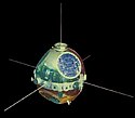
| Explorer 1 | 1. Februar 1958 | Juno I | CC | 356 km 2.548 km 33,24° | 14 kg | Explorer 1 war die erste geglückte amerikanische Satellitenmission. |  | |
| Explorer 2 | 5. März 1958 | Juno I | CC | Fehlstart | 14 kg | Satellit zur Erforschung der Ionosphäre. Weitgehend baugleich mit Explorer-1, -3, -4 und -5. |  | |
| Explorer 3 | 26. März 1958 | Juno I | CC | 186 km 2.799 km 33,38° | 14 kg | Satellit zur Erforschung der Ionosphäre. Weitgehend baugleich mit Explorer-1, -2, -4 und -5. |  | |
| Explorer 4 | 26. Juli 1958 | Juno I | CC | 263 km 2.213 km 50,25° | 17 kg | Satellit zur Erforschung der Ionosphäre. Weitgehend baugleich mit Explorer-1, -2, -3 und -5. |  | |
| Explorer 5 | 24. August 1958 | Juno I | CC | Fehlstart | 17 kg | Satellit zur Erforschung der Ionosphäre. Weitgehend baugleich mit Explorer-1, -2, -3 und -4. |  | |
| Nach Explorer 5 wurde die Explorer-Bezeichnung nur noch nach erfolgreichen Starts vergeben. Jeder Explorer-Satellit trägt eine Subbezeichnung – je nach dem welchem wissenschaftlichen Projekt er angehörte. | ||||||||
| S-1 | 16. Juli 1959 | Juno II | CC | Fehlstart | 41 kg | Forschungen zur kosmischen Strahlung und energetischen Partikeln |  | |
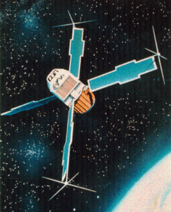
| Explorer 6 | S-2 | 7. August 1959 | Thor-DM18 Able-3 | CC | 245 km 42.400 km 47,00° | 64 kg | Untersuchung des Geomagnetismus und die Ausbreitung von Radiowellen in der höheren Atmosphäre. |  |
| Explorer 7 | S-1a | 13. Oktober 1959 | Juno II | CC | 560 km 1.090 km 50,27° | 41 kg | Forschungen zur kosmischen Strahlung und energetischen Partikeln. Weitgehend baugleich mit S-1. |  |
| 1960er | ||||||||
| S-46 | 23. März 1960 | Juno II | CC | Fehlstart | 41 kg | Satellit zur Messung der Elektronen- und Protonen-Energien in den Strahlungsgürteln. |  | |
| Explorer 8 | S-30 | 3. November 1960 | Juno II | CC | 416 km 2.290 km 49,98° | 41 kg | Erforschung der Ionosphäre. |  |
| S-56 | 4. Dezember 1960 | Scout-X1 | WFF | Fehlstart | 7 kg | Ballonsatellit zur Messung der Atmosphärendichte. |  | |
| Explorer 9 | S-56a | 16. Februar 1961 | Scout-X1 | WFF | 634 km 2.583 km 38,86° | 7 kg | Ballonsatellit zur Messung der Atmosphärendichte. |  |
| S-45 | 24. Februar 1961 | Juno II | CC | Fehlstart | 34 kg | Erforschung der Form der Ionosphäre |  | |
| Explorer 10 | P-14 | 25. März 1961 | Delta | CC | 221 km 181.100 km 33,00° | 35 kg | Untersuchung der Magnetfelder der Erde |  |
| Explorer 11 | S-15 | 27. April 1961 | Juno II | CC | 487 km 1.779 km 28,80° | 43 kg | Erster Gammaastronomiesatellit |  |
| S-45a | 25. Mai 1961 | Juno II | CC | Fehlstart | 41 kg | Erforschung der Form der Ionosphäre |  | |
| S-55 | 30. Juni 1961 | Scout-X1 | WFF | Fehlstart | 85 kg | Messung der Mikrometeoritenhäufigkeit. |  | |
| Explorer 12 | EPE-A | 16. August 1961 | Delta | CC | 314 km 77.310 km 33,10° | 38 kg | Energetic Particles Explorer: Erforschung engergetischer Partikel in der Magnetosphäre. |  |
| Explorer 13 | S-55a | 25. August 1961 | Scout-X1 | WFF | 125 km 1.164 km 37,70° | 85 kg | Messung der Mikrometeoritenhäufigkeit. Zu niedrige Umlaufbahn, Missionsfehlschlag. |  |
| Explorer 14 | EPE-B | 2. Oktober 1961 | Delta-A | CC | 281 km 98.530 km 32,95° | 40 kg | Energetic Particles Explorer: Erforschung engergetischer Partikel in der Magnetosphäre. |  |
| Explorer 15 | EPE-C | 27. Oktober 1962 | Delta-A | CC | 313 km 17.640 km 18,02° | 45 kg | Energetic Particles Explorer: Erforschung engergetischer Partikel in der Magnetosphäre. |  |
| Explorer 16 | S-55b | 16. Dezember 1962 | Scout-X3 | WFF | 750 km 1.181 km 52,01° | 101 kg | Messung der Mikrometeoritenhäufigkeit. |  |
| Explorer 17 | AE-A | 3. April 1963 | Delta-C | CC | 255 km 917 km 57,63° | 184 kg | Atmosphere Explorer: Erforschung der oberen Atmosphäre |  |
| Explorer 18 | IMP-A, IMP-1 | 27. November 1963 | Delta-C | CC | 192 km 197.616 km 33,34° | 62 kg | Interplanetary Monitoring Platform: hochelliptische Umlaufbahn zur Erforschung der Magnetosphäre. |  |
| Explorer 19 | AD-A | 19. Dezember 1963 | Scout-X4 | VAFB | 590 km 2.394 km 78,62° | 7 kg | Air Density Explorer: Ballonsatellit zur Messung der Atmosphärendichte. |  |
| BE-A | 19. März 1964 | Delta-B | CC | Fehlstart | 120 kg | Beacon Explorer: Erforschung der Ionosphäre |  | |
| Explorer 20 | IE-A | 28. August 1964 | Scout-X4 | VAFB | 871 km 1.018 km 79,87° | 44 kg | Ionosphere Explorer: Erforschung der Ionosphäre |  |
| Explorer 21 | IMP-B, IMP-2 | 4. Oktober 1964 | Delta-C | CC | 190 km 95.592 km 33,53° | 62 kg | Interplanetary Monitoring Platform: hochelliptische Umlaufbahn zur Erforschung der Magnetosphäre. |  |
| Explorer 22 | BE-B | 10. Oktober 1964 | Scout-X4 | VAFB | 889 km 1.081 km 79,69° | 60 kg | Beacon Explorer: Erforschung der Ionosphäre. |  |
| Explorer 23 | S-55c | 6. November 1964 | Scout-X4 | WFF | 466 km 977 km 51,95° | 134 kg | Messung der Mikrometeoritenhäufigkeit. |  |
| Explorer 24 | AD-B | 21. November 1964 | Scout-X4 | VAFB | 525 km 2.498 km 81,36° | 9 kg | Air Density Explorer: Ballonsatellit zur Messung der Atmosphärendichte. |  |
| Explorer 25 | IE-B, Injun-4 | 522 km 2.494 km 81,36° | 40 kg | Ionosphere Explorer: Erforschung der Ionosphäre. | ||||
| Explorer 26 | EPE-D | 21. Dezember 1964 | Delta-C | CC | 316 km 26.191 km 20,14° | 46 kg | Energetic Particles Explorer: Erforschung engergetischer Partikel in der Magnetosphäre. |  |
| Explorer 27 | BE-C | 29. April 1965 | Scout-X4 | WFF | 941 km 1.317 km 41,19° | 60 kg | Beacon Explorer: Erforschung der Ionosphäre. |  |
| Explorer 28 | IMP-C, IMP-3 | 29. Mai 1965 | Delta-C | CC | 229 km 261.206 km 30,50° | 59 kg | Interplanetary Monitoring Platform: hochelliptische Umlaufbahn zur Erforschung der Magnetosphäre. |  |
| Explorer 29 | GEOS-A | 6. November 1965 | Delta-E | CC | 1.115 km 2.277 km 59,38° | 175 kg | Geodetic Earth Orbiting Satellite: geodätische Vermessung der Erde. |  |
| Explorer 30 | SE-A, Solrad-8, IQSY | 19. November 1965 | Scout-X4 | WFF | 704 km 891 km 59,72° | 57 kg | Solar Explorer: Sonnenforschung in Zusammenarbeit mit dem Naval Research Laboratory. |  |
| Explorer 31 | DME-A | 29. November 1965 | Thor-DM21 Agena-B | VAFB | 505 km 2.978 km 79,82° | 98 kg | Direct Measurement Explorer: Erforschung der Ionosphäre, Start zusammen mit Alouette 2 |  |
| Explorer 32 | AE-B | 25. Mai 1966 | Delta-C1 | CC | 289 km 2.716 km 64,66° | 225 kg | Atmosphere Explorer: Erforschung der oberen Atmosphäre. |  |
| Explorer 33 | IMP-D, AIMP-1 | 1. Juli 1966 | Delta-E1 | CC | 30.532 km 494.230 km 29,00° | 212 kg | Interplanetary Monitoring Platform: Geplanter Mondsatellit zur Erforschung der Magnetosphäre. |  |
| Explorer 34 | IMP-F, IMP-4 | 24. Mai 1967 | Delta-E1 | VAFB | 4.006 km 207.380 km 66,97° | 75 kg | Interplanetary Monitoring Platform: hochelliptische Umlaufbahn zur Erforschung der Magnetosphäre. |  |
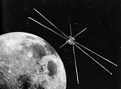
| Explorer 35 | IMP-E, AIMP-2 | 19. Juli 1967 | Delta-E1 | CC | Mondorbit 764 km 7.886 km 147,30° | kg | Interplanetary Monitoring Platform: Erforschung der Magnetosphäre der Erde aus einer Mondumlaufbahn. |  |
| Explorer 36 | GEOS-B | 11. Januar 1968 | Delta-E1 | VAFB | 1.084 km 1.577 km 105,80° | 209 kg | Geodetic Earth Orbiting Satellite: geodätischen Vermessung der Erde. |  |
| Explorer 37 | SE-B, Solrad-9 | 5. März 1968 | Scout-B | WFF | 513 km 881 km 59,43° | 90 kg | Solar Explorer: Sonnenforschung in Zusammenarbeit mit dem Naval Research Laboratory. |  |
| Explorer 38 | RAE-A | 4. Juli 1968 | Delta-J | VAFB | 5.851 km 5.861 km 120,64° | 188 kg | Radio-Astronomy-Explorer: Radioastronomie-Satellit, der Radiostrahlung im Frequenzbereich von 0,2 bis 20 MHz untersuchte. | |
| Explorer 39 | AD-C | 8. August 1968 | Scout-B | VAFB | 670 km 2.538 km 80,66° | 9 kg | Air Density Explorer: Ballonsatellit zur Messung der Atmosphärendichte. |  |
| Explorer 40 | IE-C, Injun-5 | 681 km 2.533 km 80,67° | 71 kg | Ionosphere Explorer: Erforschung der Ionosphäre. |  | |||
| Explorer 41 | IMP-G, IMP-5 | 21. Juni 1969 | Delta-E1 | VAFB | 3.920 km 172.912 km 85.10° | 79 kg | Interplanetary Monitoring Platform: Hochelliptische Umlaufbahn zur Erforschung der Magnetosphäre. |  |
| 1970er | ||||||||
| Explorer 42 | SAS-A, SAS-1, Uhuru | 12. Dezember 1970 | Scout-B | SM | 521 km 570 km 3,00° | 163 kg | Small Astronomy Satellite: Erster Röntgenastronomiesatellit zur Kartierung von Röntgenquellen. |  |
| Explorer 43 | IMP-H, IMP-5 | 13. März 1971 | Delta-M6 | CC | 1.845 km 203.130 km 31.2° | 288 kg | Interplanetary Monitoring Platform Satellit auf einer hochelliptischen Umlaufbahn zur Erforschung der Magnetosphäre |  |
| Explorer 44 | SE-C, Solrad-10 | 8. Juli 1971 | Scout-B | WFF | 436 km 630 km 51,00° | 118 kg | Solar Explorer Satellit zur Sonnenforschung in Zusammenarbeit mit dem Naval Research Laboratory. |  |
| Explorer 45 | SSS-A | 15. November 1971 | Scout-B | SM | 272 km 18.149 km 3,20° | 52 kg | Small Scientific Satellite: Erforschung der Magnetosphäre. |  |
| Explorer 46 | MTS A | 13. August 1972 | Scout-D1 | WFF | 496 km 814 km 37,70° | 90 kg | Meteoroid Technology Satellite: Messung der Mikrometeoritenhäufigkeit |  |
| Explorer 47 | IMP-I, IMP-7 | 23. September 1972 | Delta-1604 | 201.100 km 235.600 km 17,20° | 390 kg | Interplanetary Monitoring Platform: hohe Umlaufbahn zur Erforschung der Magnetosphäre |  | |
| Explorer 48 | SAS-B, SAS-2 | 15. November 1972 | Scout-D1 | SM | 526 km 526 km 1,00° | 186 kg | Small Astronomy Satellite: Gammaastronomiesatellit zur Kartierung einzelner Gammaquellen am Himmel und der diffusen Gammaemission. |  |
| Explorer 49 | RAE-B | 10. Juni 1973 | Delta-1913 | CC | Mondorbit 157 km 476 km 29,30° | 328 kg | Radio-Astronomy-Explorer: Radioastronomiesatellit erreichte fünf Tage nach dem Start einen Mondorbit. |  |
| Explorer 50 | IMP-J, IMP-8 | 26. Oktober 1973 | Delta-1604 | 141.185 km 288.857 km 28,70° | 390 kg | Interplanetary Monitoring Platform: hohe Umlaufbahn zur Erforschung der Magnetosphäre. |  | |
| Explorer 51 | AE-C | 16. Dezember 1973 | Delta-1900 | VAFB | 158 km 4.303 km 68,12° | 658 kg | Atmosphere Explorer: Erforschung der oberen Atmosphäre und der Ozonschicht. |  |
| Explorer 52 | IE-D, Injun-6, Hawkeye | 3. Juni 1974 | Scout-E1 | VAFB | 802 km 126.602 km 83,10° | 27 kg | Untersuchung der Magnetosphäre aus einer hochelliptischen Umlaufbahn. | |
| Explorer 53 | SAS-C, SAS-3 | 4. Mai 1975 | Scout-F1 | SM | 499 km 508 km 2,99° | 195 kg | Small Astronomy Satellite: Röntgenastronomiesatellit zur Positionsbestimmung von Röntgenquellen. |  |
| Explorer 54 | AE-D | 6. Oktober 1975 | Delta-2910 | VAFB | 155 km 3.816 km 90,10° | 676 kg | Atmosphere Explorer: Erforschung der oberen Atmosphäre und der Ozonschicht. |  |
| Explorer 55 | AE-E | 20. November 1975 | Delta-2910 | CC | 156 km 2.983 km 19,70° | 721 kg | Atmosphere Explorer: Erforschung der oberen Atmosphäre und der Ozonschicht. |  |
| DAD-A | 5. Dezember 1975 | Scout-F1 | VAFB | Fehlstart | 40 kg | Dual Air Density ExplorerMessung der Atmosphärendichte | ||
| DAD-B | 9 kg | Dual Air Density Explorer: Ballonsatellit zur Messung der Atmosphärendichte. |  | |||||
| Nach Explorer 55 wurden primär die Bezeichnung der Satelliten und Sonden durch ihren Projektnamen gebräuchlich. Die nummerierte Explorer-Bezeichnung wird jedoch nach einem erfolgreichen Start weiterhin vergeben. | ||||||||
| Explorer 56 | ISEE-1 | 22. Oktober 1977 | Delta-2914 | CC | 337 km 137.904 km 28,95° | 340 kg | International Sun-Earth Explorer: Erforschung der äußeren Grenzen der Magnetosphäre aus einer hochelliptischen Umlaufbahn. |  |
| Explorer 57 | IUE | 26. Januar 1978 | Delta-2914 | CC | 30.210 km 41.343 km 33,77° | 1479 kg | International Ultraviolet Explorer: Mit der ESA zusammen entwickeltes Weltraumteleskop für Ultraviolettastronomie in einem quasigeostationären Orbit. |  |
| Explorer 58 | HCMM, AEM-1 | 26. April 1978 | Scout-D1 | VAFB | 558 km 646 km 97.6° | 134 kg | Heat Capacity Mapping Mission: Thermalkartieung der Erde |  |
| Explorer 59 | ISEE-3/ICE | 12. August 1978 | Delta-2914 | CC | L-1 Orbit später heliozentrisch 0,93 AU 1,03 AU 0,10° | 469 kg | International Sun-Earth Explorer / International Cometary Explorer: Raumsonde zur Erforschung des Sonnenwindes. |  |
| Explorer 60 | SAGE, AEM-2 | 18. Februar 1979 | Scout-D1 | WFF | 456 km 506 km 55.00° | 147 kg | Stratospheric Aerosol and Gas Experiment: Messung von Aerosolen und Ozon in der Atmosphäre. | |
| Explorer 61 | Magsat, AEM-3 | 30. Oktober 1979 | Scout-G1 | VAFB | 352 km 561 km 96.80° | 181 kg | Untersuchung des nahen Erdmagnetfelds. | |
| 1980er | ||||||||
| Explorer 62 | DE-1 | 3. August 1981 | Delta-3913 | VAFB | 528 km 23.264 km 88,49° | 424 kg | Dynamics Explorer: Zwei identische Satelliten auf unterschiedlichen Umlaufbahnen zur Erforschung der Interaktion zwischen Plasma, der Magnetosphäre und der Ionosphäre. |  |
| Explorer 63 | DE-2 | 298 km 996 km 90,00° | 415 kg |  | ||||
| Explorer 64 | SME | 6. Oktober 1981 | Delta-2310 | VAFB | 335 km 337 km 97.60° | 439 kg | Solar Mesosphere Explorer: Untersuchung der ozonerzeugenden und -zerstörenden Prozesse in der Mesosphäre der Erde und des Einflusses der Sonneneinstrahlung auf diese Prozesse. |  |
| Explorer 65 | CCE | 16. August 1984 | Delta-3924 | CC | 1.095 km 49.688 km 3,19° | 242 kg | Charge Composition Explorer: Erforschung der Magnetosphäre zusammen mit einem deutschen (IRM) und einem britischen (UKS-1) Subsatelliten. |  |
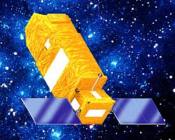
| Explorer 66 | COBE | 18. November 1989 | Delta-5920 | VAFB | 876 km 888 km 99,00° | 2.250 kg | Cosmic Background Explorer: Untersuchung der kosmischen Hintergrundstrahlung, um weitere Belege für die Theorie vom Urknall zu sammeln. |  |
| 1990er | ||||||||
| Explorer 67 | EUVE | 7. Juni 1992 | Delta-6920-10 | CC | 514 km 529 km 28,43° | 3.256 kg | Extreme Ultraviolet Explorer: Weltraumteleskop für Ultraviolettastronomie. |  |
| Explorer 68 | SAMPEX, SMEX-1 | 4. Februar 1992 | Scout-G1 | VAFB | 515 km 691 km 81,67° | 158 kg | Solar Anomalous & Magnetospheric Particle Explorer: Erforschung der Einflüsse von anomalen Solaremissionen auf die Magnetosphäre. |  |
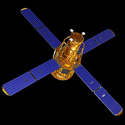
| Explorer 69 | RXTE, XTE, Rossi | 30. Dezember 1995 | Delta-7920-10 | CC | 565 km 585 km 22,99° | 3.045 kg | Rossi X-ray Timing Explorer: Orbitales Röntgenteleskop für die Beobachtung von schnellveränderlichen hochenergetischen Röntgenquellen. |  |
| Explorer 70 | FAST, SMEX-2 | 21. August 1996 | Pegasus-XL | VAFB | 351 km 4.165 km 82,98° | 180 kg | Fast Auroral Snapshot Explorer: Untersuchung der Polarlichter und damit verbundener Phänomene. |  |
| Explorer 71 | ACE | 5. August 1997 | Delta-7920-8 | CC | L-1 Orbit | 765 kg | Advanced Composition Explorer: Analyse von solaren, interplanetaren, interstellaren und kosmischen Partikeln nahe dem Lagrange-Punkt L 1. |  |
| Explorer 72 | SNOE, STEDI-1 | 26. Februar 1998 | Pegasus-XL | VAFB | 539 km 578 km 97,75° | 132 kg | Student Nitric Oxide Explorer: Atmosphärenforschungssatellit zur Messung der Stickstoffoxidkonzentrationen der oberen Atmosphäre. | |
| Explorer 73 | TRACE, SMEX-4 | 1. April 1998 | Pegasus-XL | VAFB | 599 km 641 km 97,98° | 225 kg | Transition Region and Coronal Explorer: Untersuchung der dreidimensionalen magnetischen Strukturen in der Photosphäre der Sonne. |  |
| Explorer 74 | SWAS, SMEX-3 | 6. Dezember 1998 | Pegasus-XL | VAFB | 637 km 653 km 69,90° | 283 kg | Submillimeter Wave Astronomy Satellite: Weltraumteleskop zur Untersuchung der Spektren der interstellaren Materie. |  |
| Explorer 75 | WIRE, SMEX-5 | 5. März 1999 | Pegasus-XL | VAFB | 539 km 588 km 97,53° | 275 kg | Wide Field Infrared Explorer: Infrarotteleskop mit einem mit festem Wasserstoff auf unter 14 Kelvin gekühlten 30-cm-Teleskop. |  |
| Explorer 76 | TERRIERS, STEDI-2 | 18. Mai 1999 | Pegasus-XL | VAFB | 542 km 554 km 97,72° | 121 kg | Topographic Experiment using Radiative Recombinative Ionospheric EUV and Radio Sources: Atmosphärenforschungssatellit Missionsfehlschlag |  |
| Explorer 77 | FUSE, MIDEX-0 | 23. Juni 1999 | Delta-7320 | CC | 754 km 770 km 24,99° | 1.360 kg | Far Ultraviolet Spectroscopic Explorer: Weltraumteleskop für Ultraviolettastronomie |  |
| 2000er | ||||||||
| Explorer 78 | IMAGE, MIDEX-1 | 25. März 2000 | Delta-7326 | VAFB | 987 km 45.993 km 89,92° | 494 kg | Imager for Magnetopause to Aurora Global Exploration: Untersuchung der Magnetosphäre aus einem hochelliptischen Orbit. |  |
| Explorer 79 | HETE 2 | 9. Oktober 2000 | Pegasus-H | Kw | 596 km 636 km 1,96° | 124 kg | High Energy Transient Explorer: Lokalisierung von Gammablitzen. |  |
| Explorer 80 | WMAP, MAP, Wilkinson, MIDEX-2 | 30. Juni 2001 | Delta-7425-10C | CC | L-2 Orbit | 800 kg | Wilkinson Microwave Anisotropy Probe: Messung der kosmischen Hintergrundstrahlung. |  |
| Explorer 81 | RHESSI, HESSI, SMEX-6 | 5. Februar 2002 | Pegasus-XL | VAFB | 588 km 609 km 38,04° | 293 kg | Reuven Ramaty High Energy Solar Spectroscopic Imager: Untersuchung der Sonne im Röntgen- und Gammastrahlenbereich |  |
| Explorer 82 | CHIPSat, UNEX 1 | 12. Januar 2003 | Delta-7320-10C | VAFB | 586 km 594 km 94,00° | 60 kg | Cosmic Hot Interstellar Plasma Spectrometer Satellite: Forschungssatellit zur Untersuchung heißen Gases im Weltraum mittels Ultraviolettspektroskopie. Startete zusammen mit ICESat |  |
| Explorer 83 | GALEX, SMEX-7 | 28. April 2003 | Pegasus-XL | CC | 691 km 699 km 29,01° | 312 kg | Galaxy Evolution Explorer: Beobachtung von Galaxien im ultravioletten Bereich des elektromagnetischen Spektrums |  |
| Explorer 84 | Swift, MIDEX-3 | 20. November 2004 | Delta-7320-10C | CC | 587 km 604 km 20,55° | 1.331 kg | Schnellstmögliche Registrierung von Gammablitzen um eine Nachbeobachtung durch erdgebundene Teleskope zu ermöglichen. |  |
| Explorer 85 | THEMIS A, MIDEX-5A | 17. Februar 2007 | Delta-7925-10C | CC | 3.827 km 210.480 km 3,9° | 126 kg | Time History of Events and Macroscale Interactions during Substorms: Projekt bestehend aus fünf identischen Satelliten, die Teilstürme in der Magnetosphäre der Erde erforschen. |  |
| Explorer 86 | THEMIS B, MIDEX-5B | 1.276 km 120.550 km 9,80° | 126 kg |  | ||||
| Explorer 87 | THEMIS C, MIDEX-5C | 3.827 km 67.610 km 7,00° | 126 kg |  | ||||
| Explorer 88 | THEMIS D, MIDEX-5D | 3.827 km 67.610 km 7,00° | 126 kg |  | ||||
| Explorer 89 | THEMIS E, MIDEX-5E | 1.913 km 77.180 km 12,00° | 126 kg |  | ||||
| Explorer 90 | AIM, SMEX-9 | 25. April 2007 | Pegasus-XL | VAFB | 585 km 600 km 97,79° | 200 kg | Aeronomy of Ice in the Mesosphere: Erforschung der leuchtenden Nachtwolken in der Mesosphäre | |
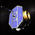
| Explorer 91 | IBEX, SMEX-10 | 19. Oktober 2008 | Pegasus-XL | Kw | 43.057 km 333.439 km 26,02° | 107 kg | Interstellar Boundary Explorer: Erforschung der Grenzschicht von Heliosphäre und lokalem interstellarem Medium durch die Messung von in der Region erzeugten energetischen neutralen Atomen. |  |
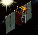
| Explorer 92 | WISE, MIDEX-6 | 14. Dezember 2009 | Delta-7320-10C | VAFB | 525 km 525 km 97,36° | 532 kg | Wide-Field Infrared Survey Explorer: Infrarotteleskop |  |
| 2010er | ||||||||
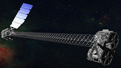
| Explorer 93 | NuSTAR, SMEX-11 | 13. Juni 2012 | Pegasus-XL | Kw | 604 km 619 km 6,03° | 360 kg | Nuclear Spectroscopic Telescope Array: Orbitales Röntgenteleskop. | |
| Explorer 94 | IRIS, SMEX-12 | 28. Juni 2013 | Pegasus-XL | VAFB | 623 km 670 km 97,95°[1] | 200 kg | Interface Region Imaging Spectrograph: Orbitales Sonnenteleskop mit Spektrograph für die Untersuchung der Chromosphäre |  |
| Explorer 95 | TESS, MIDEX-7 | 18. April 2018 | Falcon 9 | CC | 1.063 km 355.646 km 28,91° | 365 kg | Transiting Exoplanet Survey Satellite: kleines Weltraumteleskop um extrasolare Planeten mit Hilfe der Transitmethode zu finden. |  |
| Explorer 96 | ICON, MIDEX-8 | 11. Oktober 2019 | Pegasus-XL | CC | 574 km ca. 616 km 26,99°[2] | 287 kg | Ionospheric Connection Explorer Satellit zur Erforschung der Wechselwirkungen zwischen Erdatmosphäre und umgebenden Weltraum | |
| 2020er | ||||||||
| Explorer 97 | IXPE, SMEX-14 | 9. Dezember 2021 | Falcon 9 | KSC | 540 km 540 km 0°[3] | 170 kg | Imaging X-ray Polarimetry Explorer: Satellit, der Schwarze Löcher, Neutronensterne und Pulsare erforschen soll[4] |  |
| Geplante Missionen | ||||||||
| Explorer | PUNCH A (SMEX) | 2023[5] | ca. 560 km [6] | Polarimeter to Unify the Corona and Heliosphere: Konstellation aus vier Mikrosatelliten, die die Sonnenkorona und die Heliosphäre untersuchen sollen | ||||
| Explorer | PUNCH B (SMEX) | ca. 560 km | ||||||
| Explorer | PUNCH C (SMEX) | ca. 560 km | ||||||
| Explorer | PUNCH D (SMEX) | ca. 560 km | ||||||
| Explorer | Tracers A (SMEX) | 2023[7] | ca. 600 km [8] | Tandem Reconnection and Cusp Electrodynamics Reconnaissance Satellites: zwei Satelliten zur Untersuchung der Magnetopause | ||||
| Explorer | Tracers B (SMEX) | ca. 600 km | ||||||
| Explorer | SPHEREx, MIDEX-9 | 2024–2025[9] | Spectro-Photometer for the History of the Universe, Epoch of Reionization, and Ices Explorer: Weltraumteleskop, das Sterne, Galaxien und andere Himmelsobjekte im Nahen Infrarotbereich kartografisch erfassen soll. | |||||
Startorte
Bislang wurden die Explorer-Satelliten von fünf verschiedenen Startgeländen ins All geschossen:
- CC = Cape Canaveral Air Force Station, Florida
- KSC = Kennedy Space Center, Florida
- Kw = Kwajalein, Marshallinseln
- SM = San-Marco-Plattform, vor der Küste Kenias
- VAFB = Vandenberg Air Force Base, Kalifornien
- WFF = Wallops Flight Facility, Virginia
Literatur
- The R.A.E. Tables of Earth Satellites 1957–1989
Weblinks
- NASA: NASA's Explorer Program Satellites (englisch)
- R.A.E. Tables of Earth Satellites mit Ergänzungen (englisch)
- NASA: Explorers Program (englisch)
Einzelnachweise
- ↑ Michael Clormann: ISIS öffnen! in Raumfahrer.net, Datum: 28. Juni 2013, abgerufen: 2. Juli 2013; Inklination von Space-Track.org, 11. Oktober 2019
- ↑ Videoaufzeichnung des Starts, ab 1:06:30.
- ↑ IXPE (Imaging X-ray Polarimetry Explorer) im eoPortal, abgerufen am 11. Oktober 2019.
- ↑ NASA Awards Launch Services Contract for Groundbreaking Astrophysics Mission. In: NASA. 8. Juli 2019, abgerufen am 9. Juli 2019 (englisch).
- ↑ SMSR Intergrated Master Schedule (PDF, 1 MB). NASA, 1. Dezember 2020.
- ↑ NASA selects PUNCH, a new mission to study the Sun. In: Astronomy.com. 21. Juni 2019, abgerufen am 11. Oktober 2019.
- ↑ NASA Selects Missions to Study Our Sun, Its Effects on Space Weather. NASA, 20. Juni 2019, abgerufen am 11. Oktober 2019 (… it will be launched as a secondary payload with PUNCH.).
- ↑ Four Berkeley satellites could be exploring Mars and Earth by 2022. In: Berkeley News. 9. Juli 2019, abgerufen am 11. Oktober 2019.
- ↑ A New NASA Space Telescope, SPHEREx, Is Moving Ahead. NASA, 5. Januar 2021, abgerufen am 29. Januar 2021 (englisch).
Auf dieser Seite verwendete Medien
International Ultraviolet Explorer
Solrad 8 or Explorer 30
Artist's concept of the Interstellar Boundary Explorer (IBEX) spacecraft
Interface Region Imaging Spectrograph (IRIS) Graphic of proposed IRIS spacecraft. The IRIS instrument is a multi-channel imaging spectrograph with a 20 cm UV telescope. IRIS will obtain spectra along a slit (1/3 arcsec wide), and slit-jaw images. Credit: NASA
Explorer 31 (DME A)
Explorer S-45. Satellite failed to achieve orbit.
CHIPSAT satellite
Explorer 37 or Solrad 9
This perspective view of the IMAGE observatory shows an octagonal shape spacecraft covered with arrays of dual-junction, high-efficiency gallium-arsenide solar cells. The spacecraft measures 2.25 meters (7.4 feet) in diameter and 1.52 meters (4.99 feet) in height. It weighs 494 kg (1087 pounds) (including instruments). The scientific instruments and subsystems require an orbit-averaged power of 250 Watts which power is generated by the solar cells.
Explorer 45 / S-Cubed A / SSS
SAMPEX satellite
Explorer-18 (IMP-A) satellite
MTS-A (Meteoroid Test Satellite A) or Explorer-46
Dynamics Explorer (DE)
Artist concept of the Transiting Exoplanet Survey Satellite with black background.
Explorer-41 (IMP-G) satellite
Charged particles in Earth’s atmosphere – which make up the ionosphere – create bands of color above Earth’s surface, known as airglow. ICON, depicted in this artist’s concept, will study the ionosphere from a height of about 350 miles to understand how the combined effects of terrestrial weather and space weather influence this ionized layer of particles.
SAGE satellite
Artist's concept of NuSTAR on orbit. NuSTAR has a 10-m (30') mast that deploys after launch to separate the optics modules (right) from the detectors in the focal plane (left). The spacecraft, which controls NuSTAR's pointings, and the solar panels are with the focal plane. NuSTAR has two identical optics modules in order to increase sensitivity. The background is an image of the Galactic center obtained with the Chandra X-ray Observatory.
EUVE (Extreme Ultra Violet Explorer)
Explorer 40, Injun C, Injun 5, IE-C, Ionosphere Explorer-C
Explorer 50, besser unter dem Namen IMP 8 (Interplanetary Monitoring Platform 8) bekannt, in der Umlaufbahn
TERRIERS satellite
Explorer 52 / Hawkeye 1 / IE-D satellite
NASA / University of Iowa - 1974
http://space.skyrocket.de/doc_sdat/explorer_ie-d.htm
http://nssdc.gsfc.nasa.gov/database/MasterCatalog?sc=1974-040ASNOE (Student Nitric Oxide Explorer) satellite
Explorer-34 (IMP-F) satellite
Explorer 27 (BE-C, Beacon Explorer C)
International Cometary Explorer (ICE), davor als International Sun Earth Explorer 3 (ISEE 3) bezeichnet, im Anflug auf den Kometen Giacobini-Zinner.
CCE (Charge Composition Explorer), AMPTE-1
NASA-created illustration of the Wilkinson Microwave Anisotropy Probe spacecraft
SPHEREx (Spectro-Photometer for the History of the Universe, Epoch of Reionization, and Ices Explorer) is a proposed space observatory by NASA that would explore the origin of the universe, the origin and history of galaxies, and explore the origin of water in planetary systems.
Weighing 405 lbs. (184 kg), this 35-inch (89-cm) pressurized stainless steel sphere measured the density, composition, pressure and temperature of Earth's atmosphere after its launch from Cape Canaveral on April 3, 1963. The mission was one of three that Goddard Space Flight Center specifically conducted to learn more about the atmosphere's physical properties?knowledge that they ultimately used for scientific and meteorological purposes. Explorer XVII carried two spectrometers, four vacuum pressure gauges and two electrostatic probes. Before it reached its intended orbit that ranged from 158 to 570 miles (254-917 km) above Earth, the satellite was spun up to about 90 rpm.
Explorer 61, Magsat, AEM 3
Explorer-51 (AE-C) satellite
ISEE-1 satellite
RHESSI space telescope
This is an artist's concept of the THEMIS spacecraft as it might appear in orbit.
Imaging X-ray Polarimetry Explorer: X-ray space telescope of NASA
Explorer-13 (S-55a) satellite
Explorer 1 satellite
Explorer S-46
Explorer-44 (Solrad-10, SE-C) satellite
Explorer-53 (SAS-C) satellite
Die amerikanische Raumsonde Explorer 7
NASA's Swift Gamma Ray Burst Detecting Satellite
Artist's concept of the Cosmic Background Explorer (COBE) spacecraft, the predecessor to the WMAP Project. COBE was launched by NASA into an Earth Orbit in 1989 to make a full sky map of the Cosmic Microwave Background (CMB) radiation leftover from the Big Bang. The first results were released in 1992. COBE's limited resolution (7 degree wide beam) provided the first tantilising details in a full sky image of the CMB.
Explorer-47 (IMP-I) satellite
Artist's concept of Wide-field Infrared Survey Explorer. The Wide-field Infrared Survey Explorer mission will survey the entire sky in a portion of the electromagnetic spectrum called the mid-infrared with far greater sensitivity than any previous mission or program ever has. The survey will consist of over a million images, from which hundreds of millions of astronomical objects will be catalogued, providing a vast storehouse of knowledge about the solar system, the Milky Way, and the universe. The mission is scheduled to launch no earlier than Dec. 9 from Vandenberg Air Force Base in California. JPL manages the Wide-field Infrared Survey Explorer for NASA's Science Mission Directorate.
Interplanetary Monitoring Platform-E (IMP-E) other Name Explorer 35
RXTE - Rossi X-Ray Timing Explorer
Balloon Satellit Explorer 24 während eines Tests.
Explorer-20 (IE-A) satellite
SAS-B was the second in the series of small spacecraft designed to extend the astronomical studies in the X-ray, gamma-ray, ultraviolet, visible, and infrared regions. The primary objective of the SAS-B was to measure the spatial and energy distribution of primary galactic and extragalactic gamma radiation with energies between 20 and 300 MeV. The instrumentation consisted principally of a guard scintillation detector, an upper and a lower spark chamber, and a charged particle telescope.
SME (Solar Mesosphere Explorer)
Aeronomy of Ice in the Mesosphere (AIM) artist's concept


