Liste der EU-Vogelschutzgebiete in Irland

Die folgende Liste enthält alle 166 Europäischen Vogelschutzgebiete nach Art. 4 (1) der Europäischen Vogelschutzrichtliniein der Republik Irland. Die Gebiete sind Bestandteil des europäischen Schutzgebietsnetzes Natura 2000.
Die irischen Vogelschutzgebiete umfassen eine insgesamt eine Fläche von 16.943 km³, was etwa einem Viertel der Staatsfläche entspricht, wobei einige Gebiete auch Meeresflächen im atlantischen Ozean und in der Irischen und der Keltischen See umfassen. Mit einer mittleren Größe von 38,6 km² und einem Median von 3 km² sind die irischen Vogelschutzgebiete im europäischen Vergleich eher kleinflächig abgegrenzt. Das kleinste Gebiet ist mit 13 ha das Eirk Bog, ein Moor in der County Kerry, das größte sind mit 594,6 km² die Slieve Aughty Mountains südöstlich von Galway.
Hinweise zu den Angaben in der Tabelle
- Gebietsname: Amtliche Bezeichnung des Schutzgebiets
- Bild/Commons: Bild und Link zu weiteren Bildern aus dem Schutzgebiet
- WDPA-ID: Link zum Schutzgebiet in der World Database on Protected Areas
- EEA-ID: Link zum Schutzgebiet in der Datenbank der European Environment Agency (EEA)
- County: County, in welcher das Vogelschutzgebiet liegt
- Fläche: Gesamtfläche des Schutzgebiets in Hektar
- Bemerkungen: Besonderheiten und Anmerkung
Tabelle
| Gebietsname | Bild/Commons | WDPA-ID | EEA-ID | County | Fläche ha | Lage | Bemerkungen |
|---|---|---|---|---|---|---|---|
| Saltee Islands |  | IE0004002 | Wexford | 870,62 | ⊙ | ||
| Puffin Island |  | IE0004003 | Kerry | 349,14 | ⊙ | ||
| Inishkea Islands | (c) Aiden Clarke, CC BY-SA 2.0 | IE0004004 | Mayo | 1329,76 | ⊙ | ||
| Cliffs of Moher |  | IE0004005 | Clare | 873,94 | ⊙ | ||
| North Bull Island | (c) William Murphy, CC BY-SA 3.0 | IE0004006 | Dublin | 1943,47 | ⊙ | ||
| Skellig Islands |  | IE0004007 | Kerry | 624,08 | ⊙ | ||
| Blasket Islands | 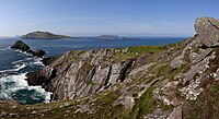 | IE0004008 | Kerry | 3620,37 | ⊙ | ||
| Lady's Island Lake |  | IE0004009 | Wexford | 478,6 | ⊙ | ||
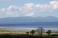
| Drumcliff Bay | (c) Kenneth Allen, CC BY-SA 2.0 | IE0004013 | Sligo | 1842,68 | ⊙ | ||
| Rockabill |  | IE0004014 | Dublin | 5227,09 | ⊙ | ||
| Rogerstown Estuary | IE0004015 | Dublin | 645,35 | ⊙ | |||
| Baldoyle Bay | (c) David Bagshaw, CC BY-SA 2.0 | IE0004016 | Dublin | 262,65 | ⊙ | ||
| Mongan Bog | 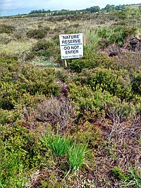 | IE0004017 | Offaly | 129,33 | ⊙ | ||
| The Raven | (c) Chris, CC BY-SA 2.0 | IE0004019 | Wexford | 4204,63 | ⊙ | ||
| Ballyteigue Burrow | (c) kevin higgins, CC BY-SA 2.0 | IE0004020 | Wexford | 660,24 | ⊙ | ||
| Old Head of Kinsale |  | IE0004021 | Cork | 53,63 | ⊙ | ||
| Ballycotton Bay | IE0004022 | Cork | 281,22 | ⊙ | |||
| Ballymacoda Bay | IE0004023 | Cork | 586,23 | ⊙ | |||
| South Dublin Bay and River Tolka Estuary |  | IE0004024 | Dublin | 2193,17 | ⊙ | ||
| Malahide Estuary |  | IE0004025 | Dublin | 764,63 | ⊙ | ||
| Dundalk Bay | (c) Eric Jones, CC BY-SA 2.0 | IE0004026 | Louth | 13237,9 | ⊙ | ||
| Tramore Back Strand |  | IE0004027 | Waterford | 675,68 | ⊙ | ||
| Blackwater Estuary | IE0004028 | Cork, Waterford | 869,8 | ⊙ | |||
| Castlemaine Harbour | (c) Pam Brophy, CC BY-SA 2.0 | IE0004029 | Kerry | 12397,41 | ⊙ | ||
| Cork Harbour |  | IE0004030 | Cork | 2660,27 | ⊙ | ||
| Inner Galway Bay |  | IE0004031 | Galway, Clare | 13261,57 | ⊙ | ||
| Dungarvan Harbour | (c) Philip Halling, CC BY-SA 2.0 | IE0004032 | Waterford | 2221,51 | ⊙ | ||
| Bannow Bay | IE0004033 | Wexford | 1363,32 | ⊙ | |||
| Trawbreaga Bay | (c) Alistair Cunningham, CC BY 3.0 | IE0004034 | Donegal | 1549,16 | ⊙ | ||
| Cummeen Strand | IE0004035 | Sligo | 1731,69 | ⊙ | |||
| Killala Bay/Moy Estuary | (c) Ingrid, CC BY-SA 2.0 | IE0004036 | Mayo, Sligo | 3202,02 | ⊙ | ||
| Blacksod Bay/Broad Haven | (c) Roger, CC BY-SA 2.0 | IE0004037 | Mayo | 8535,68 | ⊙ | ||
| Killarney National Park | 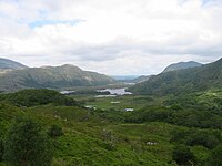 | IE0004038 | Kerry | 10328,14 | ⊙ | ||
| Derryveagh and Glendowan Mountains |  | IE0004039 | Donegal | 31483,23 | ⊙ | ||
| Wicklow Mountains |  | IE0004040 | Wicklow, Dublin | 30014,31 | ⊙ | ||
| Ballyallia Lake | IE0004041 | Clare | 140,73 | ⊙ | |||
| Lough Corrib |  | IE0004042 | Galway, Mayo | 18623,94 | ⊙ | ||
| Lough Derravaragh | IE0004043 | Westmeath | 1130,09 | ⊙ | |||
| Lough Ennell |  | IE0004044 | Westmeath | 1397,66 | ⊙ | ||
| Glen Lough | IE0004045 | Longford, Westmeath | 82,27 | ⊙ | |||
| Lough Iron | IE0004046 | Westmeath | 933,35 | ⊙ | |||
| Lough Owel |  | IE0004047 | Westmeath | 1118,64 | ⊙ | ||
| Lough Gara |  | IE0004048 | Roscommon | 1689,78 | ⊙ | ||
| Lough Oughter Complex |  | IE0004049 | Cavan | 1972,94 | ⊙ | ||
| Lough Arrow | 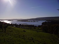 | IE0004050 | Roscommon, Sligo | 1337,91 | ⊙ | ||
| Lough Carra | (c) Mike Simms, CC BY-SA 2.0 | IE0004051 | Mayo | 1760,27 | ⊙ | ||
| Carrowmore Lake |  | IE0004052 | Mayo | 965,52 | ⊙ | ||
| Lough Cutra | (c) A McCarron, CC BY-SA 2.0 | IE0004056 | Galway | 386,72 | ⊙ | ||
| Lough Derg (Donegal) | (c) Kenneth Allen, CC BY-SA 2.0 | IE0004057 | Donegal | 889,88 | ⊙ | ||
| Lough Derg (Shannon) | (c) JP, CC BY-SA 2.0 | IE0004058 | Galway, Clare, Tipperary | 12709,47 | ⊙ | ||
| Lough Fern | IE0004060 | Donegal | 299,91 | ⊙ | |||
| Lough Kinale and Derragh Lough |  | IE0004061 | Longford, Westmeath, Cavan | 287,8 | ⊙ | ||
| Lough Mask |  | IE0004062 | Galway, Mayo | 8735,65 | ⊙ | ||
| Poulaphouca Reservoir | (c) Bob Linsdell, CC BY 3.0 | IE0004063 | Kildare, Wicklow | 2009,5 | ⊙ | ||
| Lough Ree |  | IE0004064 | Roscommon, Longford, Westmeath | 12347,98 | ⊙ | ||
| Lough Sheelin | 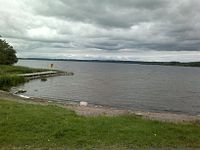 | IE0004065 | Cavan, Meath, Westmeath | 1900,92 | ⊙ | ||
| The Bull and The Cow Rocks | IE0004066 | Cork | 380,12 | ⊙ | |||
| Inishmurray | (c) Andreas F. Borchert, CC BY-SA 4.0 | IE0004068 | Sligo | 234,66 | ⊙ | ||
| Lambay Island |  | IE0004069 | Dublin | 599,3 | ⊙ | ||
| Stags of Broad Haven |  | IE0004072 | Mayo | 136,38 | |||
| Tory Island |  | IE0004073 | Donegal | 570,77 | ⊙ | ||
| Illanmaster | IE0004074 | Mayo | 164,94 | ⊙ | |||
| Lough Swilly | (c) Kenneth Allen, CC BY-SA 2.0 | IE0004075 | Donegal | 8559,56 | ⊙ | ||
| Wexford Harbour and Slobs | (c) Dr Brian Lynch, CC BY-SA 2.0 | IE0004076 | Wexford | 5979,34 | ⊙ | ||
| River Shannon and River Fergus Estuaries | (c) Bob Jones, CC BY-SA 2.0 | IE0004077 | Clare, Kerry, Limerick | 32237,6 | ⊙ | ||
| Carlingford Lough |  | IE0004078 | Louth | 595,12 | ⊙ | ||
| Boyne Estuary |  | IE0004080 | Louth, Meath | 593,43 | ⊙ | ||
| Clonakilty Bay | (c) Frank Donovan, CC BY-SA 2.0 | IE0004081 | Cork | 507,76 | ⊙ | ||
| Greers Isle | IE0004082 | Donegal | 19,13 | ⊙ | |||
| Inishbofin, Inishdooey and Inishbeg |  | IE0004083 | Donegal | 601,17 | ⊙ | ||
| Inishglora and Inishkeeragh |  | IE0004084 | Mayo | 381,89 | ⊙ | ||
| River Little Brosna Callows | IE0004086 | Offaly, Tipperary | 1100,92 | ⊙ | |||
| Lough Foyle | (c) Don MacFarlane, CC BY-SA 2.0 | IE0004087 | Donegal | 587,67 | ⊙ | ||
| Rahasane Turlough | IE0004089 | Galway | 372,3 | ⊙ | |||
| Sheskinmore Lough | IE0004090 | Donegal | 563,04 | ⊙ | |||
| Stabannan-Braganstown | IE0004091 | Louth | 251,89 | ⊙ | |||
| Tacumshin Lake | IE0004092 | Wexford | 476,17 | ⊙ | |||
| Termoncarragh Lake and Annagh Machair | IE0004093 | Mayo | 405,98 | ⊙ | |||
| Blackwater Callows | IE0004094 | Cork, Waterford | 1037,73 | ⊙ | |||
| Kilcolman Bog | IE0004095 | Cork | 56,71 | ⊙ | |||
| Middle Shannon Callows | IE0004096 | Galway, Roscommon, Offaly, Westmeath, Tipperary | 5814,85 | ⊙ | |||
| River Suck Callows | IE0004097 | Galway, Roscommon | 3182,03 | ⊙ | |||
| Owenduff/Nephin Complex | (c) Pamela Norrington, CC BY-SA 2.0 | IE0004098 | Mayo | 25692,83 | ⊙ | ||
| Pettigo Plateau | IE0004099 | Donegal | 691,28 | ⊙ | |||
| Inishtrahull | (c) Arnold Price, CC BY-SA 2.0 | IE0004100 | Donegal | 474,24 | ⊙ | ||
| Ballykenny-Fisherstown Bog | IE0004101 | RoscommonLongford | 1355,67 | ⊙ | |||
| Garriskil Bog | IE0004102 | Westmeath | 324,11 | ⊙ | |||
| All Saints Bog | IE0004103 | Offaly | 322,64 | ⊙ | |||
| Bellanagare Bog | IE0004105 | Roscommon | 1233,78 | ⊙ | |||
| Coole-Garryland Complex |  | IE0004107 | Galway | 519,95 | ⊙ | ||
| Eirk Bog |  | IE0004108 | Kerry | 13,23 | ⊙ | ||
| The Gearagh | 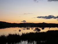 | IE0004109 | Cork | 322,58 | ⊙ | ||
| Lough Nillan Bog | IE0004110 | Donegal | 4114,34 | ⊙ | |||
| Duvillaun Islands | IE0004111 | Mayo | 529,8 | ⊙ | |||
| Howth Head Coast |  | IE0004113 | Dublin | 207,73 | ⊙ | ||
| Illaunonearaun | IE0004114 | Clare | 45,95 | ⊙ | |||
| Inishduff | IE0004115 | Donegal | 46,48 | ⊙ | |||
| Inishkeel | (c) Joseph Mischyshyn, CC BY-SA 2.0 | IE0004116 | Donegal | 124,41 | ⊙ | ||
| Ireland's Eye |  | IE0004117 | Dublin | 214,43 | ⊙ | ||
| Keeragh Islands | (c) kevin higgins, CC BY-SA 2.0 | IE0004118 | Wexford | 80 | ⊙ | ||
| Loop Head |  | IE0004119 | Clare | 377 | ⊙ | ||
| Rathlin O’Birne Island |  | IE0004120 | Donegal | 153,55 | ⊙ | ||
| Roaninish | IE0004121 | Donegal | 145,76 | ⊙ | |||
| Skerries Islands | IE0004122 | Dublin | 217,12 | ⊙ | |||
| Sovereign Islands, Sovereign Islands | IE0004124 | Cork | 28,07,2022 | ⊙ | |||
| Magharee Islands | (c) I, Terryballard, CC BY-SA 3.0 | IE0004125 | Kerry | 416,92 | ⊙ | ||
| Wicklow Head | (c) David Quinn, CC BY-SA 2.0 | IE0004127 | Wicklow | 195,05 | ⊙ | ||
| Ballysadare Bay |  | IE0004129 | Sligo | 2129,06 | ⊙ | ||
| Illancrone and Inishkeeragh | (c) Kenneth Allen, CC BY-SA 2.0 | IE0004132 | Donegal | 419,4 | ⊙ | ||
| Aughris Head | (c) Paul Burns, CC BY-SA 2.0 | IE0004133 | Sligo | 54,8 | ⊙ | ||
| Lough Rea | 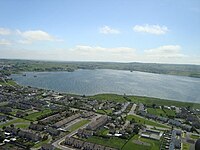 | IE0004134 | Galway | 365,41 | ⊙ | ||
| Ardboline Island and Horse Island | (c) Oliver Dixon, CC BY-SA 2.0 | IE0004135 | Sligo | 148,29 | ⊙ | ||
| Clare Island | 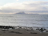 | IE0004136 | Mayo | 1005,74 | ⊙ | ||
| Dovegrove Callows | IE0004137 | Offaly | 124,51 | ⊙ | |||
| Lough Croan Turlough | IE0004139 | Roscommon | 151,26 | ⊙ | |||
| Four Roads Turlough | IE0004140 | Roscommon | 99,6 | ⊙ | |||
| Cregganna Marsh | IE0004142 | Galway | 167,86 | ⊙ | |||
| Cahore Marshes | IE0004143 | Wexford | 191,52 | ⊙ | |||
| High Island, Inishshark and Davillaun |  | IE0004144 | Galway | 1216,95 | ⊙ | ||
| Durnesh Lough | (c) Jonathan Wilkins, CC BY-SA 2.0 | IE0004145 | Donegal | 144,41 | ⊙ | ||
| Malin Head |  | IE0004146 | Donegal | 281,07 | ⊙ | ||
| Fanad Head |  | IE0004148 | Donegal | 136,07 | ⊙ | ||
| Falcarragh to Meenlaragh | (c) Joseph Mischyshyn, CC BY-SA 2.0 | IE0004149 | Donegal | 302,86 | ⊙ | ||
| Donegal Coast | IE0004150 | Donegal | 3376,56 | ⊙ | |||
| Donegal Bay |  | IE0004151 | Donegal | 10455,87 | ⊙ | ||
| Inishmore |  | IE0004152 | Galway | 1917,63 | ⊙ | ||
| Dingle Peninsula |  | IE0004153 | Kerry | 4153,23 | ⊙ | ||
| Iveragh Peninsula |  | IE0004154 | Kerry | 3486,97 | ⊙ | ||
| Beara Peninsula | IE0004155 | Cork | 2612,08 | ⊙ | |||
| Sheep's Head to Toe Head |  | IE0004156 | Cork | 2500,11 | ⊙ | ||
| River Nanny Estuary and Shore | (c) Kieran Campbell, CC BY-SA 2.0 | IE0004158 | Meath | 229,68 | ⊙ | ||
| Slyne Head to Ardmore Point Islands | IE0004159 | Galway | 3377,68 | ⊙ | |||
| Slieve Bloom Mountains | IE0004160 | Laois, Offaly | 21774,46 | ⊙ | |||
| Stack's to Mullaghareirk Mountains, Limerick Hills and Mount Eagle | IE0004161 | Cork, Kerry, Limerick | 56648,85 | ⊙ | |||
| Mullaghanish to Musheramore Mountains |  | IE0004162 | Cork | 4975,63 | ⊙ | ||
| Slieve Felim to Silvermines Mountains |  | IE0004165 | Limerick, Tipperary | 20913,05 | ⊙ | ||
| Slieve Beagh | (c) Kenneth Allen, CC BY-SA 2.0 | IE0004167 | Monaghan | 3455,35 | ⊙ | ||
| Slieve Aughty Mountains | IE0004168 | Galway, Clare | 59457,16 | ⊙ | |||
| Cruagh Island | IE0004170 | Galway | 292,44 | ⊙ | |||
| Dalkey Islands |  | IE0004172 | Dublin | 83,04 | ⊙ | ||
| Deenish Island and Scariff Island |  | IE0004175 | Kerry | 845,35 | ⊙ | ||
| Bills Rocks | (c) Oliver Dixon, CC BY-SA 2.0 | IE0004177 | Mayo | 149,66 | ⊙ | ||
| Connemara Bog Complex |  | IE0004181 | Galway | 19201,5 | ⊙ | ||
| Clare Coast | IE0004182 | Clare | 4638,65 | ⊙ | |||
| The Murrough | IE0004186 | Wicklow | 940,78 | ⊙ | |||
| Leitrim Uplands | IE0004187 | Leitrim, Sligo | 1733,55 | ⊙ | |||
| Tralee Bay Complex | (c) I, Terryballard, CC BY-SA 3.0 | IE0004188 | Kerry | 3655,61 | ⊙ | ||
| Kerry Head |  | IE0004189 | Kerry | 961,84 | ⊙ | ||
| Galley Head to Duneen Point |  | IE0004190 | Cork | 416,1 | ⊙ | ||
| Seven Heads | IE0004191 | Cork | 446,85 | ⊙ | |||
| Helvick Head to Ballyquin |  | IE0004192 | Waterford | 784,32 | ⊙ | ||
| Waterford Coast | IE0004193 | Waterford | 937,06 | ⊙ | |||
| Horn Head to Fanad Head |  | IE0004194 | Donegal | 2385,34 | ⊙ | ||
| Cross Lough (Killadoon) |  | IE0004212 | Mayo | 26,74 | ⊙ | ||
| Courtmacsherry Bay | (c) Richard Webb, CC BY-SA 2.0 | IE0004219 | Cork | 1298,71 | ⊙ | ||
| Corofin Wetlands | IE0004220 | Clare | 599,86 | ⊙ | |||
| Illaunnanoon | IE0004221 | Galway | 19,78 | ⊙ | |||
| Mullet Peninsula | (c) Roger, CC BY-SA 2.0 | IE0004227 | Mayo | 325,55 | ⊙ | ||
| Lough Conn and Lough Cullin | (c) Kay Atherton, CC BY-SA 2.0 | IE0004228 | Mayo | 6457,58 | ⊙ | ||
| Donegal Islands | IE0004230 | Donegal | 1128,8 | ⊙ | |||
| Inishbofin, Omey Island and Turbot Island | 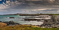 | IE0004231 | Galway | 171,47 | ⊙ | ||
| River Boyne and River Blackwater |  | IE0004232 | Louth, Meath, Westmeath | 460,14 | ⊙ | ||
| River Boyne and River Blackwater | IE0004232 | Cavan | 460,14 | ⊙ | |||
| River Nore | (c) kevin higgins, CC BY-SA 2.0 | IE0004233 | Kilkenny, Laois | 414,57 | ⊙ | ||
| Ballintemple and Ballygilgan | 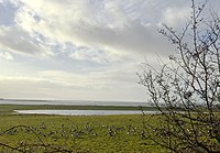 | IE0004234 | Sligo | 235,41 | ⊙ | ||
| Doogort Machair | IE0004235 | Mayo | 116,43 | ⊙ |
Weblinks
- Special Protection Areas (SPA). National Parks & Wildlife Service, abgerufen am 3. April 2022.
- Natura 2000 Network Viewer
Auf dieser Seite verwendete Medien
(c) OOjs UI Team and other contributors, MIT
An icon from the OOjs UI MediaWiki lib.
(c) David Bagshaw, CC BY-SA 2.0
The View from Strand Road Baldoyle. Near Sutton
Autor/Urheber: Megankeane13, Lizenz: CC BY-SA 4.0
A large, old tree that is in the centre of the photograph in front of Coole Lough which is a lake. Bright, blue skies can be seen behind the trees and very green grass is also seen.
(c) Dr Brian Lynch, CC BY-SA 2.0
View of Wexford Harbour
Autor/Urheber: European Comission, Lizenz: CC BY-SA 4.0
Logo of Natura 2000, a European Union's program of nature protecion areas.
(c) A McCarron, CC BY-SA 2.0
Lough Cutra & Parsons Island - Ballyturin Townland
Autor/Urheber: Sonse, Lizenz: CC BY 2.0
Beach on Ireland's Eye
(c) Arnold Price, CC BY-SA 2.0
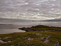
Across to Malin The lighthouse situated at the western end of Inishtrahull island.
Carlingford Lough, on the southern coast, looking seawards. The road hugging the coast on the right is the R173 to Carlingford.
(c) Kenneth Allen, CC BY-SA 2.0
Chalets at Inishkeeragh As seen from Tawnawanny
Autor/Urheber: JoachimKohler-HB, Lizenz: CC BY-SA 4.0
Blick auf Lough Corrib, südlich von Clonbur
Autor/Urheber: Racheldavis23, Lizenz: CC BY-SA 4.0
Barnacle geese migrate from Greenland in winter to Ballygilgan Nature Reserve and graze in the goosefield at the seasonal freshwater pond. The goosefield looks onto Drumcliff Bay and is near Lissadell Beach. Picture taken in January 2020.
(c) kevin higgins, CC BY-SA 2.0
Keeragh Islands Keeragh Islands off Ballymadder Point near Cullenstown.
Aerial view over Loughrea town toward lake
Autor/Urheber: Rowan McLaughlin, Lizenz: CC BY 2.0
Lough Kinale in counties Longford, Westmeath and Cavan, Ireland
Autor/Urheber: Karie Kuiper, Lizenz: CC BY-SA 4.0
Host to the Baily Lighthouse, the Howth Head peninsula is a green paradise that overlooks Dublin Bay and the hills of Dalkey and Killiney in the distance.
A rather poor picture of Keeper Hill in County Tipperary.
(c) Don MacFarlane, CC BY-SA 2.0
Lough Foyle, the view from a picnic site on its southern shore in CarrickHugh (Carraig-Aedha), a small locality in Co. Derry, Northern Ireland
Autor/Urheber: Bjørn Christian Tørrissen, Lizenz: CC BY-SA 3.0
The very tip of Dunmore Head, the westernmost point of Ireland, excluding islands, and most of the Blasket Islands showing in the background. In the back to the right is Inis Tuaisceart, in front of it the small Beginish, largest island to the right is Great Blasket Islands, and in the back to the right are Inishnabro and Inishvickillane. Tearaght Island is hidden behind the Great Blasket Island.
(c) Joseph Mischyshyn, CC BY-SA 2.0
Building at SE end of Inishkeel Island View if from beach at Naran. Some people walk out to the SE end of Inishkeel Island when the tide is out. I couldn't tell if the tide was coming in or going out. Note that two people are out on the island along the SE shore.
Autor/Urheber: J.-H. Janßen, Lizenz: CC BY-SA 3.0
Blick vom Glenealo-Tal (Glenealo Valley) in das Glendalough-Tal (Glendalough Valley) im Wicklow-Mountains-Nationalpark (Wicklow Mountains National Park), Glendalough, County Wicklow, Irland.
(c) Richard Webb, CC BY-SA 2.0
Courtmacsherry Bay. A ria, a drowned river valley. A common coastal feature in Brittany, south west Ireland ,south west Britain and the north west of the Iberian peninsula. Heads a long way inland.
Autor/Urheber: edward982, Lizenz: CC BY 3.0
A view of Cork Harbor from Blackrock Castle
(c) kevin higgins, CC BY-SA 2.0
River Nore at 'The Weir' Traditional swimming place on the Nore.
Autor/Urheber: Ingo Mehling, Lizenz: CC BY-SA 3.0
Galley Head from Rosscarbery Bay
(c) kevin higgins, CC BY-SA 2.0
Ballteige Burrow The highest dune (14m) at Ballyteige Beach.
Autor/Urheber: Karie Kuiper, Lizenz: CC BY-SA 4.0
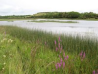
Eirk Bog was established as a Nature Reserve in 1986 and is an example of an intermediate bog, with associated poor fen and blanket bog/wet heath communities.
Autor/Urheber: Sleepyhead2, Lizenz: CC BY-SA 3.0
Inishbofin Island, Co Donegal, Ireland
Lough Ree funnels into the River Shannon north of Athlone, Ireland
(c) Aiden Clarke, CC BY-SA 2.0
Inishkea South Island.
Taken from near the Napoleonic-era lookout.
(c) Joseph Mischyshyn, CC BY-SA 2.0
Falcarragh - Beach at Ballyness Bay at end of R256
Autor/Urheber: User: (WT-shared) Spircle auf wts wikivoyage, Lizenz: CC BY-SA 4.0
Alluvial Forest at the Gearagh, Macroom, Co. Cork. Original photo by Spircle. Taken 31.10.08.
(c) Eric Jones, CC BY-SA 2.0
View of the Mountains of the Cooley Peninsula from near the Halpenny Travel Garage
(c) Mike Simms, CC BY-SA 2.0
Limestone ledges at Lough Carra Lough Carra is just one of many Irish lakes which are underlain by limestone. The water here is so hard that shells and plant stems are quite quickly encrusted with 'lime-scale' (calcite).
Autor/Urheber: Sergio, Lizenz: CC BY 2.0
The Fanad Peninsula lies between Lough Swilly and Mulroy Bay on the north coast of County Donegal in Ireland.
Autor/Urheber: Tony Hisgett from Birmingham, UK, Lizenz: CC BY 2.0
Galway bay
Sheep's Head, County Cork
(c) Frank Donovan, CC BY-SA 2.0
View from Ring Head across Clonakilty Bay Looking across Clonakilty Bay to (from right to left):
 - Muckruss Head
 - Duneen Bay
 - Duneen Point
- Ringlea Point
Autor/Urheber: Comhar, Lizenz: CC BY-SA 3.0
Lazybeds on Inishglora island off the Mullet, Erris, County Mayo, Ireland
Autor/Urheber: Carsten Clasohm, Lizenz: CC BY 3.0
View of Rathlin O'Birne island, taken from Amharc Mór, County Donegal, Ireland.
Autor/Urheber: Sjaak Kempe from Groningen, The Netherlands, Lizenz: CC BY 2.0
20120812 26 Ireland - Co. Waterford - Ballyvoile
Lough Owel looking southwest
(c) Philip Halling, CC BY-SA 2.0
Harbour and castle at Dungarvan The ruins of the castle can be seen to the left.
(c) Pamela Norrington, CC BY-SA 2.0
Lough Conn and Nephin A view of sunset over Lough Conn with Nephin to the northwest, taken from the terrace of Pontoon Bridge Hotel.
Autor/Urheber: netwhizkid, Lizenz: CC BY 2.0
View of Mullaghanish taken from the Foil road near the Top of Coom. Replacement of the old mast is underway as part of Ireland's digital switchover to DTT to be completed by 2012.
Lough Arrow with its many islands
Autor/Urheber: Emmet & Kathy, Lizenz: CC BY 2.0
A view of Lady's Island Lake, in County Wexford, Ireland at sunset.
Autor/Urheber: Andrew Kearns, Lizenz: CC BY 2.0
Inishbofin Island, County Galway, Ireland
(c) Bob Jones, CC BY-SA 2.0
Fergus Estuary at Ing At low water the ooze appears to be covered with a thin film of water which reflects the clouds.
Cross Lake, Mullet Peninsula, Erris, County Mayo. Summer 2010
Autor/Urheber: Ludwig Bickel, Lizenz: CC BY-SA 4.0
Loop Head (Halbinsel) County Clare Westküste Irland
Stags of Broadhaven on the North Mayo coast Kilcommon parish Erris
(c) Roger, CC BY-SA 2.0
Blacksod bay, with mainland in distance Cottage overlooking Blacksod Bay, just south of the town of Belmullet. Taken from the peninsula.
(c) Pam Brophy, CC BY-SA 2.0
Castlemaine Harbour near Inch. This view was taken looking west across the harbour, from the R561. This very large bay is known as Castlemaine Harbour and is flanked by the Dingle peninsula and the Ring of Kerry.
Autor/Urheber: Sonse, Lizenz: CC BY 2.0
Dún Aonghasa • Dun Aengus
is a prehistoric hill fort on the Aran Islands of County Galway, Republic of Ireland. It lies on Inishmore, at the edge of a 100 metre high cliff. Founded from 1100 BC.The Poisoned Glen in County Donegal
(c) JP, CC BY-SA 2.0
Lough Derg View of Lough Derg looking west towards Scariff from off Parker Point, Co. Tipperary. The marker buoy off Aughinish Point can be seen near the centre of the frame.
(c) Kenneth Allen, CC BY-SA 2.0
Bragan Townland Looking northwards
(c) William Murphy, CC BY-SA 3.0
Bull Island Nature Reserve
Autor/Urheber: Михал Орела, Lizenz: CC BY 2.0
Lambay Island, Co. Dublin
(c) Kay Atherton, CC BY-SA 2.0
Reedy shore of Lough Conn The reedy western shore of Lough Conn, County Mayo. The mountain in the background is Nephin, 806m, part of the Nephin Range.
Overlooking Carrowmore Lake, Erris from Faulagh Mountain, Kilcommon, Erris, co. Mayo. A pair of prehistoric standing stones can be seen in the mid ground.
Lough Ennell, looking northwest from The Bloomfield
Autor/Urheber: Tony Webster, Lizenz: CC BY-SA 3.0
Scariff and Deenish Islands 12282959374 o
(c) Kenneth Allen, CC BY-SA 2.0
Purgatory at Lough Derg Zooming in to get the maximum view.
Autor/Urheber: Amm529, Lizenz: CC BY-SA 4.0
North east quadrant of White Island along Lough Mask
(c) Roger, CC BY-SA 2.0
Coastline on north of Belmullet peninsula County Mayo
Autor/Urheber: Bjørn Christian Tørrissen, Lizenz: CC BY-SA 3.0
Looking north along the cliffs towards O'Brien's Tower.
(c) Oliver Dixon, CC BY-SA 2.0
Sunset over Bills Rocks Bills Rocks are two tiny islands set far out in the mouth of Clew Bay. Here seen from the hillside above Killeen over 25 Km away. The nearer land is the low-lying promontory at the south-west corner of Clare Island.
Autor/Urheber: Michel.Deprun, Lizenz: CC BY-SA 4.0
Logotype du réseau européen Natura 2000
Autor/Urheber: Declangi, Lizenz: CC BY-SA 4.0
Lough Gara, in Counties Sligo and Roscommon
(c) Andreas F. Borchert, CC BY-SA 4.0
Cliffs at the south-western coast of the island.
The Great Saltee
"Thunder Rock, at the very western edge of Ireland, can see the Marina at Dingle." – Original caption by astronaut Chris Hadfield.
The Dingle Peninsula in County Kerry in Ireland, with the Blasket Islands offshore to the west, photographed from the International Space Station. The Thunder Rock referred to by the photographer is a very minor feature (0.57 hectares; maximum height 36 metres) offshore to the south of the island of Inishvickillane, appearing as a white spot in this picture (52.037076 ºN, 10.606699 ºW).
(c) Paul Burns, CC BY-SA 2.0
Aughris Head, Templeboy, Sligo Aughris Head was one of the inaugural sites of the O'Dowd chieftains. Also, there is a St. Patrick's holy well near the point, reputed to clear eye problems.
Autor/Urheber: Harvey Milligan, Lizenz: CC BY-SA 4.0
Aerial View of the River Boyne Estuary and Drogheda
Lough Oughter, County Cavan
Autor/Urheber: tiarescott, Lizenz: CC BY 2.0
Cliffs on the Old Head of Kinsale
IMG_6636
(c) Oliver Dixon, CC BY-SA 2.0
Horse Island and old jetty. Seen from the foot of Knocklane Hill.
(c) Kenneth Allen, CC BY-SA 2.0
Ardnamoyle Townland Zooming NNW for a closer look of the Swilly
Dun Laoghaire, Ireland. View of harbour
Autor/Urheber: Jamip29, Lizenz: CC BY-SA 4.0
Malin head coastline looking towards the north
(c) Kieran Campbell, CC BY-SA 2.0
Mouth of the River Nanny The mighty Nanny enters the Irish Sea
(c) David Quinn, CC BY-SA 2.0
View of Wicklow and Wicklow Head as seen from the Devil's Glen.
Autor/Urheber: Alexander Redfern, Lizenz: CC BY-SA 4.0
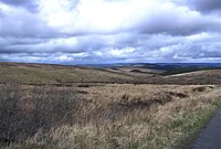
Looking from the western slope of Stumpa Dúloigh toward the Dunkerron/Iveragh mountains on the Iveragh peninsula. In the foreground lies Stumpa Dúloigh SW Top (663m), immediately behind and to the right lies Mullaghanattin (773m).
Autor/Urheber: Aturtles, Lizenz: CC BY-SA 4.0
Tramore Backstrand and Dunes, a nature reserve adjacent to Tramore Beach.
(c) Kenneth Allen, CC BY-SA 2.0
Drumcliff Bay at Coolbeg There was supposed to be site of an old castle somewhere about here but I couldn't locate it.
