Liste der Countys in Oregon
Der US-Bundesstaat Oregon ist in 36 Countys unterteilt.

Liste der Countys
| County | FIPS-Code[1] | County seat[2] | Gegründet[2] | Errichtet aus[3] | Etymologie[3] | EW-Zahl(2016)[4] | Fläche[2] | Karte |
|---|---|---|---|---|---|---|---|---|
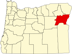
| Baker County | 001 | Baker City | 1862 | Wasco County, Union County und Malheur County | Edward Dickinson Baker, Senator aus Oregon, der während einer Schlacht im Amerikanischen Bürgerkrieg bei Ball’s Bluff fiel | 16.510 | 7.946 km² (3.068 sq mi) |  |
| Benton County | 003 | Corvallis | 1847 | Polk County | Thomas Hart Benton (1782–1858), Senator, der in die Auseinandersetzungen um Oregon Country involviert war | 91.320 | 1.751 km² (676 sq mi) |  |
| Clackamas County | 005 | Oregon City | 1843 | Einer der ursprünglich vier Distrikte des Oregon Country | Die Clackamas waren ein indianischer Stamm | 404.980 | 4.838 km² (1.868 sq mi) |  |
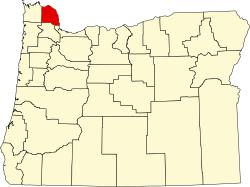
| Clatsop County | 007 | Astoria | 1844 | Aus nördlichen und westlichen Teilen des Twality District | Clatsop war ein Indianerstamm | 38.225 | 2.142 km² (827 sq mi) |  |
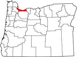
| Columbia County | 009 | Saint Helens | 1854 | Nördliche Hälfte des Washington County | Columbia River, die Nordgrenze des Countys | 50.795 | 1.702 km² (657 sq mi) |  |
| Coos County | 011 | Coquille | 1853 | Umpqua und Jackson Countys | Die Coos waren ein Indianerstamm | 63.190 | 4.144 km² (1.600 sq mi) |  |
| Crook County | 013 | Prineville | 1882 | Südliche Teile des Wasco County | George Crook (1828–1890), Bürgerkriegsoffizier | 21.580 | 7.718 km² (2.980 sq mi) |  |
| Curry County | 015 | Gold Beach | 1855 | Aus Teilen von Coos County | George Law Curry (1820–1878), Gouverneur des Oregon Territory | 22.600 | 4.214 km² (1.627 sq mi) |  |
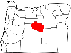
| Deschutes County | 017 | Bend | 1916 | Südlicher Teil von of Crook County | Riviere des Chutes, Französisch für Fluss der Wasserfälle. | 176.635 | 7.817 km² (3.018 sq mi) |  |
| Douglas County | 019 | Roseburg | 1852 | Umpqua County, Teile östlich des Coast Range Summit | Stephen A. Douglas (1813–1861), Senator | 110.395 | 13.046 km² (5.037 sq mi) |  |
| Gilliam County | 021 | Condon | 1885 | Östlicher Drittel von of Wasco County | Cornelius Gilliam (1798–1848), Pionier | 1.980 | 3.118 km² (1.204 sq mi) |  |
| Grant County | 023 | Canyon City | 1864 | Teile des alten Wasco und des alten Umatilla County | Ulysses S. Grant (1822–1885), Offizier und 1869–1877 Präsident der Vereinigten Staaten | 7.410 | 11.730 km² (4.529 sq mi) |  |
| Harney County | 025 | Burns | 1889 | Südliche Teile von Grant County | William S. Harney (1800–1889), Kavallerieoffizier im Pig War | 7.320 | 26.250 km² (10.135 sq mi) |  |
| Hood River County | 027 | Hood River | 1908 | Nordwesten von Wasco County | Hood River | 24.735 | 1.352 km² (522 sq mi) |  |
| Jackson County | 029 | Medford | 1852 | Lane County und neu erschlossenes Gebiet südlich Douglas und Umpqua Countys | Andrew Jackson (1767–1845), sieber Präsident der USA | 213.765 | 7.213 km² (2.785 sq mi) |  |
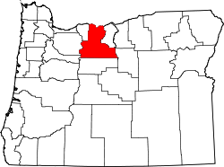
| Jefferson County | 031 | Madras | 1914 | Crook County | Mount Jefferson, der seinen Namen von Thomas Jefferson (1743–1826) hat. | 22.790 | 4.613 km² (1.781 sq mi) |  |
| Josephine County | 033 | Grants Pass | 1856 | Westlicher Hälfte von Jackson County | Virginia "Josephine" Rollins, die erste Weisse, die hier wohnte | 84.675 | 4.248 km² (1.640 sq mi) |  |
| Klamath County | 035 | Klamath Falls | 1882 | Westlicher Teil von Lake County | Die Klamath, die hier schon seit 10.000 Jahren wohnten. | 67.410 | 15.397 km² (5.945 sq mi) |  |
| Lake County | 037 | Lakeview | 1874 | Jackson und Wasco Counties | Viele Seen und heiße Quellen. | 8.015 | 20.565 km² (7.940 sq mi) |  |
| Lane County | 039 | Eugene | 1851 | Südlicher Teil von Linn County und Benton County | General Joseph Lane (1801–1881), erster Gouverneur des Oregon Territory | 365.940 | 11.795 km² (4.554 sq mi) |  |
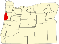
| Lincoln County | 041 | Newport | 1893 | Westlicher Teil von Benton County und Polk County | Abraham Lincoln (1809–1865), sechzehnter Präsident. | 47.735 | 2.538 km² (980 sq mi) |  |
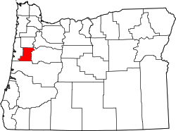
| Linn County | 043 | Albany | 1847 | Südlicher Teil von Champoeg (später Marion) County | U.S. Senator Lewis F. Linn (1795–1843) aus Missouri, Verfasser des Donation Land Act, der den Siedlern freien Zugang zum Land gewährte. | 122.315 | 5.934 km² (2.291 sq mi) |  |
| Malheur County | 045 | Vale | 1887 | Südlicher Teil des Baker County | Malheur River (genauer Riviere au Malheur, unglücklicher Fluss), weil am Fluss französischen Trappern Felle und weitere Dinge gestohlen wurden. | 31.705 | 25.610 km² (9.888 sq mi) |  |
| Marion County | 047 | Salem | 1843 | Einer der ursprünglichen vier Distrikte des Oregon Territory | Francis Marion (1732–1795), General im American Revolutionary War | 333.950 | 3.069 km² (1.185 sq mi) |  |
| Morrow County | 049 | Heppner | 1885 | Westlicher Teil von Umatilla County und ein kleiner Teil von Wasco County | Jackson L. Morrow, ein Politiker in Oregon, der sich für die Errichtung dieses Countys einsetzte. | 11.745 | 5.265 km² (2.033 sq mi) |  |
| Multnomah County | 051 | Portland | 1854 | Östlicher Teil von Washington und nördlicher Teil von Clackamas County | Nach der Siedlung der Multnomah, auf Sauvie Island. Das Wort entstand aus nematlnomaq, was etwa „flussabwärts“ bedeutet. Lewis und Clark nannten seit 1805 alle Indianer in der Gegend so. | 790.670 | 1.127 km² (435 sq mi) |  |
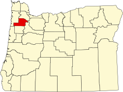
| Polk County | 053 | Dallas | 1845 | Yamhill District | James Knox Polk (1795–1849) war Präsident, als das County errichtet wurde | 79.730 | 1.919 km² (741 sq mi) |  |
| Sherman County | 055 | Moro | 1889 | Wasco County | William Tecumseh Sherman (1820–1891), Bürgerkriegsgeneral, Autor und Geschäftsmann | 1.795 | 2.132 km² (823 sq mi) |  |
| Tillamook County | 057 | Tillamook | 1853 | Clatsop, Yamhill und Polk Counties | Tillamook (auch Killamook) Volk. | 25.920 | 2.854 km² (1.102 sq mi) |  |
| Umatilla County | 059 | Pendleton | 1862 | Teile des Wasco County | Sahaptin (Sprache), es heißt möglicherweise lachende Wasser. | 79.880 | 8.327 km² (3.215 sq mi) |  |
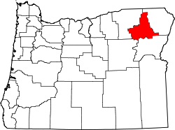
| Union County | 061 | La Grande | 1864 | Baker County | Die Stadt Union, die zwei Jahre zuvor gegründet wurde und so heißt, wegen der „Einheit“ der Staaten im Bürgerkrieg. | 26.745 | 5.276 km² (2.037 sq mi) |  |
| Wallowa County | 063 | Enterprise | 1887 | Östliche Teile des Union County. | Ein Wort der Nez-Perce-Indianer, das ein Gestell zum Fischfang beschreibt. | 7.140 | 8.146 km² (3.145 sq mi) |  |
| Wasco County | 065 | The Dalles | 1854 | Teile von Clackamas, Lane, Linn und Marion Countys | Wasco (auch Wascopam), ein Indianerstamm. | 26.700 | 6.167 km² (2.381 sq mi) |  |
| Washington County | 067 | Hillsboro | 1843 | Eines der ursprünglichen vier Distrikte von Oregon (als Twality District) | George Washington (1732–1799), Gründungsvater der USA und ihr erster Präsident | 583.595 | 1.875 km² (724 sq mi) |  |
| Wheeler County | 069 | Fossil | 1899 | Teile von Grant, Gilliam, und Crook Countys | Henry H. Wheeler, der einen Postservice betrieb. | 1.465 | 4.442 km² (1.715 sq mi) |  |
| Yamhill County | 071 | McMinnville | 1843 | Eines der ursprünglichen vier Distrikte von Oregon | Die Yamhill, waren ein Stamm der Kalapuya, die am Yamhill River lebten. | 104.990 | 1.854 km² (716 sq mi) |  |
Einzelnachweise
- ↑ EPA County FIPS Code Listing. EPA, abgerufen am 9. April 2007.
- ↑ a b c National Association of Counties: NACo – Find a county. Archiviert vom (nicht mehr online verfügbar) am 25. Oktober 2007; abgerufen am 26. April 2007.
- ↑ a b Oregon State Archives: County Government. In: Oregon Blue Book. Abgerufen am 23. Februar 2008.
- ↑ Certified Population Estimates for Oregon and Counties (2016). In: Population Research Center. Portland State University, 15. Dezember 2016, archiviert vom (nicht mehr online verfügbar) am 2. März 2017; abgerufen am 1. März 2017. Info: Der Archivlink wurde automatisch eingesetzt und noch nicht geprüft. Bitte prüfe Original- und Archivlink gemäß Anleitung und entferne dann diesen Hinweis.
Auf dieser Seite verwendete Medien
Map of Oregon highlighting Malheur County.svg
Locator map of Malheur County — in eastern Oregon.
- Credits
- David Benbennick made this map.
- For more information, see Commons:United States county locator maps.
Map of Oregon highlighting Linn County.svg
This is a locator map showing Linn County in Oregon. For more information, see Commons:United States county locator maps.
This is a locator map showing Linn County in Oregon. For more information, see Commons:United States county locator maps.
Map of Oregon highlighting Baker County.svg
This is a locator map showing Baker County in Oregon. For more information, see Commons:United States county locator maps.
This is a locator map showing Baker County in Oregon. For more information, see Commons:United States county locator maps.
Map of Oregon highlighting Umatilla County.svg
This is a locator map showing Umatilla County in Oregon. For more information, see Commons:United States county locator maps.
This is a locator map showing Umatilla County in Oregon. For more information, see Commons:United States county locator maps.
Map of Oregon highlighting Polk County.svg
This is a locator map showing Polk County in Oregon. For more information, see Commons:United States county locator maps.
This is a locator map showing Polk County in Oregon. For more information, see Commons:United States county locator maps.
Map of Oregon highlighting Jefferson County.svg
This is a locator map showing Jefferson County in Oregon. For more information, see Commons:United States county locator maps.
This is a locator map showing Jefferson County in Oregon. For more information, see Commons:United States county locator maps.
Map of Oregon highlighting Lake County.svg
This is a locator map showing Lake County in Oregon. For more information, see Commons:United States county locator maps.
This is a locator map showing Lake County in Oregon. For more information, see Commons:United States county locator maps.
Map of Oregon highlighting Hood River County.svg
This is a locator map showing Hood River County in Oregon. For more information, see Commons:United States county locator maps.
This is a locator map showing Hood River County in Oregon. For more information, see Commons:United States county locator maps.
Map of Oregon highlighting Klamath County.svg
This is a locator map showing Klamath County in Oregon. For more information, see Commons:United States county locator maps.
This is a locator map showing Klamath County in Oregon. For more information, see Commons:United States county locator maps.
Map of Oregon highlighting Multnomah County.svg
This is a locator map showing Multnomah County in Oregon. For more information, see Commons:United States county locator maps.
This is a locator map showing Multnomah County in Oregon. For more information, see Commons:United States county locator maps.
Map of Oregon highlighting Benton County.svg
This is a locator map showing Benton County in Oregon. For more information, see Commons:United States county locator maps.
This is a locator map showing Benton County in Oregon. For more information, see Commons:United States county locator maps.
Map of Oregon highlighting Union County.svg
This is a locator map showing Union County in Oregon. For more information, see Commons:United States county locator maps.
This is a locator map showing Union County in Oregon. For more information, see Commons:United States county locator maps.
Map of Oregon highlighting Lane County.svg
This is a locator map showing Lane County in Oregon. For more information, see Commons:United States county locator maps.
This is a locator map showing Lane County in Oregon. For more information, see Commons:United States county locator maps.
Map of Oregon highlighting Wasco County.svg
This is a locator map showing Wasco County in Oregon. For more information, see Commons:United States county locator maps.
This is a locator map showing Wasco County in Oregon. For more information, see Commons:United States county locator maps.
Oregon counties by date of establishment.svg
Oregon counties by date of establishment
Oregon counties by date of establishment
1840–1849
1850–1859
1860–1869
1870–1889
After 1890
Map of Oregon highlighting Deschutes County.svg
This is a locator map showing Deschutes County in Oregon. For more information, see Commons:United States county locator maps.
This is a locator map showing Deschutes County in Oregon. For more information, see Commons:United States county locator maps.
Map of Oregon highlighting Sherman County.svg
This is a locator map showing Sherman County in Oregon. For more information, see Commons:United States county locator maps.
This is a locator map showing Sherman County in Oregon. For more information, see Commons:United States county locator maps.
Oregon Locator Map.PNG
Locator Map of Oregon, United States
Locator Map of Oregon, United States
Map of Oregon highlighting Washington County.svg
This is a locator map showing Washington County in Oregon. For more information, see Commons:United States county locator maps.
This is a locator map showing Washington County in Oregon. For more information, see Commons:United States county locator maps.
Map of Oregon highlighting Wallowa County.svg
This is a locator map showing Wallowa County in Oregon.
This is a locator map showing Wallowa County in Oregon.
Map of Oregon highlighting Harney County.svg
This is a locator map showing Harney County in Oregon. For more information, see Commons:United States county locator maps.
This is a locator map showing Harney County in Oregon. For more information, see Commons:United States county locator maps.
Map of Oregon highlighting Columbia County.svg
This is a locator map showing Columbia County in Oregon. For more information, see Commons:United States county locator maps.
This is a locator map showing Columbia County in Oregon. For more information, see Commons:United States county locator maps.
Map of Oregon highlighting Jackson County.svg
This is a locator map showing Jackson County in Oregon. For more information, see Commons:United States county locator maps.
This is a locator map showing Jackson County in Oregon. For more information, see Commons:United States county locator maps.
Map of Oregon highlighting Gilliam County.svg
This is a locator map showing Gilliam County in Oregon. For more information, see Commons:United States county locator maps.
This is a locator map showing Gilliam County in Oregon. For more information, see Commons:United States county locator maps.
Map of Oregon highlighting Douglas County.svg
This is a locator map showing Douglas County in Oregon. For more information, see Commons:United States county locator maps.
This is a locator map showing Douglas County in Oregon. For more information, see Commons:United States county locator maps.
Map of Oregon highlighting Grant County.svg
This is a locator map showing Grant County in Oregon. For more information, see Commons:United States county locator maps.
This is a locator map showing Grant County in Oregon. For more information, see Commons:United States county locator maps.
Map of Oregon highlighting Marion County.svg
This is a locator map showing Marion County in Oregon. For more information, see Commons:United States county locator maps.
This is a locator map showing Marion County in Oregon. For more information, see Commons:United States county locator maps.
Map of Oregon highlighting Yamhill County.svg
This is a locator map showing Yamhill County in Oregon. For more information, see Commons:United States county locator maps.
This is a locator map showing Yamhill County in Oregon. For more information, see Commons:United States county locator maps.
Map of Oregon highlighting Lincoln County.svg
This is a locator map showing Lincoln County in Oregon. For more information, see Commons:United States county locator maps.
This is a locator map showing Lincoln County in Oregon. For more information, see Commons:United States county locator maps.
Map of Oregon highlighting Crook County.svg
This is a locator map showing Crook County in Oregon. For more information, see Commons:United States county locator maps.
This is a locator map showing Crook County in Oregon. For more information, see Commons:United States county locator maps.
Map of Oregon highlighting Coos County.svg
This is a locator map showing Coos County in Oregon. For more information, see Commons:United States county locator maps.
This is a locator map showing Coos County in Oregon. For more information, see Commons:United States county locator maps.
Map of Oregon highlighting Wheeler County.svg
This is a locator map showing Wheeler County in Oregon. For more information, see Commons:United States county locator maps.
This is a locator map showing Wheeler County in Oregon. For more information, see Commons:United States county locator maps.
Map of Oregon highlighting Morrow County.svg
This is a locator map showing Morrow County in Oregon. For more information, see Commons:United States county locator maps.
This is a locator map showing Morrow County in Oregon. For more information, see Commons:United States county locator maps.
Map of Oregon highlighting Clatsop County.svg
This is a locator map showing Clatsop County in Oregon. For more information, see Commons:United States county locator maps.
This is a locator map showing Clatsop County in Oregon. For more information, see Commons:United States county locator maps.
Map of Oregon highlighting Tillamook County.svg
This is a locator map showing Tillamook County in Oregon. For more information, see Commons:United States county locator maps.
This is a locator map showing Tillamook County in Oregon. For more information, see Commons:United States county locator maps.


