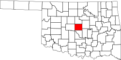
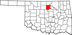
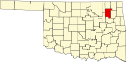
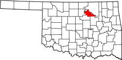
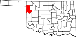
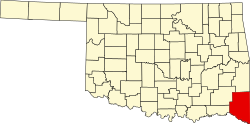
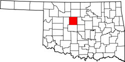
Liste der Countys in Oklahoma
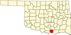
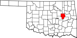
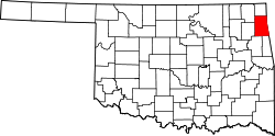
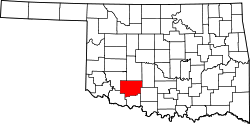
Der US-amerikanische Bundesstaat Oklahoma ist in 77 Countys unterteilt. Die offizielle Abkürzung des Staates Oklahoma lautet OK, der FIPS-Code ist 40[1]. Der FIPS-Code für jedes einzelne County beginnt also stets mit 40, an die jeweils eine dreistellige Zahl angehängt wird. Die Angaben der Bevölkerungszahlen basieren auf der Volkszählung im Jahr 2010. |
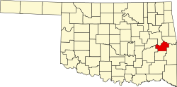
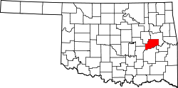
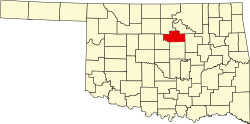
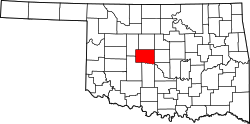
| County | FIPS- Code[2] | County Seat | Gründung | Ursprung | Namensherkunft | Einwohner 2010[3] | Fläche[2] | Karte |
|---|---|---|---|---|---|---|---|---|
| Adair | 001 | Stilwell | 1907 | Land der Cherokee | William Penn Adair (1830–1880) – Cherokeeführer und Oberst der Konföderierten | 22.683 | 1.485 km² |  |
| Alfalfa | 003 | Cherokee | 1907 | Woods County | William „Alfalfa Bill“ Murray (1869–1956) – Präsident der Verfassunggebenden Versammlung und Gouverneur von Oklahoma | 5.642 | 2.244 km² |  |
| Atoka | 005 | Atoka | 1907 | Land der Choctaw | Atoka – Häuptling der Choctaw und einer der Mitunterzeichner des Vertrages von Dancing Rabbit Creek | 14.182 | 2.527 km² |  |
| Beaver | 007 | Beaver | 1890 | Originalcounty | Beaver River | 5.636 | 4.700 km² |  |
| Beckham | 009 | Sayre | 1890 | Roger Mills County und Greer County | J. C. W. Beckham (1869–1940) – 35. Gouverneur von Kentucky (1900–1907) | 22.119 | 2.336 km² |  |
| Blaine | 011 | Watonga | 1892 | Teil der Cheyenne und Arapaho Reservation | James G. Blaine (1830–1893) – US-Senator (1876–1881) und Außenminister der USA (1881, 1889–1892) | 11.943 | 2.405 km² |  |
| Bryan | 013 | Durant | 1907 | Land der Choctaw | William Jennings Bryan (1860–1925) – Außenminister der USA (1913–1915) | 42.416 | 2.343 km² |  |
| Caddo | 015 | Anadarko | 1901 | Originalcounty | Konföderation der Caddo | 29.600 | 3.311 km² |  |
| Canadian | 017 | El Reno | 1889 | Unassigned Lands, Teil der Cheyenne und Arapaho Reservation | Canadian River | 115.541 | 2.322 km² |  |
| Carter | 019 | Ardmore | 1907 | Pickens County und Land der Chickasaw | Name einer der ersten weißen Siedlerfamilien | 47.557 | 2.129 km² |  |
| Cherokee | 021 | Tahlequah | 1907 | Land der Cherokee | Volk der Cherokee | 46.987 | 1.941 km² |  |
| Choctaw | 023 | Hugo | 1907 | Land der Choctaw | Volk der Choctaw | 15.205 | 1.995 km² |  |
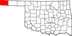
| Cimarron | 025 | Boise City | 1907 | Beaver County und Oklahoma-Territorium | Cimarron River | 2.475 | 4.752 km² |  |
| Cleveland | 027 | Norman | 1889 | Unassigned Lands | Grover Cleveland (1837–1908) – zweimaliger Präsident der USA (1885–1889 sowie 1893–1897) | 255.755 | 1.395 km² |  |
| Coal | 029 | Coalgate | 1907 | Land der Choctaw | zahlreiche Kohlegruben im County | 5.925 | 1.338 km² |  |
| Comanche | 031 | Lawton | 1901 | Reservation der Kiowa, Comanche und Apache | Volk der Comanche | 124.098 | 2.769 km² |  |
| Cotton | 033 | Walters | 1912 | Comanche County, Big Pasture | Baumwolle (engl.: cotton) – die Grundlage der Wirtschaft in diesem Gebiet | 6.193 | 1.639 km² |  |
| Craig | 035 | Vinita | 1907 | Land der Cherokee | Granville Craig – ein bekannter Farmer aus dem Volk der Cherokee | 15.029 | 1.972 km² |  |
| Creek | 037 | Sapulpa | 1907 | Land der Muskogee | Volk der Muskogee, die auch Creek genannt wurden | 69.967 | 2.461 km² |  |
| Custer | 039 | Arapaho | 1892 | Cheyenne-Arapaho Reservation | George Armstrong Custer (1839–1876) – Kavallerieoffizier des US-Heeres im Bürgerkrieg und späteren Indianerkriegen | 27.469 | 2.561 km² |  |
| Delaware | 041 | Jay | 1907 | Land der Cherokee | Volk der Lenni Lenape, auch Delaware genannt | 41.487 | 1.912 km² |  |
| Dewey | 043 | Taloga | 1892 | Cheyenne-Arapaho Reservation | George Dewey (1837–1917) – Admiral der US-Marine | 4.810 | 2.589 km² |  |
| Ellis | 045 | Arnett | 1907 | Roger Mills und Woodward County | Abraham H. Ellis – Präsident der Verfassunggebenden Versammlung ("Constitutional Convention") von Oklahoma | 4.151 | 3.190 km² |  |
| Garfield | 047 | Enid | 1893 | Land der Cherokee | James A. Garfield (1831–1881) – 20. Präsident der USA (1881) | 60.580 | 2.741 km² |  |
| Garvin | 049 | Pauls Valley | 1907 | Land der Chickasaw | Samuel Garvin – Stammesführer der Chickasaw | 27.576 | 2.077 km² |  |
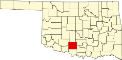
| Grady | 051 | Chickasha | 1907 | Pontotoc, Caddo, Comanche und das ehemalige Pickens County | Henry W. Grady (1851–1889) – Herausgeber der Atlanta Constitution | 52.431 | 2.850 km² |  |
| Grant | 053 | Medford | 1893 | Cherokee Outlet | Ulysses S. Grant (1822–1885) – 18. Präsident der USA (1869–1877) | 4.527 | 2.592 km² |  |
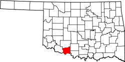
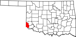
| Greer | 055 | Mangum | 1890 | texanisches Anspruchsgebiet | John Alexander Greer (1802–1855) – Vizegouverneur von Texas (1847–1851) | 6.239 | 1.656 km² |  |
| Harmon | 057 | Hollis | 1909 | Greer und Jackson County | Judson Harmon (1846–1927) – Justizminister der USA (1895–1897) | 2.922 | 1.391 km² |  |
| Harper | 059 | Buffalo | 1907 | Woods und Woodward County | Oscar G. Harper – Mitglied der Verfassunggebenden Versammlung ("Constitutional Convention") von Oklahoma | 3.685 | 2.691 km² |  |
| Haskell | 061 | Stigler | 1907 | Land der Choctaw | Charles N. Haskell (1860–1933) – erster Gouverneur von Oklahoma | 12.769 | 1.493 km² |  |
| Hughes | 063 | Holdenville | 1907 | Land der Muskogee | W.C. Hughes – Mitglied der Verfassunggebenden Versammlung ("Constitutional Convention") von Oklahoma | 14.003 | 2.084 km² |  |
| Jackson | 065 | Altus | 1907 | Greer County | Thomas Jonathan Jackson (1824–1863) genannt Stonewall – General des konföderierten Heeres. | 26.446 | 2.079 km² |  |
| Jefferson | 067 | Waurika | 1907 | Comanche County und zu einem Teil Land der Chickasaw | Thomas Jefferson (1743–1826) – dritter Präsident der USA (1801–1809) | 6.472 | 1.965 km² |  |
| Johnston | 069 | Tishomingo | 1907 | Land der Chickasaw | Douglas H. Johnston (1856–1939) – Stammesführer der Chickasaw | 10.957 | 1.665 km² |  |
| Kay | 071 | Newkirk | 1895 | cherokee Outlet | Benannt nach dem Buchstaben "K"[4] | 46.562 | 2.382 km² |  |
| Kingfisher | 073 | Kingfisher | 1890 | Unassigned Lands | Kingfisher Creek | 15.034 | 2.326 km² |  |
| Kiowa | 075 | Hobart | 1901 | Land der Kiowa-Apachen | Volk der Kiowa | 9.446 | 2.629 km² |  |
| Latimer | 077 | Wilburton | 1902 | Land der Choctaw | James S. Latimer – Abgeordneter in Oklahoma | 11.154 | 1.870 km² |  |
| Le Flore | 079 | Poteau | 1907 | Land der Choctaw | Greenwood LeFlore (1800–1865) – Häuptling der Choctaw | 50.384 | 4.116 km² |  |
| Lincoln | 081 | Chandler | 1891 | Originalcounty | Abraham Lincoln (1809–1865) – 16. Präsident der USA (1861–1865) | 34.273 | 2.466 km² |  |
| Logan | 083 | Guthrie | 1890 | Unassigned Lands | John A. Logan (1826–1886) – General des US-Heeres im Bürgerkrieg und später US-Senator von Illinois (1871–1877, 1879–1886) | 41.848 | 1.927 km² |  |
| Love | 085 | Marietta | 1907 | Land der Chickasaw | Overton Love – ein Richter und bekannter Landbesitzer aus dem Volk der Chickasaw | 9.423 | 1.331 km² |  |
| Major | 093 | Fairview | 1907 | Woods County | John C. Major – ein Mitglied der Verfassunggebenden Versammlung ("Constitutional Convention") von Oklahoma | 7.527 | 2.473 km² |  |
| Marshall | 095 | Madill | 1907 | Land der Chickasaw | Marshall – der Geburtsname der Mutter eines Mitglieds der Verfassunggebenden Versammlung ("Constitutional Convention") von Oklahoma | 15.840 | 961 km² |  |
| Mayes | 097 | Pryor | 1907 | Land der Cherokee | Samuel Houston Mayes (1845–1927) – Führer der Cherokee (1895–1899) | 41.259 | 1.697 km² |  |
| McClain | 087 | Purcell | 1907 | Land der Chickasaw | Charles M. McClain – ein Mitglied der Verfassunggebenden Versammlung ("Constitutional Convention") von Oklahoma | 34.506 | 1.478 km² |  |
| McCurtain | 089 | Idabel | 1907 | Land der Choctaw | Die Familie McCurtain, eine bekannte Landbesitzerfamilie aus dem Volk der Choctaw | 33.151 | 4.792 km² |  |
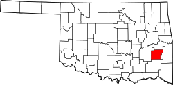
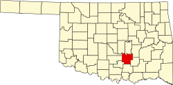
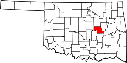
| McIntosh | 091 | Eufaula | 1907 | Land der Muskogee | Familie McIntosh – bekannte Landbesitzer aus dem Volk der Muskogee | 20.252 | 1.602 km² |  |
| Murray | 099 | Sulphur | 1907 | Land der Chickasaw | William „Alfalfa Bill“ Murray (1869–1956) – Präsident der Verfassunggebenden Versammlung und Gouverneur von Oklahoma | 13.488 | 1.079 km² |  |
| Muskogee | 101 | Muskogee | 1898 | Land der Muskogee | Volk der Muskogee | 70.990 | 2.100 km² |  |
| Noble | 103 | Perry | 1893 | Cherokee Outlet | John Willock Noble (1831–1912) – Innenminister der USA (1889–1893) | 11.561 | 1.896 km² |  |
| Nowata | 105 | Nowata | 1907 | Land der Cherokee | Die Stadt Nowata | 10.536 | 1.465 km² |  |
| Okfuskee | 107 | Okemah | 1907 | Land der Muskogee | alte Indianersiedlung in Alabama | 12.191 | 1.602 km² |  |
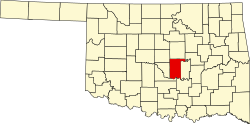
| Oklahoma | 109 | Oklahoma City | 1890 | Unassigned Lands | Wort aus der Choctaw-Sprache: okla (der Mensch) und humma (rot), also so viel wie Das Land des roten Mannes | 718.633 | 1.836 km² |  |
| Okmulgee | 111 | Okmulgee | 1907 | Land der Muskogee | indianisches Wort für sprudelndes Wasser | 40.069 | 1.806 km² |  |
| Osage | 113 | Pawhuska | 1907 | Reservation der Osage | Indianervolk der Osage | 47.472 | 5.818 km² |  |
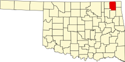
| Ottawa | 115 | Miami | 1907 | Land der Cherokee | Indianervolk der Ottawa | 31.848 | 1.219 km² |  |
| Pawnee | 117 | Pawnee | 1893 | Land der Cherokee | Indianervolk der Pawnee | 16.577 | 1.471 km² |  |
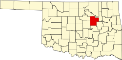
| Payne | 119 | Stillwater | 1890 | Unassigned Lands | David L. Payne (1836–1884) – organisierte 1889 den ersten Oklahoma Land Run und wird deshalb auch Vater von Oklahoma genannt | 77.350 | 1.773 km² |  |
| Pittsburg | 121 | McAlester | 1907 | Land der Choctaw | Pittsburgh, Pennsylvania, der Herkunftsort einiger der ersten weißen Siedler | 45.837 | 3.381 km² |  |
| Pontotoc | 123 | Ada | 1907 | Land der Chickasaw | ein Wort aus der Sprache der Chickasaw | 37.492 | 1.866 km² |  |
| Pottawatomie | 125 | Shawnee | 1891 | Originalcounty | Volk der Potawatomi | 69.442 | 2.040 km² |  |
| Pushmataha | 127 | Antlers | 1907 | Land der Choctaw | Pushmataha District, ein Teil des früheren Gebiets der Choctaw im damaligen Indianerterritorium | 11.572 | 3.615 km² |  |
| Roger Mills | 129 | Cheyenne | 1892 | Roger Q. Mills (1832–1911) – US-Senator von Texas (1892–1899) | 3.647 | 2.956 km² |  | |
| Rogers | 131 | Claremore | 1907 | Land der Cherokee | Clement V. Rogers (1839–1911) – Richter aus dem Volk der Cherokee und Mitglied der Verfassunggebenden Versammlung ("Constitutional Convention") von Oklahoma und Vater von Will Rogers | 86.905 | 1.750 km² |  |
| Seminole | 133 | Wewoka | 1907 | Land der Seminolen | Indianervolk der Seminolen | 25.482 | 1.639 km² |  |
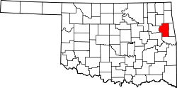
| Sequoyah | 135 | Sallisaw | 1907 | Land der Cherokee | Sequoyah (ca. 1770–1843) – Erfinder der Cherokee-Schrift | 42.391 | 1.744 km² |  |
| Stephens | 137 | Duncan | 1907 | Land der Comanche und der Chickasaw | John H. Stephens (1847–1924) – Mitglied des US-Repräsentantenhauses (1897–1917) | 45.048 | 2.254 km² |  |
| Texas | 139 | Guymon | 1907 | Beaver County und Oklahoma-Territorium | der benachbarte Bundesstaat Texas | 20.640 | 5.287 km² |  |
| Tillman | 141 | Frederick | 1907 | Land der Comanche | Benjamin Tillman (1847–1918) – Gouverneur von South Carolina (1890–1894) und US-Senator (1895–1918) | 7.992 | 2.256 km² |  |
| Tulsa | 143 | Tulsa | 1905 | Land der Muskogee | Die Stadt Tulsa, die nach der Muskogee-Siedlung Tulsey Town in Alabama benannt wurde | 603.403 | 1.477 km² |  |
| Wagoner | 145 | Wagoner | 1908 | Land der Muskogee | Bailey P. Waggoner – ein Anwalt der Missouri Pacific Railway Company | 73.085 | 1.454 km² |  |
| Washington | 147 | Bartlesville | 1897 | Land der Cherokee | George Washington (1732–1799) – erster Präsident der USA (1789–1797) | 50.976 | 1.076 km² |  |
| Washita | 149 | Cordell | 1900 | Land der Cheyenne | Washita River | 11.629 | 2.598 km² |  |
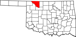
| Woods | 151 | Alva | 1893 | Cherokee Outlet | Samuel Newitt Wood (1825–1891) – Abgeordneter in Kansas | 8.878 | 3.332 km² |  |
| Woodward | 153 | Woodward | 1893 | Cherokee Outlet | B.W. Woodward – Direktor der Santa Fe Railroad | 20.081 | 3.218 km² |  |
Einzelnachweise
- ↑ FIPS-Codes von Oklahoma ( des vom 9. Juni 2010 im Internet Archive) Info: Der Archivlink wurde automatisch eingesetzt und noch nicht geprüft. Bitte prüfe Original- und Archivlink gemäß Anleitung und entferne dann diesen Hinweis.
- ↑ a b U.S. Census Bureau - Oklahoma - State & County QuickFacts ( des vom 14. Mai 2008 im Internet Archive) Info: Der Archivlink wurde automatisch eingesetzt und noch nicht geprüft. Bitte prüfe Original- und Archivlink gemäß Anleitung und entferne dann diesen Hinweis. Flächenangaben in Quadratmeilen - Umrechnung in Quadratkilometer
- ↑ U.S. Census 2010 Abgerufen am 26. Oktober 2011
- ↑ Anmerkung: Die Countys in Oklahoma wurden nach Etablierung des Territoriums abgegrenzt und provisorisch mit Zahlen oder Buchstaben bezeichnet, die anderen Countys erhielten in Folge Namen.
Auf dieser Seite verwendete Medien
This is a locator map showing Ottawa County in Oklahoma. For more information, see Commons:United States county locator maps.
This is a locator map showing Haskell County in Oklahoma. For more information, see Commons:United States county locator maps.
This is a locator map showing McIntosh County in Oklahoma. For more information, see Commons:United States county locator maps.
This is a locator map showing Kay County in Oklahoma. For more information, see Commons:United States county locator maps.
This is a locator map showing Grady County in Oklahoma. For more information, see Commons:United States county locator maps.
This is a locator map showing Tillman County in Oklahoma. For more information, see Commons:United States county locator maps.
This is a locator map showing Payne County in Oklahoma. For more information, see Commons:United States county locator maps.
This is a locator map showing Greer County in Oklahoma. For more information, see Commons:United States county locator maps.
This is a locator map showing Major County in Oklahoma. For more information, see Commons:United States county locator maps.
This is a locator map showing Adair County in Oklahoma. For more information, see Commons:United States county locator maps.
This is a locator map showing Tulsa County in Oklahoma. For more information, see Commons:United States county locator maps.
This is a locator map showing Canadian County in Oklahoma. For more information, see Commons:United States county locator maps.
This is a locator map showing Nowata County in Oklahoma. For more information, see Commons:United States county locator maps.
This is a locator map showing Bryan County in Oklahoma. For more information, see Commons:United States county locator maps.
This is a locator map showing Hughes County in Oklahoma. For more information, see Commons:United States county locator maps.
This is a locator map showing Osage County in Oklahoma. For more information, see Commons:United States county locator maps.
This is a locator map showing Pottawatomie County in Oklahoma. For more information, see Commons:United States county locator maps.
This is a locator map showing Seminole County in Oklahoma. For more information, see Commons:United States county locator maps.
This is a locator map showing Cotton County in Oklahoma. For more information, see Commons:United States county locator maps.
This is a locator map showing Lincoln County in Oklahoma. For more information, see Commons:United States county locator maps.
This is a locator map showing Latimer County in Oklahoma. For more information, see Commons:United States county locator maps.
This is a locator map showing Harper County in Oklahoma. For more information, see Commons:United States county locator maps.
This is a locator map showing Logan County in Oklahoma. For more information, see Commons:United States county locator maps.
This is a locator map showing Woodward County in Oklahoma. For more information, see Commons:United States county locator maps.
This is a locator map showing Cimarron County in Oklahoma. For more information, see Commons:United States county locator maps.
This is a locator map showing Sequoyah County in Oklahoma. For more information, see Commons:United States county locator maps.
This is a locator map showing Marshall County in Oklahoma. For more information, see Commons:United States county locator maps.
This is a locator map showing Okmulgee County in Oklahoma. For more information, see Commons:United States county locator maps.
This is a locator map showing Wagoner County in Oklahoma. For more information, see Commons:United States county locator maps.
This is a locator map showing Dewey County in Oklahoma. For more information, see Commons:United States county locator maps.
This is a locator map showing Beaver County in Oklahoma. For more information, see Commons:United States county locator maps.
This is a locator map showing Delaware County in Oklahoma. For more information, see Commons:United States county locator maps.
This is a locator map showing Le Flore County in Oklahoma. For more information, see Commons:United States county locator maps.
This is a locator map showing Comanche County in Oklahoma. For more information, see Commons:United States county locator maps.
This is a locator map showing Washington County in Oklahoma. For more information, see Commons:United States county locator maps.
This is a locator map showing Craig County in Oklahoma. For more information, see Commons:United States county locator maps.
This is a locator map showing Blaine County in Oklahoma. For more information, see Commons:United States county locator maps.
This is a locator map showing Harmon County in Oklahoma. For more information, see Commons:United States county locator maps.
This is a locator map showing Washita County in Oklahoma. For more information, see Commons:United States county locator maps.
This is a locator map showing Stephens County in Oklahoma. For more information, see Commons:United States county locator maps.
This is a locator map showing Mayes County in Oklahoma. For more information, see Commons:United States county locator maps.
This is a locator map showing Love County in Oklahoma. For more information, see Commons:United States county locator maps.
This is a locator map showing Muskogee County in Oklahoma. For more information, see Commons:United States county locator maps.
This is a locator map showing Atoka County in Oklahoma. For more information, see Commons:United States county locator maps.
This is a locator map showing McClain County in Oklahoma. For more information, see Commons:United States county locator maps.
This is a locator map showing Pontotoc County in Oklahoma. For more information, see Commons:United States county locator maps.
This is a locator map showing Johnston County in Oklahoma. For more information, see Commons:United States county locator maps.
This is a locator map showing Garvin County in Oklahoma. For more information, see Commons:United States county locator maps.
This is a locator map showing Woods County in Oklahoma. For more information, see Commons:United States county locator maps.
This is a locator map showing Jackson County in Oklahoma. For more information, see Commons:United States county locator maps.
This is a locator map showing Choctaw County in Oklahoma. For more information, see Commons:United States county locator maps.
This is a locator map showing Cherokee County in Oklahoma. For more information, see Commons:United States county locator maps.
This is a locator map showing Alfalfa County in Oklahoma. For more information, see Commons:United States county locator maps.
This is a locator map showing Creek County in Oklahoma. For more information, see Commons:United States county locator maps.
This is a locator map showing Oklahoma County in Oklahoma. For more information, see Commons:United States county locator maps.
This is a locator map showing Noble County in Oklahoma. For more information, see Commons:United States county locator maps.
This is a locator map showing Garfield County in Oklahoma. For more information, see Commons:United States county locator maps.
This is a locator map showing Rogers County in Oklahoma. For more information, see Commons:United States county locator maps.
This is a locator map showing Caddo County in Oklahoma. For more information, see Commons:United States county locator maps.
This is a locator map showing Cleveland County in Oklahoma. For more information, see Commons:United States county locator maps.
This is a locator map showing Pushmataha County in Oklahoma. For more information, see Commons:United States county locator maps.
This is a locator map showing Grant County in Oklahoma. For more information, see Commons:United States county locator maps.
Locator map of Roger Mills County — in Oklahoma.
- Credits
- David Benbennick made this map.
- For more information, see Commons:United States county locator maps.
Locator Map of Oklahoma, United States
This is a locator map showing Texas County in Oklahoma. For more information, see Commons:United States county locator maps.
This is a locator map showing Pittsburg County in Oklahoma. For more information, see Commons:United States county locator maps.
This is a locator map showing Custer County in Oklahoma. For more information, see Commons:United States county locator maps.
This is a locator map showing Murray County in Oklahoma. For more information, see Commons:United States county locator maps.
This is a locator map showing Kiowa County in Oklahoma. For more information, see Commons:United States county locator maps.
This is a locator map showing Pawnee County in Oklahoma. For more information, see Commons:United States county locator maps.
This is a locator map showing Carter County in Oklahoma. For more information, see Commons:United States county locator maps.
This is a locator map showing Ellis County in Oklahoma. For more information, see Commons:United States county locator maps.
This is a locator map showing McCurtain County in Oklahoma. For more information, see Commons:United States county locator maps.
This is a locator map showing Kingfisher County in Oklahoma. For more information, see Commons:United States county locator maps.
This is a locator map showing Jefferson County in Oklahoma. For more information, see Commons:United States county locator maps.
This is a locator map showing Coal County in Oklahoma. For more information, see Commons:United States county locator maps.
This is a locator map showing Beckham County in Oklahoma. For more information, see Commons:United States county locator maps.


