Liste der Countys in Nebraska
Der US-amerikanische Bundesstaat Nebraska ist in 93 Countys unterteilt. Die offizielle Abkürzung des Staates Nebraska lautet NE, der FIPS-Code ist 31. Der FIPS-Code für jedes einzelne County beginnt also stets mit 31, an die jeweils eine dreistellige Zahl angehängt wird. Die Angaben der Bevölkerungszahlen basieren auf der Volkszählung im Jahr 2010. |
| County | FIPS-Code[1] | County Seat | Gründung | Ursprung | Namensherkunft | Einwohner 2010[2] | Fläche[1] | Karte |
|---|---|---|---|---|---|---|---|---|
| Adams | 001 | Hastings | 1867 | Indianerland | John Adams (1735–1826) – zweiter Präsident der USA (1797–1801) | 31.364 | 1.459 km² | 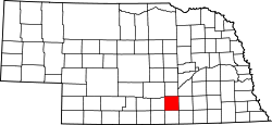 |
| Antelope | 003 | Neligh | 1871 | Indianerland | Häufiges Vorkommen von oft als Antilopen bezeichneten Gabelböcken | 6.685 | 2.220 km² |  |
| Arthur | 005 | Arthur | 1887 | Indianerland | Chester A. Arthur (1829–1886) – 21. Präsident der USA (1881–1885) | 460 | 1853 km² |  |
| Banner | 007 | Harrisburg | 1888 | Cheyenne County | Benannt nach der Hoffnung der ersten Siedler, dass das County das „Banner County“ des Staates sein möge | 690 | 1.933 km² |  |
| Blaine | 009 | Brewster | 1885 | Indianerland | James G. Blaine (1830–1893) – US - Senator (1876–1881), Außenminister (1881, 1889–1892) und Präsidentschaftskandidat im Jahr 1884 | 478 | 1.841 km² | 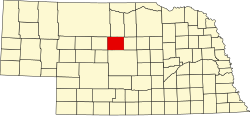 |
| Boone | 011 | Albion | 1871 | Indianerland | Daniel Boone (1734–1820) – Pionier aus Kentucky | 5.505 | 1.779 km² |  |
| Box Butte | 013 | Alliance | 1887 | Dawes County | Benannt nach einem quaderförmigen (engl.: box shaped) Monolithen (engl.: Butte) im County | 11.308 | 2.785 km² | 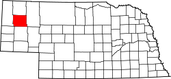 |
| Boyd | 015 | Butte | 1891 | Holt County und Indianerland | James E. Boyd (1834–1906) – achter Gouverneur von Nebraska (1892–1893) | 2.099 | 1.399 km² |  |
| Brown | 017 | Ainsworth | 1883 | Indianerland | Benannt nach der Familie Brown, den ersten weißen Siedlern der Region | 3.145 | 3.163 km² | 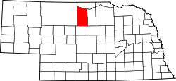 |
| Buffalo | 019 | Kearney | 1855 | Indianerland | Benannt nach den zahlreichen Büffeln (engl.: Buffalo), die die Region bevölkerten | 46.102 | 2.507 km² | 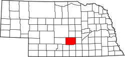 |
| Burt | 021 | Tekamah | 1854 | Eines von neun Originalcountys | Francis Burt (1807–1854) – erster Gouverneur des Nebraska - Territoriums (1854) | 6.858 | 1.276 km² |  |
| Butler | 023 | David City | 1856 | Greene County | William Orlando Butler (1791–1880) – Abgeordneter des US - Repräsentantenhauses (1839–1843) | 8.395 | 1.511 km² |  |
| Cass | 025 | Plattsmouth | 1854 | Eines von neun Originalcountys | Lewis Cass (1782–1866) – Außenminister der USA (1857–1860) | 25.241 | 1.448 km² |  |
| Cedar | 027 | Hartington | 1857 | Dixon County und Pierce County | Benannt nach dem im County häufig vorkommenden Wacholder (fälschlich als Zeder bezeichnet) | 8.852 | 1.917 km² | 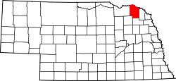 |
| Chase | 029 | Imperial | 1873 | Indianerland | Champion S. Chase (1820–1898) – erster Attorney General (etwa mit einem Justizminister vergleichbar) von Nebraska (1867–1869) | 3.966 | 2.317 km² |  |
| Cherry | 031 | Valentine | 1883 | Indianerland | Samuel A. Cherry – Leutnant des US - Heeres, der in den Indianerkriegen fiel | 5.713 | 15.437 km² | 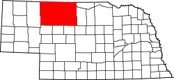 |
| Cheyenne | 033 | Sidney | 1867 | Indianerland | Benannt nach dem Volk der Cheyenne | 9.998 | 3.099 km² |  |
| Clay | 035 | Clay Center | 1855 | Indianerland | Henry Clay (1777–1852) – Außenminister der USA (1825–1829) | 6.542 | 1.484 km² |  |
| Colfax | 037 | Schuyler | 1869 | Platte County | Schuyler Colfax (1823–1885) – 17. Vizepräsident der USA (1869–1873) | 10.515 | 1,070 km² |  |
| Cuming | 039 | West Point | 1855 | Burt County | Thomas B. Cuming (1827–1858) – Gouverneur des Nebraska - Territoriums (1854–1855, 1857–1858) | 9.139 | 1.481 km² |  |
| Custer | 041 | Broken Bow | 1877 | Indianerland | George Armstrong Custer (1839–1876) – General des Unionsheeres im Bürgerkrieg, fiel später in der Schlacht am Little Bighorn | 10.939 | 6.671 km² | 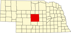 |
| Dakota | 043 | Dakota City | 1855 | Burt County | Benannt nach dem Volk der Dakota | 21.006 | 683 km² |  |
| Dawes | 045 | Chadron | 1885 | Sioux County | James W. Dawes (1844–1918) – fünfter Gouverneur von Nebraska (1883–1887) | 9.182 | 3.616 km² | 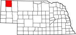 |
| Dawson | 047 | Lexington | 1860 | Indianerland | John Littleton Dawson (1813–1870) – Abgeordneter des Repräsentantenhauses der USA (1851–1855, 1863–1867) | 24.326 | 2.623 km² |  |
| Deuel | 049 | Chappell | 1888 | Cheyenne County | nach Harry Porter Deuel (1836–1914), einem Eisenbahnmanager aus Omaha | 1.941 | 1.139 km² |  |
| Dixon | 051 | Ponca | 1856 | Blackbird County, Izard County und Indianerland | Benannt nach der Familie Dixon, den ersten weißen Siedlern der Region | 6.000 | 1.234 km² |  |
| Dodge | 053 | Fremont | 1854 | Eines von neun Originalcountys | Augustus C. Dodge (1812–1883) – US - Senator von Iowa (1848–1855) und Unterstützer des Kansas - Nebraska Act | 36.691 | 1.384 km² |  |
| Douglas | 055 | Omaha | 1854 | Eines von neun Originalcountys | Stephen A. Douglas (1813–1861) – US - Senator von Illinois (1847–1861) und Präsidentschaftskandidat im Jahr 1860 | 517.110 | 857 km² |  |
| Dundy | 057 | Benkelman | 1873 | Indianerland | Elmer Scipio Dundy (1830–1896) – Richter am höchsten Gericht des Nebraska - Territoriums (1858–1862) | 2.008 | 2.382 km² |  |
| Fillmore | 059 | Geneva | 1856 | Jackson County und Indianerland | Millard Fillmore (1800–1874) – 13. Präsident der USA (1850–1853) | 5.890 | 1.493 km² | 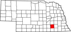 |
| Franklin | 061 | Franklin | 1867 | Kearney County | Benjamin Franklin (1706–1790) – Staatsmann und einer der Gründerväter der USA | 3.225 | 1.492 km² |  |
| Frontier | 063 | Stockville | 1872 | Indianerland | Benannt nach der damaligen Grenze zum Indianerland | 2.756 | 2.524 km² | 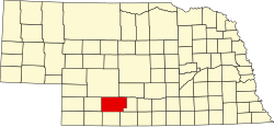 |
| Furnas | 065 | Beaver City | 1873 | Indianerland | Robert Wilkinson Furnas (1824–1905) – dritter Gouverneur von Nebraska (1873–1875) | 4.959 | 1.860 km² |  |
| Gage | 067 | Beatrice | 1855 | Indianerland | William D. Gage – ein methodistischer Geistlicher, der Kaplan des ersten Parlaments von Nebraska war | 22.311 | 2.215 km² | 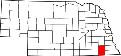 |
| Garden | 069 | Oshkosh | 1910 | Deuel County | Benannt nach der Hoffnung zweier Immobilienmakler, dass das County der Garten des Westens werden möge | 2.057 | 4.414 km² |  |
| Garfield | 071 | Burwell | 1884 | Wheeler County | James A. Garfield (1831–1881) – 29. Präsident der USA (1881) | 2.049 | 1.476 km² | 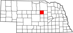 |
| Gosper | 073 | Elwood | 1873 | Indianerland | John Gosper (1842–1913) – Secretary of State von Nebraska (1873–1875) | 2.044 | 1.187 km² | 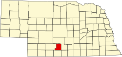 |
| Grant | 075 | Hyannis | 1887 | Indianerland | Ulysses S. Grant (1822–1885) – Oberbefehlshaber des Unionsheeres im Amerikanischen Bürgerkrieg, später 18. Präsident der USA (1869–1877) | 614 | 2.010 km² |  |
| Greeley | 077 | Greeley | 1871 | Indianerland | Horace Greeley (1811–1872) – Zeitungsverleger und Abgeordneter des US - Repräsentantenhauses (1848–1849) | 2.538 | 1.476 km² |  |
| Hall | 079 | Grand Island | 1858 | Indianerland | Augustus Hall (1814–1861) – Abgeordneter des US - Repräsentantenhauses (1855–1857) | 58.607 | 1.415 km² | 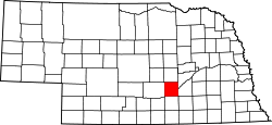 |
| Hamilton | 081 | Aurora | 1867 | Indianerland | Alexander Hamilton (1755 oder 1757–1804) – einer der Gründerväter der USA | 9.124 | 1.408 km² | 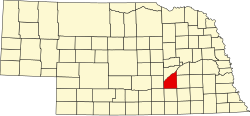 |
| Harlan | 083 | Alma | 1871 | Kearney County | James Harlan (1820–1899) – Innenminister der USA (1865–1866) | 3.423 | 1.432 km² |  |
| Hayes | 085 | Hayes Center | 1877 | Indianerland | Rutherford B. Hayes (1822–1893) – 19. Präsident der USA (1877–1881) | 967 | 1.847 km² |  |
| Hitchcock | 087 | Trenton | 1873 | Indianerland | Phineas Warren Hitchcock (1831–1881) – US - Senator von Nebraska (1871–1877) | 2.908 | 1.839 km² |  |
| Holt | 089 | O’Neill | 1860 | Indianerland | Joseph Holt (1807–1894) – Judge Advocate General (1862–1875) | 10.435 | 5,249 km² |  |
| Hooker | 091 | Mullen | 1889 | Indianerland | Joseph Hooker (1814–1879) – General des Unionsheeres im Amerikanischen Bürgerkrieg | 736 | 1.668 km² |  |
| Howard | 093 | Saint Paul | 1871 | Hall County | Oliver Otis Howard (1830–1909) – General des Unionsheeres im Amerikanischen Bürgerkrieg | 6.274 | 1.475 km² |  |
| Jefferson | 095 | Fairbury | 1856 | Indianerland | Thomas Jefferson (1743–1826) – dritter Präsident der USA | 7.547 | 1.484 km² | 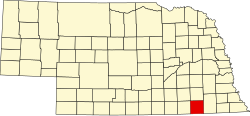 |
| Johnson | 097 | Tecumseh | 1857 | Nemaha County und Otoe County | Richard Mentor Johnson (1780–1850) – neunter Vizepräsident der USA (1837–1841) | 5.217 | 974 km² |  |
| Kearney | 099 | Minden | 1860 | Indianerland | Benannt nach Fort Kearny – 1848 gegründeter Außenposten | 6.489 | 1.337 km² |  |
| Keith | 101 | Ogallala | 1873 | Indianerland | M. C. Keith – zur damaligen Zeit der Besitzer einer der größten Ranches im westlichen Nebraska | 8.368 | 2.749 km² | 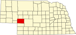 |
| Keya Paha | 103 | Springview | 1884 | Brown County und Indianerland | Dakota-Wort Ké-ya Pa-há Wa-kpá, was etwa Schildkrötenhügelfluss bedeutet | 824 | 2.003 km² |  |
| Kimball | 105 | Kimball | 1888 | Cheyenne County | Thomas L. Kimball, ein Führungsmitglied der Union Pacific Railroad | 3.821 | 2.465 km² | 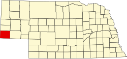 |
| Knox | 107 | Center | 1857 | Pierce County und Indianerland | Henry Knox (1750–1806) – erster US - Kriegsminister (1789–1794) | 8.701 | 2.870 km² |  |
| Lancaster | 109 | Lincoln | 1855 | Cass County und Pierce County | Benannt nach den Städten Lancaster in Pennsylvania und Lancaster in England | 285.407 | 2.173 km² | 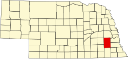 |
| Lincoln | 111 | North Platte | 1860 | Indianerland | Abraham Lincoln (1809–1865) – 16. Präsident der USA (1861–1865) | 36.288 | 6.641 km² |  |
| Logan | 113 | Stapleton | 1885 | Indianerland | John A. Logan (1826–1886) – General der Unionstruppen im Amerikanischen Bürgerkrieg, später US - Senator von Illinois (1871–1877) | 763 | 1.478 km² |  |
| Loup | 115 | Taylor | 1863 | Indianerland | Loup River – durchfließt das County | 632 | 1.476 km² | 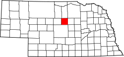 |
| Madison | 119 | Madison | 1856 | Loup County und McNeale County sowie Indianerland | James Madison (1751–1836) – vierter Präsident der USA (1809–1817) | 34.876 | 1.483 km² | 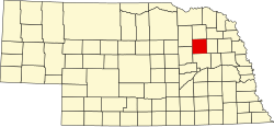 |
| McPherson | 117 | Tryon | 1867 | Indianerland | James B. McPherson (1828–1864) – zweitranghöchster General der Unionstruppen, der im Amerikanischen Bürgerkrieg fiel | 539 | 2.225 km² |  |
| Merrick | 121 | Central City | 1858 | Polk County und Indianerland | Elvira Merrick – Ehefrau von Henry W. DePuy, einem Abgeordneten in Nebraska | 7.845 | 1.256 km² |  |
| Morrill | 123 | Bridgeport | 1908 | Cheyenne County | Charles Henry Morrill (1843–1928) – Geschäftsmann aus Nebraska | 5.042 | 3.687 km² |  |
| Nance | 125 | Fullerton | 1879 | Pawnee-Reservation | Albinus Nance (1848–1911) – Gouverneur von Nebraska (1879–1883) | 3.735 | 1.143 km² |  |
| Nemaha | 127 | Auburn | 1854 | Eines von neun Originalcountys | Nimaha, das Oto-Wort für sumpfiges Wasser | 7.248 | 1.060 km² |  |
| Nuckolls | 129 | Nelson | 1860 | Indianerland | Stephen Friel Nuckolls (1825–1879) – Abgeordneter des US - Repräsentantenhauses (1869–1871) | 4.500 | 1.490 km² |  |
| Otoe | 131 | Nebraska City | 1854 | Eines von neun Originalcountys | Benannt nach dem Volk der Oto | 15.740 | 1.595 km² |  |
| Pawnee | 133 | Pawnee City | 1855 | Richardson County | Benannt nach dem Volk der Pawnee | 2.773 | 1.118 km² |  |
| Perkins | 135 | Grant | 1887 | Kieth County | Charles E. Perkins – Präsident der CB&Q - Railroad | 2.970 | 2.287 km² |  |
| Phelps | 137 | Holdrege | 1873 | Kearney County | William Phelps – ehemaliger Dampfschiffkapitän auf dem Mississippi, mutmaßlich der erste weiße Siedler der Gegend | 9.188 | 1.399 km² | 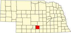 |
| Pierce | 139 | Pierce | 1856 | Izard County, McNeale County und Indianerland | Franklin Pierce (1804–1869) – 14. Präsident der USA (1853–1857) | 7.266 | 1.486 km² |  |
| Platte | 141 | Columbus | 1856 | Greene County und Loup County | Platte River | 32.237 | 1.756 km² |  |
| Polk | 143 | Osceola | 1856 | York County und Indianerland | James K. Polk (1795–1849) – elfter Präsident der USA (1845–1849) | 5.406 | 1.137 km² |  |
| Red Willow | 145 | McCook | 1873 | Indianerland | Benannt nach dem Red Willow Creek, der das County durchfließt | 11.055 | 1.856 km² | 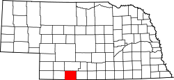 |
| Richardson | 147 | Falls City | 1854 | Eines von neun Originalcountys | William Alexander Richardson (1811–1875) – Gouverneur des Nebraska - Territoriums (1858) | 8.363 | 1.433 km² |  |
| Rock | 149 | Bassett | 1885 | Brown County | Häufig vorkommende Felsen (engl.: Rocks) im County | 1.526 | 2.612 km² |  |
| Saline | 153 | Wilber | 1867 | Indianerland | Benannt nach den Salzvorkommen in der Gegend | 14.200 | 1.490 km² | 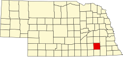 |
| Sarpy | 153 | Papillion | 1867 | Cass County und Douglas County | Peter Abadie Sarpy (1804–1865) – Pelzhändler und Unternehmer im Dienste der Union | 158.840 | 3.297 km² | 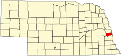 |
| Saunders | 155 | Wahoo | 1856 | Douglas County und Lancaster County | Alvin Saunders (1817–1899) – letzter Gouverneur des Nebraska - Territoriums (1861–1867) | 20.780 | 1.053 km² |  |
| Scotts Bluff | 157 | Gering | 1888 | Cheyenne County | Scotts Bluff National Monument | 36.970 | 1.915 km² |  |
| Seward | 159 | Seward | 1855 | Cass County und Pierce County | William H. Seward (1801–1872) – 24. Außenminister der USA (1861–1869) | 16.750 | 1.489 km² | 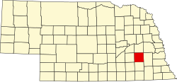 |
| Sheridan | 161 | Rushville | 1885 | Sioux County | Philip Sheridan (1831–1888) – General des Unionsheeres im Bürgerkrieg | 5.469 | 6.322 km² |  |
| Sherman | 163 | Loup City | 1871 | Buffalo County und Indianerland | William T. Sherman (1820–1891) – bekannter General des Unionsheeres im Bürgerkrieg | 3.152 | 1.466 km² | 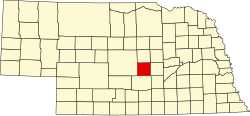 |
| Sioux | 165 | Harrison | 1877 | Indianerland | Benannt nach dem Volk der Sioux | 1.311 | 5.352 km² | 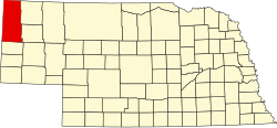 |
| Stanton | 167 | Stanton | 1855 | Izard County | Edwin M. Stanton (1814–1869) – Kriegsminister der USA (1862–1868) | 6.129 | 1.113 km² |  |
| Thayer | 169 | Hebron | 1871 | Jefferson County | John M. Thayer (1820–1906) – siebter Gouverneur von Nebraska (1887–1892) | 5.228 | 1.488 km² | 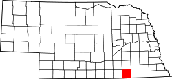 |
| Thomas | 171 | Thedford | 1887 | Indianerland | George Henry Thomas (1816–1870) – General des Unionsheeres im Bürgerkrieg | 647 | 1.846 km² |  |
| Thurston | 173 | Pender | 1889 | Blackbird County | John Mellen Thurston (1847–1916) – von 1895 bis 1901 US-Senator von Nebraska | 6.940 | 1.020 km² | 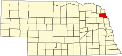 |
| Valley | 175 | Ord | 1871 | Indianerland | Benannt nach häufig in der Region vorkommenden Tälern | 4.260 | 1.471 km² |  |
| Washington | 177 | Blair | 1854 | Eines von neun Originalcountys | George Washington (1732–1799) – erster Präsident der USA (1789–1797) | 20.234 | 1.011 km² |  |
| Wayne | 179 | Wayne | 1867 | Indianerland | Anthony Wayne (1745–1796) – General der Kontinentalarmee im Amerikanischen Unabhängigkeitskrieg | 9.595 | 1.148 km² | 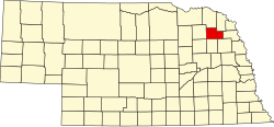 |
| Webster | 181 | Red Cloud | 1867 | Indianerland | Daniel Webster (1782–1852) – US-Senator (1845–1850) und Außenminister der USA (1850–1852) | 3.812 | 1.489 km² | 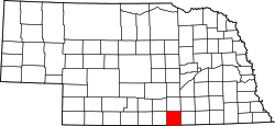 |
| Wheeler | 183 | Bartlett | 1877 | Indianerland | Daniel H. Wheeler – früherer Landwirtschaftsminister von Nebraska | 818 | 1.490 km² |  |
| York | 185 | York | 1855 | Cass und Pierce County sowie Indianerland | Entweder York in England oder York County in Pennsylvania | 13.665 | 1.491 km² | 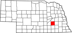 |
Einzelnachweise
- ↑ a b U.S. Census Bureau - Nebraska - State & County QuickFacts ( vom 14. Oktober 2012 im Internet Archive) Flächenangaben in Quadratmeilen - Umrechnung in Quadratkilometer
- ↑ U.S. Census 2010 Abgerufen am 15. September 2011
Auf dieser Seite verwendete Medien
This is a locator map showing Washington County in Nebraska. For more information, see Commons:United States county locator maps.
This is a locator map showing Scotts Bluff County in Nebraska. For more information, see Commons:United States county locator maps.
This is a locator map showing Otoe County in Nebraska. For more information, see Commons:United States county locator maps.
This is a locator map showing Deuel County in Nebraska. For more information, see Commons:United States county locator maps.
This is a locator map showing Howard County in Nebraska. For more information, see Commons:United States county locator maps.
This is a locator map showing Hooker County in Nebraska. For more information, see Commons:United States county locator maps.
This is a locator map showing Buffalo County in Nebraska. For more information, see Commons:United States county locator maps.
This is a locator map showing Garfield County in Nebraska. For more information, see Commons:United States county locator maps.
This is a locator map showing Wayne County in Nebraska. For more information, see Commons:United States county locator maps.
This is a locator map showing Nance County in Nebraska. For more information, see Commons:United States county locator maps.
This is a locator map showing Rock County in Nebraska. For more information, see Commons:United States county locator maps.
This is a locator map showing Cheyenne County in Nebraska. For more information, see Commons:United States county locator maps.
This is a locator map showing Dundy County in Nebraska. For more information, see Commons:United States county locator maps.
This is a locator map showing Keya Paha County in Nebraska. For more information, see Commons:United States county locator maps.
This is a locator map showing Furnas County in Nebraska. For more information, see Commons:United States county locator maps.
This is a locator map showing Blaine County in Nebraska. For more information, see Commons:United States county locator maps.
This is a locator map showing Hall County in Nebraska. For more information, see Commons:United States county locator maps.
This is a locator map showing Dodge County in Nebraska. For more information, see Commons:United States county locator maps.
This is a locator map showing Johnson County in Nebraska. For more information, see Commons:United States county locator maps.
This is a locator map showing Kimball County in Nebraska. For more information, see Commons:United States county locator maps.
This is a locator map showing Red Willow County in Nebraska. For more information, see Commons:United States county locator maps.
This is a locator map showing Saline County in Nebraska. For more information, see Commons:United States county locator maps.
This is a locator map showing Stanton County in Nebraska. For more information, see Commons:United States county locator maps.
This is a locator map showing Pierce County in Nebraska. For more information, see Commons:United States county locator maps.
This is a locator map showing Brown County in Nebraska. For more information, see Commons:United States county locator maps.
This is a locator map showing Hitchcock County in Nebraska. For more information, see Commons:United States county locator maps.
This is a locator map showing Loup County in Nebraska. For more information, see Commons:United States county locator maps.
This is a locator map showing Greeley County in Nebraska. For more information, see Commons:United States county locator maps.
This is a locator map showing Dakota County in Nebraska. For more information, see Commons:United States county locator maps.
This is a locator map showing Knox County in Nebraska. For more information, see Commons:United States county locator maps.
This is a locator map showing Keith County in Nebraska. For more information, see Commons:United States county locator maps.
This is a locator map showing Pawnee County in Nebraska. For more information, see Commons:United States county locator maps.
This is a locator map showing Thomas County in Nebraska. For more information, see Commons:United States county locator maps.
This is a locator map showing Cass County in Nebraska. For more information, see Commons:United States county locator maps.
This is a locator map showing Gage County in Nebraska. For more information, see Commons:United States county locator maps.
This is a locator map showing Harlan County in Nebraska. For more information, see Commons:United States county locator maps.
This is a locator map showing Douglas County in Nebraska. For more information, see Commons:United States county locator maps.
This is a locator map showing Boone County in Nebraska. For more information, see Commons:United States county locator maps.
This is a locator map showing Custer County in Nebraska. For more information, see Commons:United States county locator maps.
This is a locator map showing Webster County in Nebraska. For more information, see Commons:United States county locator maps.
This is a locator map showing Perkins County in Nebraska. For more information, see Commons:United States county locator maps.
This is a locator map showing Cuming County in Nebraska. For more information, see Commons:United States county locator maps.
This is a locator map showing Sarpy County in Nebraska. For more information, see Commons:United States county locator maps.
This is a locator map showing McPherson County in Nebraska. For more information, see Commons:United States county locator maps.
This is a locator map showing Garden County in Nebraska. For more information, see Commons:United States county locator maps.
This is a locator map showing Phelps County in Nebraska. For more information, see Commons:United States county locator maps.
This is a locator map showing Hamilton County in Nebraska. For more information, see Commons:United States county locator maps.
This is a locator map showing York County in Nebraska. For more information, see Commons:United States county locator maps.
This is a locator map showing Jefferson County in Nebraska. For more information, see Commons:United States county locator maps.
This is a locator map showing Gosper County in Nebraska. For more information, see Commons:United States county locator maps.
This is a locator map showing Banner County in Nebraska. For more information, see Commons:United States county locator maps.
This is a locator map showing Madison County in Nebraska. For more information, see Commons:United States county locator maps.
This is a locator map showing Polk County in Nebraska. For more information, see Commons:United States county locator maps.
This is a locator map showing Adams County in Nebraska. For more information, see Commons:United States county locator maps.
This is a locator map showing Antelope County in Nebraska. For more information, see Commons:United States county locator maps.
This is a locator map showing Wheeler County in Nebraska. For more information, see Commons:United States county locator maps.
This is a locator map showing Logan County in Nebraska. For more information, see Commons:United States county locator maps.
This is a locator map showing Dawson County in Nebraska. For more information, see Commons:United States county locator maps.
This is a locator map showing Platte County in Nebraska. For more information, see Commons:United States county locator maps.
This is a locator map showing Holt County in Nebraska. For more information, see Commons:United States county locator maps.
This is a locator map showing Grant County in Nebraska. For more information, see Commons:United States county locator maps.
Locator Map of Nebraska, United States
This is a locator map showing Lincoln County in Nebraska. For more information, see Commons:United States county locator maps.
This is a locator map showing Kearney County in Nebraska. For more information, see Commons:United States county locator maps.
This is a locator map showing Cherry County in Nebraska. For more information, see Commons:United States county locator maps.
This is a locator map showing Nemaha County in Nebraska. For more information, see Commons:United States county locator maps.
This is a locator map showing Dawes County in Nebraska. For more information, see Commons:United States county locator maps.
This is a locator map showing Valley County in Nebraska. For more information, see Commons:United States county locator maps.
This is a locator map showing Chase County in Nebraska. For more information, see Commons:United States county locator maps.
This is a locator map showing Dixon County in Nebraska. For more information, see Commons:United States county locator maps.
This is a locator map showing Morrill County in Nebraska. For more information, see Commons:United States county locator maps.
This is a locator map showing Fillmore County in Nebraska. For more information, see Commons:United States county locator maps.
This is a locator map showing Arthur County in Nebraska. For more information, see Commons:United States county locator maps.
This is a locator map showing Thayer County in Nebraska. For more information, see Commons:United States county locator maps.
This is a locator map showing Thurston County in Nebraska. For more information, see Commons:United States county locator maps.
This is a locator map showing Richardson County in Nebraska. For more information, see Commons:United States county locator maps.
This is a locator map showing Colfax County in Nebraska. For more information, see Commons:United States county locator maps.
This is a locator map showing Seward County in Nebraska. For more information, see Commons:United States county locator maps.
This is a locator map showing Clay County in Nebraska. For more information, see Commons:United States county locator maps.
This is a locator map showing Frontier County in Nebraska. For more information, see Commons:United States county locator maps.
This is a locator map showing Hayes County in Nebraska. For more information, see Commons:United States county locator maps.
This is a locator map showing Box Butte County in Nebraska. For more information, see Commons:United States county locator maps.
This is a locator map showing Franklin County in Nebraska. For more information, see Commons:United States county locator maps.
This is a locator map showing Burt County in Nebraska. For more information, see Commons:United States county locator maps.
This is a locator map showing Saunders County in Nebraska. For more information, see Commons:United States county locator maps.
This is a locator map showing Merrick County in Nebraska. For more information, see Commons:United States county locator maps.
This is a locator map showing Butler County in Nebraska. For more information, see Commons:United States county locator maps.
This is a locator map showing Boyd County in Nebraska. For more information, see Commons:United States county locator maps.
This is a locator map showing Sheridan County in Nebraska. For more information, see Commons:United States county locator maps.
This is a locator map showing Sherman County in Nebraska. For more information, see Commons:United States county locator maps.
This is a locator map showing Nuckolls County in Nebraska. For more information, see Commons:United States county locator maps.
This is a locator map showing Lancaster County in Nebraska. For more information, see Commons:United States county locator maps.
This is a locator map showing Sioux County in Nebraska. For more information, see Commons:United States county locator maps.
This is a locator map showing Cedar County in Nebraska. For more information, see Commons:United States county locator maps.


