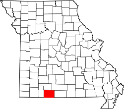
Liste der Countys in Missouri
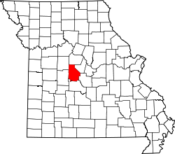
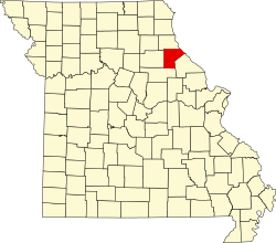
Der US-amerikanische Bundesstaat Missouri ist in 114 Countys eingeteilt. Die Stadt St. Louis gehört keinem County an. Die offizielle Abkürzung von Missouri lautet MO, der FIPS-Code ist 29. Der FIPS-Code jedes einzelnen Countys beginnt also stets mit 29, an die für jedes County eine dreistellige Zahl angehängt wird. Die Einwohnerzahlen basieren auf der Volkszählung im Jahr 2010. |
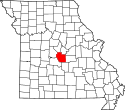
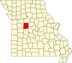
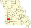
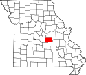
| County | FIPS-Code[1] | County Seat | Gründung | Ursprung | Namensherkunft | Einwohner 2010[2] | Fläche[3] | Karte |
|---|---|---|---|---|---|---|---|---|
| Adair | 001 | Kirksville | 1841 | Macon County | John Adair (1757–1840) – siebter Gouverneur von Kentucky | 25.607 | 1.471 km² |  |
| Andrew | 003 | Savannah | 1841 | Platte Purchase – Landerwerb von Indianern im Jahr 1836 | Andrew Jackson Davis (1826–1910) – Spiritist aus St. Louis | 17.291 | 1.127 km² |  |
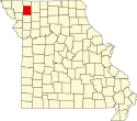
| Atchison | 005 | Rock Port | 1843 | Platte Purchase – Landerwerb von Indianern im Jahr 1836 | David Rice Atchison (1807–1886) – US-Senator von Missouri (1844–1855) | 5.685 | 1.412 km² |  |
| Audrain | 007 | Mexico | 1831 | Callaway, Monroe und Ralls County | James Hunter Audrain – Staatssenator und Milizoffizier | 25.529 | 1.795 km² |  |
| Barry | 009 | Cassville | 1835 | Greene County | William T. Barry (1784–1835) – Postminister der USA | 335.597 | 2.018 km² |  |
| Barton | 011 | Lamar | 1855 | Jasper County | David Barton (1783–1837) – einer der ersten US-Senatoren von Missouri | 12.402 | 1.538 km² |  |
| Bates | 013 | Butler | 1841 | Van Buren (heute Cass) County | Frederick Bates (1777–1825) – Zweiter Gouverneur von Missouri | 17.049 | 2.196 km² |  |
| Benton | 015 | Warsaw | 1835 | Pettis und Greene County | Thomas Hart Benton (1782–1858) – US-Senator von Missouri (1820–1851) | 19.056 | 1.829 km² |  |
| Bollinger | 017 | Marble Hill | 1851 | Cape Girardeau, Madison, Stoddard und Wayne County | George Frederick Bollinger (1770–1842) – früher Siedler in Missouri | 12.363 | 1.608 km² |  |
| Boone | 019 | Columbia | 1921 | Howard County | Daniel Boone (1734–1820) – Pionier und Jäger | 162.642 | 1.774 km² |  |
| Buchanan | 021 | Saint Joseph | 1838 | Platte Purchase – Landerwerb von Indianern im Jahr 1836 | James Buchanan (1791–1868) – 15. Präsident der USA | 89.201 | 1.062 km² |  |
| Butler | 023 | Poplar Bluff | 1849 | Wayne County | William Orlando Butler (1791–1880) – Abgeordneter des US-Repräsentantenhauses | 42.794 | 1.808 km² |  |
| Caldwell | 025 | Kingston | 1836 | Ray County | Umstritten: entweder der Scout John Caldwell oder Matthew Caldwell, Mitunterzeichner der Unabhängigkeitserklärung von Texas | 9.424 | 1.111 km² |  |
| Callaway | 027 | Fulton | 1821 | Boone, Howard und Montgomery County | James Callaway (1783–1815) – Enkel von Daniel Boone und Soldat im Britisch-Amerikanischen Krieg | 44.332 | 2.173 km² |  |
| Camden | 029 | Camdenton | 1841 | Benton, Morgan und Pulaski County | Charles Pratt, 1. Earl Camden (1714–1794) – englischer Jurist und Politiker | 44.002 | 1.696 km² |  |
| Cape Girardeau | 031 | Jackson | 1812 | Eines der fünf ursprünglichen Countys | Sieur de Girardot – französischer Offizier und Entdecker | 75.674 | 1.500 km² |  |
| Carroll | 033 | Carrollton | 1833 | Ray County | Charles Carroll (1737–1832) – einer der Gründerväter der USA | 9.295 | 1.800 km² |  |
| Carter | 035 | Van Buren | 1859 | Oregon, Reynolds, Ripley und Shannon County | Zimri Carter – einer der frühesten weißen Siedler | 6.265 | 1.316 km² |  |
| Cass | 037 | Harrisonville | 1833 | Jackson County | Lewis Cass (1782–1866) – US-Senator von Michigan, Kriegsminister und Außenminister der USA | 99.478 | 1.810 km² |  |
| Cedar | 039 | Stockton | 1845 | Dade und St. Clair County | Virginischer Wacholder (engl.: Eastern Red Cedar) – kommt in der Region häufig vor | 13.982 | 1.233 km² |  |
| Chariton | 041 | Keytesville | 1821 | Howard County | Chariton River – Nebenfluss des Missouri | 7.831 | 1.958 km² |  |
| Christian | 043 | Ozark | 1859 | Greene, Taney und Webster County | William Christian (1743–1786) – Offizier im Amerikanischen Unabhängigkeitskrieg und Politiker | 77.422 | 1.458 km² |  |
| Clark | 045 | Kahoka | 1836 | Lewis County | William Clark (1770–1838) – Entdecker, Gouverneur des Missouri-Territoriums (1813–1820) | 7.139 | 1.313 km² |  |
| Clay | 047 | Liberty | 1822 | Ray County | Henry Clay (1777–1852) – Abgeordneter des US-Repräsentantenhauses, US-Senator von Kentucky und US-Außenminister | 221.939 | 1.026 km² |  |
| Clinton | 049 | Plattsburg | 1833 | Clay County | George Clinton (1739–1812) – US-Vizepräsident (1805–1812), gehörte zu den Gründervätern der USA | 20.743 | 1.085 km² |  |
| Cole | 051 | Jefferson City | 1820 | Cooper County | Stephen Cole einer der ersten Siedler | 75.990 | 1.015 km² |  |
| Cooper | 053 | Boonville | 1818 | Howard County | Sarshel Benjamin Cooper einer der ersten Siedler | 17.601 | 1.463 km² |  |
| Crawford | 055 | Steelville | 1829 | Gasconade County | William Harris Crawford (1772–1834) – US-Senator von Georgia, Finanzminister und Kriegsminister der USA | 24.696 | 1.924 km² |  |
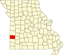
| Dade | 057 | Greenfield | 1841 | Barry und Polk County | Francis L. Dade (1793?–1835) – als Offizier in den Seminolenkriegen gefallen | 7.883 | 1.269 km² |  |
| Dallas | 059 | Buffalo | 1841 | Polk County | George M. Dallas (1792–1864) – Vizepräsident der USA (1845–1849) | 16.777 | 1.404 km² |  |
| Daviess | 061 | Gallatin | 1836 | Ray County | Joseph Hamilton Daviess (1774–1811) – fiel als Offizier der Miliz von Indiana in der Schlacht bei Tippecanoe | 8.433 | 1.469 km² |  |
| DeKalb | 063 | Maysville | 1843 | Clinton County | Johann von Kalb (1721–1780) – General der Kontinentalarmee im Amerikanischen Unabhängigkeitskrieg | 12.892 | 1.098 km² |  |
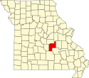
| Dent | 065 | Salem | 1851 | Crawford und Shannon County | James Dent einer der ersten Siedler | 15.657 | 1.953 km² |  |
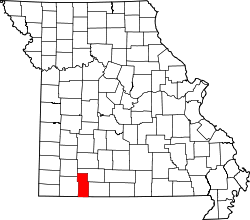
| Douglas | 067 | Ava | 1857 | Ozark County | Stephen A. Douglas (1813–1861) – unterlegener Präsidentschaftskandidat gegen Abraham Lincoln im Jahr 1860 | 13.684 | 2.111 km² |  |
| Dunklin | 069 | Kennett | 1843 | Stoddard County | Daniel Dunklin (1790–1844) – fünfter Gouverneur von Missouri | 31.953 | 1.414 km² |  |
| Franklin | 071 | Union | 1818 | St. Louis County | Benjamin Franklin (1706–1790) – einer der Gründerväter der USA | 101.492 | 2.388 km² |  |
| Gasconade | 073 | Hermann | 1821 | Franklin County | Gasconade River – Nebenfluss des Missouri | 15.222 | 1.347 km² |  |
| Gentry | 075 | Albany | 1841 | Clinton County | Richard Gentry (1788–1837) – Offizier der US-Armee | 6.738 | 1.274 km² |  |
| Greene | 077 | Springfield | 1833 | Crawford und Wayne County | Nathanael Greene (1742–1786) – General der Kontinentalarmee im Amerikanischen Unabhängigkeitskrieg | 275.174 | 1.748 km² |  |
| Grundy | 079 | Trenton | 1839 | Livingston County | Felix Grundy (1777–1840) – Kongressabgeordneter und Justizminister der USA | 10.261 | 1.129 km² |  |
| Harrison | 081 | Bethany | 1843 | Daviess County | Albert Galliton Harrison (1800–1839) – Abgeordneter des Repräsentantenhauses der USA (1835–1839) | 8.957 | 1.878 km² |  |
| Henry | 083 | Clinton | 1834 | Lillard (heute Lafayette) County | Patrick Henry (1736–1799) – erster Gouverneur von Virginia nach der Unabhängigkeitserklärung der USA | 22.272 | 1.818 km² |  |
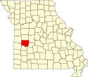
| Hickory | 085 | Hermitage | 1845 | Benton und Polk County | Andrew Jackson (1767–1845) – Präsident der USA, der den Spitznamen Old Hickory trug | 9.627 | 1.033 km² |  |
| Holt | 087 | Oregon | 1841 | Platte Purchase – Landerwerb von Indianern im Jahr 1836 | David Rice Holt – Abgeordneter in Missouri | 4.912 | 1.197 km² |  |
| Howard | 089 | Fayette | 1816 | St. Charles und St. Louis County | Benjamin Howard (1760–1814) – Brigadegeneral im Britisch-Amerikanischen Krieg von 1812 und Gouverneur des Missouri-Territoriums | 10.144 | 1.207 km² |  |
| Howell | 091 | West Plains | 1857 | Oregon County | James Howell – einer der ersten Siedler | 40.400 | 2.404 km² |  |
| Iron | 093 | Ironton | 1857 | Madison, Reynolds, St. Francois, Washington und Wayne County | Umfangreiche Eisenerzvorkommen in der Region | 10.630 | 1.427 km² |  |
| Jackson | 095 | Kansas City | 1826 | Lillard (heute Lafayette) County | Andrew Jackson (1767–1845) – Präsident der USA (1829–1837) | 674.158 | 1.567 km² |  |
| Jasper | 097 | Carthage | 1841 | Barry County | William Jasper (ca. 1750–1779) – Teilnehmer am Amerikanischen Unabhängigkeitskrieg | 117.404 | 1.658 km² |  |
| Jefferson | 099 | Hillsboro | 1818 | St. Louis und Ste. Genevieve County | Thomas Jefferson (1743–1826) – dritter Präsident und einer der Gründerväter der USA | 218.733 | 1.702 km² |  |
| Johnson | 101 | Warrensburg | 1834 | Lillard (heute Lafayette) County | Richard M. Johnson (1780–1850) – Vizepräsident der USA (1837–1841) | 52.595 | 2.152 km² |  |
| Knox | 103 | Edina | 1843 | Scotland County | Henry Knox (1750–1806) – Offizier der Kontinentalarmee und erster Kriegsminister der USA (1789–1794) | 4.131 | 1.311 km² |  |
| Laclede | 105 | Lebanon | 1849 | Camden, Pulaski und Wright County | Pierre Laclède (1729–1778) – Gründer von St. Louis | 35.571 | 1.984 km² |  |
| Lafayette | 107 | Lexington | 1821 | Cooper County | Marquis de Lafayette (1757–1834) – französischer General im Amerikanischen Unabhängigkeitskrieg | 33.381 | 1.629 km² |  |
| Lawrence | 109 | Mount Vernon | 1843 | Barry und Dade County | James Lawrence (1781–1813) – amerikanischer Marineoffizier | 38.634 | 1.588 km² |  |
| Lewis | 111 | Monticello | 1833 | Marion County | Meriwether Lewis (1774–1809) – Entdecker und Gouverneur des Louisiana-Territoriums (1808–1809) | 10.211 | 1.308 km² |  |
| Lincoln | 113 | Troy | 1818 | St. Charles County | Benjamin Lincoln (1733–1810) – General der Kontinentalarmee im Amerikanischen Unabhängigkeitskrieg | 52.566 | 1.632 km² |  |
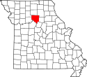
| Linn | 115 | Linneus | 1837 | Chariton County | Lewis F. Linn (1795–1843) – US-Senator von Missouri | 12.761 | 1.606 km² |  |
| Livingston | 117 | Chillicothe | 1837 | Carroll County | Edward Livingston (1764–1836) – Kongressabgeordneter und Außenminister der USA (1831–1833) | 15.195 | 1.386 km² |  |
| Macon | 121 | Macon | 1837 | Chariton und Randolph County | Nathaniel Macon (1757–1837) – Abgeordneter des Repräsentantenhauses (1791–1815) | 15.566 | 2.082 km² |  |
| Madison | 123 | Fredericktown | 1818 | Cape Girardeau und Sainte Genevieve County | James Madison (1751–1836) – vierter Präsident und einer der Gründerväter der USA | 12.226 | 1.287 km² |  |
| Maries | 125 | Vienna | 1855 | Osage und Pulaski County | Der Maries River durchfließt das County | 9.176 | 1.368 km² |  |
| Marion | 127 | Palmyra | 1826 | Ralls County | Francis Marion (1732–1795) – Offizier der Kontinentalarmee im Amerikanischen Unabhängigkeitskrieg | 28.781 | 1.134 km² |  |
| McDonald | 119 | Pineville | 1847 | Newton County | Alexander McDonald – Teilnehmer am Amerikanischen Unabhängigkeitskrieg | 23.083 | 1.399 km² |  |
| Mercer | 129 | Princeton | 1845 | Grundy County | John Francis Mercer (1759–1821) – Abgeordneter des Repräsentantenhauses der USA (1792–1794) und Gouverneur von Maryland (1801–1803) | 3.785 | 1.176 km² |  |
| Miller | 131 | Tuscumbia | 1837 | Cole und Pulaski County | John Miller (1781–1846) – vierter Gouverneur von Missouri (1826–1832) und Abgeordneter des Repräsentantenhauses der USA (1837–1843) | 24.748 | 1.533 km² |  |
| Mississippi | 133 | Charleston | 1842 | Scott County | Mississippi River – bildet die Ostgrenze des Countys und des Staates Missouri | 14.385 | 1.070 km² |  |
| Moniteau | 135 | California | 1845 | Cole und Morgan County | Der Moniteau Creek durchfließt das County | 15.607 | 1.080 km² |  |
| Monroe | 137 | Paris | 1831 | Ralls County | James Monroe (1758–1831) – fünfter Präsident der USA, In seine Amtszeit fiel die Ausarbeitung des Missouri-Kompromisses | 8.840 | 1.673 km² |  |
| Montgomery | 139 | Montgomery City | 1818 | St. Charles County | Richard Montgomery (1738–1775) – General der Kontinentalarmee im Amerikanischen Unabhängigkeitskrieg | 12.236 | 1.396 km² |  |
| Morgan | 141 | Versailles | 1833 | Cooper County | Daniel Morgan (1736–1802) – Offizier im Amerikanischen Unabhängigkeitskrieg und Abgeordneter des Repräsentantenhauses der USA | 20.565 | 1.549 km² |  |
| New Madrid | 143 | New Madrid | 1812 | Eines der fünf ursprünglichen Countys | Der County Seat New Madrid wurde nach der spanischen Hauptstadt Madrid benannt | 18.956 | 1.756 km² |  |
| Newton | 145 | Neosho | 1838 | Barry County | John Newton (1755–1780) – Teilnehmer am Amerikanischen Unabhängigkeitskrieg | 58.114 | 1.621 km² |  |
| Nodaway | 147 | Maryville | 1843 | Platte Purchase – Landerwerb von Indianern im Jahr 1836 | Nodaway River – ein Nebenfluss des Missouri | 23.370 | 2.271 km² |  |
| Oregon | 149 | Alton | 1841 | Ripley County | Oregon-Territorium | 10.881 | 2.051 km² |  |
| Osage | 151 | Linn | 1841 | Gasconade County | Osage River – ein Nebenfluss des Missouri | 13.878 | 1.570 km² |  |
| Ozark | 153 | Gainesville | 1841 | Taney County | Ozark-Plateau | 9.723 | 1.935 km² |  |
| Pemiscot | 155 | Caruthersville | 1851 | New Madrid County | Indianerwort für "flüssiger Schlamm" | 18.296 | 1.277 km² |  |
| Perry | 157 | Perryville | 1821 | Ste. Geneviere County | Oliver Hazard Perry (1785–1819) – Marineoffizier im Britisch-Amerikanischen Krieg von 1812 | 18.972 | 1.230 km² |  |
| Pettis | 159 | Sedalia | 1821 | Cooper und Saline County | Spencer Darwin Pettis (1802–1831) – Secretary of State in Missouri (1826–1828) und Abgeordneter des Repräsentantenhauses der USA (1829–1831) | 42.201 | 1.774 km² |  |
| Phelps | 161 | Rolla | 1857 | Crawford County | John S. Phelps (1814–1886) – 23. Gouverneur von Missouri | 45.156 | 1.743 km² |  |
| Pike | 163 | Bowling Green | 1818 | St. Charles County | Zebulon Pike (1779–1813) – Offizier und Entdecker | 18.516 | 1.743 km² |  |
| Platte | 165 | Platte City | 1838 | Platte Purchase – Landerwerb von Indianern im Jahr 1836 | Platte River – ein Nebenfluss des Missouri River | 89.322 | 1.088 km² |  |
| Polk | 167 | Bolivar | 1835 | Greene County | James K. Polk (1795–1849) – Elfter Präsident der USA | 31.137 | 1.650 km² |  |
| Pulaski | 169 | Waynesville | 1833 | Crawford County | Kazimierz Pułaski (1745–1779) – polnischer Freiwilliger und General im Amerikanischen Unabhängigkeitskrieg | 52.274 | 1.417 km² |  |
| Putnam | 171 | Unionville | 1843 | Adair und Sullivan County | Israel Putnam (1718–1790) – General im Amerikanischen Unabhängigkeitskrieg | 4.979 | 1.342 km² |  |
| Ralls | 173 | New London | 1821 | Pike County | Daniel Ralls – Abgeordneter in Missouri | 10.167 | 1.220 km² |  |
| Randolph | 175 | Huntsville | 1829 | Chariton und Ralls County | John Randolph of Roanoke (1773–1833) – US-Kongressabgeordneter aus Virginia | 25.414 | 1.248 km² |  |
| Ray | 177 | Richmond | 1820 | Howard County | John Ray – Abgeordneter in Missouri | 23.494 | 1.476 km² |  |
| Reynolds | 179 | Centerville | 1845 | Shannon County | Thomas Reynolds (1796–1844) – siebter Gouverneur von Missouri (1840–1844) | 6.696 | 2.100 km² |  |
| Ripley | 181 | Doniphan | 1831 | Wayne County | Eleazer Wheelock Ripley (1782–1839) – Brigadegeneral im Britisch-Amerikanischen Krieg von 1812 | 14.100 | 1.632 km² |  |
| Saline | 195 | Marshall | 1820 | Cooper County | Lokale Salzminen | 23.370 | 1.958 km² |  |
| Schuyler | 197 | Lancaster | 1843 | Adair County | Philip Schuyler (1733–1804) – General im Amerikanischen Unabhängigkeitskrieg und US-Senator von New York | 4.431 | 798 km² |  |
| Scotland | 199 | Memphis | 1841 | Clark, Lewis und Shelby County | Schottland | 4.843 | 1.134 km² |  |
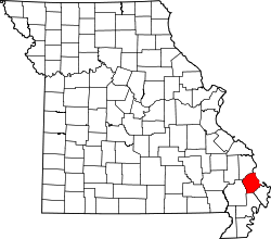
| Scott | 201 | Benton | 1822 | New Madrid County | John Guier Scott (1819–1892) – Abgeordneter des US-Repräsentantenhauses | 39.191 | 1.090 km² |  |
| Shannon | 203 | Eminence | 1837 | Ripley County | George Shannon (1785–1836) – Teilnehmer an der Lewis-und-Clark-Expedition | 8.441 | 2.600 km² |  |
| Shelby | 205 | Shelbyville | 1835 | Marion County | Isaac Shelby (1750–1826) – Erster und fünfter Gouverneur von Kentucky | 6.373 | 1.298 km² |  |
| St. Charles | 183 | Saint Charles | 1812 | Eines der fünf ursprünglichen Countys in Missouri | Karl Borromäus (1538–1584) – italienischer Kardinal, wurde als Heiliger verehrt | 360.485 | 1.453 km² | |
| St. Clair | 185 | Osceola | 1841 | Rives County (heute Henry County) | Arthur St. Clair (1736–1818) – General im Amerikanischen Unabhängigkeitskrieg und Politiker | 9.805 | 1.753 km² |  |
| St. Francois | 187 | Farmington | 1821 | Jefferson, Ste. Genevieve und Washington County | Franz von Assisi (1182–1226) – Begründer der Franziskaner | 65.359 | 1.165 km² |  |
| St. Louis County | 189 | Clayton | 1812 | Eines der fünf ursprünglichen Countys in Missouri | Ludwig IX. (1214–1270) – König von Frankreich | 998.954 | 1.316 km² |  |
| St. Louis City | 510 | St. Louis | 1876 | Bürgerentscheid für die Herauslösung der Stadt aus dem St. Louis County | Ludwig IX. (1214–1270) – König von Frankreich | 319.294 | 160 km² |  |
| Ste. Genevieve | 186 | Ste. Genevieve | 1812 | Eines der fünf ursprünglichen Countys in Missouri | Genoveva von Paris (422–502) – Schutzheilige von Paris | 18.145 | 1.300 km² | |
| Stoddard | 207 | Bloomfield | 1835 | New Madrid County | Amos Stoddard (1762–1813) – Bevollmächtigter für den Übergang des Louisiana-Territoriums an die USA nach dem Louisiana Purchase | 29.968 | 2.142 km² |  |
| Stone | 209 | Galena | 1851 | Taney County | William Stone Richter im Taney County | 32.202 | 1.199 km² |  |
| Sullivan | 211 | Milan | 1843 | Linn County | John Sullivan (1740–1795) – General im Amerikanischen Unabhängigkeitskrieg | 6.714 | 1.686 km² |  |
| Taney | 213 | Forsyth | 1837 | Greene County | Roger B. Taney (1777–1864) – Elfter US-Generalbundesanwalt, fünfter Oberster Richter der USA | 51.675 | 1.637 km² |  |
| Texas | 215 | Houston | 1843 | Shannon County und Wright County | Republik Texas | 26.008 | 3.054 km² |  |
| Vernon | 217 | Nevada | 1851 | Bates County | Miles Vernon – Senator in Missouri | 21.159 | 2.160 km² |  |
| Warren | 219 | Warrenton | 1833 | Montgomery County | Joseph Warren (1741–1775) – Arzt und Offizier, fiel im Amerikanischen Unabhängigkeitskrieg | 32.513 | 1.119 km² |  |
| Washington | 221 | Potosi | 1813 | Ste. Genevieve County | George Washington (1732–1799) – Erster Präsident der USA | 25.195 | 1.968 km² |  |
| Wayne | 223 | Greenville | 1818 | Cape Girardeau und Lawrence County | Anthony Wayne (1745–1796) – General im Amerikanischen Unabhängigkeitskrieg und Politiker | 13.521 | 1.971 km² |  |
| Webster | 225 | Marshfield | 1855 | Greene County | Daniel Webster (1782–1852) – Außenminister der USA | 36.202 | 1.536 km² |  |
| Worth | 227 | Grant City | 1861 | Gentry County | William J. Worth (1794–1849) – US-General während des Mexikanisch-Amerikanischen Krieges | 2.171 | 689 km² |  |
| Wright | 229 | Hartville | 1841 | Pulaski County | Silas Wright (1795–1847) – US-Kongressabgeordneter, Gouverneur von New York (1845–1846) | 18.815 | 1.766 km² |  |
Einzelnachweise
- ↑ U.S. Census Bureau - Missouri - State & County QuickFacts (Memento des Originals vom 14. August 2005 im Internet Archive) Info: Der Archivlink wurde automatisch eingesetzt und noch nicht geprüft. Bitte prüfe Original- und Archivlink gemäß Anleitung und entferne dann diesen Hinweis.
- ↑ U.S. Census 2010 Abgerufen am 26. Februar 2011
- ↑ U.S. Census Bureau - State & County QuickFacts (Memento des Originals vom 14. August 2005 im Internet Archive) Info: Der Archivlink wurde automatisch eingesetzt und noch nicht geprüft. Bitte prüfe Original- und Archivlink gemäß Anleitung und entferne dann diesen Hinweis. Angaben in Quadratmeilen - Umrechnung in Quadratkilometer
Auf dieser Seite verwendete Medien
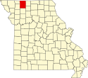
This is a locator map showing Scotland County in Missouri. For more information, see Commons:United States county locator maps.
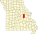
This is a locator map showing Linn County in Missouri. For more information, see Commons:United States county locator maps.
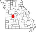
This is a locator map showing Hickory County in Missouri. For more information, see Commons:United States county locator maps.
This is a locator map showing Montgomery County in Missouri. For more information, see Commons:United States county locator maps.
This is a locator map showing Morgan County in Missouri. For more information, see Commons:United States county locator maps.
This is a locator map showing Holt County in Missouri. For more information, see Commons:United States county locator maps.
This is a locator map showing Saline County in Missouri. For more information, see Commons:United States county locator maps.
This is a locator map showing Lafayette County in Missouri. For more information, see Commons:United States county locator maps.
This is a locator map showing Moniteau County in Missouri. For more information, see Commons:United States county locator maps.
This is a locator map showing Shannon County in Missouri. For more information, see Commons:United States county locator maps.
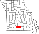
This is a locator map showing Webster County in Missouri. For more information, see Commons:United States county locator maps.
This is a locator map showing Gentry County in Missouri. For more information, see Commons:United States county locator maps.
This is a locator map showing Stone County in Missouri. For more information, see Commons:United States county locator maps.
This is a locator map showing Cedar County in Missouri. For more information, see Commons:United States county locator maps.
This is a locator map showing Saint Clair County in Missouri. For more information, see Commons:United States county locator maps.
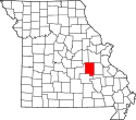
This is a locator map showing Madison County in Missouri. For more information, see Commons:United States county locator maps.
This is a locator map showing Caldwell County in Missouri. For more information, see Commons:United States county locator maps.
This is a locator map showing Saint Louis City in Missouri. For more information, see Commons:United States county locator maps.
This is a locator map showing Bates County in Missouri. For more information, see Commons:United States county locator maps.
This is a locator map showing Douglas County in Missouri. For more information, see Commons:United States county locator maps.
This is a locator map showing Harrison County in Missouri. For more information, see Commons:United States county locator maps.
This is a locator map showing Schuyler County in Missouri. For more information, see Commons:United States county locator maps.
This is a locator map showing Worth County in Missouri. For more information, see Commons:United States county locator maps.
This is a locator map showing Carroll County in Missouri. For more information, see Commons:United States county locator maps.
This is a locator map showing Crawford County in Missouri. For more information, see Commons:United States county locator maps.
This is a locator map showing Ray County in Missouri. For more information, see Commons:United States county locator maps.
This is a locator map showing Clinton County in Missouri. For more information, see Commons:United States county locator maps.
This is a locator map showing Gasconade County in Missouri. For more information, see Commons:United States county locator maps.
This is a locator map showing Macon County in Missouri. For more information, see Commons:United States county locator maps.
This is a locator map showing Monroe County in Missouri. For more information, see Commons:United States county locator maps.
This is a locator map showing McDonald County in Missouri. For more information, see Commons:United States county locator maps.
This is a locator map showing Benton County in Missouri. For more information, see Commons:United States county locator maps.
This is a locator map showing Phelps County in Missouri. For more information, see Commons:United States county locator maps.
This is a locator map showing Scott County in Missouri. For more information, see Commons:United States county locator maps.
This is a locator map showing Pemiscot County in Missouri. For more information, see Commons:United States county locator maps.
This is a locator map showing Dent County in Missouri. For more information, see Commons:United States county locator maps.
This is a locator map showing Chariton County in Missouri. For more information, see Commons:United States county locator maps.
This is a locator map showing Howell County in Missouri. For more information, see Commons:United States county locator maps.
This is a locator map showing Barton County in Missouri. For more information, see Commons:United States county locator maps.
This is a locator map showing Vernon County in Missouri. For more information, see Commons:United States county locator maps.
This is a locator map showing Mississippi County in Missouri. For more information, see Commons:United States county locator maps.
This is a locator map showing Osage County in Missouri. For more information, see Commons:United States county locator maps.
This is a locator map showing Callaway County in Missouri. For more information, see Commons:United States county locator maps.
This is a locator map showing Oregon County in Missouri. For more information, see Commons:United States county locator maps.
This is a locator map showing Miller County in Missouri. For more information, see Commons:United States county locator maps.
This is a locator map showing Daviess County in Missouri. For more information, see Commons:United States county locator maps.
This is a locator map showing Shelby County in Missouri. For more information, see Commons:United States county locator maps.
This is a locator map showing Livingston County in Missouri. For more information, see Commons:United States county locator maps.
This is a locator map showing Johnson County in Missouri. For more information, see Commons:United States county locator maps.
This is a locator map showing Grundy County in Missouri. For more information, see Commons:United States county locator maps.
This is a locator map showing Cole County in Missouri. For more information, see Commons:United States county locator maps.
This is a locator map showing Marion County in Missouri. For more information, see Commons:United States county locator maps.
This is a locator map showing Butler County in Missouri. For more information, see Commons:United States county locator maps.
This is a locator map showing Pettis County in Missouri. For more information, see Commons:United States county locator maps.
This is a locator map showing Dade County in Missouri. For more information, see Commons:United States county locator maps.
This is a locator map showing Warren County in Missouri. For more information, see Commons:United States county locator maps.
This is a locator map showing Nodaway County in Missouri. For more information, see Commons:United States county locator maps.
This is a locator map showing Stoddard County in Missouri. For more information, see Commons:United States county locator maps.
This is a locator map showing Camden County in Missouri. For more information, see Commons:United States county locator maps.
This is a locator map showing Maries County in Missouri. For more information, see Commons:United States county locator maps.
This is a locator map showing Taney County in Missouri. For more information, see Commons:United States county locator maps.
This is a locator map showing New Madrid County in Missouri. For more information, see Commons:United States county locator maps.
This is a locator map showing Perry County in Missouri. For more information, see Commons:United States county locator maps.
This is a locator map showing Saint Francois County in Missouri. For more information, see Commons:United States county locator maps.
This is a locator map showing Newton County in Missouri. For more information, see Commons:United States county locator maps.
This is a locator map showing Clay County in Missouri. For more information, see Commons:United States county locator maps.
This is a locator map showing Jackson County in Missouri. For more information, see Commons:United States county locator maps.
This is a locator map showing Henry County in Missouri. For more information, see Commons:United States county locator maps.
This is a locator map showing Audrain County in Missouri. For more information, see Commons:United States county locator maps.
This is a locator map showing Dunklin County in Missouri. For more information, see Commons:United States county locator maps.
This is a locator map showing Putnam County in Missouri. For more information, see Commons:United States county locator maps.
Locator Map of Missouri, United States
This is a locator map showing Lincoln County in Missouri. For more information, see Commons:United States county locator maps.
This is a locator map showing Adair County in Missouri. For more information, see Commons:United States county locator maps.
This is a locator map showing Bollinger County in Missouri. For more information, see Commons:United States county locator maps.
This is a locator map showing Howard County in Missouri. For more information, see Commons:United States county locator maps.
This is a locator map showing Pike County in Missouri. For more information, see Commons:United States county locator maps.
This is a locator map showing Sullivan County in Missouri. For more information, see Commons:United States county locator maps.
This is a locator map showing Ripley County in Missouri. For more information, see Commons:United States county locator maps.
This is a locator map showing Washington County in Missouri. For more information, see Commons:United States county locator maps.
This is a locator map showing Iron County in Missouri. For more information, see Commons:United States county locator maps.
This is a locator map showing DeKalb County in Missouri. For more information, see Commons:United States county locator maps.
This is a locator map showing Reynolds County in Missouri. For more information, see Commons:United States county locator maps.
This is a locator map showing Christian County in Missouri. For more information, see Commons:United States county locator maps.
This is a locator map showing Lawrence County in Missouri. For more information, see Commons:United States county locator maps.
This is a locator map showing Polk County in Missouri. For more information, see Commons:United States county locator maps.
This is a locator map showing Boone County in Missouri. For more information, see Commons:United States county locator maps.
This is a locator map showing Ralls County in Missouri. For more information, see Commons:United States county locator maps.
This is a locator map showing Saint Louis County in Missouri. For more information, see Commons:United States county locator maps.
This is a locator map showing Wright County in Missouri. For more information, see Commons:United States county locator maps.
This is a locator map showing Greene County in Missouri. For more information, see Commons:United States county locator maps.
This is a locator map showing Jefferson County in Missouri. For more information, see Commons:United States county locator maps.
This is a locator map showing Dallas County in Missouri. For more information, see Commons:United States county locator maps.
This is a locator map showing Randolph County in Missouri. For more information, see Commons:United States county locator maps.
This is a locator map showing Pulaski County in Missouri. For more information, see Commons:United States county locator maps.
This is a locator map showing Mercer County in Missouri. For more information, see Commons:United States county locator maps.
This is a locator map showing Cooper County in Missouri. For more information, see Commons:United States county locator maps.
This is a locator map showing Knox County in Missouri. For more information, see Commons:United States county locator maps.
This is a locator map showing Jasper County in Missouri. For more information, see Commons:United States county locator maps.
This is a locator map showing Laclede County in Missouri. For more information, see Commons:United States county locator maps.
This is a locator map showing Atchison County in Missouri. For more information, see Commons:United States county locator maps.
This is a locator map showing Andrew County in Missouri. For more information, see Commons:United States county locator maps.
This is a locator map showing Barry County in Missouri. For more information, see Commons:United States county locator maps.
This is a locator map showing Clark County in Missouri. For more information, see Commons:United States county locator maps.
This is a locator map showing Wayne County in Missouri. For more information, see Commons:United States county locator maps.
This is a locator map showing Cape Girardeau County in Missouri. For more information, see Commons:United States county locator maps.
This is a locator map showing Carter County in Missouri. For more information, see Commons:United States county locator maps.
This is a locator map showing Cass County in Missouri. For more information, see Commons:United States county locator maps.
This is a locator map showing Buchanan County in Missouri. For more information, see Commons:United States county locator maps.
This is a locator map showing Ozark County in Missouri. For more information, see Commons:United States county locator maps.
This is a locator map showing Platte County in Missouri. For more information, see Commons:United States county locator maps.
This is a locator map showing Lewis County in Missouri. For more information, see Commons:United States county locator maps.
This is a locator map showing Franklin County in Missouri. For more information, see Commons:United States county locator maps.


