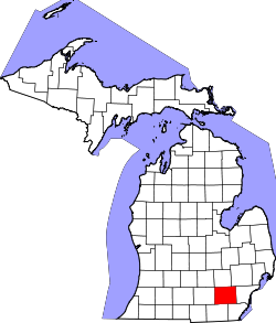
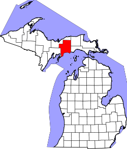
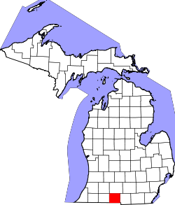
Liste der Countys in Michigan
Der US-amerikanische Bundesstaat Michigan ist in 83 Countys eingeteilt.
Die offizielle Abkürzung von Michigan lautet MI, der FIPS-Code ist 26[1]. Der FIPS-Code jedes einzelnen Countys beginnt also stets mit 26, an die für jedes County jeweils eine dreistellige Zahl angehängt wird.
Die Bevölkerungszahlen der Countys basieren auf den Ergebnissen der Volkszählung 2010.
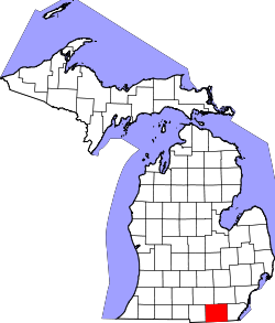
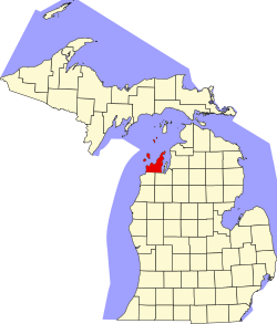
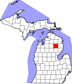
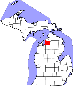
| County | FIPS-Code[2] | County Seat | Gründung | Ursprung | Namensherkunft | Einwohner 2010[3] | Fläche[2] | Karte |
|---|---|---|---|---|---|---|---|---|
| Alcona | 001 | Harrisville | Name und Grenzen festgelegt: 1840 Einrichtung der Verwaltung: 1869 | Indianerland | Benannt von Henry Schoolcraft nach einem indianischen Wort | 10.942 | 1.747 km² |  |
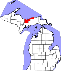
| Alger | 003 | Munising | 1885 | Schoolcraft County | Russell Alexander Alger (1836–1907) – Gouverneur von Michigan (1885–1887) und Kriegsminister der USA (1897–1899) | 9.601 | 2.377 km² |  |
| Allegan | 005 | Allegan | Name und Grenzen festgelegt: 1831 Einrichtung der Verwaltung: 1835 | Gebildet aus Teilen des Barry County und Indianerland | Pseudo-indianischer Name, erfunden von dem Entdecker und Ethnologen Henry Rowe Schoolcraft | 111.408 | 2.143 km² |  |
| Alpena | 007 | Alpena | Name und Grenzen festgelegt: 1840 Einrichtung der Verwaltung: 1857 | Gebildet aus Teilen des Mackinac County und Indianerland | Pseudo-indianischer Name, erfunden von dem Entdecker und Ethnologen Henry Rowe Schoolcraft | 29.598 | 1.487 km² |  |
| Antrim | 009 | Bellaire | 1840 | Mackinac County | County Antrim, Nordirland | 23.580 | 1.235 km² |  |
| Arenac | 011 | Standish | 1831 | Indianerland, 1857 zum Bay County, 1883 aus diesem wieder ausgegliedert | Pseudo-indianischer Name, erfunden von dem Entdecker und Ethnologen Henry Rowe Schoolcraft | 15.899 | 950 km² |  |
| Baraga | 013 | L’Anse | 1875 | Houghton County | Ireneus Frederic Baraga (1797–1868) – katholischer Missionar und erster Bischof von Sault Ste. Marie, (heute Bistum Marquette) | 8.860 | 2.341 km² |  |
| Barry | 015 | Hastings | 1829 | Indianerland | William T. Barry (1784–1835) – Postminister (1829–1835) unter US-Präsident Andrew Jackson | 59.173 | 1.440 km² |  |
| Bay | 017 | Bay City | 1857 | Gebildet aus Teilen des Arenac, des Midland und des Saginaw County | Saginaw Bay | 107.771 | 1.151 km² |  |
| Benzie | 019 | Beulah | 1863 | Leelanau County | französisch: Riviere Aux-Bec-Scies | 17.525 | 832 km² |  |
| Berrien | 021 | St. Joseph | 1829 | Indianerland | John MacPherson Berrien (1781–1856) – Justizminister (1829–1831) unter US-Präsident Andrew Jackson | 156.813 | 1.479 km² |  |
| Branch | 023 | Coldwater | 1829 | Indianerland | John Branch (1782–1863) – Marineminister (1829–1831) unter US-Präsident Andrew Jackson | 45.248 | 1.314 km² |  |
| Calhoun | 025 | Marshall | 1829 | Indianerland | John C. Calhoun (1782–1850) – Vizepräsident (1825–1832) unter den US-Präsidenten John Quincy Adams und Andrew Jackson | 136.146 | 1.836 km² |  |
| Cass | 027 | Cassopolis | 1829 | Indianerland | Lewis Cass (1782–1866) – Kriegsminister (1831–1836) unter US-Präsident Andrew Jackson und Außenminister (1857–1860) unter Präsident James Buchanan | 52.293 | 1.275 km² |  |
| Charlevoix | 029 | Charlevoix | 1869 | Gebildet aus Teilen des Antrim, des Emmet und des Otsego County | Pierre François Xavier de Charlevoix (1682–1761) – französischer Jesuit, Reisender und Historiker in Neufrankreich | 25.949 | 1.080 km² |  |
| Cheboygan | 031 | Cheboygan | 1840 | Mackinac County | Cheboygan River | 26.152 | 1.853 km² |  |
| Chippewa | 033 | Sault Ste. Marie | 1827 | Mackinac County | Indianerstamm der Anishinabe, auch Chippewa genannt | 38.520 | 4.043 km² |  |
| Clare | 035 | Harrison | 1840 | Gebildet aus Teilen des Mackinac County und Indianerland | County Clare, Irland | 30.926 | 1.468 km² |  |
| Clinton | 037 | St. Johns | 1831 | Indianerland | DeWitt Clinton (1769–1828) – Gouverneur von New York (1817–1822) | 75.382 | 1.480 km² |  |
| Crawford | 039 | Grayling | 1840 | Gebildet aus Teilen des Mackinac County und Indianerland | Fort Crawford in Wisconsin | 14.074 | 1.446 km² |  |
| Delta | 041 | Escanaba | 1843 | Gebildet aus Teilen des Mackinac County und Indianerland | Der griechischen Buchstabe Delta, da die ehemaligen Countygrenzen wie ein Dreieck aussahen | 37.069 | 3.030 km² |  |
| Dickinson | 043 | Iron Mountain | 1891 | Gebildet aus Teilen des Iron, des Marquette und des Menominee County | Donald M. Dickinson (1846–1917) – Postminister (1888–1889) unter US-Präsident Grover Cleveland | 26.168 | 1.985 km² |  |
| Eaton | 045 | Charlotte | 1829 | Indianerland | John Henry Eaton (1790–1856) – Kriegsminister (1829–1831) unter US-Präsident Andrew Jackson | 107.759 | 1.493 km² |  |
| Emmet | 047 | Petoskey | 1840 | Mackinac County | Robert Emmet (1778–1803) – irischer Rebellenführer und Nationalist | 32.694 | 1.212 km² |  |
| Genesee | 049 | Flint | 1835 | Gebildet aus dem Lapeer, dem Saginaw und dem Shiawassee County | In der Sprache der Seneca bedeutet je-nis-hi-yeh etwa schönes Tal | 425.790 | 1.657 km² |  |
| Gladwin | 051 | Gladwin | 1831 | Indianerland | Henry Gladwin (1729 oder 1730–1791) – Britischer Kommandeur von Fort Detroit während der Belagerung beim Pontiac-Aufstand | 25.692 | 1.313 km² |  |
| Gogebic | 053 | Bessemer | 1867 | Ontonagon County | Ojibwe-Wort Bic, das so viel wie Felsen bedeutet | 16.427 | 2.854 km² |  |
| Grand Traverse | 055 | Traverse City | 1851 | Omeena County | Grand Traverse Bay im Michigansee | 86.986 | 1.205 km² |  |
| Gratiot | 057 | Ithaca | 1831 | Indianerland | Charles Gratiot (1788–1855) – Armeeoffizier, Kommandeur des United States Army Corps of Engineers (1828–1838) | 42.476 | 1.477 km² |  |
| Hillsdale | 059 | Hillsdale | 1829 | Indianerland | Hügel und Täler in der Gegend | 46.699 | 1.551 km² |  |
| Houghton | 061 | Houghton | 1845 | Gebildet aus Teilen des Marquette und des Ontonagon County | Douglass Houghton (1809–1845) – Geologe, Bürgermeister von Detroit (1842–1843) | 36.628 | 2.620 km² |  |
| Huron | 063 | Bad Axe | 1840 | Sanilac County | Huronsee | 33.118 | 2.167 km² |  |
| Ingham | 065 | Mason | Name und Grenzen festgelegt: 1829 Einrichtung der Verwaltung: 1838 | Gebildet aus Teilen des Shiawassee und des Washtenaw County sowie Indianerland | Samuel D. Ingham (1779–1860) – Finanzminister (1829–1831) unter US-Präsident Andrew Jackson | 280.895 | 1.448 km² |  |
| Ionia | 067 | Ionia | 1831 | Gebildet aus Teilen des Mackinac County und Indianerland | Provinz im alten Griechenland | 63.905 | 1.485 km² |  |
| Iosco | 069 | Tawas City | 1840 | Indianerland | Pseudo-indianischer Name, erfunden von dem Entdecker und Ethnologen Henry Rowe Schoolcraft | 25.887 | 1.422 km² |  |
| Iron | 071 | Crystal Falls | 1885 | Gebildet aus Teilen des Marquette und des Menominee County | Eisenerzlagerstätten in der Gegend | 11.817 | 3.021 km² |  |
| Isabella | 073 | Mount Pleasant | 1831 | Gebildet aus Teilen des Mackinac County und Indianerland | Isabella I. (1451–1504) – spanische Königin zur Zeit der Entdeckung Amerikas | 70.311 | 1.487 km² |  |
| Jackson | 075 | Jackson | Name und Grenzen festgelegt: 1829 Einrichtung der Verwaltung: 1832 | Gebildet aus Teilen des Washtenaw County und Indianerland | Andrew Jackson (1767–1845) – siebenter Präsident der USA (1829–1837), während dessen Präsidentschaft der Staat Michigan in die Union aufgenommen wurde | 160.248 | 1.830 km² |  |
| Kalamazoo | 077 | Kalamazoo | 1829 | Indianerland | Kalamazoo River | 250.331 | 1.455 km² |  |
| Kalkaska | 079 | Kalkaska | 1840 | Mackinac County | Pseudo-indianischer Name, erfunden von dem Entdecker und Ethnologen Henry Rowe Schoolcraft | 17.153 | 1.453 km² |  |
| Kent | 081 | Grand Rapids | 1831 | Gebildet aus Teilen des Mackinac County und Indianerland | James Kent (1763–1847) – Jurist, vertrat das Michigan-Territorium gegen den Staat Ohio im Streit um den Toledo Streifen im so genannten Toledo-Krieg | 602.622 | 2.217 km² |  |
| Keweenaw | 083 | Eagle River | 1861 | Houghton County | Ojibwe-Wort gakiiwe-wewaning, des etwa Transport oder Beförderung bedeutet | 2.156 | 1.401 km² |  |
| Lake County | 085 | Baldwin | 1840 | Mackinac County | Eine Reihe von kleineren Seen in dem Gebiet | 11.539 | 1.470 km² |  |
| Lapeer | 087 | Lapeer | 1822 | Gebildet aus Teilen des Oakland und des St. Clair County | Amerikanisierung des französischen Wortes la pierre (dt.: Feuerstein) | 88.319 | 1.694 km² |  |
| Leelanau | 089 | Leland | 1840 | Mackinac County | Pseudo-indianischer Name, erfunden von dem Entdecker und Ethnologen Henry Rowe Schoolcraft | 21.708 | 903 km² |  |
| Lenawee | 091 | Adrian | 1822 | Monroe County | Indianisches Wort | 99.892 | 1.944 km² |  |
| Livingston | 093 | Howell | Name und Grenzen festgelegt: 1833 Einrichtung der Verwaltung: 1836 | Gebildet aus Teilen des Shiawassee und des Washtenaw County | Edward Livingston (1764–1836) – Außenminister (1831–1833) unter dem US-Präsidenten Andrew Jackson | 180.967 | 1.472 km² |  |
| Luce | 095 | Newberry | 1887 | Gebildet aus Teilen des Chippewa und des Mackinac County | Cyrus G. Luce (1824–1905) – Gouverneur von Michigan (1887–1891) | 6.631 | 2.339 km² |  |
| Mackinac | 097 | St. Ignace | 1818 | Wayne County | Der ursprüngliche Name Michilimackinac County orientierte sich an der französischen Interpretation des indianischen Namens für dieses Gebiet. | 11.113 | 2.648 km² |  |
| Macomb | 099 | Mount Clemens | 1818 | Wayne County | Alexander Macomb (1782–1841) – Offizier im Britisch-Amerikanischen Krieg von 1812 | 840.978 | 1.244 km² |  |
| Manistee | 101 | Manistee | 1840 | Mackinac County | Manistee River | 24.733 | 1.408 km² |  |
| Marquette | 103 | Marquette | 1843 | Gebildet aus Teilen des Chippewa und des Mackinac County | Jacques Marquette (1637–1675) – französischer Entdecker | 67.077 | 4.716 km² |  |
| Mason | 105 | Ludington | 1840 | Mackinac County | Stevens Mason (1811–1843) – Gouverneur von Wisconsin (1835–1840) | 28.705 | 1.282 km² |  |
| Mecosta | 107 | Big Rapids | 1840 | Gebildet aus Teilen des Mackinac und des Oceana County | Mecosta – ein Häuptling des Indianerstammes der Potawatomi | 42.798 | 1.439 km² |  |
| Menominee | 109 | Menominee | 1861 | Delta County | Indianerstamm der Menominee | 24.029 | 2.703 km² |  |
| Midland | 111 | Midland | 1831 | Gebildet aus Teilen des Saginaw County und Indianerland | Das Zentrum der Unteren Halbinsel Michigans | 83.629 | 1.350 km² |  |
| Missaukee | 113 | Lake City | 1840 | Mackinac County | Missaukee – ein Häuptling der Ottawa | 14.849 | 1.468 km² |  |
| Monroe | 115 | Monroe | 1817 | Wayne County | James Monroe (1758–1831) – fünfter Präsident der USA (1817–1825) | 152.021 | 1.427 km² |  |
| Montcalm | 117 | Stanton | 1831 | Gebildet aus Teilen des Mackinac County und Indianerland | Louis-Joseph de Montcalm (1712–1759) – Kommandeur der französischen Armee im Franzosen- und Indianerkrieg von 1756 bis 1863 | 63.342 | 1.834 km² |  |
| Montmorency | 119 | Atlanta | 1840 | Gebildet aus Teilen des Mackinac County und Indianerland | Montmorency – französisches Adelsgeschlecht, das auch in Kanada großen Einfluss ausübte | 9.765 | 1.418 km² |  |
| Muskegon | 121 | Muskegon | 1859 | Gebildet aus Teilen des Oceana und des Ottawa County | Muskegon River | 172.188 | 1.319 km² |  |
| Newaygo | 123 | White Cloud | 1840 | Gebildet aus Teilen des Mackinac und des Oceana County | Newaygo – ein Häuptling der Anishinabe und Mitunterzeichner des Vertrages von Saginaw | 48.460 | 2.182 km² |  |
| Oakland | 125 | Pontiac | Name und Grenzen festgelegt: 1819 Einrichtung der Verwaltung: 1820 | Macomb County | Große Bestände an Eichen (englisch: oaks) auf dem Gebiet des Countys | 1.202.362 | 2.260 km² |  |
| Oceana | 127 | Hart | 1831 | Mackinac County | Michigansee – in Anlehnung an seine Größe (Ozean) | 26.570 | 1.400 km² |  |
| Ogemaw | 129 | West Branch | 1840 | Gegründet auf Indianerland, 1867 zum Iosco County, 1873 wieder ausgegliedert | Ojibwe-Wort für Häuptling | 21.699 | 1.462 km² |  |
| Ontonagon | 131 | Ontonagon | 1843 | Gebildet aus Teilen des Chippewa und des Mackinac County | Ontonagon River | 6.780 | 3397 km² |  |
| Osceola | 133 | Reed City | 1840 | Mackinac County | Osceola (1804–1838) – Häuptling der Seminolen | 23.528 | 1.466 km² |  |
| Oscoda | 135 | Mio | 1840 | Ursprung | Pseudo-indianischer Name, erfunden von dem Entdecker und Ethnologen Henry Rowe Schoolcraft | 8.640 | 1.463 km² |  |
| Otsego | 137 | Gaylord | 1840 | Mackinac County | Otsego County in New York, aus dem viele der Siedler des Countys ursprünglich kamen | 24.164 | 1.333 km² |  |
| Ottawa | 139 | Grand Haven | 1831 | Gebildet aus Teilen des Mackinac County und Indianerland | Indianerstamm der Ottawa | 263.801 | 1.465 km² |  |
| Presque Isle | 141 | Rogers City | 1840 | Mackinac County | Damals üblicher französischer Ausdruck Presqu'île für Halbinsel | 13.376 | 1.710 km² |  |
| Roscommon | 143 | Roscommon | 1840 | Gebildet aus Teilen des Mackinac County und Indianerland | County Roscommon, Irland | 24.449 | 1.350 km² |  |
| Saginaw | 145 | Saginaw | 1822 | Oakland County | Indianischer Ausdruck | 200.169 | 2.095 km² |  |
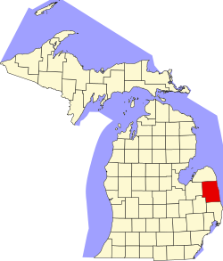
| St. Clair | 147 | Port Huron | 1820 | Macomb County | Arthur St. Clair (1736–1818) – Gouverneur des Nordwestterritoriums (1788–1802), zu dem das heutige Michigan gehörte | 163.040 | 1.876 km² |  |
| St. Joseph | 149 | Centreville | 1829 | Indianerland | St. Joseph River | 61.295 | 1.305 km² |  |
| Sanilac | 151 | Sandusky | 1822 | St. Clair County | Sanilac – Häuptling der Wyandot | 43.114 | 2.496 km² |  |
| Schoolcraft | 153 | Manistique | 1843 | Gebildet aus Teilen des Chippewa und des Mackinac County | Henry Rowe Schoolcraft (1793–1864) – Ethnologe und Indianeragent in Michigan | 8.485 | 3.051 km² |  |
| Shiawassee | 155 | Corunna | 1822 | Gebildet aus Teilen des Oakland und des St. Clair County | Shiawassee River | 70.648 | 1.395 km² |  |
| Tuscola | 157 | Caro | 1840 | Sanilac County | Pseudo-indianischer Name, erfunden von dem Entdecker und Ethnologen Henry Rowe Schoolcraft | 55.729 | 2.104 km² |  |
| Van Buren | 159 | Paw Paw | 1829 | Indianerland | Martin Van Buren (1782–1862) – achter Präsident der USA (1837–1841) | 76.258 | 1.582 km² |  |
| Washtenaw | 161 | Ann Arbor | Name und Grenzen festgelegt: 1822 Einrichtung der Verwaltung: 1826 | Gebildet aus Teilen des Oakland und des Wayne County | Indianischer Name für das Gebiet westlich von Detroit | 344.791 | 1.839 km² |  |
| Wayne | 163 | Detroit | 1815 | Im Vertrag von Detroit von den Indianern an die US-Regierung abgetretenes Gebiet | Anthony Wayne (1745–1796) – Brigadegeneral im Amerikanischen Unabhängigkeitskrieg | 1.820.584 | 1.591 km² |  |
| Wexford | 165 | Cadillac | 1840 | Mackinac County | County Wexford, Irland | 32.735 | 1.465 km² |  |
Einzelnachweise
- ↑ FIPS-Codes von Michigan ( des vom 9. Juni 2010 im Internet Archive) Info: Der Archivlink wurde automatisch eingesetzt und noch nicht geprüft. Bitte prüfe Original- und Archivlink gemäß Anleitung und entferne dann diesen Hinweis., abgerufen am 27. April 2011.
- ↑ a b U.S. Census Bureau - Michigan - State & County QuickFacts ( des vom 11. Mai 2011 im Internet Archive) Info: Der Archivlink wurde automatisch eingesetzt und noch nicht geprüft. Bitte prüfe Original- und Archivlink gemäß Anleitung und entferne dann diesen Hinweis. Flächenangaben in Quadratmeilen - Umrechnung in Quadratkilometer
- ↑ United States Census 2010, abgerufen am 27. April 2011.
Auf dieser Seite verwendete Medien
This is a locator map showing Saint Clair County in Michigan.
This is a locator map showing Washtenaw County in Michigan. For more information, see Commons:United States county locator maps.
This is a locator map showing Livingston County in Michigan. For more information, see Commons:United States county locator maps.
This is a locator map showing Alcona County in Michigan. For more information, see Commons:United States county locator maps.
This is a locator map showing Eaton County in Michigan. For more information, see Commons:United States county locator maps.
This is a locator map showing Clinton County in Michigan. For more information, see Commons:United States county locator maps.
This is a locator map showing Crawford County in Michigan. For more information, see Commons:United States county locator maps.
This is a locator map showing Mecosta County in Michigan. For more information, see Commons:United States county locator maps.
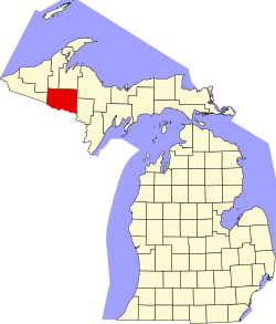
This is a locator map showing Baraga County in Michigan. For more information, see Commons:United States county locator maps.
This is a locator map showing Schoolcraft County in Michigan. For more information, see Commons:United States county locator maps.
This is a locator map showing Mackinac County in Michigan. For more information, see Commons:United States county locator maps.
Locator Map of Michigan, United States
This is a locator map showing Luce County in Michigan. For more information, see Commons:United States county locator maps.
This is a locator map showing Montmorency County in Michigan. For more information, see Commons:United States county locator maps.
This is a locator map showing Berrien County in Michigan. For more information, see Commons:United States county locator maps.
This is a locator map showing Benzie County in Michigan. For more information, see Commons:United States county locator maps.
This is a locator map showing Dickinson County in Michigan. For more information, see Commons:United States county locator maps.
This is a locator map showing Shiawassee County in Michigan. For more information, see Commons:United States county locator maps.
This is a locator map showing Ogemaw County in Michigan. For more information, see Commons:United States county locator maps.
This is a locator map showing Tuscola County in Michigan. For more information, see Commons:United States county locator maps.
This is a locator map showing Ottawa County in Michigan. For more information, see Commons:United States county locator maps.
This is a locator map showing Menominee County in Michigan. For more information, see Commons:United States county locator maps.
This is a locator map showing Delta County in Michigan. For more information, see Commons:United States county locator maps.
This is a locator map showing Gratiot County in Michigan. For more information, see Commons:United States county locator maps.
This is a locator map showing Missaukee County in Michigan. For more information, see Commons:United States county locator maps.
This is a locator map showing Lapeer County in Michigan. For more information, see Commons:United States county locator maps.
This is a locator map showing Presque Isle County in Michigan. For more information, see Commons:United States county locator maps.
This is a locator map showing Ontonagon County in Michigan. For more information, see Commons:United States county locator maps.
This is a locator map showing Clare County in Michigan. For more information, see Commons:United States county locator maps.
This is a locator map showing Oceana County in Michigan. For more information, see Commons:United States county locator maps.
This is a locator map showing Wexford County in Michigan. For more information, see Commons:United States county locator maps.
This is a locator map showing Saint Joseph County in Michigan. For more information, see Commons:United States county locator maps.
This is a locator map showing Branch County in Michigan. For more information, see Commons:United States county locator maps.
This is a locator map showing Arenac County in Michigan. For more information, see Commons:United States county locator maps.
This is a locator map showing Alger County in Michigan. For more information, see Commons:United States county locator maps.
This is a locator map showing Gogebic County in Michigan. For more information, see Commons:United States county locator maps.
This is a locator map showing Alpena County in Michigan. For more information, see Commons:United States county locator maps.
This is a locator map showing Osceola County in Michigan. For more information, see Commons:United States county locator maps.
This is a locator map showing Montcalm County in Michigan. For more information, see Commons:United States county locator maps.
This is a locator map showing Ionia County in Michigan. For more information, see Commons:United States county locator maps.
This is a locator map showing Kalamazoo County in Michigan. For more information, see Commons:United States county locator maps.
This is a locator map showing Kalkaska County in Michigan. For more information, see Commons:United States county locator maps.
This is a locator map showing Chippewa County in Michigan. For more information, see Commons:United States county locator maps.
This is a locator map showing Sanilac County in Michigan. For more information, see Commons:United States county locator maps.
This is a locator map showing Muskegon County in Michigan. For more information, see Commons:United States county locator maps.
This is a locator map showing Newaygo County in Michigan. For more information, see Commons:United States county locator maps.
This is a locator map showing Lenawee County in Michigan. For more information, see Commons:United States county locator maps.
This is a locator map showing Grand Traverse County in Michigan. For more information, see Commons:United States county locator maps.
This is a locator map showing Mason County in Michigan. For more information, see Commons:United States county locator maps.
This is a locator map showing Cass County in Michigan. For more information, see Commons:United States county locator maps.
This is a locator map showing Emmet County in Michigan. For more information, see Commons:United States county locator maps.
This is a locator map showing Lake County in Michigan. For more information, see Commons:United States county locator maps.
This is a locator map showing Leelanau County in Michigan. For more information, see Commons:United States county locator maps.
This is a locator map showing Huron County in Michigan. For more information, see Commons:United States county locator maps.
This is a locator map showing Marquette County in Michigan. For more information, see Commons:United States county locator maps.
This is a locator map showing Oakland County in Michigan. For more information, see Commons:United States county locator maps.
This is a locator map showing Van Buren County in Michigan. For more information, see Commons:United States county locator maps.
This is a locator map showing Genesee County in Michigan. For more information, see Commons:United States county locator maps.
This is a locator map showing Hillsdale County in Michigan. For more information, see Commons:United States county locator maps.
This is a locator map showing Gladwin County in Michigan. For more information, see Commons:United States county locator maps.
This is a locator map showing Saginaw County in Michigan. For more information, see Commons:United States county locator maps.
This is a locator map showing Isabella County in Michigan. For more information, see Commons:United States county locator maps.
This is a locator map showing Manistee County in Michigan. For more information, see Commons:United States county locator maps.
Locator map showing Barry County in southwestern Michigan. David Benbennick made this map. For more information, see Commons:United States county locator maps.
This is a locator map showing Macomb County in Michigan. For more information, see Commons:United States county locator maps.
This is a locator map showing Monroe County in Michigan. For more information, see Commons:United States county locator maps.
This is a locator map showing Midland County in Michigan. For more information, see Commons:United States county locator maps.
This is a locator map showing Iosco County in Michigan. For more information, see Commons:United States county locator maps.
This is a locator map showing Kent County in Michigan. For more information, see Commons:United States county locator maps.
This is a locator map showing Otsego County in Michigan. For more information, see Commons:United States county locator maps.
This is a locator map showing Oscoda County in Michigan. For more information, see Commons:United States county locator maps.
This is a locator map showing Charlevoix County in Michigan. For more information, see Commons:United States county locator maps.
This is a locator map showing Antrim County in Michigan. For more information, see Commons:United States county locator maps.
This is a locator map showing Jackson County in Michigan. For more information, see Commons:United States county locator maps.
This is a locator map showing Cheboygan County in Michigan. For more information, see Commons:United States county locator maps.
This is a locator map showing Roscommon County in Michigan. For more information, see Commons:United States county locator maps.
This is a locator map showing Allegan County in Michigan. For more information, see Commons:United States county locator maps.
This is a locator map showing Calhoun County in Michigan. For more information, see Commons:United States county locator maps.

