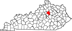
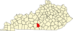
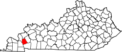
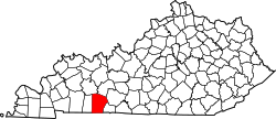
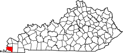
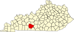
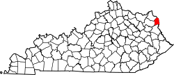
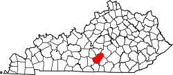
Liste der Countys in Kentucky
Der US-amerikanische Bundesstaat Kentucky ist in 120 Countys unterteilt und steht in der Zahl der Countys damit an dritter Stelle nach Texas (254) und Georgia (159). Ein Gesetz aus den frühen Tagen des Bundesstaates besagt, dass die Bezirkshauptstadt nicht weiter als einen Tagesritt von der Grenze des Countys entfernt sein darf.
Die offizielle Abkürzung von Kentucky lautet KY, der FIPS-Code ist 21. Der FIPS-Code jedes einzelnen Countys beginnt also stets mit 21, an die die in der Tabelle für jedes County genannte dreistellige Zahl angehängt wird.
Die in der Tabelle angegebenen Einwohnerzahlen basieren auf den Ergebnissen der Volkszählung im Jahr 2011.
| County | FIPS-Code[1] | County Seat | Gründung | Ursprung | Namensherkunft | Einwohner 2010[2] | Fläche[1] | Karte |
|---|---|---|---|---|---|---|---|---|
| Adair | 001 | Columbia | 1802 | Green County | John Adair (1757–1840) – Gouverneur von Kentucky (1820–1824) | 18.656 | 1.054 km² |  |
| Allen | 003 | Scottsville | 1815 | Barren County und Warren County | John Allen (1771–1813) – Offizier im Britisch-Amerikanischen Krieg von 1812 | 19.956 | 896 km² |  |
| Anderson | 005 | Lawrenceburg | 1827 | Franklin, Washington und Mercer County | Richard Clough Anderson (1788–1826) – US-Kongressabgeordneter (1817–1821) | 21.421 | 525 km² |  |
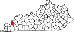
| Ballard | 007 | Wickliffe | 1842 | Hickman und McCracken County | Bland Ballard (1761–1853) – Offizier (Schlachten von Fallen Timbers und Frenchtown), Abgeordneter in Kentucky | 8.249 | 651 km² |  |
| Barren | 009 | Glasgow | 1789 | Green und Warren County | „The Barrens“, eine Region in Kentucky | 42.173 | 1.272 km² |  |
| Bath | 011 | Owingsville | 1811 | Montgomery County | Heilquellen auf dem Territorium des County | 11.591 | 734 km² |  |
| Bell | 013 | Pineville | 1867 | Harlan und Knox County | Joshua Fry Bell (1811–1870) – Abgeordneter in Kentucky (1862–1867) | 28.691 | 934 km² |  |
| Boone | 015 | Burlington | 1798 | Campbell County | Daniel Boone (1734–1820) – Pionier und Jäger | 118.811 | 638 km² |  |
| Bourbon | 017 | Paris | 1785 | Fayette County | Adelsgeschlecht der Bourbonen | 19.985 | 755 km² |  |
| Boyd | 019 | Catlettsburg | 1860 | Greenup, Carter und Lawrence County | Linn Boyd (1800–1859) – Abgeordneter des US-Kongresses (1835–1837; 1839–1855) und Vizegouverneur von Kentucky (1859) | 49.542 | 415 km² |  |
| Boyle | 021 | Danville | 1842 | Lincoln und Mercer County | John Boyle (1774–1835) – Abgeordneter des US-Repräsentantenhauses (1803–1809) und Oberster Richter von Kentucky (1810–1826) | 28.432 | 471 km² |  |
| Bracken | 023 | Brooksville | 1796 | Mason und Campbell County | William Bracken – Jäger und Fallensteller | 8.488 | 526 km² |  |
| Breathitt | 025 | Jackson | 1839 | Clay, Perry und Estill County | John Breathitt (1786–1834) – Gouverneur von Kentucky (1832–1834) | 13.878 | 1.283 km² |  |
| Breckinridge | 027 | Hardinsburg | 1799 | Hardin County | John Breckinridge (1760–1806) – US-Senator von Kentucky (1801–1805) und Justizminister (1805–1806) | 20.059 | 1.742 km² |  |
| Bullitt | 029 | Shepherdsville | 1796 | Jefferson und Nelson County | Alexander Scott Bullitt – (1761–1816) Vizegouverneur von Kentucky (1800–1804) | 74.319 | 775 km² |  |
| Butler | 031 | Morgantown | 1810 | Logan und Ohio County | Richard Butler (1743–1791) – General im Unabhängigkeitskrieg | 12.690 | 1.109 km² |  |
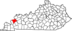
| Caldwell | 033 | Princeton | 1809 | Livingston County | John Caldwell (1757–1804) – Vizegouverneur von Kentucky (1804) | 12.984 | 899 km² |  |
| Calloway | 035 | Murray | 1822 | Hickman County | Richard Callaway (1724–1780) – einer der frühesten weißen Siedler in Kentucky | 37.191 | 1000 km² |  |
| Campbell | 037 | Alexandria | 1794 | Harrison, Mason und Scott County | John Campbell (1735–1799) – Soldat im Unabhängigkeitskrieg | 90.336 | 393 km² |  |
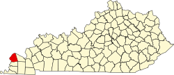
| Carlisle | 039 | Bardwell | 1886 | Hickman County | John Griffin Carlisle (1834–1910) – Abgeordneter des US-Repräsentantenhauses (1877–1889), US-Senator (1890–1892) und Finanzminister der USA (1893–1898) | 5.104 | 499 km² |  |
| Carroll | 041 | Carrollton | 1838 | Gallatin, Trimble und Henry County | Charles Carroll (1737–1832) – letzter Überlebender der Gründerväter der USA | 10.811 | 337 km² |  |
| Carter | 043 | Grayson | 1838 | Greenup und Lawrence County | William Grayson Carter (?–1849) – Senator in Kentucky (1834–1838) | 27.720 | 1.063 km² |  |
| Casey | 045 | Liberty | 1806 | Lincoln County | William Casey (1754–1816) – Soldat im Unabhängigkeitskrieg | 15.955 | 1.154 km² |  |
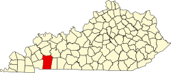
| Christian | 047 | Hopkinsville | 1796 | Logan County | William Christian (1743–1786) – Offizier im Unabhängigkeitskrieg | 73.955 | 1.868 km² |  |
| Clark | 049 | Winchester | 1792 | Bourbon und Fayette County | George Rogers Clark (1752–1818) – einer der ersten weißen Siedler von Kentucky und Kämpfer im Unabhängigkeitskrieg | 35.613 | 659 km² |  |
| Clay | 051 | Manchester | 1807 | Madison, Floyd und Knox County | Green Clay (1757–1828) – General im Unabhängigkeitskrieg, Landvermesser und Politiker | 21.730 | 1.220 km² |  |
| Clinton | 053 | Albany | 1835 | Cumberland und Wayne County | DeWitt Clinton – Gouverneur von New York (1817–1823) | 10.272 | 511 km² |  |
| Crittenden | 055 | Marion | 1842 | Livingston County | John J. Crittenden (1787–1863) – Gouverneur von Kentucky (1848–1850) | 9.315 | 938 km² |  |
| Cumberland | 057 | Burkesville | 1798 | Green County | Der Cumberland River durchfließt das County | 6.856 | 792 km² |  |
| Daviess | 059 | Owensboro | 1815 | Ohio County | Joseph Hamilton Daviess (1774–1811) – fiel als Offizier in der Schlacht bei Tippecanoe | 96.656 | 1.198 km² |  |
| Edmonson | 061 | Brownsville | 1825 | Hart, Grayson und Warren County | John Edmonson (1764–1813) – Offizier, fiel in der Schlacht bei Frenchtown | 12.161 | 784 km² |  |
| Elliott | 063 | Sandy Hook | 1869 | Morgan, Lawrence und Carter County | John Milton Elliott (1820–1879) – Abgeordneter in Kentucky | 7.852 | 606 km² |  |
| Estill | 065 | Irvine | 1808 | Clark und Madison County | James Estill (1750–1782) – Offizier, fiel im Unabhängigkeitskrieg | 14.672 | 658 km² |  |
| Fayette | 067 | Lexington | 1780 | Eines von drei ursprünglichen Countys | Marquis de Lafayette (1757–1834) – französischer Freiwilliger, General im Unabhängigkeitskrieg | 295.803 | 737 km² |  |
| Fleming | 069 | Flemingsburg | 1798 | Mason County | John Fleming (1735–1791) – einer der ersten weißen Siedler in Kentucky | 14.348 | 909 km² |  |
| Floyd | 071 | Prestonsburg | 1800 | Fleming, Montgomery und Mason County | James John Floyd (1750–1783) – Siedler und Landvermesser | 39.451 | 1.021 km² |  |
| Franklin | 073 | Frankfort | 1794 | Mercer, Shelby und Woodford County | Benjamin Franklin (1706–1790) – einer der Gründerväter der USA | 49.285 | 545 km² |  |
| Fulton | 075 | Hickman | 1845 | Hickman County | Robert Fulton (1765–1815) – Ingenieur, konstruierte das erste kommerziell nutzbare Dampfboot | 6.813 | 541 km² |  |
| Gallatin | 077 | Warsaw | 1798 | Franklin und Shelby County | Albert Gallatin (1761–1849) – Finanzminister der USA (1801–1814) | 8.589 | 256 km² |  |
| Garrard | 079 | Lancaster | 1796 | Madison, Lincoln und Mercer County | James Garrard – Gouverneur von Kentucky (1796–1804) | 16.912 | 599 km² |  |
| Grant | 081 | Williamstown | 1820 | Pendleton County | Mehrere frühe weiße Siedler mit dem Namen Grant | 24.662 | 673 km² |  |
| Graves | 083 | Mayfield | 1824 | Hickman County | Benjamin F. Graves (1771–1813) – Offizier, fiel in der Schlacht bei Frenchtown | 37.121 | 1.439 km² |  |
| Grayson | 085 | Leitchfield | 1810 | Hardin und Ohio County | William Grayson (1740–1790) – persönlicher Adjutant von George Washington | 25.746 | 1.305 km² |  |
| Green | 087 | Greensburg | 1792 | Lincoln und Nelson County | Nathanael Greene (1742–1786) – General im Unabhängigkeitskrieg | 11.258 | 748 km² |  |
| Greenup | 089 | Greenup | 1803 | Mason County | Christopher Greenup (1750–1818) – Gouverneur von Kentucky (1804–1808) | 36.910 | 896 km² |  |
| Hancock | 091 | Hawesville | 1829 | Ohio, Breckinridge und Daviess County | John Hancock (1737–1793) – Mitunterzeichner der Unabhängigkeitserklärung der USA | 8.565 | 489 km² |  |
| Hardin | 093 | Elizabethtown | 1792 | Nelson County | John Hardin (1753–1792) – Siedler | 105.543 | 1.626 km² |  |
| Harlan | 095 | Harlan | 1819 | Knox County | Silas Harlan (1753–1782) – Soldat im Unabhängigkeitskrieg | 29.278 | 1.210 km² |  |
| Harrison | 097 | Cynthiana | 1793 | Bourbon und Scott County | Benjamin Harrison (1726–1791) – Gouverneur von Virginia (1782–1784), Co-Autor der Verfassung von Kentucky | 18.846 | 802 km² |  |
| Hart | 099 | Munfordville | 1819 | Hardin und Barren County | Nathaniel G. T. Hart (1784–1813) – Offizier in der Schlacht bei Frenchtown | 18.199 | 1.077 km² |  |
| Henderson | 101 | Henderson | 1798 | Christian County | Richard Henderson (1734–1785) – Gründer der kurz bestehenden Kolonie Transylania Company | 46.250 | 1.140 km² |  |
| Henry | 103 | New Castle | 1798 | Shelby County | Patrick Henry (1736–1799) – prominenter Vertreter der Amerikanischen Unabhängigkeitsbewegung | 15.416 | 749 km² |  |
| Hickman | 105 | Clinton | 1821 | Christian County | Paschal Hickman (1778–1813) – Offizier, fiel in der Schlacht bei Frenchtown | 4.902 | 633 km² |  |
| Hopkins | 107 | Madisonville | 1806 | Henderson County | Samuel Hopkins (1753–1819) – General im Unabhängigkeitskrieg | 46.920 | 1.426 km² |  |
| Jackson | 109 | McKee | 1858 | Madison, Estill, Owsley, Clay, Laurel und Rockcastle County | Andrew Jackson (1767–1845) – siebter Präsident der USA (1829–1837) | 13.494 | 897 km² |  |
| Jefferson | 111 | Louisville | 1780 | Eines der drei ursprünglichen Countys | Thomas Jefferson (1743–1826) – dritter Präsident der USA (1801–1809) | 741.096 | 997 km² |  |
| Jessamine | 113 | Nicholasville | 1798 | Fayette County | Jessamine Creek | 48.586 | 448 km² |  |
| Johnson | 115 | Paintsville | 1843 | Floyd, Lawrence und Morgan County | Richard Mentor Johnson (1780–1850) – Vizepräsident der USA (1837–1841) | 23.356 | 677 km² |  |
| Kenton | 117 | Covington | 1840 | Campbell County | Simon Kenton (1755–1836) – Siedler | 159.720 | 420 km² |  |
| Knott | 119 | Hindman | 1884 | Perry, Letcher, Floyd und Breathitt County | James Proctor Knott (1830–1911) – Gouverneur von Kentucky (1883–1887) | 16.346 | 912 km² |  |
| Knox | 121 | Barbourville | 1799 | Lincoln County | Henry Knox – Kriegsminister der USA (1785–1794) | 31.883 | 1.004 km² |  |
| LaRue | 123 | Hodgenville | 1843 | Hardin County | John Larue (1746–1792) – einer der ersten Siedler in Kentucky | 14.193 | 682 km² |  |
| Laurel | 125 | London | 1825 | Rockcastle, Clay, Knox und Whitley County | Kalmia latifolia (Mountain-laurel) – in der Region häufig vorkommende Baumart | 58.849 | 1.128 km² |  |
| Lawrence | 127 | Louisa | 1821 | Greenup und Floyd County | James Lawrence (1781–1813) – Marineoffizier im Britisch-Amerikanischen Krieg von 1812 | 15.860 | 1.085 km² |  |
| Lee | 129 | Beattyville | 1870 | Breathitt, Estill, Owsley und Wolfe County | Robert Edward Lee (1807–1870) – General der Konföderierten im Bürgerkrieg | 7.887 | 544 km² |  |
| Leslie | 131 | Hyden | 1878 | Clay, Harlan und Perry County | Preston Leslie (1819–1907) – Gouverneur von Kentucky (1871–1875) | 11.310 | 1.046 km² |  |
| Letcher | 133 | Whitesburg | 1842 | Perry und Harlan County | Robert Letcher (1788–1861) – Gouverneur von Kentucky (1840–1844) | 24.519 | 878 km² |  |
| Lewis | 135 | Vanceburg | 1806 | Mason County | Meriwether Lewis (1774–1809) – Entdecker | 13.870 | 1.255 km² |  |
| Lincoln | 137 | Stanford | 1780 | Eines der drei ursprünglichen Countys | Benjamin Lincoln (1733–1810) – General im Unabhängigkeitskrieg | 24.742 | 871 km² |  |
| Livingston | 139 | Smithland | 1799 | Christian County | Robert R. Livingston (1746–1813) – gehörte zum Komitee, das die Unabhängigkeitserklärung dem Kontinentalkongress vorlegte | 9.519 | 819 km² |  |
| Logan | 141 | Russellville | 1792 | Lincoln County | Benjamin Logan (1742–1802) – Offizier im Unabhängigkeitskrieg | 26.835 | 1.439 km² |  |
| Lyon | 143 | Eddyville | 1854 | Caldwell County | Chittenden Lyon (1787–1842) – Abgeordneter des US-Repräsentantenhauses (1827–1835) | 8.314 | 559 km² |  |
| McCracken | 145 | Paducah | 1825 | Hickman County | Virgil McCracken – Offizier, gefallen in der Schlacht bei Frenchtown | 65.565 | 650 km² |  |
| McCreary | 147 | Whitley City | 1912 | Pulaski, Wayne und Whitley County | James B. McCreary (1838–1918) – Gouverneur von Kentucky (1912–1916) | 18.306 | 1.108 km² |  |
| McLean | 149 | Calhoun | 1854 | Daviess, Muhlenberg und Ohio County | Alney McLean (1779–1841) – Abgeordneter des US-Repräsentantenhauses (1815–1817; 1819–1821) | 9.531 | 659 km² |  |
| Madison | 151 | Richmond | 1785 | Lincoln County | James Madison (1751–1836) – vierter Präsident der USA (1809–1817) | 82.916 | 1.141 km² |  |
| Magoffin | 153 | Salyersville | 1860 | Floyd, Johnson und Morgan County | Beriah Magoffin (1815–1885) – Gouverneur von Kentucky (1859–1862) | 13.333 | 801 km² |  |
| Marion | 155 | Lebanon | 1834 | Washington County | Francis Marion (1732–1795) – General im Unabhängigkeitskrieg | 19.820 | 897 km² |  |
| Marshall | 157 | Benton | 1842 | Calloway County | John Marshall (1755–1835) – Oberster Richter der USA (1801–1835) | 31.448 | 790 km² |  |
| Martin | 159 | Inez | 1870 | Floyd, Johnson, Pike und Lawrence County | John Preston Martin – Abgeordneter des US-Kongresses (1845–1847) | 12.929 | 598 km² |  |
| Mason | 161 | Maysville | 1788 | Bourbon County | George Mason (1725–1792) – Politiker aus Virginia | 17.490 | 624 km² |  |
| Meade | 163 | Brandenburg | 1823 | Breckinridge und Hardin County | James Meade gefallen in der Schlacht bei Frenchtown | 28.602 | 799 km² |  |
| Menifee | 165 | Frenchburg | 1869 | Bath, Montgomery, Morgan, Powell und Wolfe County | Richard Menefee (1809–1841) – Abgeordneter des US-Repräsentantenhauses (1837–1839) | 6.306 | 528 km² |  |
| Mercer | 167 | Harrodsburg | 1785 | Lincoln County | Hugh Mercer (1726–1777) – fiel als Brigadegeneral im Unabhängigkeitskrieg | 21.331 | 650 km² |  |
| Metcalfe | 169 | Edmonton | 1860 | Barren, Hart, Green, Adair, Cumberland und Monroe County | Thomas Metcalfe (1780–1855) – Gouverneur von Kentucky (1828–1832) | 10.099 | 753 km² |  |
| Monroe | 171 | Tompkinsville | 1820 | Barren und Cumberland County | James Monroe (1758–1831) – fünfter Präsident der USA (1817–1825) | 10.963 | 857 km² |  |
| Montgomery | 173 | Mount Sterling | 1796 | Clark County | Richard Montgomery (1738–1775) – General im Unabhängigkeitskrieg | 26.499 | 514 km² |  |
| Morgan | 175 | West Liberty | 1822 | Bath und Floyd County | Daniel Morgan (1736–1802) – General im Unabhängigkeitskrieg | 13.923 | 936 km² |  |
| Muhlenberg | 177 | Greenville | 1798 | Christian und Logan County | Peter Muhlenberg (1746–1807) – General im Unabhängigkeitskrieg | 31.499 | 1.230 km² |  |
| Nelson | 179 | Bardstown | 1784 | Jefferson County | Thomas Nelson junior (1738–1789) – einer der Gründerväter der USA | 43.437 | 1.095 km² |  |
| Nicholas | 181 | Carlisle | 1799 | Mason und Bourbon County | George Nicholas (1743–1799) – Offizier im Unabhängigkeitskrieg | 7.135 | 509 km² |  |
| Ohio | 183 | Hartford | 1798 | Hardin County | Ohio River – bildete vor der Abspaltung des Daviess und des Hancock County die Nordgrenze des Ohio County | 23.842 | 1.538 km² |  |
| Oldham | 185 | La Grange | 1823 | Henry, Jefferson und Shelby County | William Oldham (1753–1791) – Offizier im Unabhängigkeitskrieg | 60.316 | 490 km² |  |
| Owen | 187 | Owenton | 1819 | Franklin, Gallatin und Scott County | Abraham Owen (1769–1811) – fiel als Offizier in der Schlacht bei Tippecanoe | 10.841 | 912 km² |  |
| Owsley | 189 | Booneville | 1843 | Breathitt, Clay und Estill County | William Owsley (1782–1862) – Gouverneur von Kentucky (1844–1848) | 4.755 | 513 km² |  |
| Pendleton | 191 | Falmouth | 1798 | Campbell und Bracken County | Edmund Pendleton (1721–1803) – Abgeordneter des Kontinentalkongresses | 14.877 | 727 km² |  |
| Perry | 193 | Hazard | 1820 | Floyd und Clay County | Oliver Hazard Perry (1785–1819) – Admiral Britisch-Amerikanischen Krieg von 1812 | 28.712 | 886 km² |  |
| Pike | 195 | Pikeville | 1821 | Floyd County | Zebulon Pike (1779–1813) – Entdecker von Pikes Peak | 65.024 | 2.040 km² |  |
| Powell | 197 | Stanton | 1852 | Clark, Estill und Montgomery County | Lazarus W. Powell (1812–1867) – Gouverneur von Kentucky (1851–1855) | 12.613 | 467 km² |  |
| Pulaski | 199 | Somerset | 1798 | Green und Lincoln County | Kazimierz Pułaski (1745–1779) – polnischer Freiwilliger, fiel im Unabhängigkeitskrieg | 63.063 | 1.714 km² |  |
| Robertson | 201 | Mount Olivet | 1767 | Bracken, Harrison, Mason, und Nicholas County | George Robertson – Oberster Richter von Kentucky (1828–1843) | 2.282 | 259 km² |  |
| Rockcastle | 203 | Mount Vernon | 1810 | Lincoln, Madison, Knox und Pulaski County | Rockcastle River – bildet die Grenze zum Laurel County | 17.056 | 822 km² |  |
| Rowan | 205 | Morehead | 1856 | Fleming und Morgan County | John Rowan (1773–1843) – Kongressabgeordneter von Kentucky (1809–1811; 1825–1831) | 23.333 | 727 km² |  |
| Russell | 207 | Jamestown | 1825 | Adair, Wayne und Cumberland County | William Russell (1758–1825) – Offizier und Abgeordneter | 17.565 | 657 km² |  |
| Scott | 209 | Georgetown | 1792 | Woodford County | Charles Scott – vierter Gouverneur von Kentucky (1808–1812) | 47.173 | 737 km² |  |
| Shelby | 211 | Shelbyville | 1792 | Jefferson County | Isaac Shelby (1750–1826) – erster Gouverneur von Kentucky (1792–1796; 1812–1816) | 42.074 | 995 km² |  |
| Simpson | 213 | Franklin | 1819 | Allen, Logan und Warren County | John Simpson – Offizier, fiel in der Schlacht bei Frenchtown | 17.327 | 612 km² |  |
| Spencer | 215 | Taylorsville | 1824 | Nelson, Shelby und Bullitt County | Spears Spencer – Offizier, fiel in der Schlacht bei Tippecanoe | 17.061 | 484 km² |  |
| Taylor | 217 | Campbellsville | 1848 | Green County | Zachary Taylor (1784–1850) – 12. Präsident der USA (1849–1850) | 24.512 | 699 km² |  |
| Todd | 219 | Elkton | 1819 | Logan und Christian County | John Todd (1750–1782) – Offizier, fiel im Unabhängigkeitskrieg | 12.460 | 975 km² |  |
| Trigg | 221 | Cadiz | 1820 | Christian und Caldwell County | Stephen Trigg (1744–1782) – Offizier, fiel im Unabhängigkeitskrieg | 14.339 | 1.148 km² |  |
| Trimble | 223 | Bedford | 1837 | Gallatin, Henry und Oldham County | Robert Trimble (1776–1828) – Richter am Obersten Gerichtshof der USA (1826–1828) | 8.809 | 386 km² |  |
| Union | 225 | Morganfield | 1811 | Henderson County | Einmütige Entscheidung zur Gründung eines neuen Countys | 15.007 | 894 km² |  |
| Warren | 227 | Bowling Green | 1796 | Logan County | Joseph Warren (1741–1775) – General im Amerikanischen Unabhängigkeitskrieg | 113.792 | 1.412 km² |  |
| Washington | 229 | Springfield | 1792 | Jefferson County | George Washington (1732–1799) – erster Präsident der USA (1789–1797) | 11.717 | 779 km² |  |
| Wayne | 231 | Monticello | 1800 | Pulaski County und Cumberland County | Anthony Wayne (1745–1796) – General im Unabhängigkeitskrieg | 20.813 | 1.190 km² |  |
| Webster | 233 | Dixon | 1860 | Henderson, Hopkins und Union County | Daniel Webster (1782–1852) – Außenminister der USA (1841–1843; 1850–1852) | 13.621 | 867 km² |  |
| Whitley | 235 | Williamsburg | 1818 | Knox County | William Whitley (1749–1813) – einer der frühen Siedler in Kentucky | 35.637 | 1.140 km² |  |
| Wolfe | 237 | Campton | 1860 | Breathitt, Owsley und Powell County | Nathaniel Wolfe (1808–1865) – Abgeordneter in Kentucky | 7.355 | 577 km² |  |
| Woodford | 239 | Versailles | 1788 | Fayette County | William Woodford (1734–1780) – General im Unabhängigkeitskrieg | 24.939 | 694 km² |  |
Einzelnachweise
- ↑ a b U.S. Census Bureau – Kentucky – State & County QuickFacts (Memento des vom 22. Juni 2015 im Internet Archive) Info: Der Archivlink wurde automatisch eingesetzt und noch nicht geprüft. Bitte prüfe Original- und Archivlink gemäß Anleitung und entferne dann diesen Hinweis. Flächenangaben in Quadratmeilen – Umrechnung in Quadratkilometer
- ↑ United States Census 2011 Abgerufen am 17. März 2011
Auf dieser Seite verwendete Medien
This is a locator map showing Menifee County in Kentucky. For more information, see Commons:United States county locator maps.
This is a locator map showing Trimble County in Kentucky. For more information, see Commons:United States county locator maps.
This is a locator map showing Washington County in Kentucky. For more information, see Commons:United States county locator maps.
This is a locator map showing Floyd County in Kentucky. For more information, see Commons:United States county locator maps.
This is a locator map showing Russell County in Kentucky. For more information, see Commons:United States county locator maps.
This is a locator map showing Hancock County in Kentucky. For more information, see Commons:United States county locator maps.
This is a locator map showing Oldham County in Kentucky. For more information, see Commons:United States county locator maps.
This is a locator map showing Leslie County in Kentucky. For more information, see Commons:United States county locator maps.
This is a locator map showing Jessamine County in Kentucky. For more information, see Commons:United States county locator maps.
This is a locator map showing Cumberland County in Kentucky. For more information, see Commons:United States county locator maps.
This is a locator map showing Lewis County in Kentucky. For more information, see Commons:United States county locator maps.
This is a locator map showing Edmonson County in Kentucky. For more information, see Commons:United States county locator maps.
This is a locator map showing Fayette County in Kentucky. For more information, see Commons:United States county locator maps.
This is a locator map showing Powell County in Kentucky. For more information, see Commons:United States county locator maps.
This is a locator map showing Marshall County in Kentucky. For more information, see Commons:United States county locator maps.
This is a locator map showing Wayne County in Kentucky. For more information, see Commons:United States county locator maps.
This is a locator map showing Woodford County in Kentucky. For more information, see Commons:United States county locator maps.
This is a locator map showing Owen County in Kentucky. For more information, see Commons:United States county locator maps.
This is a locator map showing Bell County in Kentucky. For more information, see Commons:United States county locator maps.
This is a locator map showing Metcalfe County in Kentucky. For more information, see Commons:United States county locator maps.
This is a locator map showing Pulaski County in Kentucky. For more information, see Commons:United States county locator maps.
This is a locator map showing Scott County in Kentucky. For more information, see Commons:United States county locator maps.
This is a locator map showing Hopkins County in Kentucky. For more information, see Commons:United States county locator maps.
This is a locator map showing Monroe County in Kentucky. For more information, see Commons:United States county locator maps.
This is a locator map showing Pendleton County in Kentucky. For more information, see Commons:United States county locator maps.
This is a locator map showing Greenup County in Kentucky. For more information, see Commons:United States county locator maps.
This is a locator map showing Breathitt County in Kentucky. For more information, see Commons:United States county locator maps.
This is a locator map showing Jefferson County in Kentucky. For more information, see Commons:United States county locator maps.
This is a locator map showing Robertson County in Kentucky. For more information, see Commons:United States county locator maps.
This is a locator map showing Perry County in Kentucky. For more information, see Commons:United States county locator maps.
This is a locator map showing Bullitt County in Kentucky. For more information, see Commons:United States county locator maps.
This is a locator map showing Carlisle County in Kentucky. For more information, see Commons:United States county locator maps.
This is a locator map showing Kenton County in Kentucky. For more information, see Commons:United States county locator maps.
This is a locator map showing Lyon County in Kentucky. For more information, see Commons:United States county locator maps.
This is a locator map showing Shelby County in Kentucky. For more information, see Commons:United States county locator maps.
This is a locator map showing Todd County in Kentucky. For more information, see Commons:United States county locator maps.
This is a locator map showing Owsley County in Kentucky. For more information, see Commons:United States county locator maps.
This is a locator map showing Bracken County in Kentucky. For more information, see Commons:United States county locator maps.
This is a locator map showing Magoffin County in Kentucky. For more information, see Commons:United States county locator maps.
This is a locator map showing Casey County in Kentucky. For more information, see Commons:United States county locator maps.
This is a locator map showing Madison County in Kentucky. For more information, see Commons:United States county locator maps.
This is a locator map showing Pike County in Kentucky. For more information, see Commons:United States county locator maps.
This is a locator map showing Spencer County in Kentucky. For more information, see Commons:United States county locator maps.
This is a locator map showing Estill County in Kentucky. For more information, see Commons:United States county locator maps.
This is a locator map showing Harlan County in Kentucky. For more information, see Commons:United States county locator maps.
This is a locator map showing Bourbon County in Kentucky. For more information, see Commons:United States county locator maps.
This is a locator map showing Clay County in Kentucky. For more information, see Commons:United States county locator maps.
Locator Map of Kentucky, United States
This is a locator map showing Laurel County in Kentucky. For more information, see Commons:United States county locator maps.
This is a locator map showing Logan County in Kentucky. For more information, see Commons:United States county locator maps.
This is a locator map showing Ohio County in Kentucky. For more information, see Commons:United States county locator maps.
This is a locator map showing Livingston County in Kentucky. For more information, see Commons:United States county locator maps.
This is a locator map showing Bath County in Kentucky. For more information, see Commons:United States county locator maps.
This is a locator map showing Graves County in Kentucky. For more information, see Commons:United States county locator maps.
This is a locator map showing Rockcastle County in Kentucky. For more information, see Commons:United States county locator maps.
This is a locator map showing Hart County in Kentucky. For more information, see Commons:United States county locator maps.
This is a locator map showing Carter County in Kentucky. For more information, see Commons:United States county locator maps.
This is a locator map showing Green County in Kentucky. For more information, see Commons:United States county locator maps.
This is a locator map showing Lawrence County in Kentucky. For more information, see Commons:United States county locator maps.
This is a locator map showing Garrard County in Kentucky. For more information, see Commons:United States county locator maps.
This is a locator map showing Allen County in Kentucky. For more information, see Commons:United States county locator maps.
This is a locator map showing Elliott County in Kentucky. For more information, see Commons:United States county locator maps.
This is a locator map showing Mercer County in Kentucky. For more information, see Commons:United States county locator maps.
This is a locator map showing Martin County in Kentucky. For more information, see Commons:United States county locator maps.
This is a locator map showing w:Anderson County, Bath County, Fayette County in Kentucky. For more information, see Commons:United States county locator maps.
This is a locator map showing Marion County in Kentucky. For more information, see Commons:United States county locator maps.
This is a locator map showing McCracken County in Kentucky. For more information, see Commons:United States county locator maps.
This is a locator map showing Crittenden County in Kentucky. For more information, see Commons:United States county locator maps.
This is a locator map showing Harrison County in Kentucky. For more information, see Commons:United States county locator maps.
This is a locator map showing Lee County in Kentucky. For more information, see Commons:United States county locator maps.
This is a locator map showing Nelson County in Kentucky. For more information, see Commons:United States county locator maps.
This is a locator map showing Whitley County in Kentucky. For more information, see Commons:United States county locator maps.
This is a locator map showing Montgomery County in Kentucky. For more information, see Commons:United States county locator maps.
This is a locator map showing Letcher County in Kentucky. For more information, see Commons:United States county locator maps.
This is a locator map showing Christian County in Kentucky. For more information, see Commons:United States county locator maps.
This is a locator map showing Breckinridge County in Kentucky. For more information, see Commons:United States county locator maps.
This is a locator map showing Taylor County in Kentucky. For more information, see Commons:United States county locator maps.
This is a locator map showing Gallatin County in Kentucky. For more information, see Commons:United States county locator maps.
This is a locator map showing McCreary County in Kentucky. For more information, see Commons:United States county locator maps.
This is a locator map showing Union County in Kentucky. For more information, see Commons:United States county locator maps.
This is a locator map showing Caldwell County in Kentucky. For more information, see Commons:United States county locator maps.
This is a locator map showing Franklin County in Kentucky. For more information, see Commons:United States county locator maps.
This is a locator map showing Grant County in Kentucky. For more information, see Commons:United States county locator maps.
This is a locator map showing Rowan County in Kentucky. For more information, see Commons:United States county locator maps.
This is a locator map showing Knox County in Kentucky. For more information, see Commons:United States county locator maps.
This is a locator map showing Anderson County in Kentucky. For more information, see Commons:United States county locator maps.
This is a locator map showing Mason County in Kentucky. For more information, see Commons:United States county locator maps.
This is a locator map showing Wolfe County in Kentucky. For more information, see Commons:United States county locator maps.
This is a locator map showing Ballard County in Kentucky. For more information, see Commons:United States county locator maps.
This is a locator map showing Fleming County in Kentucky. For more information, see Commons:United States county locator maps.
This is a locator map showing Muhlenberg County in Kentucky. For more information, see Commons:United States county locator maps.
This is a locator map showing Calloway County in Kentucky. For more information, see Commons:United States county locator maps.
This is a locator map showing Webster County in Kentucky. For more information, see Commons:United States county locator maps.
This is a locator map showing Trigg County in Kentucky. For more information, see Commons:United States county locator maps.
This is a locator map showing Boyle County in Kentucky. For more information, see Commons:United States county locator maps.
This is a locator map showing Campbell County in Kentucky. For more information, see Commons:United States county locator maps.
This is a locator map showing Hickman County in Kentucky. For more information, see Commons:United States county locator maps.
This is a locator map showing Lincoln County in Kentucky. For more information, see Commons:United States county locator maps.
This is a locator map showing Hardin County in Kentucky. For more information, see Commons:United States county locator maps.
This is a locator map showing McLean County in Kentucky. For more information, see Commons:United States county locator maps.
This is a locator map showing Carroll County in Kentucky. For more information, see Commons:United States county locator maps.
This is a locator map showing Warren County in Kentucky. For more information, see Commons:United States county locator maps.
This is a locator map showing Jackson County in Kentucky. For more information, see Commons:United States county locator maps.
This is a locator map showing Knott County in Kentucky. For more information, see Commons:United States county locator maps.
This is a locator map showing Butler County in Kentucky. For more information, see Commons:United States county locator maps.
This is a locator map showing Henry County in Kentucky. For more information, see Commons:United States county locator maps.
This is a locator map showing Boyd County in Kentucky. For more information, see Commons:United States county locator maps.
This is a locator map showing Fulton County in Kentucky. For more information, see Commons:United States county locator maps.
This is a locator map showing Johnson County in Kentucky. For more information, see Commons:United States county locator maps.
This is a locator map showing Meade County in Kentucky. For more information, see Commons:United States county locator maps.
This is a locator map showing Clinton County in Kentucky. For more information, see Commons:United States county locator maps.
This is a locator map showing Daviess County in Kentucky. For more information, see Commons:United States county locator maps.
This is a locator map showing Nicholas County in Kentucky. For more information, see Commons:United States county locator maps.
This is a locator map showing Clark County in Kentucky. For more information, see Commons:United States county locator maps.
This is a locator map showing Morgan County in Kentucky. For more information, see Commons:United States county locator maps.
This is a locator map showing Simpson County in Kentucky. For more information, see Commons:United States county locator maps.
This is a locator map showing Adair County in Kentucky. For more information, see Commons:United States county locator maps.
This is a locator map showing Grayson County in Kentucky. For more information, see Commons:United States county locator maps.
This is a locator map showing Boone County in Kentucky. For more information, see Commons:United States county locator maps.


