Liste der Countys in Iowa
Der US-amerikanische Bundesstaat Iowa ist in 99 Countys eingeteilt. Die offizielle Abkürzung von Iowa ist IA, der FIPS-Code ist 19. Der FIPS-Code jedes einzelnen Countys beginnt also stets mit 19, an die die in der Tabelle für jedes County genannte dreistellige Zahl angehängt wird. Die in der Tabelle angegebenen Einwohnerzahlen basieren auf den Ergebnissen der Volkszählung im Jahr 2010. | O'Brien |
| County | FIPS-Code[1] | County Seat | Gründung | Ursprung | Namensherkunft | Einwohner 2010[2] | Fläche[3] | Karte |
|---|---|---|---|---|---|---|---|---|
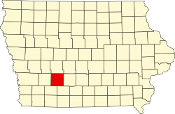
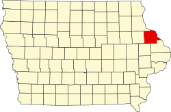
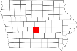
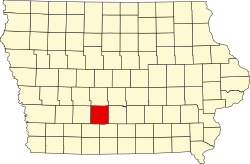
| Adair | 001 | Greenfield | 1851 | Cass County | John Adair (1757–1840) sechster Gouverneur von Kentucky | 7.682 | 1.474 km² | |
| Adams | 003 | Corning | 1851 | Taylor County | John Adams zweiter Präsident der Vereinigten Staaten (1797–1801) | 4.029 | 1.098 km² | |
| Allamakee | 005 | Waukon | 1847 | Clayton County | Allen Magee, ein Händler, der mit den Indigenen Handel trieb | 14.330 | 1.658 km² | |
| Appanoose | 007 | Centerville | 1843 | Davis County | Appanoose, Häuptling, der die Friedenspartei im Black-Hawk-Krieg anführte | 12.887 | 1.285 km² | |
| Audubon | 009 | Audubon | 1851 | Black Hawk County und Cass County | John James Audubon (1785–1851), Ornithologe und Künstler | 6.119 | 1.147 km² | |
| Benton | 011 | Vinton | 1837 | Indianerland und Wisconsin-Territorium | Thomas Hart Benton, US-Senator (1821–1851) | 26.076 | 1.854 km² | |
| Black Hawk | 013 | Waterloo | 1843 | Delaware County | Black Hawk (1767–1838), Häuptling der Sauk und Meskwaki im Black-Hawk-Krieg | 131.090 | 1.469 km² | |
| Boone | 015 | Boone | 1847 | Polk County | Nathan Boone (1781–1863), einer der ersten Erkunder Iowas | 26.306 | 1.481 km² | |
| Bremer | 017 | Waverly | 1853 | Indianerland und Winnebago County | Fredrika Bremer (1801–1865), schwedische Autorin und Frauenrechtlerin | 24.276 | 1.109 km² | |
| Buchanan | 019 | Independence | 1837 | Delaware County und Wisconsin-Territorium | James Buchanan, 15. Präsident der USA (1857–1861) | 20.958 | 1.479 km² | |
| Buena Vista | 021 | Storm Lake | 1851 | Clay County und Sac County | Schlacht von Buena Vista, eine Schlacht während des Mexikanisch-Amerikanischen Krieges | 20.260 | 1.489 km² | |
| Butler | 023 | Allison | 1851 | Black Hawk County und Buchanan County | William Orlando Butler (1791–1880), erfolgloser Kandidat der Demokraten für das Amt des Vizepräsidenten der USA | 14.867 | 1.502 km² | |
| Calhoun | 025 | Rockwell City | 1851 | Fox County (umbenannt) | John C. Calhoun, Vizepräsident der USA (1825–1832) | 9.670 | 1.476 km² | |
| Carroll | 027 | Carroll | 1851 | Guthrie County | Charles Carroll (1737–1832), am längsten lebender Unterzeichner der Unabhängigkeitserklärung der USA | 20.816 | 1.474 km² | |
| Cass | 029 | Atlantic | 1851 | Pottawattamie County | Lewis Cass, US-Senator von Michigan und erfolgloser Präsidentschaftskandidat (1848) | 13.956 | 1.461 km² | |
| Cedar | 031 | Tipton | 1837 | Wisconsin-Territorium | Red Cedar River, der Fluss, der das County durchfließt | 18.499 | 1.502 km² | |
| Cerro Gordo | 033 | Mason City | 1851 | Floyd County | Schlacht von Cerro Gordo im Mexikanisch-Amerikanischen Krieg | 44.151 | 1.471 km² | |
| Cherokee | 035 | Cherokee | 1851 | Crawford County | Indianerstamm der Cherokee | 12.072 | 1.494 km² | |
| Chickasaw | 037 | New Hampton | 1851 | Fayette County | Indianerstamm der Chickasaw | 12.439 | 1.308 km² | |
| Clarke | 039 | Osceola | 1846 | Lucas County | James Clarke, dritter Gouverneur des Iowa-Territoriums (1845–1846) | 9.286 | 1.116 km² | |
| Clay | 041 | Spencer | 1851 | Indianerland | Henry Clay, Jr. (1807–1847), Offizier im Mexikanisch-Amerikanischen Krieg | 16.667 | 1.474 km² | |
| Clayton | 043 | Elkader | 1837 | Dubuque County und Wisconsin-Territorium | John M. Clayton (1796–1856), Senator von Delaware | 18.129 | 2.018 km² | |
| Clinton | 045 | Clinton | 1837 | Dubuque County und Wisconsin-Territorium | DeWitt Clinton (1769–1828), Gouverneur von New York | 49.116 | 1.800 km² | |
| Crawford | 047 | Denison | 1851 | Shelby County | William Harris Crawford (1772–1834), Senator von Georgia, gehörte der US-Regierung als Finanzminister und als Kriegsminister an | 17.096 | 1.849 km² | |
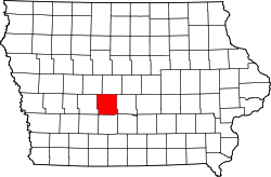
| Dallas | 049 | Adel | 1846 | Polk County | George M. Dallas (1792–1864), elfter Vizepräsident der USA | 66.135 | 1.518 km² | |
| Davis | 051 | Bloomfield | 1843 | Van Buren County | Garrett Davis (1801–1872), Kongressabgeordneter | 8.753 | 1.303 km² | |
| Decatur | 053 | Leon | 1846 | Appanoose County | Stephen Decatur (1779–1820), Marineoffizier im Britisch-Amerikanischen Krieg von 1812 | 8.457 | 1.378 km² | |
| Delaware | 055 | Manchester | 1837 | Dubuque County und Wisconsin-Territorium | Bundesstaat Delaware oder das Delaware County im Staat New York | 17.764 | 1.497 km² | |
| Des Moines | 057 | Burlington | 1834 | Michigan-Territorium und Wisconsin-Territorium | Des Moines River, Der Fluss, der einst das County durchfloss | 40.325 | 1.077 km² | |
| Dickinson | 059 | Spirit Lake | 1851 | Kossuth County | Daniel S. Dickinson (1800–1866), Senator von New York | 16.667 | 987 km² | |
| Dubuque | 061 | Dubuque | 1834 | Michigan-Territorium und Wisconsin-Territorium | Julien Dubuque (1762–1810), erster ständiger weißer Siedler in Iowa | 93.653 | 1.575 km² | |
| Emmet | 063 | Estherville | 1851 | Dickinson County und Kossuth County | Robert Emmet (1778–1803), irischer Rebellenführer | 10.302 | 1.026 km² | |
| Fayette | 065 | West Union | 1837 | Clayton County und Wisconsin-Territorium | Marquis de Lafayette (1757–1834), französischer General, der den Amerikanischen Unabhängigkeitskrieg unterstützte | 20.880 | 1.893 km² | |
| Floyd | 067 | Charles City | 1851 | Chickasaw County | Charles Floyd (1782–1804), Teilnehmer der Lewis-und-Clark-Expedition, der in Iowa starb | 16.303 | 1.298 km² | |
| Franklin | 069 | Hampton | 1851 | Chickasaw County | Benjamin Franklin (1706–1790), einer der Gründerväter der USA | 10.680 | 1.507 km² | |
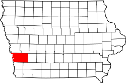
| Fremont | 071 | Sidney | 1847 | Pottawattamie County | John Charles Frémont (1813–1890), Entdecker und Politiker | 7.441 | 1.323 km² | |
| Greene | 073 | Jefferson | 1851 | Dallas County | Nathanael Greene (1742–1786), General im Amerikanischen Unabhängigkeitskrieg | 9.336 | 1.471 km² | |
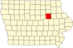
| Grundy | 075 | Grundy Center | 1851 | Black Hawk County | Felix Grundy (1777–1840), US-Senator von Tennessee und Justizminister der USA | 12.453 | 1.303 km² | |
| Guthrie | 077 | Guthrie Center | 1851 | Jackson County | Edwin B. Guthrie, Offizier im Mexikanisch-Amerikanischen Krieg | 10.954 | 1.531 km² | |
| Hamilton | 079 | Webster City | 1856 | Webster County | William W. Hamilton, Präsident des Senates von Iowa (1856–1857) | 15.673 | 1.494 km² | |
| Hancock | 081 | Garner | 1851 | Wright County | John Hancock (1737–1793), Präsident des Kontinentalkongresses (1775–1777) | 11.341 | 1.479 km² | |
| Hardin | 083 | Eldora | 1851 | Black Hawk County | John J. Hardin (1810–1847), Abgeordneter des Repräsentantenhauses und General der Miliz von Illinois | 17.534 | 1.474 km² | |
| Harrison | 085 | Logan | 1851 | Pottawattamie County | William H. Harrison (1773–1841), neunter Präsident der USA | 14.928 | 1.805 km² | |
| Henry | 087 | Mount Pleasant | 1836 | Wisconsin-Territorium | Henry Dodge (1782–1867), Gouverneur des Wisconsin-Territoriums oder James Dougherty Henry, General im Black-Hawk-Krieg[4] | 20.145 | 1.124 km² | |
| Howard | 089 | Cresco | 1851 | Chickasaw County | Tilghman Ashurst Howard (1797–1844), Abgeordneter des Repräsentantenhauses der USA | 9.566 | 1.225 km² | |
| Humboldt | 091 | Dakota City | 1857 | Webster County | Alexander von Humboldt (1769–1859), deutscher Wissenschaftler | 9.815 | 1.124 km² | |
| Ida | 093 | Ida Grove | 1851 | Cherokee County | Idagebirge in Griechenland oder der Frauenname Ida | 7.089 | 1.119 km² | |
| Iowa | 095 | Marengo | 1843 | Washington County | Iowa River, der Fluss der das County durchfließt oder der Indianerstamm der Iowa | 16.355 | 1.518 km² | |
| Jackson | 097 | Maquoketa | 1837 | Wisconsin-Territorium | Andrew Jackson (1767–1845), siebter Präsident der USA | 19.848 | 1.647 km² | |
| Jasper | 099 | Newton | 1846 | Mahaska County | William Jasper (1750–1779), Sergeant und Kriegsheld im Amerikanischen Unabhängigkeitskrieg | 36.842 | 1.891 km² | |
| Jefferson | 101 | Fairfield | 1839 | Indianerland | Thomas Jefferson (1743–1826), dritter Präsident der USA | 16.843 | 1.127 km² | |
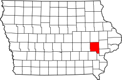
| Johnson | 103 | Iowa City | 1837 | Des Moines County und Wisconsin-Territorium | Richard M. Johnson (1780–1850), Vizepräsident der USA (1837–1841) | 130.882 | 1.590 km² | |
| Jones | 105 | Anamosa | 1837 | Wisconsin-Territorium | George W. Jones (1804–1896), Senator von Iowa | 20.638 | 1.489 km² | |
| Keokuk | 107 | Sigourney | 1837 | Washington County | Keokuk (1767–1848), Häuptling des Indianerstammes der Sauk | 10.511 | 1.500 km² | |
| Kossuth | 109 | Algona | 1851 | Webster County | Lajos Kossuth (1802–1894), ungarischer Freiheitskämpfer | 15.543 | 2.520 km² | |
| Lee | 111 | Fort Madison und Keokuk | 1851 | Des Moines County | entweder William Elliott Lee (Geschäftsmann) oder Robert E. Lee (1807–1870), General der Armee der Südstaaten | 35.862 | 1.339 km² | |
| Linn | 113 | Cedar Rapids | 1837 | Wisconsin-Territorium | Lewis F. Linn (1795–1843), Arzt und Senator von Missouri | 211.226 | 1.860 km² | |
| Louisa | 115 | Wapello | 1836 | Des Moines County | Louisa in Virginia | 11.387 | 1.041 km² | |
| Lucas | 117 | Chariton | 1846 | Monroe County | Robert Lucas (1781–1853), erster Gouverneur des Iowa-Territorium | 8.898 | 1.116 km² | |
| Lyon | 119 | Rock Rapids | 1851 | Woodbury County | Nathaniel Lyon (1818–1861), erster gefallener General der Unionsarmee im Sezessionskrieg | 11.581 | 1.523 km² | |
| Madison | 121 | Winterset | 1846 | Polk County | James Madison (1751–1836), vierter Präsident der USA | 15.679 | 1.453 km² | |
| Mahaska | 123 | Oskaloosa | 1843 | Land der Sauk und Meskwaki | Mahaska (1784–1834), Häuptling der Iowa | 22.381 | 1.479 km² | |
| Marion | 125 | Knoxville | 1845 | Washington County | Francis Marion (1732–1795), General im Amerikanischen Unabhängigkeitskrieg | 33.309 | 1.435 km² | |
| Marshall | 127 | Marshalltown | 1846 | Jasper County | John Marshall (1755–1835), vierter Oberster Richter der USA | 40.648 | 1.481 km² | |
| Mills | 129 | Glenwood | 1851 | Pottawattamie County | Frederick Mills, Offizier, fiel im Mexikanisch-Amerikanischen Krieg | 15.059 | 1.132 km² | |
| Mitchell | 131 | Osage | 1851 | Chickasaw County | John Mitchel (1815–1875), irischer Rebellenführer | 10.776 | 1.215 km² | |
| Monona | 133 | Onawa | 1851 | Harrison County | Monona im Clayton County, benannt nach dem indianischen Wort Monona (schönes Tal) | 9.243 | 1.795 km² | |
| Monroe | 135 | Albia | 1843 | Wapello County | James Monroe (1758–1831), fünfter Präsident der USA | 7.970 | 1.121 km² | |
| Montgomery | 137 | Red Oak | 1851 | Polk County | Richard Montgomery (1738–1775), General im Amerikanischen Unabhängigkeitskrieg | 10.740 | 1.098 km² | |
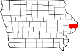
| Muscatine | 139 | Muscatine | 1836 | Des Moines County | Indianerstamm der Mascouten | 42.745 | 1.137 km² | |
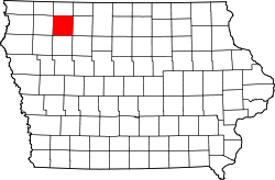
| O’Brien | 141 | Primghar | 1851 | Cherokee County | William Smith O’Brien (1803–1864), irischer Rebellenführer | 14.398 | 1.484 km² | |
| Osceola | 143 | Sibley | 1871 | Woodbury County | Osceola (1804–1838), Häuptling des Indianerstammes der Seminolen | 6.462 | 1.033 km² | |
| Page | 145 | Clarinda | 1847 | Pottawattamie County | John Page, Offizier, der im Mexikanisch-Amerikanischen Krieg fiel | 15.932 | 1.386 km² | |
| Palo Alto | 147 | Emmetsburg | 1851 | Kossuth County | Schlacht von Palo Alto während des Mexikanisch-Amerikanischen Krieges | 9.421 | 1.461 km² | |
| Plymouth | 149 | Le Mars | 1851 | Woodbury County | Der heutige Ort Plymouth in Massachusetts ist der Landeplatz der Pilgerväter, die mit der Mayflower nach Amerika kamen | 24.986 | 2.238 km² | |
| Pocahontas | 151 | Pocahontas | 1851 | Greene County und Humboldt County | Pocahontas (1595–1618), berühmte „Indianerprinzessin“ aus Virginia | 7.310 | 1.497 km² | |
| Polk | 153 | Des Moines | 1846 | Indianerland | James K. Polk (1795–1849), elfter Präsident der USA | 430.640 | 1.476 km² | |
| Pottawattamie | 155 | Council Bluffs | 1847 | Indianerland | Indianerstamm der Potawatomi | 93.158 | 2.471 km² | |
| Poweshiek | 157 | Montezuma | 1843 | Land des Volks der Meskwaki | Poweshiek, Häuptling der Meskwaki | 18.914 | 1.515 km² | |
| Ringgold | 159 | Mount Ayr | 1847 | Taylor County | Samuel Ringgold (1796–1846), Offizier, gefallen im Mexikanisch-Amerikanischen Krieg | 5.131 | 1.393 km² | |
| Sac | 161 | Sac City | 1851 | Greene County | Volk der Sauk (auch Sac) | 10.350 | 1.492 km² | |
| Scott | 163 | Davenport | 1837 | Wisconsin-Territorium | Winfield Scott (1786–1866), US-General im Britisch-Amerikanischen Krieg von 1812 und im Mexikanisch-Amerikanischen Krieg | 165.224 | 1.186 km² | |
| Shelby | 165 | Harlan | 1851 | Cass County | Isaac Shelby (1750–1826), General im Amerikanischen Unabhängigkeitskrieg und im Britisch-Amerikanischen Krieg von 1812 | 12.167 | 1.531 km² | |
| Sioux | 167 | Orange City | 1851 | Plymouth County | Volk der Sioux | 33.704 | 1.989 km² | |
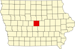
| Story | 169 | Nevada | 1846 | Boone County, Jasper County und Polk County | Joseph Story (1779–1845), Richter am Obersten Gerichtshof der Vereinigten Staaten | 89.542 | 1.484 km² | |
| Tama | 171 | Toledo | 1843 | Benton County und Boone County | entweder Taimah (Häuptlich der Fox-Indianer), Taomah (Frau des Häuptlings Poweshiek) oder der Indianerhäuptling Potama | 17.767 | 1.867 km² | |
| Taylor | 173 | Bedford | 1847 | Page County | Zachary Taylor (1784–1850), 12. Präsident der USA | 6.317 | 1.383 km² | |
| Union | 175 | Creston | 1851 | Clarke County | „Die Union“, Bezeichnung der Nordstaaten während des Sezessionskrieges | 12.534 | 1.098 km² | |
| Van Buren | 177 | Keosauqua | 1836 | Des Moines County | Martin Van Buren (1782–1862), achter Präsident der USA | 7.570 | 1.256 km² | |
| Wapello | 179 | Ottumwa | 1843 | Indianerland | Wapello, Häuptling der Meskwaki | 35.625 | 1.119 km² | |
| Warren | 181 | Indianola | 1846 | Polk County | Joseph Warren (1741–1775), General im Amerikanischen Unabhängigkeitskrieg | 46.225 | 1.481 km² | |
| Washington | 183 | Washington | 1839 | Wisconsin-Territorium | George Washington (1732–1799), erster Präsident der Vereinigten Staaten | 21.704 | 1.474 km² | |
| Wayne | 185 | Corydon | 1846 | Appanoose County | Anthony Wayne (1745–1796), General im Amerikanischen Unabhängigkeitskrieg | 6.403 | 1.362 km² | |
| Webster | 187 | Fort Dodge | 1853 | Risley County und Yell County, (aufgelöst)[5] | Daniel Webster (1782–1852), Senator von Massachusetts und Außenminister | 38.013 | 1.852 km² | |
| Winnebago | 189 | Forest City | 1851 | Kossuth County | dem Volk der Winnebago | 10.866 | 1.036 km² | |
| Winneshiek | 191 | Decorah | 1847 | Indianerland | Winneshiek, Häuptling der Winnebago | 21.056 | 1.787 km² | |
| Woodbury | 193 | Sioux City | 1853 | Polk County | Levi Woodbury (1789–1851), Gouverneur von New Hampshire | 102.172 | 2.261 km² | |
| Worth | 195 | Northwood | 1851 | Mitchell County | William Jenkins Worth (1794–1849), Offizier im Black-Hawk-Krieg und im Mexikanisch-Amerikanischen Krieg | 7.598 | 1.036 km² | |
| Wright | 197 | Clarion | 1851 | Webster County und Kossuth County | Silas Wright (1795–1847), Gouverneur von New York und Joseph A. Wright (1810–1867), Gouverneur von Indiana | 13.229 | 1.505 km² |
Weblinks
- Geschichte der Countys in Iowa (auf Englisch)
Einzelnachweise
- ↑ U.S. Census Bureau - State & County QuickFacts ( vom 27. Mai 2010 im Internet Archive)
- ↑ United States Census 2010
- ↑ U.S. Census Bureau - State & County QuickFacts ( vom 27. Mai 2010 im Internet Archive) Angaben in Quadratmeilen - Umrechnung in Quadratkilometer
- ↑ Henry County, Iowa
- ↑ History of Fort Dodge and Webster County, Iowa, erschienen 1913, Autor: H. M. Pratt
Auf dieser Seite verwendete Medien
This is a locator map showing Mitchell County in Iowa. For more information, see Commons:United States county locator maps.
This is a locator map showing Audubon County in Iowa. For more information, see Commons:United States county locator maps.
This is a locator map showing Poweshiek County in Iowa. For more information, see Commons:United States county locator maps.
This is a locator map showing Hancock County in Iowa. For more information, see Commons:United States county locator maps.
This is a locator map showing Chickasaw County in Iowa. For more information, see Commons:United States county locator maps.
This is a locator map showing Shelby County in Iowa. For more information, see Commons:United States county locator maps.
This is a locator map showing Woodbury County in Iowa. For more information, see Commons:United States county locator maps.
This is a locator map showing Appanoose County in Iowa. For more information, see Commons:United States county locator maps.
This is a locator map showing Pocahontas County in Iowa. For more information, see Commons:United States county locator maps.
This is a locator map showing Decatur County in Iowa. For more information, see Commons:United States county locator maps.
This is a locator map showing Davis County in Iowa. For more information, see Commons:United States county locator maps.
This is a locator map showing Emmet County in Iowa. For more information, see Commons:United States county locator maps.
This is a locator map showing Linn County in Iowa. For more information, see Commons:United States county locator maps.
This is a locator map showing Montgomery County in Iowa. For more information, see Commons:United States county locator maps.
This is a locator map showing Webster County in Iowa. For more information, see Commons:United States county locator maps.
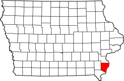
This is a locator map showing Louisa County in Iowa. For more information, see Commons:United States county locator maps.
This is a locator map showing Dallas County in Iowa. For more information, see Commons:United States county locator maps.
This is a locator map showing O'Brien County in Iowa. For more information, see Commons:United States county locator maps.
This is a locator map showing Adams County in Iowa. For more information, see Commons:United States county locator maps.
This is a locator map showing Pottawattamie County in Iowa. For more information, see Commons:United States county locator maps.
This is a locator map showing Benton County in Iowa. For more information, see Commons:United States county locator maps.
This is a locator map showing Black Hawk County in Iowa. For more information, see Commons:United States county locator maps.
This is a locator map showing Lee County in Iowa. For more information, see Commons:United States county locator maps.
This is a locator map showing Osceola County in Iowa. For more information, see Commons:United States county locator maps.
This is a locator map showing Lucas County in Iowa. For more information, see Commons:United States county locator maps.
This is a locator map showing Mahaska County in Iowa. For more information, see Commons:United States county locator maps.
This is a locator map showing Marshall County in Iowa. For more information, see Commons:United States county locator maps.
This is a locator map showing Johnson County in Iowa. For more information, see Commons:United States county locator maps.
This is a locator map showing Buena Vista County in Iowa. For more information, see Commons:United States county locator maps.
This is a locator map showing Allamakee County in Iowa. For more information, see Commons:United States county locator maps.
This is a locator map showing Washington County in Iowa. For more information, see Commons:United States county locator maps.
This is a locator map showing Clayton County in Iowa. For more information, see Commons:United States county locator maps.
This is a locator map showing Taylor County in Iowa. For more information, see Commons:United States county locator maps.
This is a locator map showing Winneshiek County in Iowa. For more information, see Commons:United States county locator maps.
This is a locator map showing Plymouth County in Iowa. For more information, see Commons:United States county locator maps.
This is a locator map showing Clarke County in Iowa. For more information, see Commons:United States county locator maps.
This is a locator map showing Lyon County in Iowa. For more information, see Commons:United States county locator maps.
This is a locator map showing Page County in Iowa. For more information, see Commons:United States county locator maps.
This is a locator map showing Adair County in Iowa. For more information, see Commons:United States county locator maps.
This is a locator map showing Mills County in Iowa. For more information, see Commons:United States county locator maps.
This is a locator map showing Harrison County in Iowa. For more information, see Commons:United States county locator maps.
This is a locator map showing Wright County in Iowa. For more information, see Commons:United States county locator maps.
This is a locator map showing Henry County in Iowa. For more information, see Commons:United States county locator maps.
This is a locator map showing Dickinson County in Iowa. For more information, see Commons:United States county locator maps.
This is a locator map showing Monona County in Iowa. For more information, see Commons:United States county locator maps.
This is a locator map showing Winnebago County in Iowa. For more information, see Commons:United States county locator maps.
This is a locator map showing Van Buren County in Iowa. For more information, see Commons:United States county locator maps.
This is a locator map showing Kossuth County in Iowa. For more information, see Commons:United States county locator maps.
This is a locator map showing Fayette County in Iowa. For more information, see Commons:United States county locator maps.
This is a locator map showing Ida County in Iowa. For more information, see Commons:United States county locator maps.
This is a locator map showing Jones County in Iowa. For more information, see Commons:United States county locator maps.
This is a locator map showing Scott County in Iowa. For more information, see Commons:United States county locator maps.
This is a locator map showing Dubuque County in Iowa. For more information, see Commons:United States county locator maps.
This is a locator map showing Polk County in Iowa. For more information, see Commons:United States county locator maps.
This is a locator map showing Jasper County in Iowa. For more information, see Commons:United States county locator maps.
This is a locator map showing Madison County in Iowa. For more information, see Commons:United States county locator maps.
This is a locator map showing Iowa County in Iowa. For more information, see Commons:United States county locator maps.
This is a locator map showing Carroll County in Iowa. For more information, see Commons:United States county locator maps.
This is a locator map showing Union County in Iowa. For more information, see Commons:United States county locator maps.
This is a locator map showing Crawford County in Iowa. For more information, see Commons:United States county locator maps.
This is a locator map showing Marion County in Iowa. For more information, see Commons:United States county locator maps.
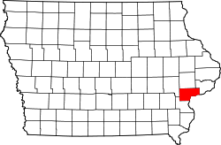
Locator Map of Iowa, United States
This is a locator map showing Fremont County in Iowa. For more information, see Commons:United States county locator maps.
This is a locator map showing Cherokee County in Iowa. For more information, see Commons:United States county locator maps.
This is a locator map showing Des Moines County in Iowa. For more information, see Commons:United States county locator maps.
This is a locator map showing Boone County in Iowa. For more information, see Commons:United States county locator maps.
This is a locator map showing Buchanan County in Iowa. For more information, see Commons:United States county locator maps.
This is a locator map showing Clay County in Iowa. For more information, see Commons:United States county locator maps.
This is a locator map showing Worth County in Iowa. For more information, see Commons:United States county locator maps.
This is a locator map showing Warren County in Iowa. For more information, see Commons:United States county locator maps.
This is a locator map showing Ringgold County in Iowa. For more information, see Commons:United States county locator maps.
This is a locator map showing Hardin County in Iowa. For more information, see Commons:United States county locator maps.
This is a locator map showing Jefferson County in Iowa. For more information, see Commons:United States county locator maps.
This is a locator map showing Jackson County in Iowa. For more information, see Commons:United States county locator maps.
This is a locator map showing Guthrie County in Iowa. For more information, see Commons:United States county locator maps.
This is a locator map showing Cerro Gordo County in Iowa. For more information, see Commons:United States county locator maps.
This is a locator map showing Cass County in Iowa. For more information, see Commons:United States county locator maps.
This is a locator map showing Humboldt County in Iowa. For more information, see Commons:United States county locator maps.
This is a locator map showing Calhoun County in Iowa. For more information, see Commons:United States county locator maps.
This is a locator map showing Monroe County in Iowa. For more information, see Commons:United States county locator maps.
This is a locator map showing Wapello County in Iowa. For more information, see Commons:United States county locator maps.
This is a locator map showing Hamilton County in Iowa. For more information, see Commons:United States county locator maps.
This is a locator map showing Keokuk County in Iowa. For more information, see Commons:United States county locator maps.
This is a locator map showing Greene County in Iowa. For more information, see Commons:United States county locator maps.
This is a locator map showing Bremer County in Iowa. For more information, see Commons:United States county locator maps.
This is a locator map showing Clinton County in Iowa. For more information, see Commons:United States county locator maps.
This is a locator map showing Story County in Iowa. For more information, see Commons:United States county locator maps.
This is a locator map showing Tama County in Iowa. For more information, see Commons:United States county locator maps.
This is a locator map showing Wayne County in Iowa. For more information, see Commons:United States county locator maps.
This is a locator map showing Floyd County in Iowa. For more information, see Commons:United States county locator maps.
This is a locator map showing Sioux County in Iowa. For more information, see Commons:United States county locator maps.
This is a locator map showing Palo Alto County in Iowa. For more information, see Commons:United States county locator maps.
This is a locator map showing Butler County in Iowa. For more information, see Commons:United States county locator maps.
This is a locator map showing Howard County in Iowa. For more information, see Commons:United States county locator maps.
This is a locator map showing Franklin County in Iowa. For more information, see Commons:United States county locator maps.
This is a locator map showing Delaware County in Iowa. For more information, see Commons:United States county locator maps.
This is a locator map showing Cedar County in Iowa. For more information, see Commons:United States county locator maps.
This is a locator map showing Sac County in Iowa. For more information, see Commons:United States county locator maps.
This is a locator map showing Muscatine County in Iowa. For more information, see Commons:United States county locator maps.
This is a locator map showing Grundy County in Iowa. For more information, see Commons:United States county locator maps.


