Liste der Countys in Hawaii
Der US-Bundesstaat Hawaii ist in fünf Countys unterteilt (Einwohnerzahlen Stand: 2020).[1] Alle wurden im Jahr 1905 gegründet.
| County | FIPS Code | County Seat | Namensherkunft | Bevölkerung | Fläche | Lage |
|---|---|---|---|---|---|---|
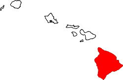
| Hawaii County | 001 | Hilo | Hawaii Big Island | 200.629 | 13.175 km² | |
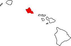
| Honolulu County | 003 | Honolulu | Honolulu, die Hauptstadt des Bundesstaates | 1.016.508 | 5.509 km² | |
| Kalawao County | 005 | keiner | Vom Dorf Kalawao | 82 | 36 km² | |
| Kauai County | 007 | Lihue | Kaua'i, die größte Insel des Countys | 73.298 | 3.279 km² | |
| Maui County | 009 | Wailuku | Maui, die größte Insel des Countys | 164.754 | 6.213 km² |
Weblinks
Einzelnachweise
- ↑ 2020 Population and Housing State Data - Hawaii U.S. Census Bureau, 12. August 2021, abgerufen am 15. August 2021
Auf dieser Seite verwendete Medien
This is a locator map showing Kauai County in Hawaii. For more information, see Commons:United States county locator maps.
This is a locator map showing Kalawao County in Hawaii. For more information, see Commons:United States county locator maps.
Locator Map of Hawaii, United States
Locator map showing the Big island of Hawaiʻi—Hawaii County — in the state of Hawaii.
This is a locator map showing Maui County in Hawaii. For more information, see Commons:United States county locator maps.


