Laurel (Batangas)
| Municipality of Laurel | ||
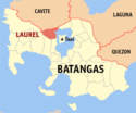
| Lage von Laurel in der Provinz Batangas | ||
|---|---|---|
 | ||
| Basisdaten | ||
| Region: | CALABARZON | |
| Provinz: | Batangas | |
| Barangays: | 21 | |
| Distrikt: | 3. Distrikt von Batangas | |
| PSGC: | 041011000 | |
| Einkommensklasse: | 4. Einkommensklasse | |
| Haushalte: | 5153 Zensus 1. Mai 2000 | |
| Einwohnerzahl: | 39.444 Zensus 1. August 2015 | |
| Koordinaten: | 14° 3′ N, 120° 54′ O | |
| Postleitzahl: | 4221 | |
| Geographische Lage auf den Philippinen | ||
| ||
Laurel ist eine philippinische Stadtgemeinde in der Provinz Batangas. Sie hat 39.444 Einwohner (Zensus 1. August 2015).
Herkunft des Namens
Die Stadtgemeinde ist nach José P. Laurel benannt.
Baranggays
Laurel ist politisch unterteilt in 21 Baranggays.
|
|
Auf dieser Seite verwendete Medien
(c) Karte: NordNordWest, Lizenz: Creative Commons by-sa-3.0 de
Positionskarte der Philippinen
Autor/Urheber: Mike Gonzalez (TheCoffee), Lizenz: CC-BY-SA-3.0
Map of Batangas showing the location of Laurel


