Lake Placid Olympic Sports Complex Cross Country Biathlon Center
| Lake Placid Olympic Sports Complex Cross Country Biathlon Center | ||
|---|---|---|
| Daten | ||
| Ort | ||
| Eröffnung | 1978 | |
| Veranstaltungen | ||
Koordinaten: 44° 13′ 27,9″ N, 73° 54′ 48,7″ W
Das Lake Placid Olympic Sports Complex Cross Country Biathlon Center ist ein Biathlonstadion am Mount Van der Hoeven in Lake Placid im US-Bundesstaat New York.
Geschichte
Das Lake Placid Olympic Sports Complex Cross Country Biathlon Center wurde 1978 anlässlich der Olympischen Winterspiele 1980 eröffnet. Während den Spielen war das Stadion Austragungsort der Langlauf- und Biathlonwettkämpfe. Auch der Langlauf in der Nordischen Kombination wurde hier ausgetragen.
Heute verfügt die Sportstätte über Loipen mit einer Gesamtlänge von über 50 Kilometern. Außerdem ist die Anlage Austragungsort des järhlichen SkimarathonLake Placid Loppet.
Während der Winter World University Games 2023 war das Stadion erneut Wettkampfstätte der Biathlon und Skilanglauf-Wettkämpfe.
Weblinks
- Olympia-Report (Memento vom 10. April 2008 im Internet Archive) (englisch)
Auf dieser Seite verwendete Medien
Autor/Urheber: TUBS
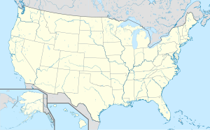
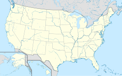
Location map of the USA (Hawaii and Alaska shown in sidemaps).
Main map: EquiDistantConicProjection : Central parallel :
* N: 37.0° N
Central meridian :
* E: 96.0° W
Standard parallels:
* 1: 32.0° N
* 2: 42.0° N
Made with Natural Earth. Free vector and raster map data @ naturalearthdata.com.
Formulas for x and y:
x = 50.0 + 124.03149777329222 * ((1.9694462586094064-({{{2}}}* pi / 180))
      * sin(0.6010514667026994 * ({{{3}}} + 96) * pi / 180))
y = 50.0 + 1.6155950752393982 * 124.03149777329222 * 0.02613325650382181
      - 1.6155950752393982  * 124.03149777329222 *
     (1.3236744353715044  - (1.9694462586094064-({{{2}}}* pi / 180))
      * cos(0.6010514667026994 * ({{{3}}} + 96) * pi / 180))
Hawaii side map: Equirectangular projection, N/S stretching 107 %. Geographic limits of the map:
- N: 22.4° N
- S: 18.7° N
- W: 160.7° W
- E: 154.6° W
Alaska side map: Equirectangular projection, N/S stretching 210.0 %. Geographic limits of the map:
- N: 72.0° N
- S: 51.0° N
- W: 172.0° E
- E: 129.0° W
Olympic Rings without "rims" (gaps between the rings), As used, eg. in the logos of the 2008 and 2016 Olympics. The colour scheme applied here was specified in 2023 guidelines.
Pictograms of Olympic sports - Speed Skating
Pictograms of Olympic sports - Ski jumping
Pictograms of Olympic sports - Nordic combined
Pictograms of Olympic sports - Ice hockey
Pictograms of Olympic sports - Figure skating
Pictograms of Olympic sports - Bobsleigh
Pictograms of Olympic sports - Luge
Pictograms of Olympic sports - Biathlon
Pictograms of Olympic sports - Cross country skiing
Pictograms of Olympic sports - Alpine skiing
Autor/Urheber:
Unbekannt
, Lizenz: LogoLogo der Olympischen Winterspiele 1980 Lake Placid


