Lady Newnes Bay
| Lady Newnes Bay | ||
|---|---|---|
| Gewässer | Rossmeer | |
| Landmasse | Viktorialand | |
| Geographische Lage | 73° 40′ S, 167° 30′ O | |
| ||
| Breite | ca. 100 km | |
| Inseln | Apostrophe Island, Emerging Island | |
| Zuflüsse | Aviator-Gletscher, Falkner-Gletscher, Fitzgerald-Gletscher, Icebreaker-Gletscher, Parker-Gletscher, Ridgeway-Gletscher, Suter-Gletscher, Wylde-Gletscher | |
Die Lady Newnes Bay ist eine 100 km breite Bucht an der Borchgrevink-Küste des ostantarktischen Viktorialands. Sie reicht von der Coulman-Insel im Nordosten bis zum Kap Sibbald im Südwesten.
Teilnehmer der Southern Cross-Expedition (1898–1900) des norwegischen Polarforschers Carsten Egeberg Borchgrevink entdeckten sie. Borchgrevink benannte sie nach Priscilla Jenney Hillyard (1848–1925), der Ehefrau des britischen Zeitungsverlegers George Newnes (1851–1910), des Hauptgeldgebers der Forschungsreise.[1]
Weblinks
- Lady Newnes Bay auf geographic.org (englisch)
- Lady Newnes Bay. In: Geographic Names Information System. United States Geological Survey, United States Department of the Interior, archiviert vom (englisch).
Einzelnachweise
- ↑ John Stewart: Antarctica – An Encyclopedia. Bd. 2, McFarland & Co., Jefferson und London 2011, ISBN 978-0-7864-3590-6, S. 891 (englisch).
 Westteil: Kartenblatt Mount Murchison
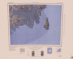 Ostteil: Kartenblatt Coulman Island
Auf dieser Seite verwendete Medien

C73193s5 Ant.Map Mount Murchison.jpg
1:250,000-scale topographic reconnaissance map of the Southern Cross Mountains area from 162°-166°30'E to 73°-74°S in Antarctica, including the Mountaineer Range with Mount Murchison, and Aviator and Campbell Glaciers. Mapped, edited and published by the U.S. Geological Survey in cooperation with the National Science Foundation.
1:250,000-scale topographic reconnaissance map of the Southern Cross Mountains area from 162°-166°30'E to 73°-74°S in Antarctica, including the Mountaineer Range with Mount Murchison, and Aviator and Campbell Glaciers. Mapped, edited and published by the U.S. Geological Survey in cooperation with the National Science Foundation.

Antarctica relief location map.jpg
Autor/Urheber: Alexrk2, Lizenz: CC BY-SA 3.0
Physische Positionskarte Antarktis, Mittabstandstreue Azimutalprojektion
Autor/Urheber: Alexrk2, Lizenz: CC BY-SA 3.0
Physische Positionskarte Antarktis, Mittabstandstreue Azimutalprojektion

C73189s1 Ant.Map Coulman Island.jpg
1:250,000-scale topographic reconnaissance map of the Coulman Island area from 166°30'-171°E to 73°-74°S in Antarctica, including Mariner and Borchgrevink Glaciers. Mapped, edited and published by the U.S. Geological Survey in cooperation with the National Science Foundation.
1:250,000-scale topographic reconnaissance map of the Coulman Island area from 166°30'-171°E to 73°-74°S in Antarctica, including Mariner and Borchgrevink Glaciers. Mapped, edited and published by the U.S. Geological Survey in cooperation with the National Science Foundation.