Kraken Mare
Das Kraken Mare ist ein Methansee auf dem Saturntrabanten Titan.
Größe und Lage
Er dürfte mit einer Fläche von rund 400.000 Quadratkilometern größer als das Kaspische Meer sein. Er ist der größte bekannte See dieses Mondes und befindet sich bei 68° N / 310° W westlich des Ligeia Mare in der Nordpolregion. Neuere Messungen bestätigen die Seenatur durch Messung der Reflexion der Oberfläche.[1] Neuere Radarmessungen ergaben, dass der See möglicherweise eine Tiefe von bis zu 100 Metern hat. Der See soll aus ca. 70 % flüssigem Methan, 16 % Stickstoff und 14 % Ethan bestehen.[2][3]
Entdeckung
Er wurde 2007 durch die Cassini-Raumsonde entdeckt und 2008 nach dem Kraken, einem in Norwegen legendären Seemonster, benannt.
Inseln
Eine Insel im See erhielt den Namen Mayda Insula.
Geplante Erforschung
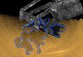
Als Teil der geplanten TandEM (Titan and Enceladus Mission) der ESA und NASA ist ein Lander vorgesehen, welcher auf dem Kraken Mare landen soll, um u. a. seine Zusammensetzung und Tiefe genau zu bestimmen.
Bildergalerie

Auf dieser nachkolorierten Radarabtastung ist das Kraken Mare im linken, unteren Quadranten zu sehen.
Das Kraken Mare auf einem Mosaik von Radaraufnahmen der Cassini-Sonde

Eine Landesonde, welche Teil der vorgeschlagenen TandEM/TSSM-Studie ist, soll im Jahre 2030 im Kraken Mare landen.
Einzelnachweise
- ↑ Elisabeth Mittelbach, Ulrich Köhler, Ralf Jaumann, Katrin Stephan: Kraken Mare: ein spiegelndes Gewässer auf dem Saturnmond Titan. In: DLR-Portal, 17. Dezember 2009. Abgerufen am 24. Dezember 2009.
- ↑ Erste Tiefenmessung in Titans größtem See. Scinexx Wissensmagazin, 21. Januar 2021, abgerufen am 25. Februar 2021
- ↑ Poggiali, V. et al. (2020): The Bathymetry of Moray Sinus at Titan's Kraken Mare. Abgerufen im Jahr 2020 (englisch).
https://www.scinexx.de/news/kosmos/erste-tiefenmessung-in-titans-groesstem-see/
Weblinks
Auf dieser Seite verwendete Medien

Radar image of a large sea on Titan. This image blends a near natural-color view with imagery collected by the radar instrument aboard Cassini, for a dramatic reveal of the north pole of Saturn's largest moon.

This Cassini false-color mosaic shows all synthetic-aperture radar images to date of Titan's north polar region. Approximately 60 percent of Titan's north polar region, above 60 degrees north latitude, is now mapped with radar. About 14 percent of the mapped region is covered by what is interpreted as liquid hydrocarbon lakes.
Features thought to be liquid are shown in blue and black, and the areas likely to be solid surface are tinted brown. The terrain in the upper left of this mosaic is imaged at lower resolution than the remainder of the image
Most of the many lakes and seas seen so far are contained in this image, including the largest known body of liquid on Titan. These seas are most likely filled with liquid ethane, methane and dissolved nitrogen.
Many bays, islands and presumed tributary networks are associated with the seas. The large feature in the upper right center of this image is at least 100,000 square kilometers (40,000 square miles) in area, greater in extent than Lake Superior (82,000 square kilometers or 32,000 square miles), one of Earth's largest lakes. This Titan feature covers a greater fraction of the surface, at least 0.12 percent, than the Black Sea, Earth's largest terrestrial inland sea, at 0.085 percent. Larger seas may exist, as it is probable that some of these bodies are connected, either in areas unmapped by radar or under the surface (see PIA08365).
Of the 400 observed lakes and seas, 70 percent of their area is taken up by large "seas" greater than 26,000 square kilometers (10,000 square miles).
The Cassini-Huygens mission is a cooperative project of NASA, the European Space Agency and the Italian Space Agency. The Jet Propulsion Laboratory, a division of the California Institute of Technology in Pasadena, manages the mission for NASA's Science Mission Directorate, Washington, D.C. The Cassini orbiter was designed, developed and assembled at JPL. The radar instrument was built by JPL and the Italian Space Agency, working with team members from the United States and several European countries.
For more information about the Cassini-Huygens mission, visit http://saturn.jpl.nasa.gov/home/index.cfm.
The original NASA image has been modified by rotating 90 degrees clockwise, cropping and reduction in size (the linear pixel density was reduced 50%).
Some of the features in this image have been annotated in Wikimedia Commons.
Die Landersonde, welche Hauptbestandteil der für 2020 vorgeschlagenen Titan Saturn System Mission/TandEM werden soll. Um das Jahr 2030 soll der Lander auf dem Kraken Mare auf dem Titan landen.