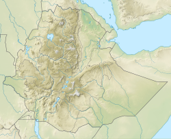
Korath
| Korath | ||
|---|---|---|
| Höhe | 912 m | |
| Lage | Äthiopien | |
| Koordinaten | 5° 6′ 0″ N, 35° 52′ 48″ O | |
| ||
| Gestein | Tephrit, Trachyt und Basalt | |
Das Korath-Vulkangebiet ist eine Gruppe von etwa 20 Tuffkegeln in Südäthiopien am Turkanariss. Sie besitzen jeweils Lavaflüsse, die bis zu 5 Kilometer weit geflossen sind. Die jüngsten Flüsse entsprangen einem zentral gelegenen Krater und ergossen sich durch einen Bruch im Rand dieses Kraters.[1] Das genaue Alter ist unbekannt, wurde aber mittels der Radiokarbonmethode auf minimal 7900 Jahre begrenzt.[2] Es wird vermutet, dass die Lava zwischen 30.000 und 7900 Jahre alt ist.[3]
Einzelnachweise
- ↑ Global Volcanism Program | Korath Range. Abgerufen am 18. August 2019.
- ↑ F.H. Brown, I.S.E. Carmichael: Quaternary volcanoes of the lake Rudolf Region: 1. The basanite-tephrite series of the Korath range. In: Lithos. Band 2, Nr. 3, Januar 1969, S. 239–260, doi:10.1016/S0024-4937(69)80018-6 (elsevier.com [abgerufen am 18. August 2019]).
- ↑ A Davidson: The Omo River Project : reconnaissance geology and geochemistry of parts of Ilubabor, Kefa, Gemu Gofa and Sidamo, Ethiopia. Hrsg.: Ethiopian Institute of Geological Surveys. 1983, S. 1–89.
Auf dieser Seite verwendete Medien
The fissure-controlled Korath Range is an isolated group of tuff cones and lava flows in southern Ethiopia that were erupted along the Turkana Rift. The Korath Range tuff cones issued many lava flows that traveled up to about 5 km, forming lobate margins, most prominently on the western flanks of the massif. The apparent youngest flow issued from the central crater and flowed through a breach in its rim.
(c) Karte: NordNordWest, Lizenz: Creative Commons by-sa-3.0 de
Positionskarte von Äthiopien


