Kitaibaraki
| Kitaibaraki-shi 北茨城市 | ||
|---|---|---|
| Geographische Lage in Japan | ||
| Region: | Kantō | |
| Präfektur: | Ibaraki | |
| Koordinaten: | 36° 48′ N, 140° 45′ O | |
| Basisdaten | ||
| Fläche: | 186,49 km² | |
| Einwohner: | 41.352 (1. März 2021) | |
| Bevölkerungsdichte: | 222 Einwohner je km² | |
| Gemeindeschlüssel: | 08215-5 | |
| Symbole | ||
| Flagge/Wappen: | ||
| Baum: | Kiefern | |
| Blume: | Rhododendron | |
| Vogel: | Sturmmöwe | |
| Rathaus | ||
| Adresse: | Kitaibaraki City Hall 1630 Isoharachō-Isohara Kitaibaraki-shi Ibaraki-ken 319-0192 | |
| Webadresse: | https://www.city-kitaibaraki.jp/ | |
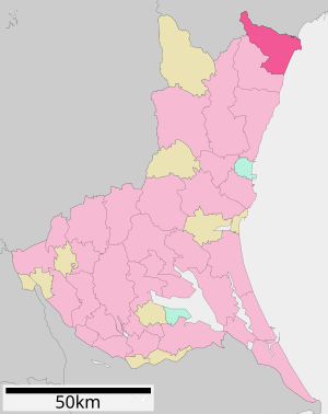
| Lage der Gemeinde Kitaibaraki in der Präfektur Ibaraki | ||
Kitaibaraki (japanisch 北茨城市, -shi, dt. „Nord-Ibaraki“) ist eine Stadt in Japan an der Pazifik-Küste der Präfektur Ibaraki.
Geographie
Kitaibaraki liegt nördlich von Hitachi und südlich von Iwaki.
Geschichte
Kitaibaraki war früher ein Ort, der Kohle am südlichen Ende des Jōban-Kohlefeld förderte. Es wurden Anstrengungen unternommen, neue Industrien aufzubauen. Es waren dort Künstler ansässig, wie der Maler Yokoyama Taikan und der Kunstförderer Okakura Kakuzō. Letzterer baute am Izura-Küstenabschnitt einen roten, sechseckigen Pavillon, „Rokkakudō“ (六角堂) genannt. Der Pavillon wurde 2011 durch das unten beschriebenen Tsunami zerstört, ist aber inzwischen wieder aufgebaut.
Die Stadt Kitaibaraki wurde am 31. März 1956 aus den ehemaligen Gemeinden Isohara, Otsu, Sekinan, Sekimoto, Hiragata und Minaminakazato aus dem Landkreis Taga gegründet.

a: Überflutungs-Höhen (Dreiecke) und Auflaufhöhen (Kreise)
b: Tsunamischaden
c: Wasserspuren auf verglaster Eingangstür[1]
Am 11. März 2011 wurde die Stadt vom Tōhoku-Erdbeben und dem darauffolgenden Tsunami getroffen. Die Anzahl der völlig zerstörten Wohngebäude wird auf 188 und die der teilweise zerstörten auf 1.336 beziffert.[2] Die Brand- und Katastrophenschutzbehörde meldete in ihrem Schadensbericht 10 Tote und einen Vermissten in Kitaibaraki.[2] Im Ortsteil Hirakatacho wurden der Fischereihafen und das Wohngebiet schwer beschädigt. Der Tsunami zerstörte das erste Geschoss vieler Häuser. Wasserspuren an den Gebäuden zeigen Überflutungshöhen von 6,6–7,2 m an, während Trümmerspuren Auflaufhöhen von 7,9 und 8,1 m belegen.[3]
Verkehr
- Zug:
- Straße:
- Jōban-Autobahn nach Tokio oder Iwaki
- Nationalstraße 6 nach Tokio oder Sendai
Söhne und Töchter der Stadt
- Tatsuya Ishi, Sänger
Angrenzende Städte und Gemeinden
Einzelnachweise
- ↑ Yoshinobu Tsuji, Kenji Satake, Takeo Ishibe, Tomoya Harada, Akihito Nishiyama, Satoshi Kusumoto: Tsunami Heights along the Pacific Coast of Northern Honshu Recorded from the 2011 Tohoku. In: Pure and Applied Geophysics. Band 171, Nr. 12, 2014, S. 3183–3215, doi:10.1007/s00024-014-0779-x. (Online veröffentlicht am 19. März 2014). Lizenz: Creative Commons Attribution 4.0 International (CC BY 4.0). Hier: S. 3193, Figure 12.
- ↑ a b 平成23年(2011年)東北地方太平洋沖地震(東日本大震災)について(第157報) (Memento vom 18. März 2018 auf WebCite) (PDF (Memento vom 18. März 2018 auf WebCite)), 総務省消防庁 (Fire and Disaster Management Agency), 7. März 2018.
- ↑ Yoshinobu Tsuji, Kenji Satake, Takeo Ishibe, Tomoya Harada, Akihito Nishiyama, Satoshi Kusumoto: Tsunami Heights along the Pacific Coast of Northern Honshu Recorded from the 2011 Tohoku. In: Pure and Applied Geophysics. Band 171, Nr. 12, 2014, S. 3183–3215, doi:10.1007/s00024-014-0779-x. (Online veröffentlicht am 19. März 2014).
Literatur
- S. Noma (Hrsg.): Kita Ibaraki. In: Japan. An Illustrated Encyclopedia. Kodansha, 1993. ISBN 4-06-205938-X, S. 793.
Weblinks
- Offizielle Website (japanisch)
Auf dieser Seite verwendete Medien
Autor/Urheber: Maximilian Dörrbecker (Chumwa), Lizenz: CC BY-SA 3.0
Postionskarte von Japan
Quadratische Plattkarte.
Bei Nutzung der Hauptkarte mit den Hauptinseln gelten folgende geographische Begrenzungen für die (Gesamt-)Karte:
- N: 45°51'37" N (45.86°N)
- S: 30°01'13" N (30.02°N)
- W: 128°14'24" O (128.24°O)
- O: 149°16'13" O (149.27°O)
Bei Nutzung der Nebenkarte mit den Ryūkyū-Inseln gelten folgende geographische Begrenzungen für die (Gesamt-)Karte:
- N: 39°32'25" N (39.54°N)
- S: 23°42'36" N (23.71°N)
- W: 110°25'49" O (110.43°O)
- O: 131°26'25" O (131.44°O)
Flag of Ibaraki Prefecture.
(c) LERK, CC BY 3.0
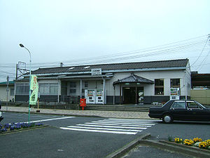
The building of Ōtsukō Station, East Japan Railway Jōban Line
Autor/Urheber: Yoshinobu Tsuji, Kenji Satake, Takeo Ishibe, Tomoya Harada, Akihito Nishiyama, Satoshi Kusumoto: "Tsunami Heights along the Pacific Coast of Northern Honshu Recorded from the 2011 Tohoku", Pure and Applied Geophysics, 171, 12, (2014), pp. 3183–3215, DOI:10.1007/s00024-014-0779-x, online published on 19 March 2014. License: Creative Commons Attribution 4.0 International (CC BY 4.0). Here p. 3193, Figure 12., Lizenz: CC BY 4.0
Source: Yoshinobu Tsuji, Kenji Satake, Takeo Ishibe, Tomoya Harada, Akihito Nishiyama, Satoshi Kusumoto: "Tsunami Heights along the Pacific Coast of Northern Honshu Recorded from the 2011 Tohoku", Pure and Applied Geophysics, 171, 12, (2014), pp. 3183–3215, DOI:10.1007/s00024-014-0779-x, online published on 19 March 2014. License: Creative Commons Attribution 4.0 International (CC BY 4.0). Here p. 3193, Figure 12.
Caption as given in the above cited source: "Figure 12 - a Tsunami heights at Hirakatacho, Kitaibaraki City, Ibaraki Prefecture. The symbols and their meanings are the same as in Fig. 3. b View of tsunami damage at Hirakatacho. c Watermarks on windowpanes of entrance doors of the guesthouse Yanagiya (0.89 m above ground level, B3)"
Context as given in the above cited source: "At Hirakatacho in Kitaibaraki City, the fishing port and residential area were severely damaged (Fig. 12). The first floors of many houses were
destroyed by the tsunami and some houses collapsed completely. Watermarks on buildings indicated inundation heights ranging 6.6–7.2 m, while debris indicated runup heights of 7.9 and 8.1 m (B1–B5)."Autor/Urheber: Lincun, Lizenz: CC BY-SA 3.0
Location of Kitaibaraki in Ibaraki Prefecture


