Kings Dominion
| Kings Dominion | |||
|---|---|---|---|
 | |||
| Ort | Doswell, Virginia, | ||
| Eröffnung | 3. Mai 1975 | ||
| Website | www.kingsdominion.com | ||
| |||
Koordinaten: 37° 50′ 24″ N, 77° 26′ 42″ W
Kings Dominion ist ein Freizeitpark im US-amerikanischen Bundesstaat Virginia. Der am 3. Mai 1975 eröffnete Park wurde 1993 von Paramount aufgekauft und in Paramount's Kings Dominion umbenannt. 2006 übernahm Cedar Fair Entertainment Company den Park und nannte ihn wieder in Kings Dominion um.
Liste der Achterbahnen

Bestehende Achterbahnen
| Name | Typ | Hersteller | Eröffnungsjahr | Weblinks |
|---|---|---|---|---|
| Anaconda | Stahlachterbahn mit Inversionen | Arrow Dynamics | 1991 | [1] [2] |
| Apple Zapple | Wilde Maus | Mack Rides | 2002 | [3] [4] |
| Back Lot Stunt Coaster | Launched Coaster | Premier Rides | 2006 | [5] [6] |
| Dominator | Floorless Coaster | Bolliger & Mabillard | 2008 | [7] [8] |
| Flight of Fear | Launched Coaster, Dunkelachterbahn | Premier Rides | 1996 | [9] [10] |
| Great Pumpkin Coaster | Familienachterbahn | E&F Miler Industries | 1997 | [11] [12] |
| Grizzly | Holzachterbahn | unbekannt | 1982 | [13] [14] |
| Project 305 Intimidator 305 (bis 2023) | Giga Coaster | Intamin | 2010 | [15] [16] [17] |
| Racer 75 | Holzachterbahn, Racing Roller Coaster | Philadelphia Toboggan Coasters | 1975 | [18] [19] |
| Rapterra | Wing Coaster | Bolliger & Mabillard | 2025 (im Bau) | [20] |
| Reptilian | Bobachterbahn | Mack Rides | 1988 | [21] [22] |
| Tumbili | 4th-Dimension-Coaster | S&S | 2022 | [23] [24] |
| Twisted Timbers | Hybrid Coaster | Rocky Mountain Construction | 2018 | [25] [26] [27] |
| Woodstock Express | Holzachterbahn, Familienachterbahn | Philadelphia Toboggan Coasters | 1974 | [28] [29] |
Geschlossene Achterbahnen
| Name | Typ | Hersteller | Eröffnungsjahr | Schließungsjahr | Weblinks |
|---|---|---|---|---|---|
| Galaxi | Stahlachterbahn ohne Inversionen | S.D.C. | 1975 | 1983 | [30] |
| Hurler | Holzachterbahn | International Coasters | 1994 | 2015 | [31] |
| HyperSonic XLC | Launched Coaster | S&S | 2001 | 2007 | [32] |
| King Kobra | Launched Coaster, Shuttle Coaster | Schwarzkopf | 1977 | 1986 | [33] |
| Shockwave | Stand-Up Coaster | Togo | 1986 | 2015 | [34] |
| Volcano, The Blast Coaster | Launched Coaster, Inverted Coaster | Intamin | 1998 | 2018 | [35] [36] |
Weblinks
- offizielle Website (englisch)
Auf dieser Seite verwendete Medien
Autor/Urheber: TUBS
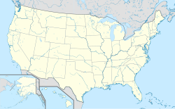
Location map of the USA (Hawaii and Alaska shown in sidemaps).
Main map: EquiDistantConicProjection : Central parallel :
* N: 37.0° N
Central meridian :
* E: 96.0° W
Standard parallels:
* 1: 32.0° N
* 2: 42.0° N
Made with Natural Earth. Free vector and raster map data @ naturalearthdata.com.
Formulas for x and y:
x = 50.0 + 124.03149777329222 * ((1.9694462586094064-({{{2}}}* pi / 180))
      * sin(0.6010514667026994 * ({{{3}}} + 96) * pi / 180))
y = 50.0 + 1.6155950752393982 * 124.03149777329222 * 0.02613325650382181
      - 1.6155950752393982  * 124.03149777329222 *
     (1.3236744353715044  - (1.9694462586094064-({{{2}}}* pi / 180))
      * cos(0.6010514667026994 * ({{{3}}} + 96) * pi / 180))
Hawaii side map: Equirectangular projection, N/S stretching 107 %. Geographic limits of the map:
- N: 22.4° N
- S: 18.7° N
- W: 160.7° W
- E: 154.6° W
Alaska side map: Equirectangular projection, N/S stretching 210.0 %. Geographic limits of the map:
- N: 72.0° N
- S: 51.0° N
- W: 172.0° E
- E: 129.0° W
I took this picture in April 2007.
The logo for Kings Dominion.


