Kasiruta
| Kasiruta | ||
|---|---|---|
 | ||
| Gewässer | Molukkensee | |
| Inselgruppe | Bacaninseln | |
| Geographische Lage | 0° 24′ S, 127° 12′ O | |
| Länge | 28 km | |
| Breite | 14 km | |
| Fläche | 394 km² | |
| Höchste Erhebung | 730 m | |
Kasiruta ist eine indonesische Insel. Sie liegt im Südwesten der Molukken.
Geographie
Die hügelige, üppig bewachsene Insel ist etwa 400 km² groß. Sie liegt wenige Kilometer vor der Nordwestküste von Bacan, der Hauptinsel der Bacaninseln. Die höchste Erhebung hat eine Höhe von 730 m.
Fauna
Auf Kasiruta beheimatet ist unter anderem die Rotbraune Reinwardttaube.
Weblinks
Auf dieser Seite verwendete Medien
Autor/Urheber: Uwe Dedering, Lizenz: CC BY-SA 3.0
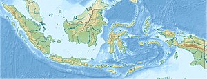
Location map of Indonesia.
Equirectangular projection. Strechted by 100.0%. Geographic limits of the map:
- N: 6.5° N
- W: 94.5° E
- E: 141.5° E
- S: -11.5° N
ID Kasiruta.PNG


