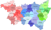
Kanton Châtel-sur-Moselle
| Ehemaliger Kanton Châtel-sur-Moselle | |
|---|---|
| Region | Lothringen |
| Département | Vosges |
| Arrondissement | Épinal |
| Hauptort | Châtel-sur-Moselle |
| Auflösungsdatum | 29. März 2015 |
| Einwohner | 19.871 (1. Jan. 2012) |
| Bevölkerungsdichte | 80 Einw./km² |
| Fläche | 247.94 km² |
| Gemeinden | 23 |
| INSEE-Code | 8806 |
Der Kanton Châtel-sur-Moselle war bis 2015 ein französischer Wahlkreis im Arrondissement Épinal, im Département Vosges und in der Region Lothringen; sein Hauptort war Châtel-sur-Moselle. Letzte Vertreterin im Generalrat des Départements war von 2008 bis 2015 Colette Marchal (zunächst DVD, jetzt NC).
Lage
Der Kanton lag im Norden des Départements Vosges.
Gemeinden
Der Kanton bestand aus 23 Gemeinden:
| Gemeinde | Einwohner Jahr | Fläche km² | Bevölkerungsdichte | Code INSEE | Postleitzahl |
|---|---|---|---|---|---|
| Badménil-aux-Bois | 146 (2013) | 9,14 | 16 Einw./km² | 88027 | 88330 |
| Bayecourt | 271 (2013) | 6,92 | 39 Einw./km² | 88040 | 88150 |
| Châtel-sur-Moselle | 1.680 (2013) | 11,86 | 142 Einw./km² | 88094 | 88330 |
| Chavelot | 1.472 (2013) | 6,16 | 239 Einw./km² | 88099 | 88150 |
| Damas-aux-Bois | 266 (2013) | 29,46 | 9 Einw./km² | 88121 | 88330 |
| Domèvre-sur-Durbion | 290 (2013) | 12,51 | 23 Einw./km² | 88143 | 88330 |
| Frizon | 496 (2013) | 11,75 | 42 Einw./km² | 88190 | 88440 |
| Gigney | 55 (2013) | 5,09 | 11 Einw./km² | 88200 | 88390 |
| Girmont | 993 (2013) | 12,73 | 78 Einw./km² | 88204 | 88150 |
| Hadigny-les-Verrières | 382 (2013) | 13,74 | 28 Einw./km² | 88224 | 88330 |
| Haillainville | 173 (2013) | 12,26 | 14 Einw./km² | 88228 | 88330 |
| Igney | 1.181 (2013) | 7,66 | 154 Einw./km² | 88247 | 88150 |
| Mazeley | 271 (2013) | 10,39 | 26 Einw./km² | 88294 | 88150 |
| Moriville | 429 (2013) | 25,05 | 17 Einw./km² | 88313 | 88330 |
| Nomexy | 2.192 (2013) | 7,95 | 276 Einw./km² | 88327 | 88440 |
| Oncourt | 185 (2013) | 3,94 | 47 Einw./km² | 88337 | 88150 |
| Pallegney | 176 (2013) | 5,93 | 30 Einw./km² | 88342 | 88330 |
| Rehaincourt | 331 (2013) | 15,22 | 22 Einw./km² | 88379 | 88330 |
| Sercœur | 256 (2013) | 9,18 | 28 Einw./km² | 88454 | 88600 |
| Thaon-les-Vosges | 7.895 (2013) | 11,7 | 675 Einw./km² | 88465 | 88150 |
| Vaxoncourt | 527 (2013) | 8,43 | 63 Einw./km² | 88497 | 88330 |
| Villoncourt | 114 (2013) | 6,4 | 18 Einw./km² | 88509 | 88150 |
| Zincourt | 90 (2013) | 4,47 | 20 Einw./km² | 88532 | 88330 |
Bevölkerungsentwicklung
| 1962 | 1968 | 1975 | 1982 | 1990 | 1999 | 2006 | 2012 |
|---|---|---|---|---|---|---|---|
| 20.000 | 18.925 | 18.920 | 19.440 | 19.351 | 19.212 | 19.568 | 19.871 |
Auf dieser Seite verwendete Medien
Autor/Urheber: Clemclar, Carte d'origine de Poulpy, Lizenz: CC BY-SA 3.0
Carte des cantons des Vosges avant le redécoupage cantonal de 2014
Autor/Urheber: Michiel1972, Lizenz: CC BY-SA 3.0
Location of the canton within its arrondissement.


