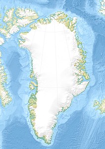
Kangerlussuaq (Fjord, Qaanaaq)
| Kangerlussuaq Inglefield Bredning | ||
|---|---|---|
| Gewässer | Baffin Bay | |
| Landmasse | Hayes-Halbinsel | |
| Geographische Lage | 77° 25′ N, 68° 47′ W | |
| Breite | ca. 15 km | |
| Länge | ca. 120 km | |
| Inseln | Qeqertaarsuusarsuaq, Qeqertat, Quajaqqisaarsuaq | |
| Zuflüsse | Qungasissat Kangerlua, Kangerluarsuk, Kangerluarsorujuk | |
Der Kangerlussuaq („großer Fjord“; dänisch Inglefield Bredning) ist ein grönländischer Fjord im Distrikt Qaanaaq in der Avannaata Kommunia.
Geografie

Der Kangerlussuaq teilt die Hayes-Halbinsel in zwei Hälften. Der Fjord hat eine Länge von rund 120 km und eine Breite von rund 15 km, was ihn zu einem der größten Fjorde des Landes macht. Der Fjord wird an seinem Ende vor allem durch den großen Gletscher Qaqujaarsuup Sermia (Heilprin Gletsjer) sowie den Doppelgletscher Qeqertaarsuusarsuup Sermia (Tracy Gletsjer) und Tuttulipaluup Sermia (Farquhar Gletsjer) gespeist. Im Norden fließen noch die beiden kleinen Gletscher Toornaarsulissuup Sermii (Melville Gletsjer und Sharp Gletsjer) sowie der ebenso kleine Paarnarsuit Sermiat (Hart Gletsjer) einer Bucht zu, die durch die Insel Qeqertaarsuusarsuaq (Josephine Peary Ø) abgegrenzt wird.
Im Süden vor dem Qaqujaarsuup Sermia liegt die Inselgruppe Qeqertat mit dem Dorf Qeqertat sowie die südlich davon gelegene kleine Insel Quajaqqisaarsuaq. Der Bucht fließt von Süden her der Fjord Qungasissat Kangerlua (Academy Bugt) zu. Nach Westen hin verjüngt sich die Bucht von einer Breite von maximal 35 km auf 15 km. Von Norden her mündet der Quinnisut Sermiat (Hubbard Gletsjer) in den Fjord. Etwa 15 km weiter westlich mündet auch der Kangerluarsuk (Bowdoin Fjord) in den Kangerlussuaq.
Etwa 80 km nach seinem Ursprung öffnet sich der Fjord im Norden auf Höhe der Stadt Qaanaaq zum Meer hin. Vor der Stadt verläuft der Murchison Sund, der durch die nördlich des Kangerlussuaq liegende Insel Qeqertarsuaq (Herbert Ø) abgegrenzt wird. Westlich davon liegt die Insel Kiatak (Northumberland Ø). Gegenüber dem Murchison Sund am Südufer des Kangerlussuaq mündet der Kangerluarsorujuk (Olrik Fjord). Südlich von Kiatak mündet der Kangerlussuaq in den nördlichsten Ausläufer der Baffin Bay, bevor diese in die Nares-Straße übergeht.[1]
Geschichte
Der Kangerlussuaq wurde während 1860/61 der American Arctic Expedition unter Isaac Israel Hayes zu Ehren des britischen Admirals Edward Inglefield mit dem Namen Inglefield Gulf versehen. Der englische Name wurde später durch den dänischen Namen Inglefield Bredning ersetzt.[2]
Einzelnachweise
- ↑ Nunat Aqqi. Karte über die vom Grönländischen Ortsnamenausschuss offiziell anerkannten Ortsnamen. Oqaasileriffik.
- ↑ Dan Laursen: The Place Names of North Greenland. In: Kommissionen for Videnskabelige Undersøgelser i Grønland (Hrsg.): Meddelelser om Grønland. Band 180, Nr. 2. C. A. Reitzels Forlag, Kopenhagen 1972, ISBN 87-421-0070-4, S. 262.
Auf dieser Seite verwendete Medien
Autor/Urheber: Internet Archive Book Images, Lizenz: No restrictions
Identifier: northwardovergre001pear (find matches)
Title: Northward over the great ice : a narrative of life and work along the shores and upon the interior ice-cap of northern Greenland in the years 1886 and 1891-1897, with a description of the little tribe of Smith Sound Eskimos, the most northerly human beings in the world, and an account of the discovery and bringing home of the Saviksue or great Cape York meteorites
Year: 1898 (1890s)
Authors: Peary, Robert E. (Robert Edwin), 1856-1920
Subjects: Eskimos
Publisher: New York, NY : F.A. Stokes Company
Contributing Library: Wellesley College Library
Digitizing Sponsor: Boston Library Consortium Member Libraries
View Book Page: Book Viewer
About This Book: Catalog Entry
View All Images: All Images From Book
Click here to view book online to see this illustration in context in a browseable online version of this book.
Text Appearing Before Image:
AT THE SNOW VILLAGE. Cape Cleveland, I was again very forcibly impressedwith the great similarity between the northern shoreof Herbert Island and the south-eastern shore ofMcCormick Bay, and the sharply marked differenceof character between Herbert and NorthumberlandIslands, Northumberland is evidently a part of thesame dark granite formation that walls RobertsonBay in towering grandeur, while Herbert Island is apart of the same crumbling, disintegrated sandstoneand drift formation which reaches from Cape Cleve-land to Bowdoin Bay in Murchison Sound.
Text Appearing After Image:
Around Inglefield Gulf by Sledge 251 At Cape Cleveland we separated, Panikpa with-his equipage keeping along the beaten path whichwound away through the bergs to the deserted igloosof Kiaktoksuami, under the vertical walls of the east-ern end of Herbert Island, while I, with the rest ofthe party, branched out on a new road, an air-linefor the channel between Herbert and Northumber-land Islands. A short distance away from CapeCleveland we encountered disagreeable going in theshape of a broad zone of snow with underlying water,caused, undoubtedly, by the overflow from the tidalcrack stretching from Cape Cleveland in the directionof Cape Robertson. After the first few steps in thefreezing slush, Mrs. Peary, Gibson, and myself slippedon our snow-shoes, and as the sledges easily keptupon the surface of the snow, this threw the bruntof the disagreeable situation upon Kyo and the poordogs, who struggled and floundered through the arcticmorass, until at last we reached dry snow beyond it. Aft
Note About Images
Autor/Urheber: Uwe Dedering, Lizenz: CC BY-SA 3.0
Relief location map of Greenland.
- Projection: EquiDistantConicProjection.
- Area of interest:
- N: 85.0° N
- S: 59.0° N
- W: -75.0° E
- E: -10.0° E
- Projection center:
- NS: 72.0° N
- WE: -42.5° E
- Standard parallels:
- 1: 64.0° N
- 2: 80.0° N
- GMT projection: -JD-42.5/72/64/80/20c
- GMT region: -R-60.16/57.61/24.5/79.91r
- GMT region for grdcut: -R-120.24/57.61/24.5/85.78r
- Relief: SRTM30plus.
- Made with Natural Earth. Free vector and raster map data @ naturalearthdata.com.


