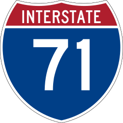
Interstate 71
 | |||||||||||||||||||||||||||||||||||||||||||
| Basisdaten | |||||||||||||||||||||||||||||||||||||||||||
|---|---|---|---|---|---|---|---|---|---|---|---|---|---|---|---|---|---|---|---|---|---|---|---|---|---|---|---|---|---|---|---|---|---|---|---|---|---|---|---|---|---|---|---|
| Länge: | 345 mi/556 km | ||||||||||||||||||||||||||||||||||||||||||
| Bundesstaaten: | Kentucky Ohio | ||||||||||||||||||||||||||||||||||||||||||
| Karte | |||||||||||||||||||||||||||||||||||||||||||
 | |||||||||||||||||||||||||||||||||||||||||||
Verlauf
| |||||||||||||||||||||||||||||||||||||||||||
Die Interstate 71 (kurz I-71) ist ein Interstate Highway im Mittleren Westen der Vereinigten Staaten. Sie beginnt an den Interstates 64 und 65 in Louisville und endet an der Interstate 90 in Cleveland.
Längen
| Meilen | km | Staat | |
| 97 | 156 | Kentucky | |
| 248 | 399 | Ohio | |
| 345 | 556 | Total | |
Wichtige Städte
Zubringer und Umgehungen
- Interstate 471 im Norden Kentuckys
- Interstate 271 bei Weymouth
Weblinks
- Interstate Guide (englisch)
Auf dieser Seite verwendete Medien
Uses the Roadgeek 2005 fonts. (United States law does not permit the copyrighting of typeface designs, and the fonts are meant to be copies of a U.S. Government-produced work anyway.) Colors are from [1] (Pantone Red 187 and Blue 294), converted to RGB by [2]. The outside border has a width of 1 (1 mm) and a color of black so it shows up; in reality, signs have no outside border.
(c) Dailynetworks, CC BY-SA 3.0
Taken with my camera on July 22, 2007 while traveling through Columbus. Blurred car license plate for privacy.
600 mm by 600 mm (24 in by 24 in) Interstate shield, made to the specifications of the 2004 edition of Standard Highway Signs (sign M1-1). Uses the Roadgeek 2005 fonts. (United States law does not permit the copyrighting of typeface designs, and the fonts are meant to be copies of a U.S. Government-produced work anyway.) Colors are from [1] (Pantone Red 187 and Blue 294), converted to RGB by [2]. The outside border has a width of 1 (1 mm) and a color of black so it shows up; in reality, signs have no outside border.
600 mm by 600 mm (24 in by 24 in) Interstate shield, made to the specifications of the 2004 edition of Standard Highway Signs (sign M1-1). Uses the Roadgeek 2005 fonts. (United States law does not permit the copyrighting of typeface designs, and the fonts are meant to be copies of a U.S. Government-produced work anyway.) Colors are from [1] (Pantone Red 187 and Blue 294), converted to RGB by [2]. The outside border has a width of 1 (1 mm) and a color of black so it shows up; in reality, signs have no outside border.


