Interstate 64
 | |||||||||||||||||||||||||||||||||||||||||||||||||||||||||||||||||||||||||||||||||||||
| Basisdaten | |||||||||||||||||||||||||||||||||||||||||||||||||||||||||||||||||||||||||||||||||||||
|---|---|---|---|---|---|---|---|---|---|---|---|---|---|---|---|---|---|---|---|---|---|---|---|---|---|---|---|---|---|---|---|---|---|---|---|---|---|---|---|---|---|---|---|---|---|---|---|---|---|---|---|---|---|---|---|---|---|---|---|---|---|---|---|---|---|---|---|---|---|---|---|---|---|---|---|---|---|---|---|---|---|---|---|---|---|
| Länge: | 960 mi/1547 km | ||||||||||||||||||||||||||||||||||||||||||||||||||||||||||||||||||||||||||||||||||||
| Bundesstaaten: | Missouri Illinois Indiana Kentucky West Virginia Virginia | ||||||||||||||||||||||||||||||||||||||||||||||||||||||||||||||||||||||||||||||||||||
| Karte | |||||||||||||||||||||||||||||||||||||||||||||||||||||||||||||||||||||||||||||||||||||
 | |||||||||||||||||||||||||||||||||||||||||||||||||||||||||||||||||||||||||||||||||||||
Verlauf
| |||||||||||||||||||||||||||||||||||||||||||||||||||||||||||||||||||||||||||||||||||||
Die Interstate 64 (Abkürzung I-64) ist Teil des Interstate-Highway-Systems der USA. Ihr westliches Ende befindet sich in Wentzville (Missouri) westlich der Ausfahrt zur Missouri Supplemental Route, ihr östliches Ende ist bei Bowers Hill in Chesapeake (Virginia) beim Autobahnkreuz mit der Interstate 264 und Interstate 664.
Wichtige Städte entlang der Route
- St. Louis
- Mount Vernon
- Louisville
- Frankfort
- Lexington
- Ashland
- Huntington
- Charleston
- Beckley
- Lewisburg
- Lexington
- Staunton
- Charlottesville (Virginia)
- Richmond
- Williamsburg
- Newport News
- Hampton
- Norfolk
- Virginia Beach (Virginia)
- Chesapeake
Zubringer und Umgehungen
- Interstate 164 bei Evansville
- Interstate 264 bei Louisville
- Interstate 264 im Gebiet des Hampton Roads
- Interstate 464 im Gebiet des Hampton Roads
- Interstate 564 im Gebiet des Hampton Roads
- Interstate 664 im Gebiet des Hampton Roads
Galerie
 Übergang zu I-64 bei Lexington
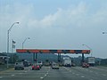 (c) Decimal10, CC BY-SA 3.0Zahlstelle auf der I-64
 Einfahrt West Virginia auf I-64
Literatur
- Rand McNally: The Road Atlas 2005. 2005.
Weblinks
- Artikel von American Byways zu Interstate 64
- Offizielle Website der West Virginia Turnpike
- Roads to the Future
- Missouri Verkehrsministerium zur Verlängerung von I-64
| Main Interstates | 2 • 4 • 5 • 8 • 10 • 11 • 12 • 14 • 15 • 16 • 17 • 19 • 20 • 22 • 24 • 25 • 26 • 27 • 29 • 30 • 35 • 37 • 39 • 40 • 41 • 43 • 44 • 45 • 49 • 55 • 57 • 59 • 64 • 65 • 66 • 68 • 69 • 70 • 71 • 72 • 73 • 74 • 75 • 76 (West) • 76 (Ost) • 77 • 78 • 79 • 80 • 81 • 82 • 83 • 84 (West) • 84 (Ost) • 85 • 86 (West) • 86 (Ost) • 87 (Nord) • 87 (Süd) • 88 (West) • 88 (Ost) • 89 • 90 • 91 • 93 • 94 • 95 • 96 • 97 • 99 • 238 |  |
|---|---|---|
| Hawaii | ||
| Alaska | ||
| Puerto Rico | PR-1 • PR-2 • PR-3 |
Auf dieser Seite verwendete Medien


Autor/Urheber: Die Autorenschaft wurde nicht in einer maschinell lesbaren Form angegeben. Es wird MPD01605~commonswiki als Autor angenommen (basierend auf den Rechteinhaber-Angaben)., Lizenz: CC BY 2.5
I took this picture and grant use as long as I am credited as Bobby Hidy.


Uses the Roadgeek 2005 fonts. (United States law does not permit the copyrighting of typeface designs, and the fonts are meant to be copies of a U.S. Government-produced work anyway.) Colors are from [1] (Pantone Red 187 and Blue 294), converted to RGB by [2]. The outside border has a width of 1 (1 mm) and a color of black so it shows up; in reality, signs have no outside border.


West Virginia state welcome sign on the eastern end of Interstate-64 (at the Virginia state line).


600 mm by 600 mm (24 in by 24 in) Interstate shield, made to the specifications of the 2004 edition of Standard Highway Signs (sign M1-1). Uses the Roadgeek 2005 fonts. (United States law does not permit the copyrighting of typeface designs, and the fonts are meant to be copies of a U.S. Government-produced work anyway.) Colors are from [1] (Pantone Red 187 and Blue 294), converted to RGB by [2]. The outside border has a width of 1 (1 mm) and a color of black so it shows up; in reality, signs have no outside border.

