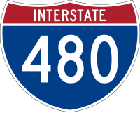
Interstate 480 (Iowa-Nebraska)
 | |
| Basisdaten | |
|---|---|
| Länge: | 4,90 mi/7,89 km[1] |
| Bundesstaaten: | Iowa Nebraska |
| Verlaufsrichtung: | Ost-West |
| Karte | |
 | |
Die Interstate 480 (kurz I-480) ist ein kurzer Interstate Highway in den Vereinigten Staaten, der die Innenstadt von Omaha in Nebraska ausgehend von der Interstate 80 mit Council Bluffs in Iowa mit der Interstate 29 verbindet. Die gesamte Länge beträgt nur 7,89 km (4,90 mi). Der Streckenabschnitt in Nebraska wird Gerald R. Ford Freeway genannt.
Geschichte
Die Interstate 480 wurde am 21. Oktober 1966 eröffnet.[2]
Im Jahre 1999 sollte die I-480 in südlicher Richtung nach Plattsmouth und anschließend in Richtung bis zur Interstate 29 auf eine Gesamtlänge von 31 Kilometer erweitert werden. Der Gesetzentwurf des Repräsentantenhauses kam jedoch nie durch die Ausschüsse. Stattdessen begannen die Staaten Nebraska und Iowa damit, zwei Brücken über den Missouri River zu planen.
Einzelnachweise
- ↑ Federal Highway Administration: Auxiliary Routes of the Dwight D. Eisenhower National System Of Interstate and Defense Highways vom 31. Oktober 2002, geöffnet am 29. November 2009
- ↑ Iowa Highways:Interstate 480 ( des vom 19. November 2009 im Internet Archive) Info: Der Archivlink wurde automatisch eingesetzt und noch nicht geprüft. Bitte prüfe Original- und Archivlink gemäß Anleitung und entferne dann diesen Hinweis., geöffnet am 29. November 2009
Weblinks
- Interstate-Guide (englisch)
Auf dieser Seite verwendete Medien
Autor/Urheber: 25or6to4, Lizenz: CC BY-SA 3.0
Map of Interstate 480 in Pottawattamie County, Iowa and Douglas County, Nebraska
600 mm × 600 mm (24 in × 24 in) U.S. Highway shield, made to the specifications of the 2004 edition of Standard Highway Signs. (Note that there is a missing "J" label on the left side of the diagram.) Uses the Roadgeek 2005 fonts. (United States law does not permit the copyrighting of typeface designs, and the fonts are meant to be copies of a U.S. Government-produced work anyway.)
600 mm by 600 mm (24 in by 24 in) Interstate shield, made to the specifications of the 2004 edition of Standard Highway Signs (sign M1-1). Uses the Roadgeek 2005 fonts. (United States law does not permit the copyrighting of typeface designs, and the fonts are meant to be copies of a U.S. Government-produced work anyway.) Colors are from [1] (Pantone Red 187 and Blue 294), converted to RGB by [2]. The outside border has a width of 1 (1 mm) and a color of black so it shows up; in reality, signs have no outside border.
600 mm × 600 mm (24 in × 24 in) U.S. Highway shield, made to the specifications of the 2004 edition of Standard Highway Signs. (Note that there is a missing "J" label on the left side of the diagram.) Uses the Roadgeek 2005 fonts. (United States law does not permit the copyrighting of typeface designs, and the fonts are meant to be copies of a U.S. Government-produced work anyway.)


