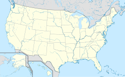
Hurlburt Field
| Hurlburt Field | ||
|---|---|---|
 | ||
| Kenndaten | ||
| ICAO-Code | KHRT | |
| FAA-LID | HRT | |
| Koordinaten | 30° 25′ 40″ N, 86° 41′ 21″ W | |
| Höhe über MSL | 12 m (39 ft) | |
| Basisdaten | ||
| Betreiber | U.S. Air Force | |
| Start- und Landebahn | ||
| 18/36 | 2926 m × 46 m Beton | |
Das Hurlburt Field (ICAO-Code: KHRT, FAA-LID: HRT) ist ein Militärflugplatz der United States Air Force (USAF) im Okaloosa County im US-Bundesstaat Florida. Er liegt westlich der Stadt Mary Esther, auf dem Gebiet der Eglin Air Force Base Reservation. Früher gehörte Hurlburt Field als Field No. 9 zur Eglin AFB. Die gesamte Basis hat eine Größe von 27 km² und beschäftigt fast 8000 Militärangehörige. Im United States Census 2020 wurden für den Hurlburt Field Census-designated place 2.176 Einwohner gezählt.
Hurlburt Field ist die Heimat des Air Force Special Operations Command und des 1st Special Operations Wing. Das Geschwader unterstützt mit seinen Einheiten Spezialeinsätze für alle Major Commands. Die dem Wing unterstellte 1st Special Operations Group hat über 1400 Angehörige und unterteilt sich in acht Staffeln: 4th Special Operations Squadron mit AC-130U Spooky Gunship, 8th Special Operations Squadron mit CV-22 Osprey, 15th Special Operations Squadron mit MC-130H Combat Talon II, 34th Special Operations Squadron und 319th Special Operations Squadron mit U-28A als fliegende Einheiten sowie die 1st Special Operations Support Squadron, 23rd Weather Squadron, 1st Special Operations Group, Detachment 1 und die 11th Intelligence Squadron zur Unterstützung.[1] Das Naval Special Warfare Center (NSWC) unterhält eine Ausbildungseinheit (Combat Training Range Detachment) der Navy SEALs auf dem Stützpunkt.
Das Gelände wurde nach First Lieutenant Donald Wilson Hurlburt benannt, der 1943 bei einem Flugzeugabsturz auf dem Gelände starb.
Weblinks
- Offizielle Website (englisch)
Einzelnachweise
- ↑ 1st Special Operations Group. In: US Air Force. Abgerufen am 23. Februar 2018.
Auf dieser Seite verwendete Medien
Autor/Urheber: TUBS
Location map of the USA (Hawaii and Alaska shown in sidemaps).
Main map: EquiDistantConicProjection : Central parallel :
* N: 37.0° N
Central meridian :
* E: 96.0° W
Standard parallels:
* 1: 32.0° N
* 2: 42.0° N
Made with Natural Earth. Free vector and raster map data @ naturalearthdata.com.
Formulas for x and y:
x = 50.0 + 124.03149777329222 * ((1.9694462586094064-({{{2}}}* pi / 180))
      * sin(0.6010514667026994 * ({{{3}}} + 96) * pi / 180))
y = 50.0 + 1.6155950752393982 * 124.03149777329222 * 0.02613325650382181
      - 1.6155950752393982  * 124.03149777329222 *
     (1.3236744353715044  - (1.9694462586094064-({{{2}}}* pi / 180))
      * cos(0.6010514667026994 * ({{{3}}} + 96) * pi / 180))
Hawaii side map: Equirectangular projection, N/S stretching 107 %. Geographic limits of the map:
- N: 22.4° N
- S: 18.7° N
- W: 160.7° W
- E: 154.6° W
Alaska side map: Equirectangular projection, N/S stretching 210.0 %. Geographic limits of the map:
- N: 72.0° N
- S: 51.0° N
- W: 172.0° E
- E: 129.0° W
This is a locator map showing Okaloosa County in Florida. For more information, see Commons:United States county locator maps.
A U.S. Air Force Lockheed WC-130H Hercules aircraft in flight over Keesler AFB, Mississippi (USA).


