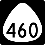
Hawaiʻi State Route 460
 | |
|---|---|
| Basisdaten | |
| Gesamtlänge: | 26 km / 16 Meilen |
| Anfangspunkt: | |
| Endpunkt: | Maunaloa |
| County: | Maui County |
| Wichtige Städte: | Kaunakakai, Maunaloa |
Die Hawaiʻi State Route 460 ist eine Straße, welche den Westen der Insel Molokaʻi im US-Bundesstaat Hawaiʻi erschließt.
Verlauf
Die auch als Maunaloa Highway bekannte Straße verbindet die Ortschaft Kaunakakai an der Südküste der Insel Molokaʻi mit der im Westen der Insel gelegenen Ortschaft Maunaloa und führt vorbei am Flughafen Molokaʻi Airport. Von der 16 Meilen (26 Kilometer) langen Strecke gehen die State Routes 465, 470 und 480 ab, in Kaunakakai geht sie in die State Route 450 über.
Auf dieser Seite verwendete Medien
600 mm by 600 mm (24 in by 24 in) Hawaii shield, made to the specifications of the Manual on Uniform Traffic Control Devices (MUTCD), 2003 Edition (sign M1-5). Uses the Roadgeek 2005 fonts. (United States law does not permit the copyrighting of typeface designs, and the fonts are meant to be copies of a U.S. Government-produced work anyway.)
600 mm by 600 mm (24 in by 24 in) Hawaii shield, made to the specifications of the Manual on Uniform Traffic Control Devices (MUTCD), 2003 Edition (sign M1-5). Uses the Roadgeek 2005 fonts. (United States law does not permit the copyrighting of typeface designs, and the fonts are meant to be copies of a U.S. Government-produced work anyway.)

