Hale’s Location
| Hale's Location | ||
|---|---|---|
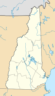
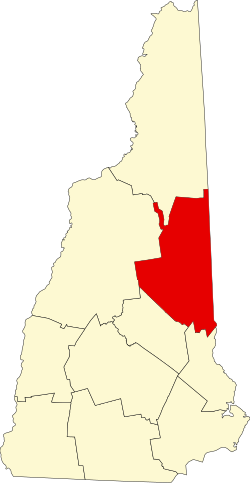
Lage in New Hampshire | ||
| Basisdaten | ||
| Staat: | Vereinigte Staaten | |
| Bundesstaat: | New Hampshire | |
| County: | Carroll County | |
| Koordinaten: | 44° 2′ N, 71° 10′ W | |
| Zeitzone: | Eastern (UTC−5/−4) | |
| Einwohner: | 132 (Stand: 2020) | |
| Haushalte: | 139 (Stand: 2020) | |
| Fläche: | 6,4 km² (ca. 2 mi²) | |
| Bevölkerungsdichte: | 21 Einwohner je km² | |
| Höhe: | 176 m | |
| Postleitzahl: | 03860 | |
| Vorwahl: | +1 603 | |
| FIPS: | 33-32500 | |
| GNIS-ID: | 871993 | |
Hale's Location ist eine Township im Carroll County von New Hampshire, einem der Neuenglandstaaten der USA. Es entstand als Land-grant, trägt den Namen nach dem Siedler, dem es zugeteilt wurde[1] und ist die einzige Township in Caroll County sowie eine von zweien in New Hampshire, die nicht in Coös County liegen. Das ebenfalls als Location bezeichnete Hart’s Location ist rechtlich eine eigenständige Town. 2020 hatte Hale's Location laut Census 132 Einwohner in 89 Haushalten.[2]
Geographie
Hale's Location liegt in den White Mountains am Osthang des Moat Mountain und reicht bis ins Tal des Saco River nahe der Ortschaft North Conway in der Town of Conway. Im Süden grenzt es an Albany, im Westen und Norden an Bartlett. Die Fläche umfasst 6,4 km².[3] Im Norden von Hale's Location liegt die 1352 Fuß (412 Meter)[4] hohe White Horse Ledge als höchster Punkt des Gebietes.
Demographie
Bevölkerungsentwicklung
| Volkszählungsergebnisse[5][2] – Hale's Location, New Hampshire | ||||||||||
|---|---|---|---|---|---|---|---|---|---|---|
| Jahr | 1940 | 1950 | 1960 | 1970 | 1980 | 1990 | 2000 | 2010 | 2020 | 2030 |
| Einwohner | 8 | 2 | 120 | 132 | ||||||
Einzelnachweise
- ↑ Georgia Drew Merrill: History of Carroll County, New Hampshire. W. A. Fergusson & Co., Boston, MA 1889, Town of Conway, S. 853 (englisch, Scan – Internet Archive [abgerufen am 11. März 2022]).
- ↑ a b Decennial Census 2020. US Census Bureau, abgerufen am 2. Oktober 2021.
- ↑ Census-Gazetteer File. 2021, abgerufen am 11. März 2022 (englisch).
- ↑ White Horse Ledge. In: Geographic Names Information System. United States Geological Survey, United States Department of the Interior, abgerufen am 22. April 2021 (englisch).
- ↑ 1790–1980 US Census
Auf dieser Seite verwendete Medien
Autor/Urheber: Alexrk2, Lizenz: CC BY 3.0
Positionskarte von New Hampshire, USA
This is a locator map showing Carroll County in New Hampshire. For more information, see Commons:United States county locator maps.


