Guelb er Richat


Guelb er Richat (arabisch قلب الريشات, DMG Qalb ar-Rīšāt), deutsch auch Richat-Struktur, umschrieben mit Auge Afrikas, Bull’s Eye oder Auge der Sahara, ist ein ringförmiges, kraterähnliches geomorphologisches Gebilde in Mauretanien im Westen der Sahara.
Guelb (arabisch قلب, DMG Qalb) bedeutet in der arabischen Sprache „Herz“. Die Ringhügel liegen in der Region Adrar etwa 30 Kilometer nordöstlich der Kleinstadt Ouadane. Sie haben einen Durchmesser von 45 Kilometern. Die konzentrischen Ringwälle sind nur wenige Meter hoch und bestehen aus Sedimentgestein.
Da die Struktur aus dem Weltall besonders auffällig zu sehen ist, wurde sie bei Shuttle-Missionen von Astronauten als Landmarke zur Orientierung benutzt.
Interpretationen zur Entstehung
Ursprünglich wurde die Struktur als Meteoritenkrater interpretiert, was aber wegen fehlender Impaktgesteine nicht allgemein unterstützt wird. Der Sahara-Forscher Théodore Monod[1] veröffentlichte 1954 eine Schrift, in der er fünf derartige Krater in Mauretanien beschrieb und bei vieren einschließlich des Richat die gängige Auffassung unterstützte, es könne sich um eine vulkanische Explosion auf der Erde handeln, nur beim fünften wollte er die Einwirkung eines Meteoriten nicht ausschließen.[2] Der Geophysiker Robert S. Dietz schloss 1969 einen Meteoriteneinschlag aus.[3]
Die Entstehung dieser kreisförmigen Struktur ist nicht restlos geklärt, eine neuere Studie geht davon aus, dass die Struktur durch die Erosion einer Domstruktur entstand. Diese wiederum sei durch magmatische Intrusionen aufgewölbt worden, durch die dabei entstandenen Schwächezonen seien hydrothermale Fluide eingedrungen, die eine Verkarstung und Silifizierung des Materials verursacht hätten.[4] Aeromagnetische und gravimetrische Vermessungen der Struktur unter der Oberfläche unterstützen diese Hypothese. Aufgrund von ringförmigen Verwerfungen seien gabbroische Ring-Dykes über einem großen intrusiven Magmakörper entstanden, bei der Erosion des Doms seien abwechselnd harte und weiche Gesteinsschichten erodiert worden.[5]
Weblinks
- Artikel in Der Spiegel
- NASA Earth Observatory: NASA Earth Observatory page (englisch)
- Earth's Richat Structure – Astronomy Picture of the Day vom 28. Oktober 2002 (englisch).
- Annual Meteoritical Society Meeting (2001) (PDF, englisch; 83 kB)
- ens.ch Foto vom Zentrum. März 2009
Einzelnachweise
- ↑ Théodore Monod, Souvenirs sahariens d'un vieux géologue amateur, COFRHIGEO 1986, Webseite der Annales des Mines
- ↑ U.B. Marvin: Théodore André Monod and the lost 'Fer de Dieu' meteorite of Chinguetti, Mauritania. In: Patrick N. Wyse Jackson (Hrsg.): Four Centuries of Geological Travel: The Search for Knowledge on Foot, Bicycle, Sledge and Camel. (Geological Society Special Publication) Geological Society, 2007, S. 201 (bei Google Books)
- ↑ Robert S. Dietz, Robert Fudali, William Cassidy: Richat and Semsiyat Domes (Mauritania): Not Astroblemes. In: Geological Society of America Bulletin. Band 80, Nr. 7, 1969, ISSN 0016-7606, S. 1367, doi:10.1130/0016-7606(1969)80[1367:RASDMN]2.0.CO;2 (geoscienceworld.org [abgerufen am 8. Dezember 2023]).
- ↑ Guillaume Matton, Michel Jébrak, James K.W. Lee: Resolving the Richat enigma: Doming and hydrothermal karstification above an alkaline complex. In: Geology, August 2005 (Geological Society of America), Vol. 33, Nr. 8, S. 665–668.
- ↑ El Houssein Abdeina, Sara Bazin, Gilles Chazot, Hervé Bertrand, Bernard Le Gall, Nasrrddine Youbi, Mohamed Salem Sabar, Mohamed Khalil Bensalah, Moulay Ahmed Boumehdi: Geophysical modelling of the deep structure of the Richat magmatic intrusion (northern Mauritania): insights into its kinematics of emplacement. In: Arabian Journal of Geosciences. Band 14, Nr. 22, 3. November 2021, ISSN 1866-7538, S. 2315, doi:10.1007/s12517-021-08734-4.
Koordinaten: 21° 8′ N, 11° 24′ W
Auf dieser Seite verwendete Medien
Autor/Urheber: Heribertus2, Lizenz: CC BY-SA 4.0
Topografische Karte der Guelb er Richat-Struktur in Mauretanien, Sahara
Autor/Urheber: Clemens Schmillen, Lizenz: CC BY-SA 4.0
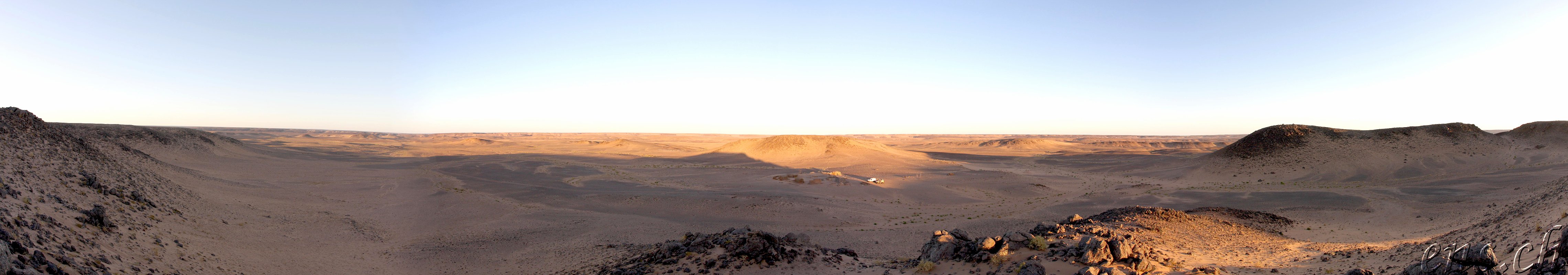
Guelb er Richât, Mauritania
PIA04963: Richat Structure, Mauritania - This prominent circular feature, known as the Richat Structure, in the Sahara desert of Mauritania is often noted by astronauts because it forms a conspicuous 50-kilometer-wide (30-mile-wide) bull's-eye on the otherwise rather featureless expanse of the desert. Initially mistaken for a possible impact crater, it is now known to be an eroded circular anticline (structural dome) of layered sedimentary rocks.
Extensive sand dunes occur in this region and the interaction of bedrock topography, wind, and moving sand is evident in this scene. Note especially how the dune field ends abruptly short of the cliffs at the far right as wind from the northeast (lower right) apparently funnels around the cliff point, sweeping clean areas near the base of the cliff. Note also the small isolated peak within the dune field. That peak captures some sand on its windward side, but mostly deflects the wind and sand around its sides, creating a sand-barren streak that continues far downwind.
This view was generated from a Landsat satellite image draped over an elevation model produced by the Shuttle Radar Topography Mission (SRTM). The view uses a 6-times vertical exaggeration to greatly enhance topographic expression. For vertical scale, note that the height of the mesa ridge in the back center of the view is about 285 meters (about 935 feet) tall. Colors of the scene were enhanced by use of a combination of visible and infrared bands, which helps to differentiate bedrock (browns), sand (yellow, some white), minor vegetation in drainage channels (green), and salty sediments (bluish whites). Some shading of the elevation model was included to further highlight the topographic features.
Elevation data used in this image was acquired by the Shuttle Radar Topography Mission (SRTM) aboard the Space Shuttle Endeavour, launched on February 11, 2000. SRTM used the same radar instrument that comprised the Spaceborne Imaging Radar-C/X-Band Synthetic Aperture Radar (SIR-C/X-SAR) that flew twice on the Space Shuttle Endeavour in 1994. SRTM was designed to collect three-dimensional measurements of the Earth's surface. To collect the 3-D data, engineers added a 60-meter-long (200-foot) mast, installed additional C-band and X-band antennas, and improved tracking and navigation devices. The mission is a cooperative project between the National Aeronautics and Space Administration (NASA), the National Geospatial-Intelligence Agency (NGA) of the U.S. Department of Defense (DoD), and the German and Italian space agencies. It is managed by NASA's Jet Propulsion Laboratory, Pasadena, Calif., for NASA's Earth Science Enterprise, Washington, D.C.
- View Size: 68 kilometers (42 miles) wide by 112 kilometers (69 miles) distance
- Location: 21.2 degrees North latitude, 11.7 degrees West longitude
- Orientation: View toward west-northwest
- Image Data: Landsat Bands 1, 4, 7 in B.G.R.
- Date Acquired: February 2000 (SRTM), January 13, 1987 (Landsat)
Richat Structure, Oudane, Mauritania - This prominent circular feature in the Sahara desert of Mauritania has attracted attention since the earliest space missions because it forms a conspicuous bull's-eye in the otherwise rather featureless expanse of the desert. Described by some as looking like an outsized ammonite in the desert, the structure [which has a diameter of almost 50 kilometers (30 miles)] has become a landmark for shuttle crews. Initially interpreted as a meteorite impact structure because of its high degree of circularity, it is now thought to be merely a symmetrical uplift (circular anticline) that has been laid bare by erosion. Paleozoic quartzites form the resistant beds outlining the structure. The image was acquired October 7, 2000, covers an area of 45 x 47 km, and is located at 20.9 degrees north latitude and 11.6 degrees west longitude.

Autor/Urheber: Eric Gaba (Sting - fr:Sting), Lizenz: CC BY-SA 3.0
Blank administrative map of Mauritania, for geo-location purposes.