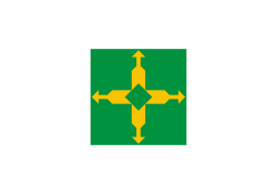
Guará (Distrito Federal)
| Região Administrativa de Guará Guará | ||
|---|---|---|
| Koordinaten | 15° 49′ 53″ S, 47° 58′ 48″ W | |
 Guará auf der Karte des Distrito Federal Guará auf der Karte des Distrito Federal | ||
| Symbole | ||
| ||
| Gründung | 21.4.1969 | |
| Basisdaten | ||
| Staat | Brasilien | |
| Bundesdistrikt | Distrito Federal | |
| Verwaltungsregion | RA X | |
| ISO 3166-2 | BR-DF | |
| Fläche | 37,5 km² | |
| Einwohner | 112.989 (PDAD/2004) | |
| Dichte | 3013 Ew./km² | |
| Telefonvorwahl | (+55) 61 | |
| Zeitzone | UTC−3 | |
| Website | guara.df (brasilianisches Portugiesisch) | |
| Politik | ||
| Regionaladministrator | Antônio Carlos de Santana Freitas | |
| Kultur | ||
| Schutzpatron | Paulus von Tarsus | |
| Stadtfest | 4. Juli | |
Guará, amtlich portugiesisch Região Administrativa de Guará (RA X), ist eine Verwaltungsregion und Satellitenstadt mit 112 989 Einwohnern im brasilianischen Bundesdistrikt, 12 km südwestlich vom Stadtzentrum. Die Verwaltungsregion grenzt an Águas Claras, Vicente Pires, SCIA, SIA, Brasília, Candangolândia und Núcleo Bandeirante an.
Wirtschaft
- Einkaufszentrum ParkShopping
Verkehr
Guará ist durch zwei Metrostationen der Metrô Brasília an das Stadtzentrum angebunden:
- Feira
- Guará
Verwaltung
Administrator der Verwaltungsregion ist Antônio Carlos de Santana Freitas.
Weblinks
- Website der Verwaltungsregion Guará (portugiesisch)
Auf dieser Seite verwendete Medien
Autor/Urheber:
- Brazil_location_map.svg: NordNordWest
- derivative work: Виктор В (talk)
Location map of Brazil
Flag of the administrative region of Guará, in the Federal District, Brazil.
Autor/Urheber: FORTES, Lizenz: CC BY 2.5
Map locator of Distrito Federal's Guará city


