Granard
| Granard Gránard Granard | ||
|---|---|---|
| ||
| Koordinaten | 53° 46′ 46″ N, 7° 29′ 32″ W | |
| Basisdaten | ||
| Staat | Irland | |
| Provinz | Leinster | |
| Grafschaft | Longford | |
| ISO 3166-2 | IE-LD | |
| Höhe | 82 m | |
| Fläche | 1 km² | |
| Einwohner | 1058 (2022[1]) | |
| Dichte | 1060 Ew./km² | |
| Telefonvorwahl | +353 (0)43 | |
(c) Sarah777, CC BY-SA 2.0 Market Street, Granard (2010) | ||

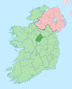
Granard (irisch Gránard) ist eine Landstadt im Nordosten des County Longford im mittleren nordöstlichen Binnenland der Republik Irland.
Verkehr und Demografie
Der Ort liegt an der Einmündung der Regionalstraße R194 in die Nationalstraße N55, zwischen Athlone im Südwesten und Cavan im Nordosten.[2] Ein Teil der R194 verläuft durch den Ort. An den Schienenverkehr in Irland ist Granard nicht mehr angeschlossen; jedoch ist der Ort durch Bus Éireann überregional angebunden. Die nächstgelegene größere Ortschaft ist Edgeworthstown im Südwesten.
Die Einwohnerzahl Granards (ohne Umland) wurde bei der Volkszählung 2022 mit 1058 Personen ermittelt. Sie blieb damit in den letzten 30 Jahren nahezu konstant, während sie im gesamten Land erheblich zunahm.[1]
Sehenswürdigkeiten
Nordwestlich von Granard liegt das Portal Tomb von Cleenrah und östlich Granards liegt der Lough Sheelin.
Persönlichkeiten
- Eddie Macken (* 1949 in Granard), Springreiter
Siehe auch
Weblinks
Einzelnachweise
- ↑ a b Granard (Town) auf citypopulation.de, abgerufen am 20. Dezember 2023
- ↑ Karte von Irland (stark vergrößerbar)
Auf dieser Seite verwendete Medien
Autor/Urheber: Robert French, Lizenz: No restrictions
Main Street, Granard, Co. Longford in all its glory with lots going on. Overloaded donkeys, people moving at pace (in the centre of the road), boys gathering for their moment of fame and immortality - all human life is there! But where is the dog?
Lots of input from various community contributors on the businesses pictured, with thanks especially to [/photos/gnmcauley/ Niall McAuley] and [/photos/47297387@N03/ Carol Maddock] for refining the ~50 year catalogue range to a ~5 year range!
Photographer: Robert French
Collection: Lawrence Photograph Collection
Date: Catalogue range c.1865-1914. Though likely c.1901-1907
NLI Ref: L_CAB_08230
You can also view this image, and many thousands of others, on the NLI’s catalogue at catalogue.nli.ie(c) Sarah777, CC BY-SA 2.0
Market Street, Granard, near to Granard, Longford, Ireland. Part of the R194 through the town.
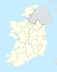
(c) Karte: NordNordWest, Lizenz: Creative Commons by-sa-3.0 de
Positionskarte von Irland
Autor/Urheber:
- Island_of_Ireland_location_map.svg: *Ireland_location_map.svg: NordNordWest
- Northern_Ireland_location_map.svg: NordNordWest
- Northern_Ireland_-_Counties.png: Maximilian Dörrbecker (Chumwa)
- derivative work: Rannpháirtí anaithnid (talk)
- derivative work: Mabuska (talk)
The island of Ireland, showing international border between Ireland and Northern Ireland, traditional provinces, traditional counties, and local authority areas in Ireland and Northern Ireland.


