Goddard Space Flight Center
Koordinaten: 38° 59′ 32″ N, 76° 51′ 8″ W


Das Goddard Space Flight Center (GSFC) der NASA, benannt nach dem Raketenpionier Robert Goddard, ist beheimatet in Greenbelt im Prince George’s County im amerikanischen Bundesstaat Maryland. Weitere dazugehörende Einrichtungen liegen auf Wallops Island in Virginia.
Das GSFC ist ein wissenschaftliches Forschungslabor für unbemannte Raumfahrt und wurde am 1. Mai 1959 gegründet.
Im GSFC angesiedelt sind das World Data Center for Satellite Information (WDC SI)[1], das weltweit alle Raumflugkörper registriert, und das NASA Space Science Data Coordinated Archive, das alle wissenschaftlichen Ergebnisse von US-Forschungssatelliten und Raumsonden sowie Beschreibungen dieser und ihrer wissenschaftlichen Instrumente archiviert.
Die Registrierung erfolgt durch die Nummerierungen der Satelliten und Sonden, es handelt sich bei der Spacecraft ID (SCID) um eine 8 oder 10 Bits lange Binärzahl, die vom Consultative Committee for Space Data Systems (CCSDS) eingeführt und standardisiert wurde.
Wissenschaftliche Missionen
- Advanced Composition Explorer (ACE)
- ASTRO-E2
- Compton Gamma Ray Observatory (CGRO)
- Cluster II
- Cosmic Background Explorer (COBE)
- Extreme Ultraviolet Explorer (EUVE)
- Comet Nucleus Tour (CONTOUR)
- Fast Auroral Snapshot Explorer (FAST)
- Gamma-ray Large Area Space Telescope (GLAST)
- High Energy Transient Explorer 2 (HETE-2)
- ISEE/ICE-Programm Der Satellit ISEE 1 kam wie ISEE 3/ICE aus den USA, die ESA stellte ISEE 2
- Imager for Magnetopause-to-Aurora Global Exploration (IMAGE)
- IMP-8
- International Ultraviolet Explorer (IUE)
- Microwave Anisotropy Probe spacecraft (MAP)
- Polar
- Ramaty High-Energy Solar Spectroscopic Imager spacecraft (RHESSI)
- Solar, Anomalous and Magnetospheric Particle Explorer (SAMPEX)
- Solar and Heliospheric Observatory (SOHO)
- Submillimeter Wave Astronomy Satellite (SWAS)
- Swift
- Thermosphere, Ionosphere, Mesosphere, Energetics and Dynamics (TIMED)
- Transition Region And Coronal Explorer (TRACE)
- Wind
- Rossi X-ray Timing Explorer (RXTE)
- DAVINCI (geplant für 2029)
Weblinks
- history.nasa.gov: Dreams, Hopes, Realities - NASA's Goddard Space Flight Center: The First Forty Years (Online-Buch, engl.)
- nasa.gov: Goddard Space Flight Center Homepage (engl.)
- youtube.com: NASA Goddard (Eigener „Youtube-Kanal“)
Einzelnachweise
Auf dieser Seite verwendete Medien
Autor/Urheber: TUBS
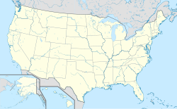
Location map of the USA (Hawaii and Alaska shown in sidemaps).
Main map: EquiDistantConicProjection : Central parallel :
* N: 37.0° N
Central meridian :
* E: 96.0° W
Standard parallels:
* 1: 32.0° N
* 2: 42.0° N
Made with Natural Earth. Free vector and raster map data @ naturalearthdata.com.
Formulas for x and y:
x = 50.0 + 124.03149777329222 * ((1.9694462586094064-({{{2}}}* pi / 180))
      * sin(0.6010514667026994 * ({{{3}}} + 96) * pi / 180))
y = 50.0 + 1.6155950752393982 * 124.03149777329222 * 0.02613325650382181
      - 1.6155950752393982  * 124.03149777329222 *
     (1.3236744353715044  - (1.9694462586094064-({{{2}}}* pi / 180))
      * cos(0.6010514667026994 * ({{{3}}} + 96) * pi / 180))
Hawaii side map: Equirectangular projection, N/S stretching 107 %. Geographic limits of the map:
- N: 22.4° N
- S: 18.7° N
- W: 160.7° W
- E: 154.6° W
Alaska side map: Equirectangular projection, N/S stretching 210.0 %. Geographic limits of the map:
- N: 72.0° N
- S: 51.0° N
- W: 172.0° E
- E: 129.0° W
Eröffnung des Goddard Space Flight Centers


