Gespanschaft Sisak-Moslavina
| Gespanschaft Sisak-Moslavina Sisačko-moslavačka županija | |||||
|---|---|---|---|---|---|
| |||||
| Karte | |||||
 | |||||
| Basisdaten | |||||
| Staat: | |||||
| Sitz: | Sisak | ||||
| Fläche: | 4.468 km² | ||||
| Einwohner: | 137.876 (31. Dezember 2021) | ||||
| Bevölkerungsdichte: | 31 Einwohner je km² | ||||
| Größte Stadt: | Sisak | ||||
| Telefonvorwahl: | 044 | ||||
| ISO 3166-2: | HR-03 | ||||
| NUTS3-Code4: | HR028 | ||||
| Koordinaten | 45° 13′ N, 16° 15′ O | ||||
| Struktur und Verwaltung (Stand: 2023) | |||||
| Städte: | 6 | ||||
| Gemeinden: | 13 | ||||
| Siedlungen: | 456 | ||||
| Gespan: | Ivan Celjak[1] (HDZ) | ||||
| Postanschrift: | Stjepana i Antuna Radića 36 44 000 Sisak | ||||
| Webpräsenz: | |||||
| Gemeindekarte | |||||
 | |||||
Die Gespanschaft Sisak-Moslavina [] (kroatisch Sisačko-moslavačka županija) ist eine Gespanschaft in Zentralkroatien. Sie liegt südlich von Zagreb und grenzt im Süden an Bosnien-Herzegowina. Sie hat eine Fläche von 4.448 km² und 137.876 Einwohner (Stand 31. Dezember 2021).[2] Der Verwaltungssitz ist Sisak.
Bevölkerung

Zusammensetzung der Bevölkerung nach Nationalitäten (Daten der Volkszählung von 2011):
| Ethnie | Anzahl | Prozent |
|---|---|---|
| Kroaten | 142.077 | 82,39 % |
| Serben | 21.002 | 12,18 % |
| Bosniaken | 2.464 | 1,43 % |
| Roma | 1.463 | 0,85 % |
| Tschechen | 578 | 0,34 % |
| Albaner | 576 | 0,33 % |
| Ukrainer | 257 | 0,15 % |
| Slowaken | 212 | 0,12 % |
| Italiener | 183 | 0,11 % |
Städte und Gemeinden
Die Gespanschaft Sisak-Moslavina ist in 6 Städte und 13 Gemeinden gegliedert. Diese werden nachstehend jeweils mit der Einwohnerzahl zur Zeit der Volkszählung von 2011 aufgeführt.
Städte
| Stadt | Einw. |
|---|---|
| Glina | 9.283 |
| Hrvatska Kostajnica | 2.756 |
| Kutina | 22.760 |
| Novska | 13.518 |
| Petrinja | 24.671 |
| Sisak | 47.768 |
Gemeinden
| Gemeinde | Einw. |
|---|---|
| Donji Kukuruzari | 1.643 |
| Dvor | 5.570 |
| Gvozd | 2.970 |
| Hrvatska Dubica | 2.089 |
| Jasenovac | 1.997 |
| Lekenik | 6.032 |
| Lipovljani | 3.455 |
| Majur | 1.185 |
| Martinska Ves | 3.488 |
| Popovača | 11.905 |
| Sunja | 5.748 |
| Topusko | 2.985 |
| Velika Ludina | 2.625 |
Verkehr
| Autobahnen | A3, A11 (im Bau) | |
| Nationalstraßen (Državne ceste) | D30, D31, D36, D37 … | 419 km |
| Gespanschaftsstraßen (Županijske ceste) | 797 km | |
| Lokalstraßen (Lokalne ceste) | 751 km | |
| Nicht-klassifizierte-Straßen (Nerazvrstane ceste) | 2000 km |
Weblinks
- PDF bei www.glasila.hr (1,71 MB)
- http://www.smz.hr Gespanschaft Sisak-Moslavina
Einzelnachweise
- ↑ [1]
- ↑ CENSUS OF POPULATION. Croatian Bureau of Statistics, abgerufen am 12. Juni 2023.
Auf dieser Seite verwendete Medien
Das Bild dieser Flagge lässt sich leicht mit einem Rahmen versehen
Autor/Urheber: DIREKTOR, Lizenz: CC BY-SA 3.0
Historical regions of the Republic of Croatia:
Autor/Urheber: Hmxhmx, Lizenz: CC BY-SA 4.0
Population pyramid of Sisak-Moslavina County. Version in English. Data from 2011 Census; available at: https://www.dzs.hr/Eng/censuses/census2011/results/htm/E01_01_01/e01_01_01_zup03.html
Coat of arms representing Istria in the crown of the official coat of arms of Croatia.
Coat of arms representing region of Dubrovnik in the crown of the official coat of arms of Croatia.
Autor/Urheber:
unbekannt
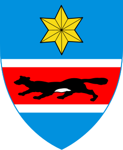
, Lizenz: PD-Amtliches WerkWappen Gespanschaft Sisak und Moslavina Kroatien
Coat of arms representing Dalmatia in the crown of the official coat of arms of Croatia.
Autor/Urheber: SiBr4
Coat of arms by Timbouctou, Lizenz: CC BY-SA 3.0
Flag of Sisak-Moslavina County, Croatia. While the image on the official site has horizontal stripes along the top edge of the flag (like in the first revision below), the text underneath it says the stripes should be vertical and on the left (hoist) side.
Autor/Urheber: Tschubby, Lizenz: CC BY-SA 3.0
Gespanschaft Sisak-Moslavina
Autor/Urheber: TUBS
Lage der Gespannschaft XY (siehe Dateiname) in Kroatien.


